Àird Chollaim

Hill, Mountain in Inverness-shire

Scotland

Àird Chollaim

Kirk at Stocanais The sign on the wall says that this is the Stockinish meeting house of the North Harris Free Presbyterian Church.
Kirk at Stocanais Credit: Anne Burgess

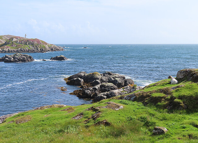
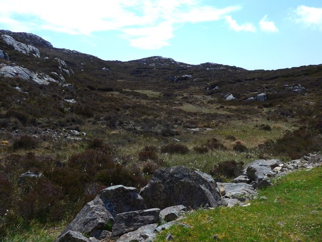
Àird Chollaim, located in Inverness-shire, is a prominent hill/mountain that offers breathtaking views and outdoor recreational opportunities. Situated in the Scottish Highlands, this natural wonder stands tall at an elevation of approximately 561 meters (1,841 feet) above sea level.

With its commanding presence, Àird Chollaim boasts a distinctive rugged terrain characterized by steep slopes and rocky outcrops. Its summit is adorned with a trig point, providing a convenient marker for hikers and climbers. The ascent to the top can be challenging, but the reward is a panoramic vista of the surrounding landscape, including the Great Glen and Loch Ness.

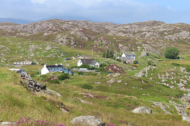
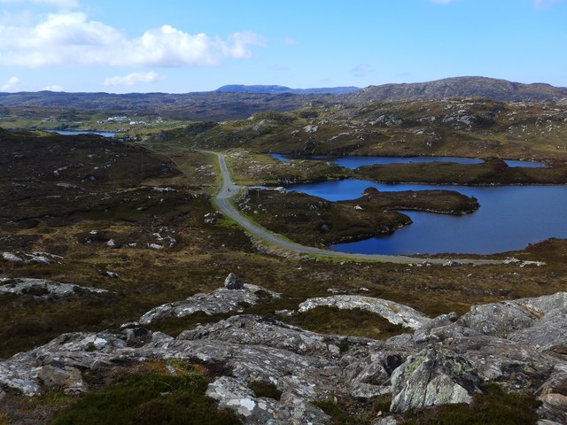
The hill/mountain is nestled within a region renowned for its natural beauty and is a popular destination for outdoor enthusiasts. It offers a range of activities such as hillwalking, mountaineering, and wildlife spotting. The heather-clad slopes attract a variety of bird species, including golden eagles, peregrine falcons, and ptarmigans, making it a birdwatcher's paradise.

In addition to its natural beauty, Àird Chollaim holds historical and cultural significance. The area is steeped in folklore and legends, with tales of ancient battles and mythical creatures adding to its allure. The hill/mountain also forms part of the West Highland Way, a long-distance trail that traverses the Highlands, attracting trekkers from around the world.

Whether exploring its challenging trails, soaking in the breathtaking vistas, or immersing oneself in the rich history and folklore, Àird Chollaim offers an unforgettable experience for nature lovers and adventure seekers alike.

If you have any feedback on the listing, please let us know in the comments section below.

Àird Chollaim Images

Images are sourced within 2km of 57.82609/-6.7967264 or Grid Reference NG1591. Thanks to Geograph Open Source API. All images are credited.
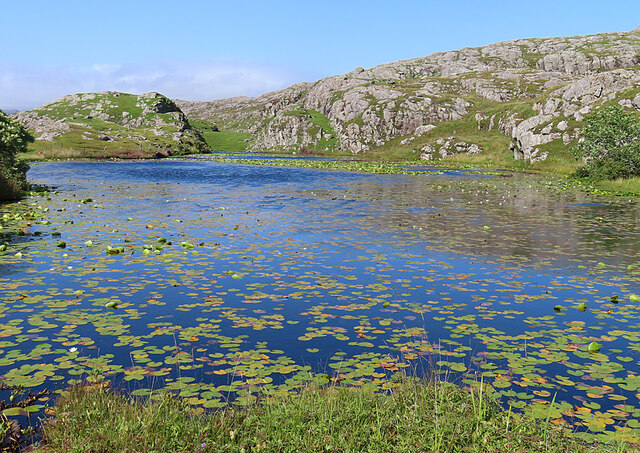
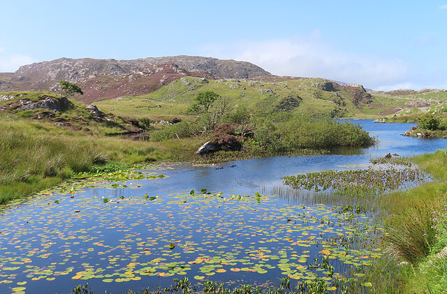
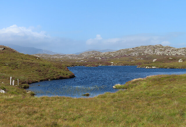
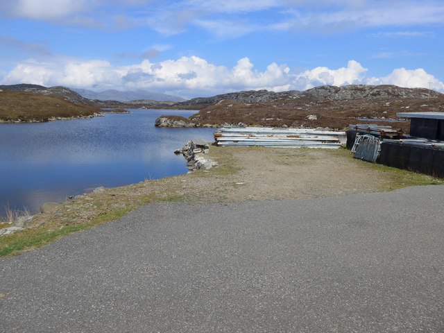
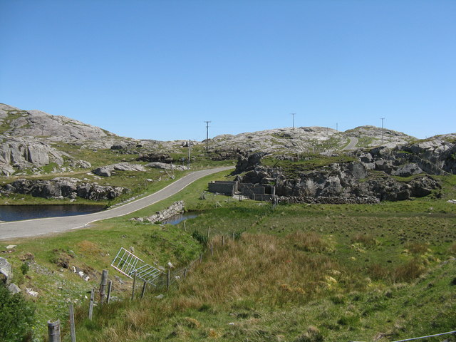
Kirk at Stocanais The sign on the wall says that this is the Stockinish meeting house of the North Harris Free Presbyterian Church.
Kirk at Stocanais
The sign on the wall says that this is the Stockinish meeting house of the North Harris Free Presbyterian Church.
White Water-lily (Nymphaea alba) I always associate water-lilies with the lochans of eastern Harris, and was glad to find some still in flower in August, as I have only ever been to na h-Eileanan an Iar in spring and early summer before.
White Water-lily (Nymphaea alba)
I always associate water-lilies with the lochans of eastern Harris, and was glad to find some still in flower in August, as I have only ever been to na h-Eileanan an Iar in spring and early summer before.
Loch a' Chaolais This lochan is well covered with the floating leaves of the White Water-lily (Nymphaea alba).
Loch a' Chaolais
This lochan is well covered with the floating leaves of the White Water-lily (Nymphaea alba).
Loch Chliuthair This inlet opens in to Loch Cluer, another of the eastern Harris sea-lochs.
Loch Chliuthair
This inlet opens in to Loch Cluer, another of the eastern Harris sea-lochs.
Loch Cluer Loch Chliuthair in Gaelic takes its name from the village of Cliuthar, anglicised as Cluer.
Loch Cluer
Loch Chliuthair in Gaelic takes its name from the village of Cliuthar, anglicised as Cluer.
Collam A handful of houses beside Loch Ghreosabhaigh.
Collam
A handful of houses beside Loch Ghreosabhaigh.
Fish Farm In the outer part of Loch Ghreosabhagh. I take it that the poles and nets are to discourage birds form taking the fish.
Fish Farm
In the outer part of Loch Ghreosabhagh. I take it that the poles and nets are to discourage birds form taking the fish.
Lochan near Greosabhagh A lochan liberally sprinkled with water-lily leaves.
Lochan near Greosabhagh
A lochan liberally sprinkled with water-lily leaves.
Loch Harmasaig Most of this loch is hidden behind the knoll on the left.
Loch Harmasaig
Most of this loch is hidden behind the knoll on the left.
Loch nan Uidhean Typical 'Cnoc and Lochan' topography, with a small loch hemmed in by steeply dipping hummocky Lewisian gneiss.
Loch nan Uidhean
Typical 'Cnoc and Lochan' topography, with a small loch hemmed in by steeply dipping hummocky Lewisian gneiss.
Nameless Lochan That is to say, the map doesn't name it.
Nameless Lochan
That is to say, the map doesn't name it.
Loch Harmasaig
Loch Harmasaig
Rough ground at Druim nan-Uidhean
Old pontoon equipment at Loch Harmasaig
The road to Greosabhagh A typical East Harris view - water and rock, rock and water.

Shots of parts of the island were used by Stanley Kubrick as the surface of Jupiter in the film 2001: A Space Odyssey.
The road to Greosabhagh
A typical East Harris view - water and rock, rock and water. Shots of parts of the island were used by Stanley Kubrick as the surface of Jupiter in the film 2001: A Space Odyssey.
Houses at Greosabhagh On The Golden Road.
Houses at Greosabhagh
On The Golden Road.
Road at Caolas Stocinis/Kyles Stockinish Looking over a short causeway across the end of Loch a' Chaolais.
Road at Caolas Stocinis/Kyles Stockinish
Looking over a short causeway across the end of Loch a' Chaolais.
Loch a' Chaolais A small loch in the rocky landscape, with pond weed [Potomageton sp.].
Loch a' Chaolais
A small loch in the rocky landscape, with pond weed [Potomageton sp.].
Show me another place!

Àird Chollaim is located at Grid Ref: NG1591 (Lat: 57.82609, Lng: -6.7967264)

Unitary Authority: Na h-Eileanan an Iar

Police Authority: Highlands and Islands

What 3 Words

///solid.pretty.signature. Near Tarbert, Na h-Eileanan Siar

Related Wikis

Stockinish Island

Stockinish Island (Scottish Gaelic: Eilean Stocainis) is an uninhabited island off Harris, in the Outer Hebrides. == Geography and geology == Stockinish...

East Loch Tarbert

East Loch Tarbert (Scottish Gaelic: Loch an Tairbeairt) is a sea loch that lies to the east of Harris in the Outer Hebrides of Scotland. The loch contains...

Sgeotasaigh

Scotasay (Scottish Gaelic: Sgeotasaigh) is small island in the Outer Hebrides of Scotland. It lies 1 kilometre (0.6 miles) off the east coast of Harris...

Harris distillery

Harris distillery is a Scotch whisky and Gin distillery in Tarbert on the Isle of Harris, Scotland. The distillery was the first legal distillery ever...

Nearby Amenities

Located within 500m of 57.82609,-6.7967264
Passing Place
Lat/Long: 57.8299362/-6.8000002
Passing Place
Lat/Long: 57.828171/-6.8013761
Passing Place
Lat/Long: 57.8237135/-6.8007252
Passing Place
Lat/Long: 57.8231806/-6.799972
Material: wood
Power: pole
Lat/Long: 57.8254463/-6.8021964
Material: wood
Power: pole
Lat/Long: 57.8281951/-6.8017881
Material: wood
Power: pole
Lat/Long: 57.8268694/-6.8021588
Material: wood
Power: pole
Lat/Long: 57.8288101/-6.8015545
Material: wood
Power: pole
Lat/Long: 57.8295909/-6.8012966
Barrier: cattle_grid
Lat/Long: 57.8218264/-6.7988267
Generator Method: wind_turbine
Generator Source: wind
Generator Type: horizontal_axis
Power: generator
Lat/Long: 57.8220736/-6.7943357
Passing Place
Lat/Long: 57.8292199/-6.8003826
Passing Place
Lat/Long: 57.8267439/-6.8016122
Passing Place
Lat/Long: 57.8259712/-6.8017329
Passing Place
Lat/Long: 57.8246772/-6.8013909
Power: pole
Lat/Long: 57.8247772/-6.8021924
Power: pole
Lat/Long: 57.8244892/-6.8017891
Power: pole
Lat/Long: 57.822741/-6.8010396
Power: pole
Lat/Long: 57.823592/-6.8014068
The data included in this document is from www.openstreetmap.org. The data is made available under ODbL.

Have you been to Àird Chollaim?

Leave your review of Àird Chollaim below (or comments, questions and feedback).