Hornby Wood

Wood, Forest in Lancashire Wyre

England

Hornby Wood

Modern Milestone, Lancaster Canal NW of Cabus Nook Bridge, in the parish of Cabus.

Inscription reads: Garstang / 2 // 1819 / 2019 // Lancaster / 11

Milestone Society National ID: LAN-19
Modern Milestone, Lancaster Canal Credit: David Garside

Hornby Wood is a picturesque forest located in the county of Lancashire, England. Covering an area of approximately 30 acres, it is a popular destination for nature enthusiasts and outdoor lovers alike. The woodland is situated near the village of Hornby, which adds to its charm and accessibility.

The forest is predominantly composed of native tree species such as oak, beech, and birch, creating a diverse and vibrant ecosystem. The lush vegetation provides a haven for numerous wildlife species, including birds, mammals, and insects. Visitors often have the opportunity to spot squirrels, deer, and a variety of bird species as they explore the wood's winding paths.

Hornby Wood offers a tranquil escape from the hustle and bustle of everyday life, providing a serene setting for walking, picnicking, and simply enjoying the natural surroundings. The forest boasts well-maintained trails that cater to both leisurely strolls and more challenging hikes. Along these paths, visitors can admire the woodland's beauty and take in breathtaking views of the surrounding countryside.

The wood also plays an important role in conservation efforts, as it is part of a larger network of protected areas in Lancashire. This ensures the preservation of the forest's unique ecosystem and contributes to the overall biodiversity of the region.

In summary, Hornby Wood is a delightful forest in Lancashire that offers a peaceful retreat from urban life. With its diverse flora and fauna, well-marked trails, and stunning views, it is a must-visit destination for nature lovers and those seeking a connection with the natural world.

If you have any feedback on the listing, please let us know in the comments section below.
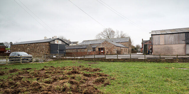
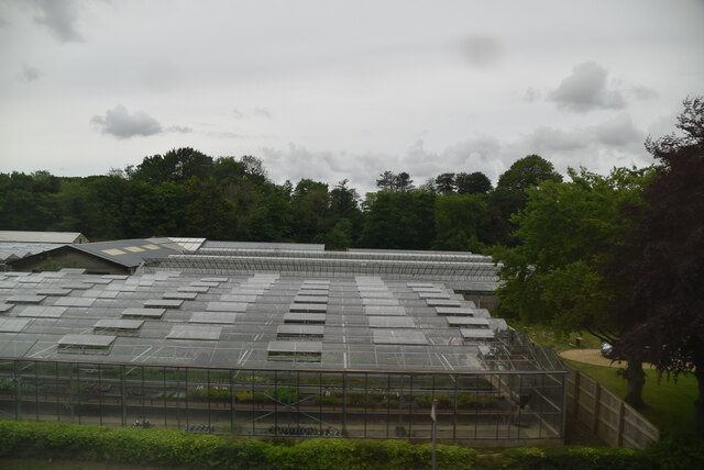
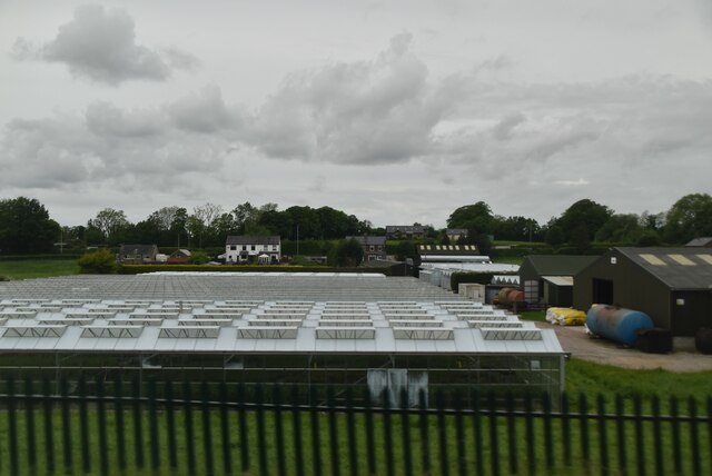
Hornby Wood Images

Images are sourced within 2km of 53.932684/-2.7995794 or Grid Reference SD4748. Thanks to Geograph Open Source API. All images are credited.

Modern Milestone, Lancaster Canal NW of Cabus Nook Bridge, in the parish of Cabus.

Inscription reads: Garstang / 2 // 1819 / 2019 // Lancaster / 11

Milestone Society National ID: LAN-19
Modern Milestone, Lancaster Canal
NW of Cabus Nook Bridge, in the parish of Cabus. Inscription reads: Garstang / 2 // 1819 / 2019 // Lancaster / 11 Milestone Society National ID: LAN-19
Old Holly Farm Old Holly Farm is a family-run working organic dairy farm, which until recently was open to the public with visitor attractions of a nature no longer specified on the farm's website. This aspect of the farm's work was a victim of the Coronavirus Covid-19 pandemic as the owners made the difficult decision not to reopen after the third national lockdown in March 2021.
Old Holly Farm
Old Holly Farm is a family-run working organic dairy farm, which until recently was open to the public with visitor attractions of a nature no longer specified on the farm's website. This aspect of the farm's work was a victim of the Coronavirus Covid-19 pandemic as the owners made the difficult decision not to reopen after the third national lockdown in March 2021.
OS Bench Mark OS flush bracket bench mark on old building on E side of A6. 29.46 m above datum.
OS Bench Mark
OS flush bracket bench mark on old building on E side of A6. 29.46 m above datum.
OS Bench Mark, damaged OS cut bench mark on W parapet of Park Lane Bridge. At some point presumably the bridge was damaged and the bench mark defaced when replacing the stones. It was 9.39 m above datum.
OS Bench Mark, damaged
OS cut bench mark on W parapet of Park Lane Bridge. At some point presumably the bridge was damaged and the bench mark defaced when replacing the stones. It was 9.39 m above datum.
Milestone Marker 36-21 F (between bridges 74-73), Lancaster Canal Milestone located by the side of the Lancaster Canal
This milestone is 21 miles from the centre of Preston and 36 miles from Kendal

Inscription reads:- 
Garstang / 4 :: Lancaster / 9 

Milestone Society National ID: LAN-21R
Milestone Marker 36-21 F (between bridges 74-73), Lancaster Canal
Milestone located by the side of the Lancaster Canal This milestone is 21 miles from the centre of Preston and 36 miles from Kendal Inscription reads:- Garstang / 4 :: Lancaster / 9 Milestone Society National ID: LAN-21R
Milestone Marker 37-20 F (between bridges 71-70), Lancaster Canal Milestone located by the side of the Lancaster Canal
This milestone is 20 miles from the centre of Preston and 37 miles from Kendal

Inscription reads:- 
Garstang / 3 :: Lancaster / 10 

Milestone Society National ID: LAN-20R
Milestone Marker 37-20 F (between bridges 71-70), Lancaster Canal
Milestone located by the side of the Lancaster Canal This milestone is 20 miles from the centre of Preston and 37 miles from Kendal Inscription reads:- Garstang / 3 :: Lancaster / 10 Milestone Society National ID: LAN-20R
Old Milestone by the A6, Garstang Road, Cabus Metal plates (one missing) attached to stone post by the A6, in parish of Cabus (Wyre District), Garstang Road; Fowlers Hill where old curve forms a lay-by, in hedge between road and lay-by, beside lamp-post behind wide grass verge, on West side of road. Lancaster twin iron plate, erected by the Garstang & Heronsyke turnpike trust in the 19th century. 

Inscription reads:-
: (LANCASTER / IX / MILES) : : (CABUS) : : GARSTANG / 1¾ / MILES : 
Pivot benchmark on top. 

Milestone Society National ID: LA_LAGS09
Old Milestone by the A6, Garstang Road, Cabus
Metal plates (one missing) attached to stone post by the A6, in parish of Cabus (Wyre District), Garstang Road; Fowlers Hill where old curve forms a lay-by, in hedge between road and lay-by, beside lamp-post behind wide grass verge, on West side of road. Lancaster twin iron plate, erected by the Garstang & Heronsyke turnpike trust in the 19th century. Inscription reads:- : (LANCASTER / IX / MILES) : : (CABUS) : : GARSTANG / 1¾ / MILES : Pivot benchmark on top. Milestone Society National ID: LA_LAGS09
Old Boundary Marker on the A6 Parish Boundary Marker on the west side of the A6 70 metres north of the junction with Middle Holly. On the boundary of Cabus and Cleveley parishes. Cleveley parish became part of Forton parish in 1935. Grade II Listed details <span class="nowrap"><a title="https://historicengland.org.uk/listing/the-list/list-entry/1163288" rel="nofollow ugc noopener" href="https://historicengland.org.uk/listing/the-list/list-entry/1163288">Link</a><img style="margin-left:2px;" alt="External link" title="External link - shift click to open in new window" src="https://s1.geograph.org.uk/img/external.png" width="10" height="10"/></span>. See also <a title="https://www.geograph.org.uk/photo/6038627" href="https://www.geograph.org.uk/photo/6038627">Link</a> for an older photo.

Milestone Society National ID: LA_LAGS07pb
Old Boundary Marker on the A6
Parish Boundary Marker on the west side of the A6 70 metres north of the junction with Middle Holly. On the boundary of Cabus and Cleveley parishes. Cleveley parish became part of Forton parish in 1935. Grade II Listed details LinkExternal link. See also Link for an older photo. Milestone Society National ID: LA_LAGS07pb
Glasshouses
Glasshouses
Daisy Clough Nursery
Medieval Wayside Cross base and Roman milestone by Stony Lane, Forton parish On Stony Lane north of its junction with the B5272 Garstang Road. Forton parish. See also <a title="https://www.geograph.org.uk/photo/6050604" href="https://www.geograph.org.uk/photo/6050604">Link</a> and <a title="https://www.geograph.org.uk/photo/1198410" href="https://www.geograph.org.uk/photo/1198410">Link</a>.

Forton Cross is a wayside cross with an old base. Grade II listed details <span class="nowrap"><a title="https://historicengland.org.uk/listing/the-list/list-entry/1318231" rel="nofollow ugc noopener" href="https://historicengland.org.uk/listing/the-list/list-entry/1318231">Link</a><img style="margin-left:2px;" alt="External link" title="External link - shift click to open in new window" src="https://s1.geograph.org.uk/img/external.png" width="10" height="10"/></span>.

Milestone Society National ID: LAWY_FOR

The Roman milestone looks more like the stump of a stone cross with its associated socket stone.

Milestone Society National ID: LA_XROMAN05
Medieval Wayside Cross base and Roman milestone by Stony Lane, Forton parish
On Stony Lane north of its junction with the B5272 Garstang Road. Forton parish. See also Link and Link. Forton Cross is a wayside cross with an old base. Grade II listed details LinkExternal link. Milestone Society National ID: LAWY_FOR The Roman milestone looks more like the stump of a stone cross with its associated socket stone. Milestone Society National ID: LA_XROMAN05
Moorhead Cottage Situated on Middle Holly, immediately south of the junction with Ratcliffe Wharf Lane in an area where individual dwellings are scattered about within the rather diffuse parish of Forton.
Moorhead Cottage
Situated on Middle Holly, immediately south of the junction with Ratcliffe Wharf Lane in an area where individual dwellings are scattered about within the rather diffuse parish of Forton.
Old Milestone Marker 35-22 F (between bridges 77-76), Lancaster Canal Old Milestone located by the side of the Lancaster Canal
This milestone is 22 miles from the centre of Preston and 35 miles from Kendal

Inscription reads:- 
Garstang / 5 (missing) :: Lancaster / 8 (missing) 

Milestone Society National ID: LAN-22
Old Milestone Marker 35-22 F (between bridges 77-76), Lancaster Canal
Old Milestone located by the side of the Lancaster Canal This milestone is 22 miles from the centre of Preston and 35 miles from Kendal Inscription reads:- Garstang / 5 (missing) :: Lancaster / 8 (missing) Milestone Society National ID: LAN-22
Weavers Lane
Weavers Lane
Weak "ridge"
Weak "ridge"
Bridge 69 on the Lancaster Canal The bridges either side all have names, but apparently not this one
Bridge 69 on the Lancaster Canal
The bridges either side all have names, but apparently not this one
Narrowboats moored on the Lancaster Canal
Winmarleigh Bridge over the Lancaster Canal
Show me another place!

Hornby Wood is located at Grid Ref: SD4748 (Lat: 53.932684, Lng: -2.7995794)

Administrative County: Lancashire

District: Wyre

Police Authority: Lancashire

What 3 Words

///cattle.riots.backhand. Near Garstang, Lancashire

Related Wikis

St Luke's Church, Winmarleigh

St Luke's Church is in the village of Winmarleigh, Lancashire, England. It is an active Church of England parish church in the Diocese of Blackburn, the...

Winmarleigh

Winmarleigh is a village and civil parish of the Borough of Wyre in Lancashire, England. The population taken at the 2011 census was 273. The village,...

Winmarleigh Hall

Winmarleigh Hall is a former country house located to the south of the village of Winmarleigh, Lancashire, England, now operated by PGL as an adventure...

Cabus

Cabus is a village and civil parish in Lancashire, England. It lies 12 miles north of Preston, 9 miles south of Lancaster and 16 miles north east of Blackpool...

Nearby Amenities

Located within 500m of 53.932684,-2.7995794
Post Box
Collection Times: Mo-Fr 16:30; Sa 10:30
Operator: Royal Mail
Post Box Type: lamp
Ref: PR3 62
Royal Cypher: EIIR
Royal Cypher Wikidata: Q33102113
Lat/Long: 53.9322599/-2.7943445
The data included in this document is from www.openstreetmap.org. The data is made available under ODbL.

Have you been to Hornby Wood?

Leave your review of Hornby Wood below (or comments, questions and feedback).