Birch Coppice

Wood, Forest in Shropshire

England

Birch Coppice

Park Gate farm Buildings at Park Gate
Park Gate farm Credit: Richard Law

Birch Coppice, located in Shropshire, England, is a picturesque woodland area known for its dense birch trees and tranquil atmosphere. Spanning over a vast area, this forest is a popular destination for nature lovers and outdoor enthusiasts.

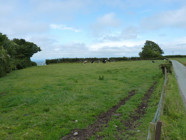
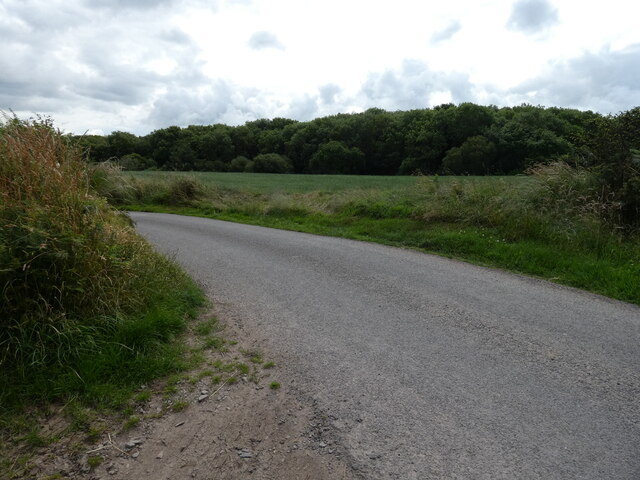
The woodland is characterized by its rich biodiversity, featuring a variety of flora and fauna. The dominant birch trees provide a beautiful green canopy, while the forest floor is covered in a thick carpet of moss and ferns. Other tree species, such as oak and beech, can also be found scattered throughout the woodland.

Birch Coppice is home to a diverse range of wildlife. Visitors may catch glimpses of deer, foxes, and numerous bird species, including woodpeckers and owls. The forest's tranquil ambiance makes it an ideal habitat for these creatures.

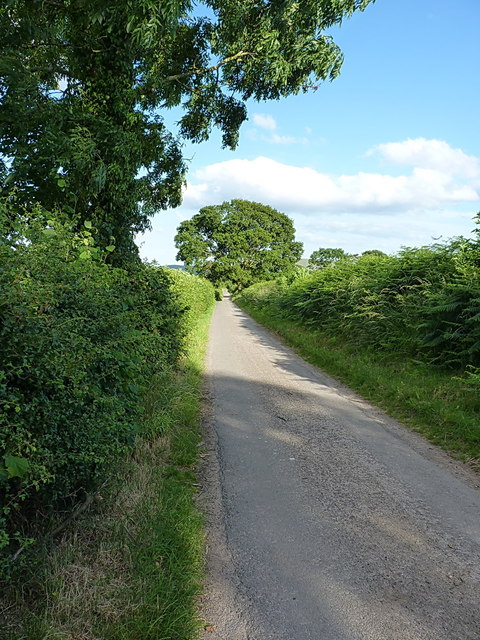
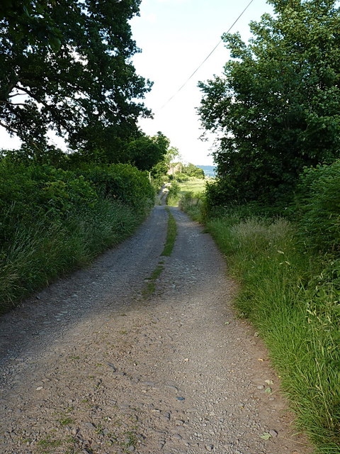
The woodland offers numerous walking trails, allowing visitors to explore its natural beauty. These paths wind through the forest, taking hikers past enchanting streams and peaceful ponds. The birdwatching opportunities are also abundant, making it a haven for bird enthusiasts.

In addition to its natural beauty, Birch Coppice holds historical significance. It is believed that the woodland has remained relatively untouched for centuries, serving as a living testament to the region's past. The forest is also home to several ancient trees, some of which are estimated to be hundreds of years old.

Overall, Birch Coppice in Shropshire, with its dense birch trees, diverse wildlife, and historical value, offers a serene and captivating experience for all those who visit.

If you have any feedback on the listing, please let us know in the comments section below.

Birch Coppice Images

Images are sourced within 2km of 52.607618/-2.8096753 or Grid Reference SJ4501. Thanks to Geograph Open Source API. All images are credited.

Park Gate farm Buildings at Park Gate
Park Gate farm
Buildings at Park Gate
Cattle in a field near Park Gate
Lane to Netley One of the many narrow lanes on the north end of the Long Mynd; ideal cycling country - until you meet a tractor coming the other way.
Lane to Netley
One of the many narrow lanes on the north end of the Long Mynd; ideal cycling country - until you meet a tractor coming the other way.
The Range Rovers' Graveyard? Rather like the mythical Elephants' Graveyard, except that this one does exist. There were 4 full-blown Range Rovers, a classic Landrover Defender, a shonky caravan and (just out of shot) a VW Golf. All tucked into the corner of this field, and all beginning to deteriorate somewhat.
The Range Rovers' Graveyard?
Rather like the mythical Elephants' Graveyard, except that this one does exist. There were 4 full-blown Range Rovers, a classic Landrover Defender, a shonky caravan and (just out of shot) a VW Golf. All tucked into the corner of this field, and all beginning to deteriorate somewhat.
On the lane to Walkmills A narrow lane between Smethcott Dingle and the Walkmills junction; this is ideal cycling country, so long as you are OK with some hills.
On the lane to Walkmills
A narrow lane between Smethcott Dingle and the Walkmills junction; this is ideal cycling country, so long as you are OK with some hills.
Track through Longnor Park towards Park Farm An unsurfaced farm track and footpath, leading to the small settlement at park Farm, from where several paths spread out into the surrounding farmland.
Track through Longnor Park towards Park Farm
An unsurfaced farm track and footpath, leading to the small settlement at park Farm, from where several paths spread out into the surrounding farmland.
Buildings at Park Farm The place has several very noisy dogs, although they backed off when approached. This is, after all, a right of way.
Buildings at Park Farm
The place has several very noisy dogs, although they backed off when approached. This is, after all, a right of way.
Wilderley to Stapleton road
Grassland near Wilderley
Field, Wilderley
Field, Wilderley
Field, Wilderley
Field, Wilderley
Camouflaged Motte and Bailey Castle Dense tree growth makes it difficult to see the remains of this motte and bailey castle. <span class="nowrap"><a title="https://historicengland.org.uk/listing/the-list/list-entry/1014746?section=official-list-entry" rel="nofollow ugc noopener" href="https://historicengland.org.uk/listing/the-list/list-entry/1014746?section=official-list-entry">Link</a><img style="margin-left:2px;" alt="External link" title="External link - shift click to open in new window" src="https://s1.geograph.org.uk/img/external.png" width="10" height="10"/></span>
Camouflaged Motte and Bailey Castle
Dense tree growth makes it difficult to see the remains of this motte and bailey castle. LinkExternal link
Bungalow at Cottage Farm east of Church Pulverbatch Quiet rural position on the edge of huge grassland fields.
Bungalow at Cottage Farm east of Church Pulverbatch
Quiet rural position on the edge of huge grassland fields.
Jumble of farm buildings at Cottage Farm, east of Church Pulverbatch Every farm has its share of corrugated-iron sheds, makeshift buildings and storage units. There’s very often an old caravan somewhere as well!
Jumble of farm buildings at Cottage Farm, east of Church Pulverbatch
Every farm has its share of corrugated-iron sheds, makeshift buildings and storage units. There’s very often an old caravan somewhere as well!
Side road leading to some farms and dwellings east of Church Pulverbatch I was intrigued by these names and substantial lane. The OS Map shown that there is a Middle, Little and Upper Shadymoor up this track, but where Featherdown fits in I couldn’t guess.
Side road leading to some farms and dwellings east of Church Pulverbatch
I was intrigued by these names and substantial lane. The OS Map shown that there is a Middle, Little and Upper Shadymoor up this track, but where Featherdown fits in I couldn’t guess.
Long Coppice woodland viewed from road leading to Wilderley Hall Lovely patch of deciduous woodland stretching for about a mile in a northeast to south west direction.
Long Coppice woodland viewed from road leading to Wilderley Hall
Lovely patch of deciduous woodland stretching for about a mile in a northeast to south west direction.
Wilderley Hall Farm, east of Pulverbatch Substantial farm buildings and farmhouse. Large barns housing a milking herd, and huge vats of milk on view. It appears, from an advertisement on the building, that the farm is a milk source for one of the major supermarkets.
Wilderley Hall Farm, east of Pulverbatch
Substantial farm buildings and farmhouse. Large barns housing a milking herd, and huge vats of milk on view. It appears, from an advertisement on the building, that the farm is a milk source for one of the major supermarkets.
Motte and Bailey site at Wilderley Hall I was looking for the ancient motte and bailey here, as marked on the OS Map, but  this was all I could find - a wired off enclosure probably used to rear game birds. Shame I couldn’t see and visit our ancient heritage.
Motte and Bailey site at Wilderley Hall
I was looking for the ancient motte and bailey here, as marked on the OS Map, but this was all I could find - a wired off enclosure probably used to rear game birds. Shame I couldn’t see and visit our ancient heritage.
Show me another place!

Birch Coppice is located at Grid Ref: SJ4501 (Lat: 52.607618, Lng: -2.8096753)

Unitary Authority: Shropshire

Police Authority: West Mercia

What 3 Words

///sprinting.guarding.brittle. Near Longnor, Shropshire

Nearby Locations

Upper Wood Birch Coppice

Related Wikis

Smethcott

Smethcott (sometimes Smethcote) is a civil parish and dispersed hamlet near the village of Picklescott, in Shropshire, England. The population of the civil...

Picklescott

Picklescott is a village in Shropshire, England. It is located in the northern foothills of the Long Mynd, approximately 5 kilometres (3 miles) northwest...

Church Pulverbatch

Church Pulverbatch is a small village and civil parish in central Shropshire, England. The population of the parish was 344 at the time of the 2001 census...

Dorrington, Shropshire

Dorrington is a large village in Shropshire, England, it is located 6 miles (9.7 km) south of Shrewsbury. The population of the village was estimated as...

Nearby Amenities

Located within 500m of 52.607618,-2.8096753
Ford: yes
Source: Bing
Lat/Long: 52.6118298/-2.8098313
The data included in this document is from www.openstreetmap.org. The data is made available under ODbL.

Have you been to Birch Coppice?

Leave your review of Birch Coppice below (or comments, questions and feedback).