Strefford Wood

Wood, Forest in Shropshire

England

Strefford Wood

A49 Near Upper Affcot Looking north from lay-by on southbound side
A49 Near Upper Affcot Credit: Richard Cooke

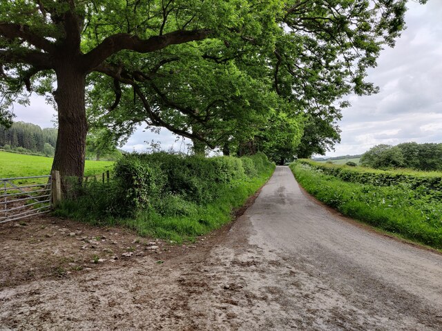
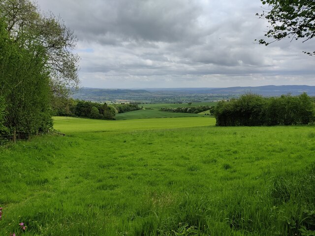
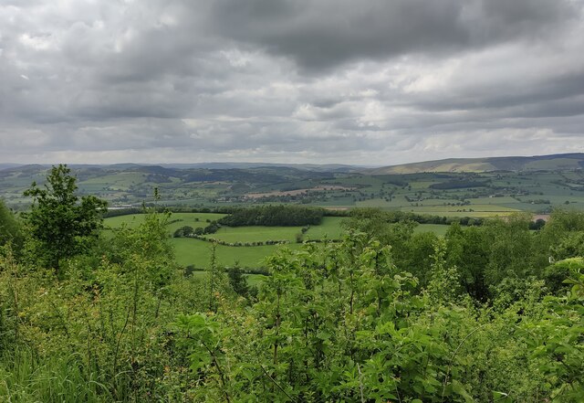
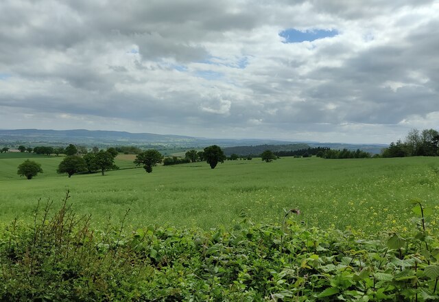
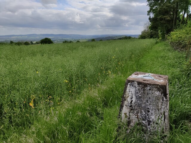
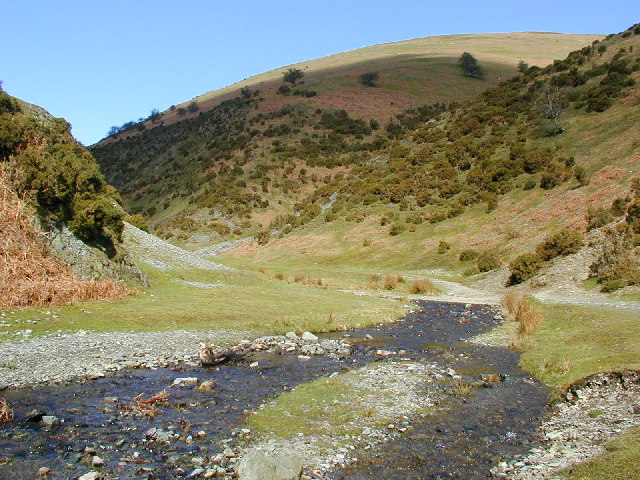
Strefford Wood is a picturesque woodland located in Shropshire, England. Covering an area of approximately 100 acres, it is a haven for nature enthusiasts and those seeking tranquility amidst nature's beauty. The wood is situated near the village of Strefford, offering easy access to visitors from nearby towns and villages.

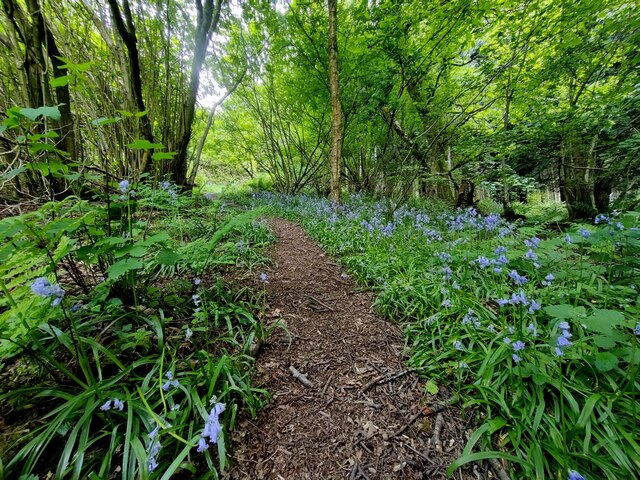
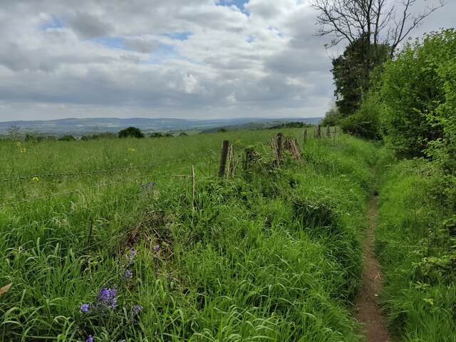
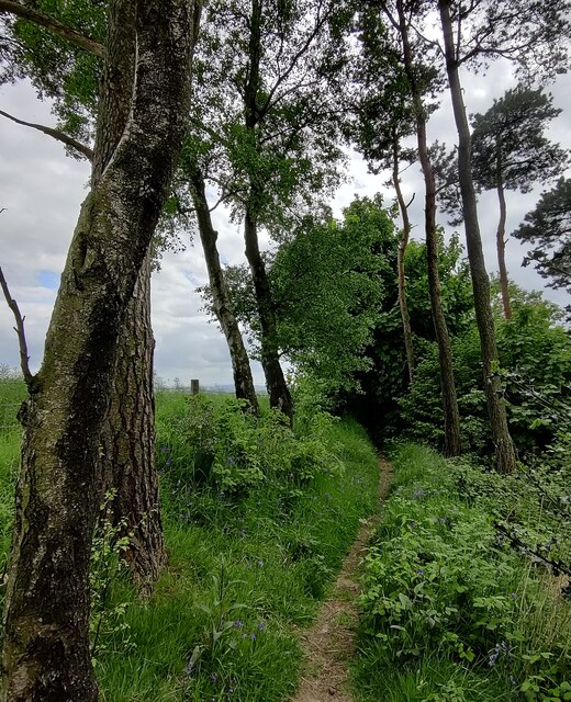
The woodland is predominantly composed of oak and beech trees, although other species such as sycamore, birch, and holly can also be found. These trees provide a dense canopy, creating a sheltered and serene environment. The forest floor is carpeted with a rich diversity of flora, including bluebells, primroses, and wild garlic, which bloom in vibrant colors during the spring.

Strefford Wood is home to a variety of wildlife, making it an ideal spot for birdwatching and animal spotting. Visitors may catch glimpses of woodland birds such as woodpeckers, owls, and warblers, as well as small mammals like squirrels and hedgehogs. The wood is also frequented by deer, which can be observed grazing in the early morning or evening hours.

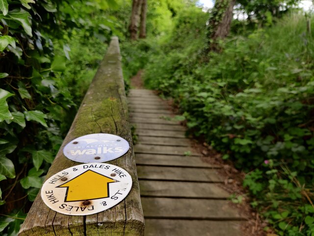
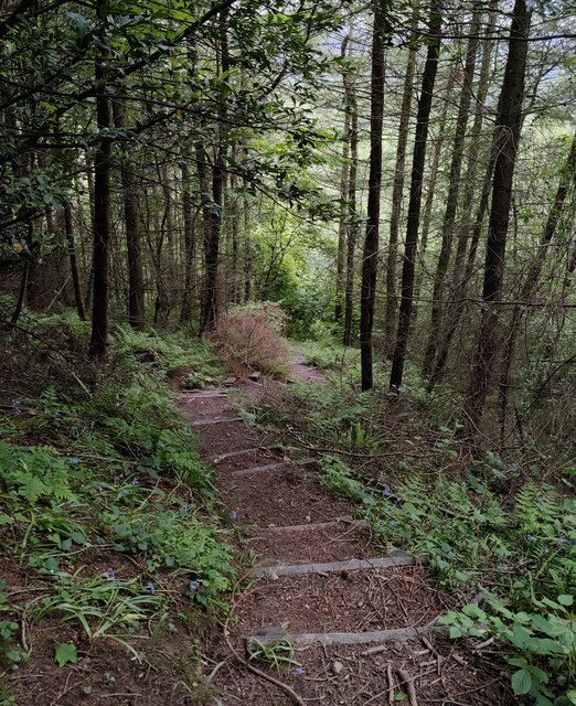
Several well-maintained footpaths and trails meander through the wood, providing visitors with the opportunity to explore its natural wonders. The paths are suitable for walkers of all abilities, offering a peaceful and pleasant environment for leisurely strolls, dog walking, or family outings.

Overall, Strefford Wood is a captivating natural gem in the heart of Shropshire, offering visitors a chance to immerse themselves in the beauty of a traditional English woodland. Whether it is for a peaceful walk, wildlife observation, or simply to enjoy the serenity of nature, this woodland is a must-visit destination for nature lovers.

If you have any feedback on the listing, please let us know in the comments section below.

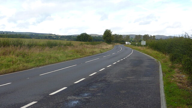
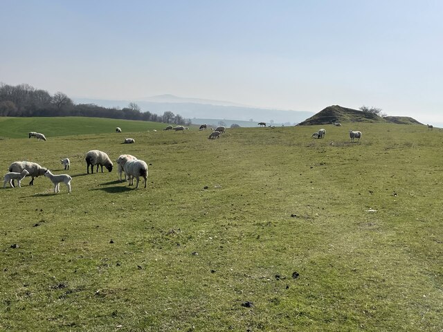
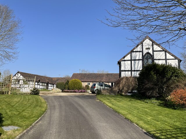
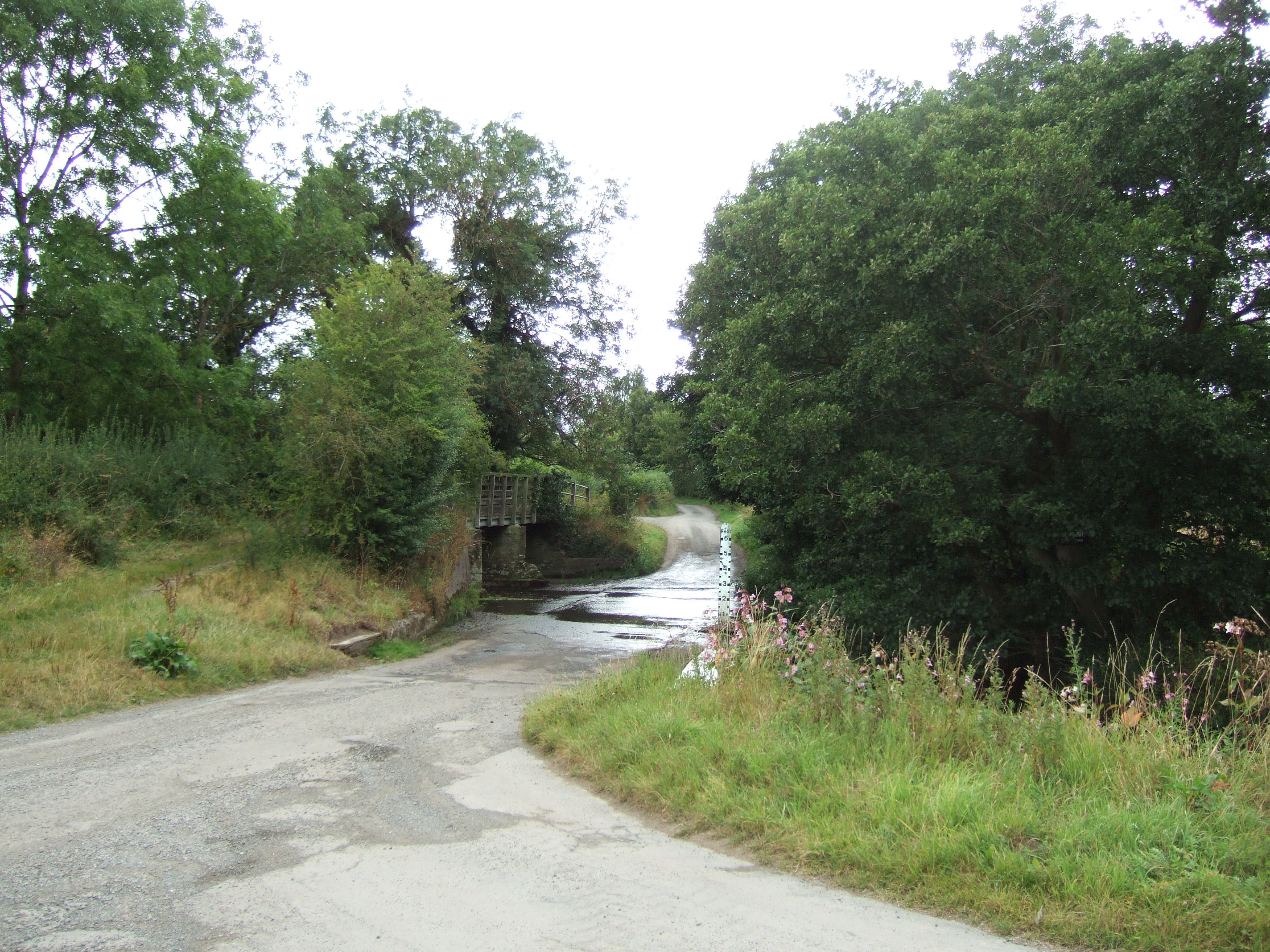
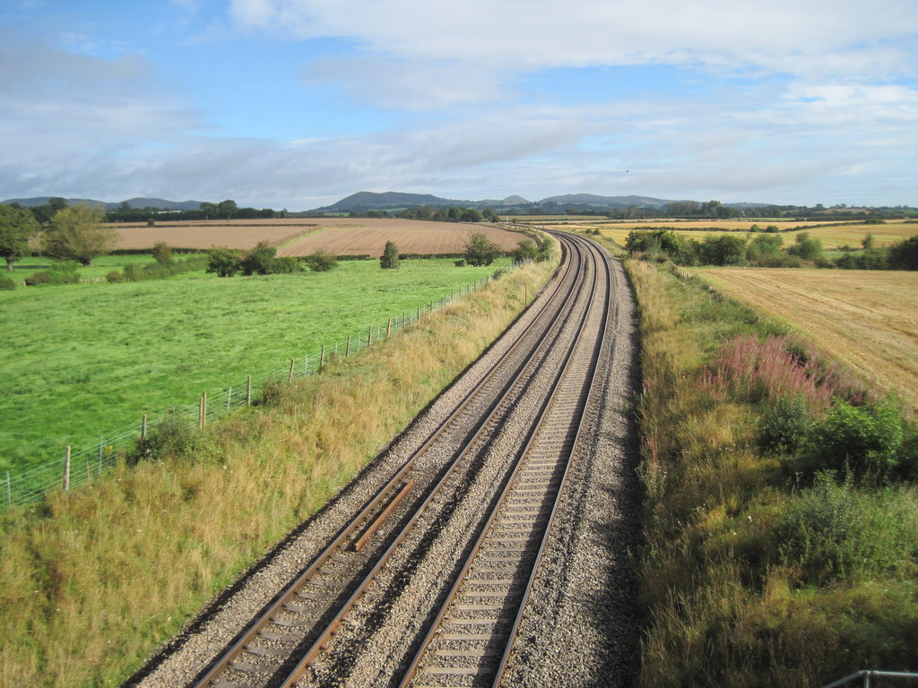
Strefford Wood Images

Images are sourced within 2km of 52.464389/-2.8107973 or Grid Reference SO4585. Thanks to Geograph Open Source API. All images are credited.

A49 Near Upper Affcot Looking north from lay-by on southbound side
A49 Near Upper Affcot
Looking north from lay-by on southbound side
Rocky outcrops on Halford Hill, north east of Craven Arms Peaceful and contented sheep on the hillside.
Rocky outcrops on Halford Hill, north east of Craven Arms
Peaceful and contented sheep on the hillside.
Lower Dinchope residence The building on the right is the old chapel, with a date plate of 1862 and an original stained glass window.
Lower Dinchope residence
The building on the right is the old chapel, with a date plate of 1862 and an original stained glass window.
Lane near Callow Hill
Woodland at Callow Hill Callow Hill, 336m (1,102 ft), is the highest point of Wenlock Edge, Flounders' Folly is a tower on the summit.
Woodland at Callow Hill
Callow Hill, 336m (1,102 ft), is the highest point of Wenlock Edge, Flounders' Folly is a tower on the summit.
Track and bridleway at Callow Hill Callow Hill, 336m (1,102 ft), is the highest point of Wenlock Edge, Flounders' Folly is a tower on the summit.
Track and bridleway at Callow Hill
Callow Hill, 336m (1,102 ft), is the highest point of Wenlock Edge, Flounders' Folly is a tower on the summit.
Path through Frizland Coppice at Callow Hill
Corve Dale viewed from Callow Hill Callow Hill, 336m (1,102 ft), is the highest point of Wenlock Edge, Flounders' Folly is a tower on the summit.
Corve Dale is the valley formed by the River Corve, it lies between Wenlock Edge and the Clee Hills in Shropshire.
Corve Dale viewed from Callow Hill
Callow Hill, 336m (1,102 ft), is the highest point of Wenlock Edge, Flounders' Folly is a tower on the summit. Corve Dale is the valley formed by the River Corve, it lies between Wenlock Edge and the Clee Hills in Shropshire.
Flounders' Folly on Callow Hill Callow Hill, 336m (1,102 ft), is the highest point of Wenlock Edge.
Flounders' Folly is a tower on the summit of Callow Hill, it is 80 feet (24 m) tall and 16 feet (4.9 m) square. It was built in 1838 by Benjamin Flounders (1768–1846), an industrial entrepreneur and philanthropic Yorkshireman. It has had several owners down the years, and was owned for a time by the actress Julie Christie. It is now owned by the Flounders Folly Trust and is occasionally open to the public.
Flounders' Folly on Callow Hill
Callow Hill, 336m (1,102 ft), is the highest point of Wenlock Edge. Flounders' Folly is a tower on the summit of Callow Hill, it is 80 feet (24 m) tall and 16 feet (4.9 m) square. It was built in 1838 by Benjamin Flounders (1768–1846), an industrial entrepreneur and philanthropic Yorkshireman. It has had several owners down the years, and was owned for a time by the actress Julie Christie. It is now owned by the Flounders Folly Trust and is occasionally open to the public.
Wenlock Edge viewed from Callow Hill Callow Hill, 336m (1,102 ft), is the highest point of Wenlock Edge, Flounders' Folly is a tower on the summit.
Wenlock Edge viewed from Callow Hill
Callow Hill, 336m (1,102 ft), is the highest point of Wenlock Edge, Flounders' Folly is a tower on the summit.
Flounders' Folly on Callow Hill Callow Hill, 336m (1,102 ft), is the highest point of Wenlock Edge.
Flounders' Folly is a tower on the summit of Callow Hill, it is 80 feet (24 m) tall and 16 feet (4.9 m) square. It was built in 1838 by Benjamin Flounders (1768–1846), an industrial entrepreneur and philanthropic Yorkshireman. It has had several owners down the years, and was owned for a time by the actress Julie Christie. It is now owned by the Flounders Folly Trust and is occasionally open to the public.
Flounders' Folly on Callow Hill
Callow Hill, 336m (1,102 ft), is the highest point of Wenlock Edge. Flounders' Folly is a tower on the summit of Callow Hill, it is 80 feet (24 m) tall and 16 feet (4.9 m) square. It was built in 1838 by Benjamin Flounders (1768–1846), an industrial entrepreneur and philanthropic Yorkshireman. It has had several owners down the years, and was owned for a time by the actress Julie Christie. It is now owned by the Flounders Folly Trust and is occasionally open to the public.
Farmland south of Callow Hill
Path on Callow Hill Callow Hill, 336m (1,102 ft), is the highest point of Wenlock Edge.
Path on Callow Hill
Callow Hill, 336m (1,102 ft), is the highest point of Wenlock Edge.
Bluebells near Flounders' Folly Flounders' Folly is a tower on the summit of Callow Hill, it is 80 feet (24 m) tall and 16 feet (4.9 m) square. It was built in 1838 by Benjamin Flounders (1768–1846), an industrial entrepreneur and philanthropic Yorkshireman. It has had several owners down the years, and was owned for a time by the actress Julie Christie. It is now owned by the Flounders Folly Trust and is occasionally open to the public.
Bluebells near Flounders' Folly
Flounders' Folly is a tower on the summit of Callow Hill, it is 80 feet (24 m) tall and 16 feet (4.9 m) square. It was built in 1838 by Benjamin Flounders (1768–1846), an industrial entrepreneur and philanthropic Yorkshireman. It has had several owners down the years, and was owned for a time by the actress Julie Christie. It is now owned by the Flounders Folly Trust and is occasionally open to the public.
Triangulation pillar on Callow Hill Callow Hill, 336m (1,102 ft), is the highest point of Wenlock Edge.
Triangulation pillar on Callow Hill
Callow Hill, 336m (1,102 ft), is the highest point of Wenlock Edge.
Path on Callow Hill Callow Hill, 336m (1,102 ft), is the highest point of Wenlock Edge.
Path on Callow Hill
Callow Hill, 336m (1,102 ft), is the highest point of Wenlock Edge.
Footbridge and path at Callow Hill Callow Hill, 336m (1,102 ft), is the highest point of Wenlock Edge.
Footbridge and path at Callow Hill
Callow Hill, 336m (1,102 ft), is the highest point of Wenlock Edge.
Steps descending Callow Hill Callow Hill, 336m (1,102 ft), is the highest point of Wenlock Edge.
Steps descending Callow Hill
Callow Hill, 336m (1,102 ft), is the highest point of Wenlock Edge.
Show me another place!

Strefford Wood is located at Grid Ref: SO4585 (Lat: 52.464389, Lng: -2.8107973)

Unitary Authority: Shropshire

Police Authority: West Mercia

What 3 Words

///array.blotchy.bricks. Near Craven Arms, Shropshire

Nearby Locations

Ash Beds Strefford Wood

Related Wikis

Strefford

Strefford is a historic hamlet in Shropshire, England. It lies in the civil parish of Wistanstow and is situated just off the A49 road 2 miles (3.2 km...
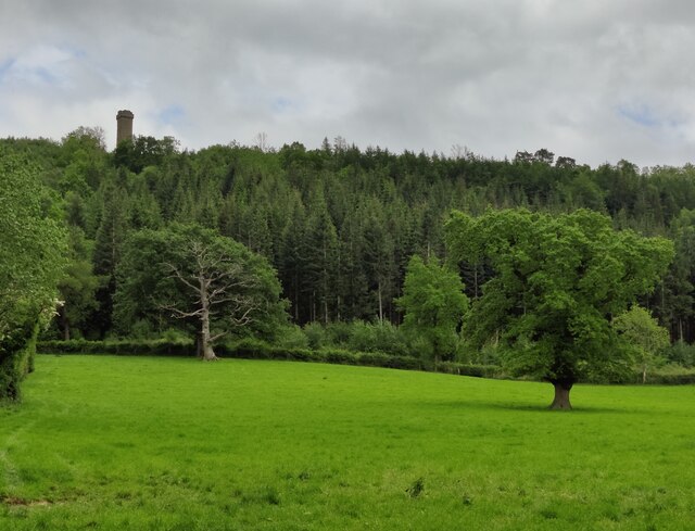
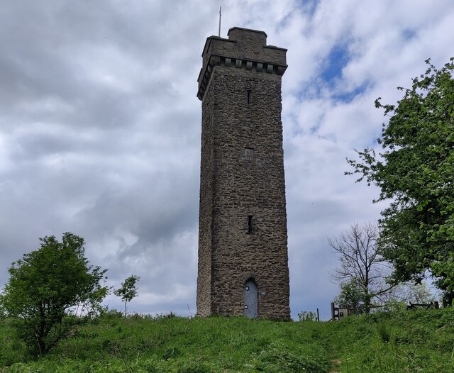
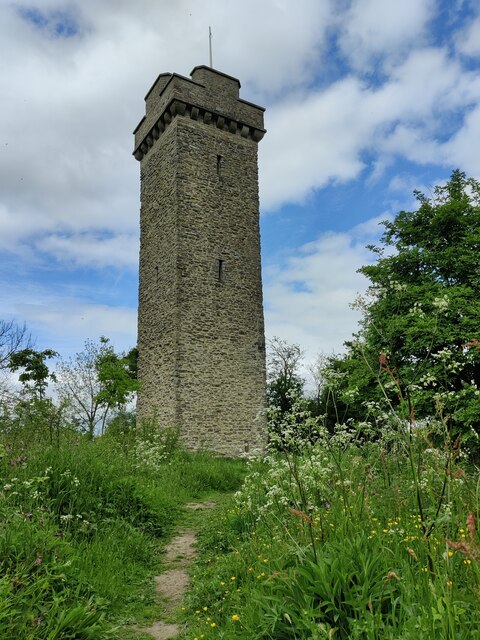
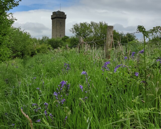
Flounders' Folly

Flounders' Folly is a tower, built in 1838, on Callow Hill, near Craven Arms at the western end of Wenlock Edge in Shropshire, England. The tower is approximately...

Upper Affcot

Upper Affcot is a hamlet in Shropshire, England. It is located on the A49 north of Craven Arms and south of Church Stretton, between the hamlets of Strefford...

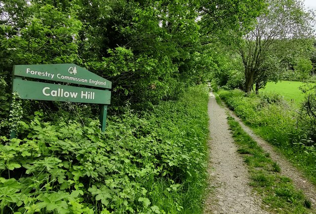
Callow Hill, Shropshire

Callow Hill is a hill near the village of Lower Dinchope between Craven Arms and Ludlow in the English county of Shropshire. Its summit marks the highest...

Wistanstow Halt railway station

Wistanstow Halt railway station was a station in Wistanstow, Shropshire, England. The station was opened in 1934 and closed in 1956. == References... ==

Wistanstow

Wistanstow is a village and parish in Shropshire, England. Wistanstow is located about 5 miles (8.0 km) south of Church Stretton and 8+1⁄2 miles (13.7...

Alcaston

Alcaston is a village in Shropshire, England. == See also == Listed buildings in Acton Scott == External links == Media related to Alcaston at Wikimedia...

Quinny Brook

Quinny Brook is a tributary stream of the River Onny which flows through the Shropshire Hills Area of Outstanding Natural Beauty in England. == Course... ==

Nearby Amenities

Located within 500m of 52.464389,-2.8107973
Power: pole
Lat/Long: 52.4672367/-2.814914
Power: pole
Lat/Long: 52.4660896/-2.8149194
Power: pole
Lat/Long: 52.4650013/-2.8148443
Power: pole
Lat/Long: 52.4642986/-2.8155738
Power: pole
Lat/Long: 52.4636907/-2.816239
Power: pole
Lat/Long: 52.4629161/-2.8170705
Power: pole
Lat/Long: 52.4682204/-2.8142944
The data included in this document is from www.openstreetmap.org. The data is made available under ODbL.

Have you been to Strefford Wood?

Leave your review of Strefford Wood below (or comments, questions and feedback).