Brow Wood

Wood, Forest in Cumberland Eden

England

Brow Wood

Fields with Motherby beyond Agricultural land north of Penruddock.
Part of the summit ridge of Blencathra is visible in the distance.
Fields with Motherby beyond Credit: Trevor Littlewood

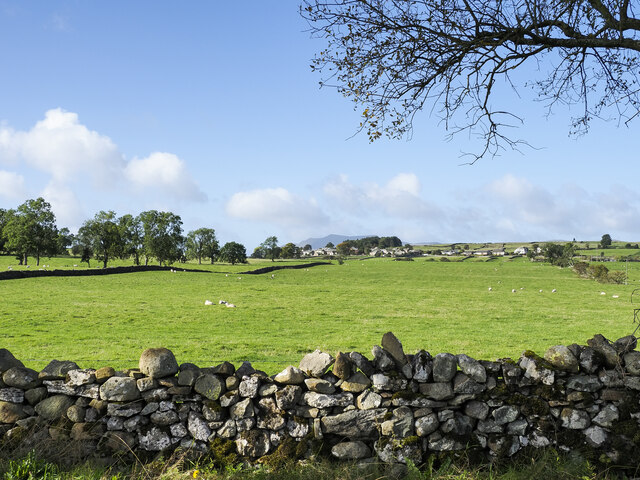
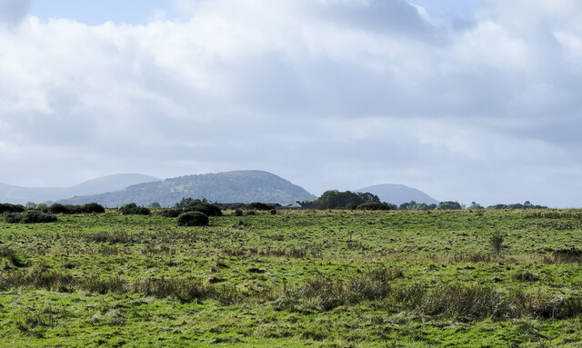
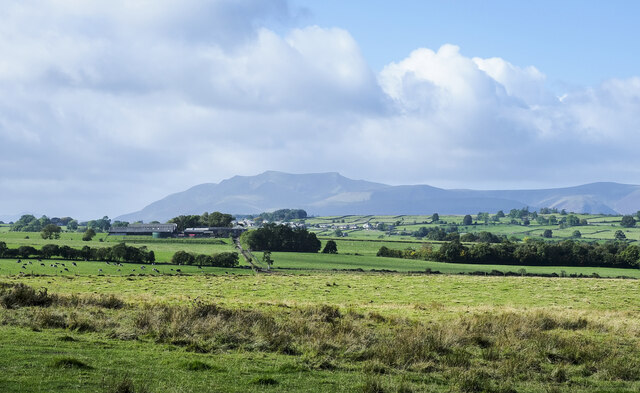
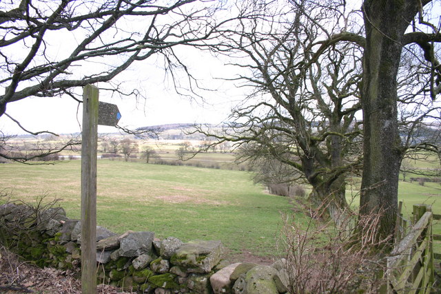
Brow Wood, also known as Cumberland Wood or Cumberland Forest, is a picturesque woodland located in the county of Cumbria, England. Situated in the northern part of the Lake District National Park, this enchanting forest covers an area of approximately 10 square kilometers.

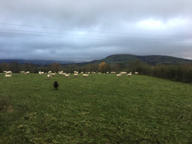
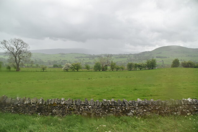
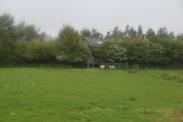
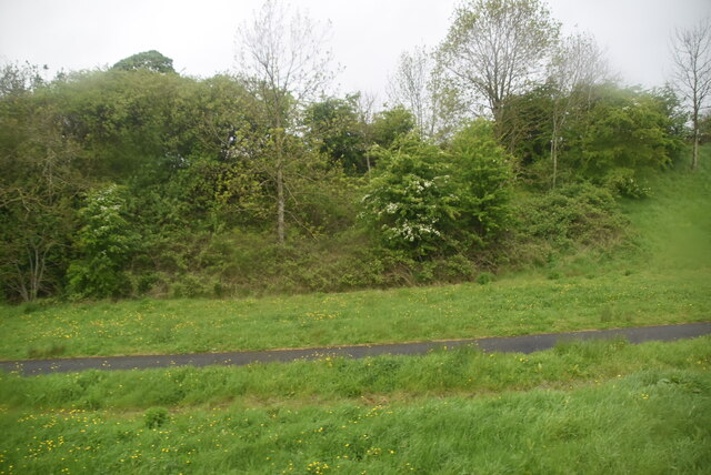
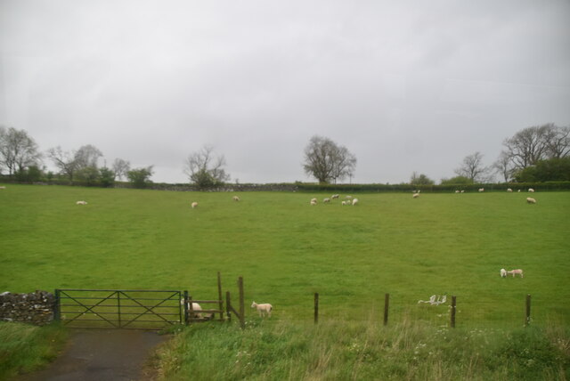
Brow Wood is characterized by its diverse range of flora and fauna, making it a haven for nature enthusiasts and wildlife lovers. The forest is home to a variety of tree species, including oak, beech, and birch, creating a rich and vibrant canopy that changes with the seasons. The forest floor is carpeted with a tapestry of wildflowers, adding to its beauty and charm.

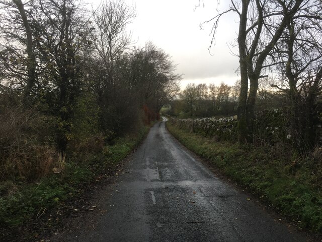
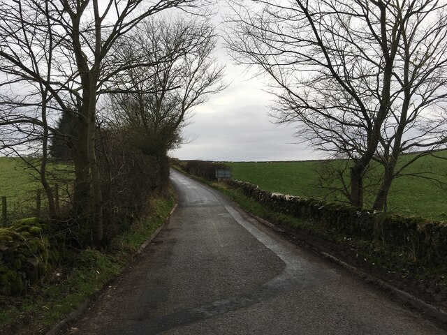
The woodland is crisscrossed by a network of well-maintained footpaths, allowing visitors to explore its hidden treasures. These paths wind through the forest, leading to tranquil glades, babbling brooks, and captivating viewpoints that offer breathtaking vistas of the surrounding countryside.

Brow Wood is teeming with wildlife, providing a natural habitat for numerous species. Visitors may be lucky enough to spot red squirrels darting among the trees or catch a glimpse of deer grazing in the meadows. The forest is also home to a variety of bird species, including woodpeckers, owls, and various songbirds, making it a birdwatcher's paradise.

For those seeking outdoor activities, Brow Wood offers ample opportunities. The forest is a popular spot for hiking, with trails of varying difficulty levels catering to all abilities. Mountain biking is also a favored pastime, with dedicated trails weaving through the forest, providing an exhilarating experience for riders.

Overall, Brow Wood is a magical place where nature thrives, offering visitors a tranquil retreat amidst the breathtaking landscapes of the Lake District National Park.

If you have any feedback on the listing, please let us know in the comments section below.
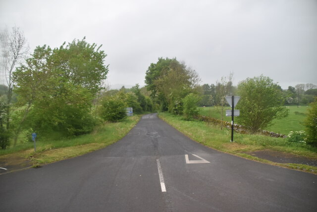
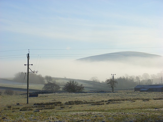
Brow Wood Images

Images are sourced within 2km of 54.638868/-2.8585438 or Grid Reference NY4427. Thanks to Geograph Open Source API. All images are credited.

Fields with Motherby beyond Agricultural land north of Penruddock.
Part of the summit ridge of Blencathra is visible in the distance.
Fields with Motherby beyond
Agricultural land north of Penruddock. Part of the summit ridge of Blencathra is visible in the distance.
Access road for Kirkbarrow The road to Kirkbarrow Farm: the apex of a roof of one of the buildings can be seen breaking the skyline.
Access road for Kirkbarrow
The road to Kirkbarrow Farm: the apex of a roof of one of the buildings can be seen breaking the skyline.
Roughly vegetated ground south of Gillbarffs Wood The ground has surely seen some agricultural improvement but at best it can be described only as rough grazing.
Great Mell Fell is the domed hill at the centre of the image.
Roughly vegetated ground south of Gillbarffs Wood
The ground has surely seen some agricultural improvement but at best it can be described only as rough grazing. Great Mell Fell is the domed hill at the centre of the image.
Rough Grazing on Division Moor The curiously named area of ground named on OS maps as Division Moor.
Blencathra and other hills of the Northern Fells are in the distance.
Rough Grazing on Division Moor
The curiously named area of ground named on OS maps as Division Moor. Blencathra and other hills of the Northern Fells are in the distance.
Sheep grazing near Penruddock
Minor road towards Greystoke
Minor road towards Dacrebank
Old Boundary Marker near Penruddock Hall Township Boundary Marker on the east side of the minor road south of Motherby, near Penruddock Hall and opposite water troughs. Until 1866 this was the boundary of Motherby and Gill and Hutton Soil townships, then Greystoke and Hutton Soil parishes until 1934, then Greystoke and Hutton parishes. Now entirely in Hutton parish. The plate is now missing. 

Milestone Society National ID: CU_HUTT03pb
Old Boundary Marker near Penruddock Hall
Township Boundary Marker on the east side of the minor road south of Motherby, near Penruddock Hall and opposite water troughs. Until 1866 this was the boundary of Motherby and Gill and Hutton Soil townships, then Greystoke and Hutton Soil parishes until 1934, then Greystoke and Hutton parishes. Now entirely in Hutton parish. The plate is now missing. Milestone Society National ID: CU_HUTT03pb
Bush, dry stone wall and pasture south of A66
Water company building by A66
North lakeland pasture
Two sheep
Two sheep
A66 The A66 is a major road in northern England running from near Middlesbrough to Workington. The section between Scotch Corner and Penrith is a Trans-Pennine route between the A1 and M6, following an old Roman Road.
Wikipedia: <span class="nowrap"><a title="http://en.wikipedia.org/wiki/A66_road" rel="nofollow ugc noopener" href="http://en.wikipedia.org/wiki/A66_road">Link</a><img style="margin-left:2px;" alt="External link" title="External link - shift click to open in new window" src="https://s1.geograph.org.uk/img/external.png" width="10" height="10"/></span>
A66
The A66 is a major road in northern England running from near Middlesbrough to Workington. The section between Scotch Corner and Penrith is a Trans-Pennine route between the A1 and M6, following an old Roman Road. Wikipedia: LinkExternal link
Road cutting, A66
Road cutting, A66
Sheep grazing
Sheep grazing
Regional Route 71
Regional Route 71
North Lakeland pasture
Show me another place!

Brow Wood is located at Grid Ref: NY4427 (Lat: 54.638868, Lng: -2.8585438)

Administrative County: Cumbria

District: Eden

Police Authority: Cumbria

What 3 Words

///jugs.secrets.workroom. Near Penrith, Cumbria

Nearby Locations

Crow Wood Brow Wood

Related Wikis

Hutton, Cumbria

Hutton is a small civil parish about 6 miles (9.7 km) west of Penrith in the English county of Cumbria. The parish contains the small mansion and former...

St Andrew's Church, Dacre

St Andrew's Church is in the village of Dacre, Cumbria, England. It is an active Anglican parish church in the deanery of Penrith, the archdeaconry of...

Dacre, Cumbria

Dacre (English: ) is a small village, civil parish and electoral ward in the Lake District National Park in the Eden District of Cumbria, England, and...

Dacre Castle

Dacre Castle is a moated tower house in the village of Dacre, 4 miles (6.4 km) south-west of Penrith, Cumbria, England. It was constructed in the mid-14th...
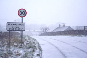
Penruddock

Penruddock is a small village in Cumbria, England, 5.5 miles to the west of Penrith. It forms part of the civil parish of Hutton. == History == The name...
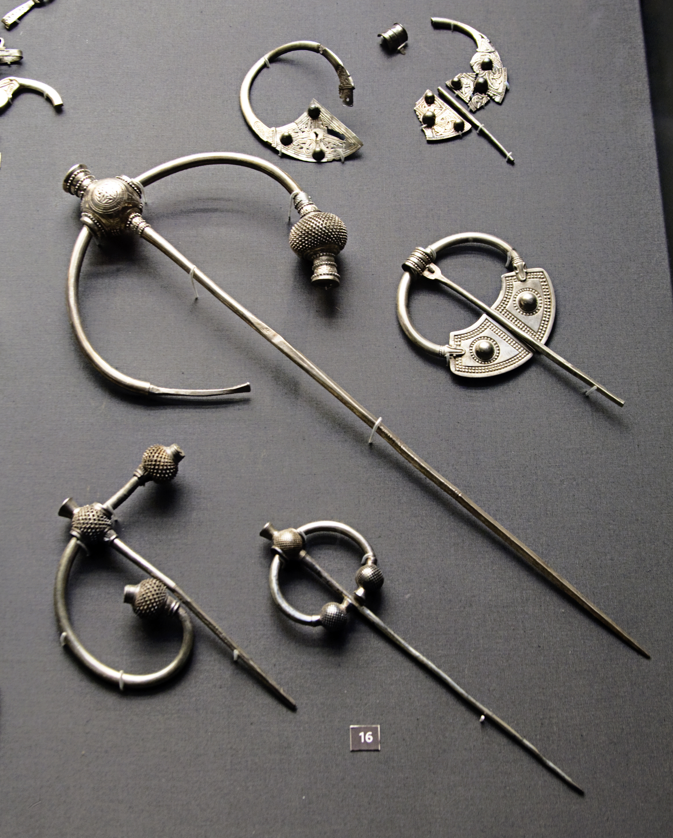
Penrith Hoard

The Penrith Hoard is a dispersed hoard of 10th century silver penannular brooches found at Flusco Pike, Newbiggin Moor, near Penrith in Cumbria, and now...

Penruddock railway station

Penruddock railway station was situated on the Cockermouth, Keswick and Penrith Railway between Penrith and Cockermouth in Cumberland (now in Cumbria)...

Soulby, Dacre

Soulby is a hamlet in the civil parish of Dacre, near the villages of Dacre and Pooley Bridge and the A592 road, in the Eden district, in the English county...

Related Videos

Ullswater Heights Holiday Home and Lodge Park | Full Tour!

Join us inside Ullswater Heights luxury holiday homes and lodges. An in-depth look inside the lodge and all the little things you ...

Walking Tour Around Hoseasons Flusco Wood Luxury Lodges

Our regular scheduling is Tuesdays, Thursday and Friday so please join us then and don't forget to subscribe. Join this channel to ...

A cheeky hidden pond tucked away on the Dalemain Loop of the Ullswater way, Lake District

We were walking around the Dalemain Loop of the Ullswater Way and we stumbled across this little gem of a pond, there was ...

Soulands Yoga and Health Studio / Dacre, Penrith / Lake District

Soulands Studio offers a peaceful, welcoming and intimate space, which has been designed to create an atmosphere of ...

Nearby Amenities

Located within 500m of 54.638868,-2.8585438
Generator Method: photovoltaic
Generator Output Electricity: yes
Generator Source: solar
Generator Type: solar_photovoltaic_panel
Location: roof
Power: generator
Lat/Long: 54.639892/-2.8619845
Generator Method: photovoltaic
Generator Output Electricity: yes
Generator Source: solar
Generator Type: solar_photovoltaic_panel
Location: roof
Power: generator
Lat/Long: 54.6398154/-2.8622223
Dacre Bank
Ele: 302
Natural: peak
Lat/Long: 54.6403837/-2.8517714
Power: pole
Lat/Long: 54.6426321/-2.8556599
Power: pole
Lat/Long: 54.6423253/-2.8571643
Power: pole
Lat/Long: 54.6419564/-2.8589933
Power: pole
Lat/Long: 54.6417874/-2.8606138
Power: pole
Lat/Long: 54.6415978/-2.8623892
Power: pole
Lat/Long: 54.6414203/-2.8642272
Power: pole
Lat/Long: 54.641353/-2.8649302
The data included in this document is from www.openstreetmap.org. The data is made available under ODbL.

Have you been to Brow Wood?

Leave your review of Brow Wood below (or comments, questions and feedback).