An Apainn

Settlement in Argyllshire

Scotland

An Apainn

Trig point on Airds Hill
Trig point on Airds Hill Credit: Steven Brown

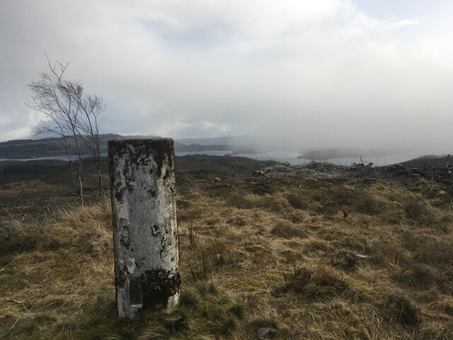
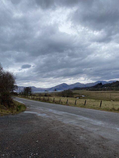
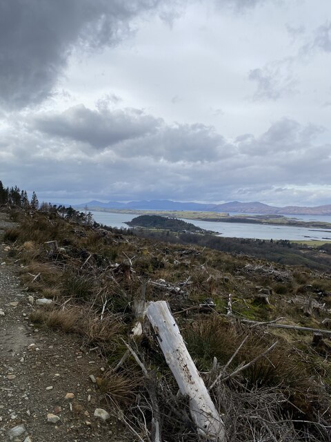
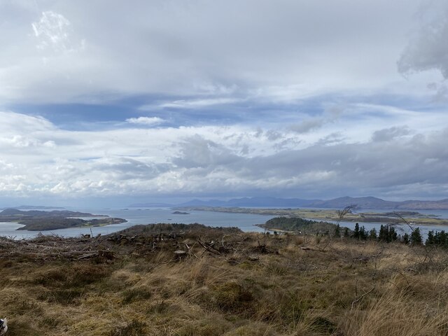
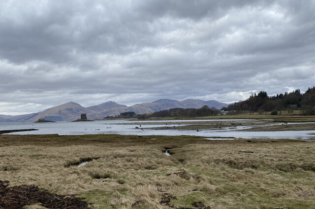
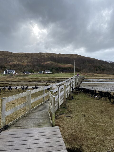
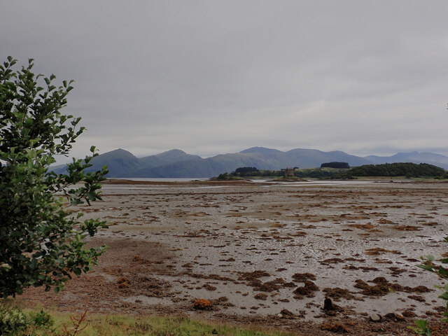
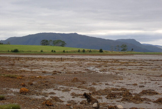
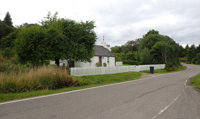
An Apainn, also known as Appin, is a small coastal village located in Argyllshire, Scotland. Situated on the west coast of the country, it lies approximately 15 miles northwest of the town of Oban. Nestled in a picturesque setting, An Apainn is surrounded by stunning natural landscapes, including the Scottish Highlands and Loch Linnhe.

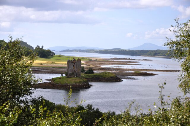
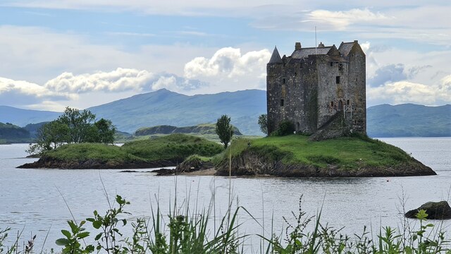
The village is known for its rich history, dating back to ancient times. It has been inhabited for over 4,000 years, with evidence of early settlements and historical landmarks scattered throughout the area. One of the notable landmarks is Castle Stalker, a four-story tower house situated on an islet in Loch Laich. Built in the 14th century, the castle is a popular tourist attraction and offers breathtaking views of the surrounding scenery.

An Apainn is also a popular destination for outdoor enthusiasts. The village serves as a gateway to Glencoe, a renowned area for hiking, mountaineering, and winter sports. The nearby Loch Linnhe provides opportunities for fishing, boating, and wildlife spotting.

In terms of amenities, An Apainn offers a range of facilities to cater to residents and visitors. There are several accommodation options, including hotels, bed and breakfasts, and self-catering cottages. The village also has a few local shops, cafes, and restaurants, providing essential services and a taste of local cuisine.

With its stunning natural beauty, rich history, and outdoor recreational opportunities, An Apainn is a charming village that attracts visitors from all over the world. It offers a tranquil and idyllic escape for those seeking a peaceful retreat in the heart of the Scottish Highlands.

If you have any feedback on the listing, please let us know in the comments section below.

An Apainn Images

Images are sourced within 2km of 56.562502/-5.359795 or Grid Reference NM9346. Thanks to Geograph Open Source API. All images are credited.

Trig point on Airds Hill
Castle Stalker near Portnacroish Castle Stalker was built around 1446 by the Stewarts and is still in the family to this day.
Castle Stalker near Portnacroish
Castle Stalker was built around 1446 by the Stewarts and is still in the family to this day.
View towards Castle Stalker
View from track to Airds Hill towards Port Appin
Stunning views from Airds Hill
Loch Laich and Castle Stalker
Footbridge crossing Loch Laich
Ceann an t-Sailein View across Ceann an t-Sailein, a creek off Loch Laich, at low tide, with Beinn Donn in the distance to the right.
Ceann an t-Sailein
View across Ceann an t-Sailein, a creek off Loch Laich, at low tide, with Beinn Donn in the distance to the right.
Castle Stalker
Castle Stalker
Castle Stalker
Castle Stalker
A view across Loch Laich at low tide Castle Stalker is in the distance.
A view across Loch Laich at low tide
Castle Stalker is in the distance.
A view across Loch Laich at low tide Achosrigan is on the other side of the loch.
A view across Loch Laich at low tide
Achosrigan is on the other side of the loch.
A view across Loch Laich at low tide Castle Stalker is in the distance.
A view across Loch Laich at low tide
Castle Stalker is in the distance.
A view across Loch Laich at low tide Castle Stalker and Achosrigan can be seen across the loch.
A view across Loch Laich at low tide
Castle Stalker and Achosrigan can be seen across the loch.
A view across Loch Laich at low tide
Cuildhu, a house on the road on the southern shore of Loch Laich
Castle Stalker <span class="nowrap"><a title="https://canmore.org.uk/site/23298/castle-stalker" rel="nofollow ugc noopener" href="https://canmore.org.uk/site/23298/castle-stalker">Link</a><img style="margin-left:2px;" alt="External link" title="External link - shift click to open in new window" src="https://s1.geograph.org.uk/img/external.png" width="10" height="10"/></span>
Castle Stalker
Show me another place!

An Apainn is located at Grid Ref: NM9346 (Lat: 56.562502, Lng: -5.359795)

Unitary Authority: Argyll and Bute

Police Authority: Argyll and West Dunbartonshire

Also known as: Appin

What 3 Words

///ambient.phones.skinning. Near Oban, Argyll & Bute

Nearby Locations

An Apainn Appin

Related Wikis

Appin

Appin (Scottish Gaelic: An Apainn) is a coastal district of the Scottish West Highlands bounded to the west by Loch Linnhe, to the south by Loch Creran...

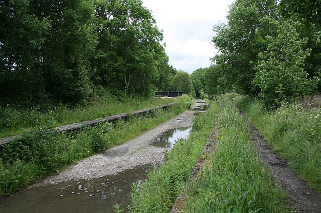
Appin railway station

Appin was a railway station in Scotland, close to the Sound of Shuna on the east shore of Loch Laiche - an arm of Loch Linnhe, Portnacroish, Appin in Argyll...

Castle Stalker

Castle Stalker (Scottish Gaelic: Caisteal an Stalcaire) is a four-storey tower house or keep in the Scottish county of Argyll. It is set on a tidal islet...

Shuna Island

Shuna Island or simply Shuna is an island in Loch Linnhe, offshore from Appin, in Argyll and Bute, Scotland. The island is approximately two kilometres...

Nearby Amenities

Located within 500m of 56.562502,-5.359795
Appin
Is In: Argyll, Scotland, UK
Name En: Appin
Name Gd: An Apainn
Place: village
Wikidata: Q1404409
Wikipedia: en:Appin
Lat/Long: 56.5617885/-5.3584857
Bus Stop
Lat/Long: 56.5608686/-5.3573761
Townhall
Appin Village Hall
Lat/Long: 56.5596114/-5.3558281
Fuel
Operator: Highland Fuels
Source: survey
Lat/Long: 56.5620538/-5.3586339
Place Of Worship
Source: OS_OpenData_StreetView
Lat/Long: 56.5645559/-5.3546351
Place Of Worship
Source: OS_OpenData_StreetView
Lat/Long: 56.5598737/-5.3566726
Kirkton
Is In: Argyll, Scotland, UK
Place: hamlet
Source: OS_OpenData_StreetView
Lat/Long: 56.5599665/-5.3573216
School
Strath of Appin Primary School Gaelic Medium
Addr Postcode: PA38 4BG
Email: enquiries-strathofappin@argyll-bute.gov.uk
Official Name: Strath of Appin Primary School Gaelic Medium
Operator: Argyll and Bute Council
Operator Wikidata: Q28530251
Phone: +44 1631 730345
Ref GB Uprn: 125066783
Ref Seedcode: 8100020
Religion: none
School: primary
Source: OS_OpenData_StreetView
Website: https://www.strathappin.argyll-bute.sch.uk/
Lat/Long: 56.5635149/-5.3603284
Kinlochlaich Garden Self Catering
Addr City: Appin
Addr Postcode: PA38 4BD
Tourism: chalet
Website: https://www.kinlochlaichgardenselfcatering.co.uk/
Lat/Long: 56.5660143/-5.3560444
Place: farm
Lat/Long: 56.564343/-5.3524892
Power: pole
Lat/Long: 56.5641596/-5.3542055
Power: pole
Lat/Long: 56.5637569/-5.3554809
Power: pole
Lat/Long: 56.5633844/-5.3566933
Power: pole
Lat/Long: 56.5634746/-5.357742
Power: pole
Lat/Long: 56.5636002/-5.3582865
Power: pole
Lat/Long: 56.5639283/-5.359228
Power: pole
Lat/Long: 56.564184/-5.3599736
Power: pole
Lat/Long: 56.5644589/-5.3607434
Power: pole
Lat/Long: 56.5647146/-5.3614864
Power: pole
Lat/Long: 56.564671/-5.3625458
Power: pole
Lat/Long: 56.5646067/-5.3643751
Power: pole
Lat/Long: 56.5645254/-5.3662151
Power: pole
Transformer: distribution
Lat/Long: 56.5635958/-5.3594399
Power: pole
Lat/Long: 56.5588675/-5.3554897
Power: pole
Lat/Long: 56.5591937/-5.3559628
Power: pole
Lat/Long: 56.5599477/-5.3570374
Power: pole
Lat/Long: 56.5608888/-5.3582933
Power: pole
Lat/Long: 56.5615236/-5.3593285
Power: pole
Lat/Long: 56.5621409/-5.3603214
Give Way
Direction: forward
Lat/Long: 56.5622175/-5.3584933
Post Box
Lat/Long: 56.5621642/-5.3585832
Post Box
Lat/Long: 56.5632208/-5.3601014
The data included in this document is from www.openstreetmap.org. The data is made available under ODbL.

Have you been to An Apainn?

Leave your review of An Apainn below (or comments, questions and feedback).