Berry House Wood

Wood, Forest in Lancashire West Lancashire

England

Berry House Wood

The Mere, Martin Mere Wetlands Centre The lake, Martin Mere, was formed at the end of the last Ice Age when water filled a depression in the glacial drift. Until the late seventeenth century, this lake was the largest body of freshwater in England (5 miles in diameter, 20 miles circumference – three times the size of Windermere). Christopher Saxton's map from 1579 <span class="nowrap"><a title="http://en.wikipedia.org/wiki/Christopher_Saxton" rel="nofollow ugc noopener" href="http://en.wikipedia.org/wiki/Christopher_Saxton">Link</a><img style="margin-left:2px;" alt="External link" title="External link - shift click to open in new window" src="https://s1.geograph.org.uk/img/external.png" width="10" height="10"/></span>  shows the original giant lake stretching from Rufford in the east, to Churchtown (then known as North Meols) in the west.
The Mere, Martin Mere Wetlands Centre Credit: David Dixon

Berry House Wood is a picturesque woodland located in Lancashire, England. Spanning an area of approximately 50 acres, it is a haven for nature lovers and outdoor enthusiasts. The wood is situated near the village of Berry, hence its name, and is easily accessible by a network of footpaths and trails.

The woodland is predominantly composed of native trees such as oak, birch, and beech, which create a dense canopy overhead, casting dappled sunlight on the forest floor. This pristine environment provides a thriving habitat for a wide variety of flora and fauna. Visitors can expect to encounter an array of woodland birds, including woodpeckers, owls, and thrushes, as well as small mammals like squirrels and rabbits.

The wood offers a tranquil retreat from the bustling urban areas nearby, providing a peaceful setting for walking, jogging, or simply immersing oneself in nature. The well-maintained footpaths meander through the wood, enabling visitors to explore its different sections and discover its hidden gems.

Berry House Wood is particularly beautiful during the spring and summer months when the forest floor is carpeted with wildflowers, adding bursts of color to the greenery. In autumn, the woodland transforms into a kaleidoscope of vibrant hues as the leaves change, creating a stunning visual spectacle.

Managed by the local council, Berry House Wood is a cherished natural resource for the community. It offers a valuable space for education, recreation, and relaxation, making it a cherished destination for nature enthusiasts and families alike.

If you have any feedback on the listing, please let us know in the comments section below.

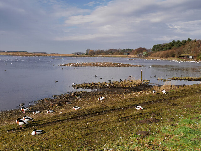
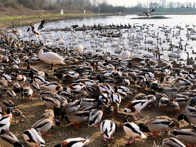
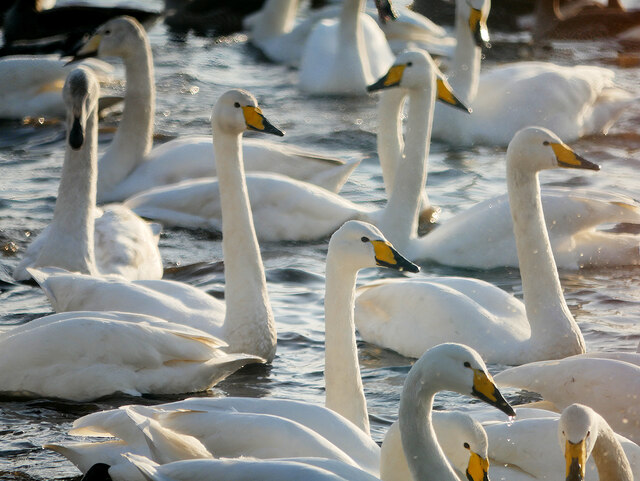
Berry House Wood Images

Images are sourced within 2km of 53.63657/-2.8687263 or Grid Reference SD4215. Thanks to Geograph Open Source API. All images are credited.

The Mere, Martin Mere Wetlands Centre The lake, Martin Mere, was formed at the end of the last Ice Age when water filled a depression in the glacial drift. Until the late seventeenth century, this lake was the largest body of freshwater in England (5 miles in diameter, 20 miles circumference – three times the size of Windermere). Christopher Saxton's map from 1579 <span class="nowrap"><a title="http://en.wikipedia.org/wiki/Christopher_Saxton" rel="nofollow ugc noopener" href="http://en.wikipedia.org/wiki/Christopher_Saxton">Link</a><img style="margin-left:2px;" alt="External link" title="External link - shift click to open in new window" src="https://s1.geograph.org.uk/img/external.png" width="10" height="10"/></span>  shows the original giant lake stretching from Rufford in the east, to Churchtown (then known as North Meols) in the west.
The Mere, Martin Mere Wetlands Centre
The lake, Martin Mere, was formed at the end of the last Ice Age when water filled a depression in the glacial drift. Until the late seventeenth century, this lake was the largest body of freshwater in England (5 miles in diameter, 20 miles circumference – three times the size of Windermere). Christopher Saxton's map from 1579 LinkExternal link shows the original giant lake stretching from Rufford in the east, to Churchtown (then known as North Meols) in the west.
Mallard in Eclipse Plumage I think this is a male mallard in its eclipse plumage. It is on the edge of the mere outside the Discovery Hide at the Martin Mere Wetlands Centre.

Male ducks (drakes) require their colourful plumage in spring to attract a mate during the breeding season. After the breeding season, the males begin to moult, replacing the old worn-out feathers with new ones. During this period, they are largely flightless and so are more vulnerable to predators; to provide some protection the brightly coloured body feathers are replaced by duller brown ones, similar to those of the females. This is known as the eclipse plumage and is worn by the drakes until their flight feathers have regrown and a second moult occurs when the male will once again grow back into his full colours.
Mallard in Eclipse Plumage
I think this is a male mallard in its eclipse plumage. It is on the edge of the mere outside the Discovery Hide at the Martin Mere Wetlands Centre. Male ducks (drakes) require their colourful plumage in spring to attract a mate during the breeding season. After the breeding season, the males begin to moult, replacing the old worn-out feathers with new ones. During this period, they are largely flightless and so are more vulnerable to predators; to provide some protection the brightly coloured body feathers are replaced by duller brown ones, similar to those of the females. This is known as the eclipse plumage and is worn by the drakes until their flight feathers have regrown and a second moult occurs when the male will once again grow back into his full colours.
The Mere, viewed from a hide A view of the mere from one of the small hides/shelters on the path along the eastern side of the lake.
The Mere, viewed from a hide
A view of the mere from one of the small hides/shelters on the path along the eastern side of the lake.
Carum Field, Martin Mere Wetland Centre WWT Martin Mere is a wetland nature reserve managed by the Wildfowl and Wetlands Trust (WWT). Situated on the West Lancashire Coastal Plain, it is one of nine reserves managed by the WWT, and it is designated as a Site of Special Scientific Interest (SSSI), an SPA (Special Protection Area) and a Ramsar Site <span class="nowrap"><a title="http://en.wikipedia.org/wiki/Ramsar_Site" rel="nofollow ugc noopener" href="http://en.wikipedia.org/wiki/Ramsar_Site">Link</a><img style="margin-left:2px;" alt="External link" title="External link - shift click to open in new window" src="https://s1.geograph.org.uk/img/external.png" width="10" height="10"/></span> .

The centre takes its name from the mere on the west side of the reserve which has been provided with eleven observation hides. On the east side of the reserve there are a number of pens providing habitats for birds from Africa, Australasia, North America, South America, Siberia, and Asia.

The lake, Martin Mere, was formed at the end of the last Ice Age, when water filled a depression in the glacial drift. Until the late seventeenth century, this lake was the largest body of fresh water in England (5 miles in diameter, 20 miles circumference – three times the size of Windermere). Christopher Saxton's map from 1579 <span class="nowrap"><a title="http://en.wikipedia.org/wiki/Christopher_Saxton" rel="nofollow ugc noopener" href="http://en.wikipedia.org/wiki/Christopher_Saxton">Link</a><img style="margin-left:2px;" alt="External link" title="External link - shift click to open in new window" src="https://s1.geograph.org.uk/img/external.png" width="10" height="10"/></span>  shows the original giant lake stretching from Rufford in the east, to Churchtown (then known as North Meols) in the west. 

Active management of the mere began in 1692 when the first drainage channel was dug, and further attempts to drain it were made in the 1780s, but effective drainage was only achieved in the mid-19th century with the introduction of steam pumping. Farms and market gardens were established on the rich soils of the reclaimed land. 

The first 363 acres of the site, known as Holcroft's Farm, were purchased in 1972 through local fundraising and the site was opened to the public in 1975 by Sir Peter Scott, founder of the WWT. Since then the reserve has been extended and is now one of Britain's most important wetland sites, visited by thousands of migrating wildfowl in the autumn and winter. It is also home to 100 species of tame birds, many on the endangered list and part of breeding programmes.

<span class="nowrap"><a title="http://www.wwt.org.uk/wetland-centres/martin-mere/" rel="nofollow ugc noopener" href="http://www.wwt.org.uk/wetland-centres/martin-mere/">Link</a><img style="margin-left:2px;" alt="External link" title="External link - shift click to open in new window" src="https://s1.geograph.org.uk/img/external.png" width="10" height="10"/></span>  WWT Martin Mere Wetland Centre website
<span class="nowrap"><a title="http://www.rspb.org.uk/groups/Liverpool/places/343075/" rel="nofollow ugc noopener" href="http://www.rspb.org.uk/groups/Liverpool/places/343075/">Link</a><img style="margin-left:2px;" alt="External link" title="External link - shift click to open in new window" src="https://s1.geograph.org.uk/img/external.png" width="10" height="10"/></span>  RSPB Liverpool group
<span class="nowrap"><a title="http://en.wikipedia.org/wiki/WWT_Martin_Mere" rel="nofollow ugc noopener" href="http://en.wikipedia.org/wiki/WWT_Martin_Mere">Link</a><img style="margin-left:2px;" alt="External link" title="External link - shift click to open in new window" src="https://s1.geograph.org.uk/img/external.png" width="10" height="10"/></span>  Wikipedia
Carum Field, Martin Mere Wetland Centre
WWT Martin Mere is a wetland nature reserve managed by the Wildfowl and Wetlands Trust (WWT). Situated on the West Lancashire Coastal Plain, it is one of nine reserves managed by the WWT, and it is designated as a Site of Special Scientific Interest (SSSI), an SPA (Special Protection Area) and a Ramsar Site LinkExternal link . The centre takes its name from the mere on the west side of the reserve which has been provided with eleven observation hides. On the east side of the reserve there are a number of pens providing habitats for birds from Africa, Australasia, North America, South America, Siberia, and Asia. The lake, Martin Mere, was formed at the end of the last Ice Age, when water filled a depression in the glacial drift. Until the late seventeenth century, this lake was the largest body of fresh water in England (5 miles in diameter, 20 miles circumference – three times the size of Windermere). Christopher Saxton's map from 1579 LinkExternal link shows the original giant lake stretching from Rufford in the east, to Churchtown (then known as North Meols) in the west. Active management of the mere began in 1692 when the first drainage channel was dug, and further attempts to drain it were made in the 1780s, but effective drainage was only achieved in the mid-19th century with the introduction of steam pumping. Farms and market gardens were established on the rich soils of the reclaimed land. The first 363 acres of the site, known as Holcroft's Farm, were purchased in 1972 through local fundraising and the site was opened to the public in 1975 by Sir Peter Scott, founder of the WWT. Since then the reserve has been extended and is now one of Britain's most important wetland sites, visited by thousands of migrating wildfowl in the autumn and winter. It is also home to 100 species of tame birds, many on the endangered list and part of breeding programmes. LinkExternal link WWT Martin Mere Wetland Centre website LinkExternal link RSPB Liverpool group LinkExternal link Wikipedia
Feeding amongst the berries A number of feeding stations have been installed in the area outside the Janet Kear Hide, to attract perching birds from the nearby trees. When I visited, there were lots of small birds, mainly finches, taking seeds from the feeders but this one was perched on a branch a few metres away. Judging by the red stain on its beak, I think it must have preferred the berries.
Feeding amongst the berries
A number of feeding stations have been installed in the area outside the Janet Kear Hide, to attract perching birds from the nearby trees. When I visited, there were lots of small birds, mainly finches, taking seeds from the feeders but this one was perched on a branch a few metres away. Judging by the red stain on its beak, I think it must have preferred the berries.
Goldfinch on a feeder at Martin Mere A number of feeding stations have been installed in the area outside the Janet Kear Hide, to attract perching birds from the nearby trees. When I visited, there were lots of small birds, mainly finches, taking seeds from the feeders but this goldfinch was easily the most colourful.
Goldfinch on a feeder at Martin Mere
A number of feeding stations have been installed in the area outside the Janet Kear Hide, to attract perching birds from the nearby trees. When I visited, there were lots of small birds, mainly finches, taking seeds from the feeders but this goldfinch was easily the most colourful.
Nature Trail, Martin Mere Wetlands Centre Nature trail and path to the hides.
Nature Trail, Martin Mere Wetlands Centre
Nature trail and path to the hides.
Martin Mere Wetlands Centre, Ron Barker Hide WWT Martin Mere is a wetland nature reserve managed by the Wildfowl and Wetlands Trust (WWT). Situated on the West Lancashire Coastal Plain, it is one of nine reserves managed by the WWT, and it is designated as a Site of Special Scientific Interest (SSSI), an SPA (Special Protection Area) and a Ramsar Site <span class="nowrap"><a title="http://en.wikipedia.org/wiki/Ramsar_Site" rel="nofollow ugc noopener" href="http://en.wikipedia.org/wiki/Ramsar_Site">Link</a><img style="margin-left:2px;" alt="External link" title="External link - shift click to open in new window" src="https://s1.geograph.org.uk/img/external.png" width="10" height="10"/></span> .

The centre takes its name from the mere on the west side of the reserve which has been provided with eleven observation hides. On the east side of the reserve there are a number of pens providing habitats for birds from Africa, Australasia, North America, South America, Siberia, and Asia.

The lake, Martin Mere, was formed at the end of the last Ice Age, when water filled a depression in the glacial drift. Until the late seventeenth century, this lake was the largest body of fresh water in England (5 miles in diameter, 20 miles circumference – three times the size of Windermere). Christopher Saxton's map from 1579 <span class="nowrap"><a title="http://en.wikipedia.org/wiki/Christopher_Saxton" rel="nofollow ugc noopener" href="http://en.wikipedia.org/wiki/Christopher_Saxton">Link</a><img style="margin-left:2px;" alt="External link" title="External link - shift click to open in new window" src="https://s1.geograph.org.uk/img/external.png" width="10" height="10"/></span>  shows the original giant lake stretching from Rufford in the east, to Churchtown (then known as North Meols) in the west. 

Active management of the mere began in 1692 when the first drainage channel was dug, and further attempts to drain it were made in the 1780s, but effective drainage was only achieved in the mid-19th century with the introduction of steam pumping. Farms and market gardens were established on the rich soils of the reclaimed land. 

The first 363 acres of the site, known as Holcroft's Farm, were purchased in 1972 through local fundraising and the site was opened to the public in 1975 by Sir Peter Scott, founder of the WWT. Since then the reserve has been extended and is now one of Britain's most important wetland sites, visited by thousands of migrating wildfowl in the autumn and winter. It is also home to 100 species of tame birds, many on the endangered list and part of breeding programmes.

<span class="nowrap"><a title="http://www.wwt.org.uk/wetland-centres/martin-mere/" rel="nofollow ugc noopener" href="http://www.wwt.org.uk/wetland-centres/martin-mere/">Link</a><img style="margin-left:2px;" alt="External link" title="External link - shift click to open in new window" src="https://s1.geograph.org.uk/img/external.png" width="10" height="10"/></span>  WWT Martin Mere Wetland Centre website
<span class="nowrap"><a title="http://www.rspb.org.uk/groups/Liverpool/places/343075/" rel="nofollow ugc noopener" href="http://www.rspb.org.uk/groups/Liverpool/places/343075/">Link</a><img style="margin-left:2px;" alt="External link" title="External link - shift click to open in new window" src="https://s1.geograph.org.uk/img/external.png" width="10" height="10"/></span>  RSPB Liverpool group
<span class="nowrap"><a title="http://en.wikipedia.org/wiki/WWT_Martin_Mere" rel="nofollow ugc noopener" href="http://en.wikipedia.org/wiki/WWT_Martin_Mere">Link</a><img style="margin-left:2px;" alt="External link" title="External link - shift click to open in new window" src="https://s1.geograph.org.uk/img/external.png" width="10" height="10"/></span>  Wikipedia
Martin Mere Wetlands Centre, Ron Barker Hide
WWT Martin Mere is a wetland nature reserve managed by the Wildfowl and Wetlands Trust (WWT). Situated on the West Lancashire Coastal Plain, it is one of nine reserves managed by the WWT, and it is designated as a Site of Special Scientific Interest (SSSI), an SPA (Special Protection Area) and a Ramsar Site LinkExternal link . The centre takes its name from the mere on the west side of the reserve which has been provided with eleven observation hides. On the east side of the reserve there are a number of pens providing habitats for birds from Africa, Australasia, North America, South America, Siberia, and Asia. The lake, Martin Mere, was formed at the end of the last Ice Age, when water filled a depression in the glacial drift. Until the late seventeenth century, this lake was the largest body of fresh water in England (5 miles in diameter, 20 miles circumference – three times the size of Windermere). Christopher Saxton's map from 1579 LinkExternal link shows the original giant lake stretching from Rufford in the east, to Churchtown (then known as North Meols) in the west. Active management of the mere began in 1692 when the first drainage channel was dug, and further attempts to drain it were made in the 1780s, but effective drainage was only achieved in the mid-19th century with the introduction of steam pumping. Farms and market gardens were established on the rich soils of the reclaimed land. The first 363 acres of the site, known as Holcroft's Farm, were purchased in 1972 through local fundraising and the site was opened to the public in 1975 by Sir Peter Scott, founder of the WWT. Since then the reserve has been extended and is now one of Britain's most important wetland sites, visited by thousands of migrating wildfowl in the autumn and winter. It is also home to 100 species of tame birds, many on the endangered list and part of breeding programmes. LinkExternal link WWT Martin Mere Wetland Centre website LinkExternal link RSPB Liverpool group LinkExternal link Wikipedia
Martin Mere Wetlands Centre, Boat House Sluice WWT Martin Mere is a wetland nature reserve managed by the Wildfowl and Wetlands Trust (WWT). Situated on the West Lancashire Coastal Plain, it is one of nine reserves managed by the WWT, and it is designated as a Site of Special Scientific Interest (SSSI), an SPA (Special Protection Area) and a Ramsar Site <span class="nowrap"><a title="http://en.wikipedia.org/wiki/Ramsar_Site" rel="nofollow ugc noopener" href="http://en.wikipedia.org/wiki/Ramsar_Site">Link</a><img style="margin-left:2px;" alt="External link" title="External link - shift click to open in new window" src="https://s1.geograph.org.uk/img/external.png" width="10" height="10"/></span> .

The centre takes its name from the mere on the west side of the reserve which has been provided with eleven observation hides. On the east side of the reserve there are a number of pens providing habitats for birds from Africa, Australasia, North America, South America, Siberia, and Asia.

The lake, Martin Mere, was formed at the end of the last Ice Age, when water filled a depression in the glacial drift. Until the late seventeenth century, this lake was the largest body of fresh water in England (5 miles in diameter, 20 miles circumference – three times the size of Windermere). Christopher Saxton's map from 1579 <span class="nowrap"><a title="http://en.wikipedia.org/wiki/Christopher_Saxton" rel="nofollow ugc noopener" href="http://en.wikipedia.org/wiki/Christopher_Saxton">Link</a><img style="margin-left:2px;" alt="External link" title="External link - shift click to open in new window" src="https://s1.geograph.org.uk/img/external.png" width="10" height="10"/></span>  shows the original giant lake stretching from Rufford in the east, to Churchtown (then known as North Meols) in the west. 

Active management of the mere began in 1692 when the first drainage channel was dug, and further attempts to drain it were made in the 1780s, but effective drainage was only achieved in the mid-19th century with the introduction of steam pumping. Farms and market gardens were established on the rich soils of the reclaimed land. 

The first 363 acres of the site, known as Holcroft's Farm, were purchased in 1972 through local fundraising and the site was opened to the public in 1975 by Sir Peter Scott, founder of the WWT. Since then the reserve has been extended and is now one of Britain's most important wetland sites, visited by thousands of migrating wildfowl in the autumn and winter. It is also home to 100 species of tame birds, many on the endangered list and part of breeding programmes.

<span class="nowrap"><a title="http://www.wwt.org.uk/wetland-centres/martin-mere/" rel="nofollow ugc noopener" href="http://www.wwt.org.uk/wetland-centres/martin-mere/">Link</a><img style="margin-left:2px;" alt="External link" title="External link - shift click to open in new window" src="https://s1.geograph.org.uk/img/external.png" width="10" height="10"/></span>  WWT Martin Mere Wetland Centre website
<span class="nowrap"><a title="http://www.rspb.org.uk/groups/Liverpool/places/343075/" rel="nofollow ugc noopener" href="http://www.rspb.org.uk/groups/Liverpool/places/343075/">Link</a><img style="margin-left:2px;" alt="External link" title="External link - shift click to open in new window" src="https://s1.geograph.org.uk/img/external.png" width="10" height="10"/></span>  RSPB Liverpool group
<span class="nowrap"><a title="http://en.wikipedia.org/wiki/WWT_Martin_Mere" rel="nofollow ugc noopener" href="http://en.wikipedia.org/wiki/WWT_Martin_Mere">Link</a><img style="margin-left:2px;" alt="External link" title="External link - shift click to open in new window" src="https://s1.geograph.org.uk/img/external.png" width="10" height="10"/></span>  Wikipedia
Martin Mere Wetlands Centre, Boat House Sluice
WWT Martin Mere is a wetland nature reserve managed by the Wildfowl and Wetlands Trust (WWT). Situated on the West Lancashire Coastal Plain, it is one of nine reserves managed by the WWT, and it is designated as a Site of Special Scientific Interest (SSSI), an SPA (Special Protection Area) and a Ramsar Site LinkExternal link . The centre takes its name from the mere on the west side of the reserve which has been provided with eleven observation hides. On the east side of the reserve there are a number of pens providing habitats for birds from Africa, Australasia, North America, South America, Siberia, and Asia. The lake, Martin Mere, was formed at the end of the last Ice Age, when water filled a depression in the glacial drift. Until the late seventeenth century, this lake was the largest body of fresh water in England (5 miles in diameter, 20 miles circumference – three times the size of Windermere). Christopher Saxton's map from 1579 LinkExternal link shows the original giant lake stretching from Rufford in the east, to Churchtown (then known as North Meols) in the west. Active management of the mere began in 1692 when the first drainage channel was dug, and further attempts to drain it were made in the 1780s, but effective drainage was only achieved in the mid-19th century with the introduction of steam pumping. Farms and market gardens were established on the rich soils of the reclaimed land. The first 363 acres of the site, known as Holcroft's Farm, were purchased in 1972 through local fundraising and the site was opened to the public in 1975 by Sir Peter Scott, founder of the WWT. Since then the reserve has been extended and is now one of Britain's most important wetland sites, visited by thousands of migrating wildfowl in the autumn and winter. It is also home to 100 species of tame birds, many on the endangered list and part of breeding programmes. LinkExternal link WWT Martin Mere Wetland Centre website LinkExternal link RSPB Liverpool group LinkExternal link Wikipedia
Wild wetland area of Martin Mere WWT
Black-headed Gull at Martin Mere Wetlands Centre A black-headed gull perched on a fence post at the side of the Mere.
Black-headed Gull at Martin Mere Wetlands Centre
A black-headed gull perched on a fence post at the side of the Mere.
The Mere, Martin Mere Wetlands Centre WWT Martin Mere is a wetland nature reserve managed by the Wildfowl and Wetlands Trust (WWT). Situated on the West Lancashire Coastal Plain, it is one of nine reserves managed by the WWT, and it is designated as a Site of Special Scientific Interest (SSSI), an SPA (Special Protection Area) and a Ramsar Site <span class="nowrap"><a title="http://en.wikipedia.org/wiki/Ramsar_Site" rel="nofollow ugc noopener" href="http://en.wikipedia.org/wiki/Ramsar_Site">Link</a><img style="margin-left:2px;" alt="External link" title="External link - shift click to open in new window" src="https://s1.geograph.org.uk/img/external.png" width="10" height="10"/></span> .

The centre takes its name from the mere on the west side of the reserve which has been provided with eleven observation hides. On the east side of the reserve there are a number of pens providing habitats for birds from Africa, Australasia, North America, South America, Siberia, and Asia.

The lake, Martin Mere, was formed at the end of the last Ice Age, when water filled a depression in the glacial drift. Until the late seventeenth century, this lake was the largest body of fresh water in England (5 miles in diameter, 20 miles circumference – three times the size of Windermere). Christopher Saxton's map from 1579 <span class="nowrap"><a title="http://en.wikipedia.org/wiki/Christopher_Saxton" rel="nofollow ugc noopener" href="http://en.wikipedia.org/wiki/Christopher_Saxton">Link</a><img style="margin-left:2px;" alt="External link" title="External link - shift click to open in new window" src="https://s1.geograph.org.uk/img/external.png" width="10" height="10"/></span>  shows the original giant lake stretching from Rufford in the east, to Churchtown (then known as North Meols) in the west. 

Active management of the mere began in 1692 when the first drainage channel was dug, and further attempts to drain it were made in the 1780s, but effective drainage was only achieved in the mid-19th century with the introduction of steam pumping. Farms and market gardens were established on the rich soils of the reclaimed land. 

The first 363 acres of the site, known as Holcroft's Farm, were purchased in 1972 through local fundraising and the site was opened to the public in 1975 by Sir Peter Scott, founder of the WWT. Since then the reserve has been extended and is now one of Britain's most important wetland sites, visited by thousands of migrating wildfowl in the autumn and winter. It is also home to 100 species of tame birds, many on the endangered list and part of breeding programmes.

<span class="nowrap"><a title="http://www.wwt.org.uk/wetland-centres/martin-mere/" rel="nofollow ugc noopener" href="http://www.wwt.org.uk/wetland-centres/martin-mere/">Link</a><img style="margin-left:2px;" alt="External link" title="External link - shift click to open in new window" src="https://s1.geograph.org.uk/img/external.png" width="10" height="10"/></span>  WWT Martin Mere Wetland Centre website
<span class="nowrap"><a title="http://www.rspb.org.uk/groups/Liverpool/places/343075/" rel="nofollow ugc noopener" href="http://www.rspb.org.uk/groups/Liverpool/places/343075/">Link</a><img style="margin-left:2px;" alt="External link" title="External link - shift click to open in new window" src="https://s1.geograph.org.uk/img/external.png" width="10" height="10"/></span>  RSPB Liverpool group
<span class="nowrap"><a title="http://en.wikipedia.org/wiki/WWT_Martin_Mere" rel="nofollow ugc noopener" href="http://en.wikipedia.org/wiki/WWT_Martin_Mere">Link</a><img style="margin-left:2px;" alt="External link" title="External link - shift click to open in new window" src="https://s1.geograph.org.uk/img/external.png" width="10" height="10"/></span>  Wikipedia
The Mere, Martin Mere Wetlands Centre
WWT Martin Mere is a wetland nature reserve managed by the Wildfowl and Wetlands Trust (WWT). Situated on the West Lancashire Coastal Plain, it is one of nine reserves managed by the WWT, and it is designated as a Site of Special Scientific Interest (SSSI), an SPA (Special Protection Area) and a Ramsar Site LinkExternal link . The centre takes its name from the mere on the west side of the reserve which has been provided with eleven observation hides. On the east side of the reserve there are a number of pens providing habitats for birds from Africa, Australasia, North America, South America, Siberia, and Asia. The lake, Martin Mere, was formed at the end of the last Ice Age, when water filled a depression in the glacial drift. Until the late seventeenth century, this lake was the largest body of fresh water in England (5 miles in diameter, 20 miles circumference – three times the size of Windermere). Christopher Saxton's map from 1579 LinkExternal link shows the original giant lake stretching from Rufford in the east, to Churchtown (then known as North Meols) in the west. Active management of the mere began in 1692 when the first drainage channel was dug, and further attempts to drain it were made in the 1780s, but effective drainage was only achieved in the mid-19th century with the introduction of steam pumping. Farms and market gardens were established on the rich soils of the reclaimed land. The first 363 acres of the site, known as Holcroft's Farm, were purchased in 1972 through local fundraising and the site was opened to the public in 1975 by Sir Peter Scott, founder of the WWT. Since then the reserve has been extended and is now one of Britain's most important wetland sites, visited by thousands of migrating wildfowl in the autumn and winter. It is also home to 100 species of tame birds, many on the endangered list and part of breeding programmes. LinkExternal link WWT Martin Mere Wetland Centre website LinkExternal link RSPB Liverpool group LinkExternal link Wikipedia
WWT Martin Mere, the Mere WWT Martin Mere is a wetland nature reserve managed by the Wildfowl and Wetlands Trust (WWT). Situated on the West Lancashire Coastal Plain, it is one of nine reserves managed by the WWT, and it is designated as a Site of Special Scientific Interest (SSSI), an SPA (Special Protection Area) and a Ramsar Site <span class="nowrap"><a title="http://en.wikipedia.org/wiki/Ramsar_Site" rel="nofollow ugc noopener" href="http://en.wikipedia.org/wiki/Ramsar_Site">Link</a><img style="margin-left:2px;" alt="External link" title="External link - shift click to open in new window" src="https://s1.geograph.org.uk/img/external.png" width="10" height="10"/></span> .

The centre takes its name from the mere on the west side of the reserve which has been provided with eleven observation hides. On the east side of the reserve there are a number of pens providing habitats for birds from Africa, Australasia, North America, South America, Siberia, and Asia.

The lake, Martin Mere, was formed at the end of the last Ice Age, when water filled a depression in the glacial drift. Until the late seventeenth century, this lake was the largest body of fresh water in England (5 miles in diameter, 20 miles circumference – three times the size of Windermere). Christopher Saxton's map from 1579 <span class="nowrap"><a title="http://en.wikipedia.org/wiki/Christopher_Saxton" rel="nofollow ugc noopener" href="http://en.wikipedia.org/wiki/Christopher_Saxton">Link</a><img style="margin-left:2px;" alt="External link" title="External link - shift click to open in new window" src="https://s1.geograph.org.uk/img/external.png" width="10" height="10"/></span>  shows the original giant lake stretching from Rufford in the east, to Churchtown (then known as North Meols) in the west. 

Active management of the mere began in 1692 when the first drainage channel was dug, and further attempts to drain it were made in the 1780s, but effective drainage was only achieved in the mid-19th century with the introduction of steam pumping. Farms and market gardens were established on the rich soils of the reclaimed land. 

The first 363 acres of the site, known as Holcroft's Farm, were purchased in 1972 through local fundraising and the site was opened to the public in 1975 by Sir Peter Scott, founder of the WWT. Since then the reserve has been extended and is now one of Britain's most important wetland sites, visited by thousands of migrating wildfowl in the autumn and winter. It is also home to 100 species of tame birds, many on the endangered list and part of breeding programmes.

<span class="nowrap"><a title="http://www.wwt.org.uk/wetland-centres/martin-mere/" rel="nofollow ugc noopener" href="http://www.wwt.org.uk/wetland-centres/martin-mere/">Link</a><img style="margin-left:2px;" alt="External link" title="External link - shift click to open in new window" src="https://s1.geograph.org.uk/img/external.png" width="10" height="10"/></span>  WWT Martin Mere Wetland Centre website
<span class="nowrap"><a title="http://www.rspb.org.uk/groups/Liverpool/places/343075/" rel="nofollow ugc noopener" href="http://www.rspb.org.uk/groups/Liverpool/places/343075/">Link</a><img style="margin-left:2px;" alt="External link" title="External link - shift click to open in new window" src="https://s1.geograph.org.uk/img/external.png" width="10" height="10"/></span>  RSPB Liverpool group
<span class="nowrap"><a title="http://en.wikipedia.org/wiki/WWT_Martin_Mere" rel="nofollow ugc noopener" href="http://en.wikipedia.org/wiki/WWT_Martin_Mere">Link</a><img style="margin-left:2px;" alt="External link" title="External link - shift click to open in new window" src="https://s1.geograph.org.uk/img/external.png" width="10" height="10"/></span>  Wikipedia
WWT Martin Mere, the Mere
WWT Martin Mere is a wetland nature reserve managed by the Wildfowl and Wetlands Trust (WWT). Situated on the West Lancashire Coastal Plain, it is one of nine reserves managed by the WWT, and it is designated as a Site of Special Scientific Interest (SSSI), an SPA (Special Protection Area) and a Ramsar Site LinkExternal link . The centre takes its name from the mere on the west side of the reserve which has been provided with eleven observation hides. On the east side of the reserve there are a number of pens providing habitats for birds from Africa, Australasia, North America, South America, Siberia, and Asia. The lake, Martin Mere, was formed at the end of the last Ice Age, when water filled a depression in the glacial drift. Until the late seventeenth century, this lake was the largest body of fresh water in England (5 miles in diameter, 20 miles circumference – three times the size of Windermere). Christopher Saxton's map from 1579 LinkExternal link shows the original giant lake stretching from Rufford in the east, to Churchtown (then known as North Meols) in the west. Active management of the mere began in 1692 when the first drainage channel was dug, and further attempts to drain it were made in the 1780s, but effective drainage was only achieved in the mid-19th century with the introduction of steam pumping. Farms and market gardens were established on the rich soils of the reclaimed land. The first 363 acres of the site, known as Holcroft's Farm, were purchased in 1972 through local fundraising and the site was opened to the public in 1975 by Sir Peter Scott, founder of the WWT. Since then the reserve has been extended and is now one of Britain's most important wetland sites, visited by thousands of migrating wildfowl in the autumn and winter. It is also home to 100 species of tame birds, many on the endangered list and part of breeding programmes. LinkExternal link WWT Martin Mere Wetland Centre website LinkExternal link RSPB Liverpool group LinkExternal link Wikipedia
Martin Mere Wetland Centre WWT Martin Mere is a wetland nature reserve managed by the Wildfowl and Wetlands Trust (WWT). Situated on the West Lancashire Coastal Plain, it is one of nine reserves managed by the WWT, and it is designated as a Site of Special Scientific Interest (SSSI), an SPA (Special Protection Area) and a Ramsar Site <span class="nowrap"><a title="http://en.wikipedia.org/wiki/Ramsar_Site" rel="nofollow ugc noopener" href="http://en.wikipedia.org/wiki/Ramsar_Site">Link</a><img style="margin-left:2px;" alt="External link" title="External link - shift click to open in new window" src="https://s1.geograph.org.uk/img/external.png" width="10" height="10"/></span> .

The centre takes its name from the mere on the west side of the reserve which has been provided with eleven observation hides. On the east side of the reserve there are a number of pens providing habitats for birds from Africa, Australasia, North America, South America, Siberia, and Asia.

The lake, Martin Mere, was formed at the end of the last Ice Age, when water filled a depression in the glacial drift. Until the late seventeenth century, this lake was the largest body of fresh water in England (5 miles in diameter, 20 miles circumference – three times the size of Windermere). Christopher Saxton's map from 1579 <span class="nowrap"><a title="http://en.wikipedia.org/wiki/Christopher_Saxton" rel="nofollow ugc noopener" href="http://en.wikipedia.org/wiki/Christopher_Saxton">Link</a><img style="margin-left:2px;" alt="External link" title="External link - shift click to open in new window" src="https://s1.geograph.org.uk/img/external.png" width="10" height="10"/></span>  shows the original giant lake stretching from Rufford in the east, to Churchtown (then known as North Meols) in the west. 

Active management of the mere began in 1692 when the first drainage channel was dug, and further attempts to drain it were made in the 1780s, but effective drainage was only achieved in the mid-19th century with the introduction of steam pumping. Farms and market gardens were established on the rich soils of the reclaimed land. 

The first 363 acres of the site, known as Holcroft's Farm, were purchased in 1972 through local fundraising and the site was opened to the public in 1975 by Sir Peter Scott, founder of the WWT. Since then the reserve has been extended and is now one of Britain's most important wetland sites, visited by thousands of migrating wildfowl in the autumn and winter. It is also home to 100 species of tame birds, many on the endangered list and part of breeding programmes.

<span class="nowrap"><a title="http://www.wwt.org.uk/wetland-centres/martin-mere/" rel="nofollow ugc noopener" href="http://www.wwt.org.uk/wetland-centres/martin-mere/">Link</a><img style="margin-left:2px;" alt="External link" title="External link - shift click to open in new window" src="https://s1.geograph.org.uk/img/external.png" width="10" height="10"/></span>  WWT Martin Mere Wetland Centre website
<span class="nowrap"><a title="http://www.rspb.org.uk/groups/Liverpool/places/343075/" rel="nofollow ugc noopener" href="http://www.rspb.org.uk/groups/Liverpool/places/343075/">Link</a><img style="margin-left:2px;" alt="External link" title="External link - shift click to open in new window" src="https://s1.geograph.org.uk/img/external.png" width="10" height="10"/></span>  RSPB Liverpool group
<span class="nowrap"><a title="http://en.wikipedia.org/wiki/WWT_Martin_Mere" rel="nofollow ugc noopener" href="http://en.wikipedia.org/wiki/WWT_Martin_Mere">Link</a><img style="margin-left:2px;" alt="External link" title="External link - shift click to open in new window" src="https://s1.geograph.org.uk/img/external.png" width="10" height="10"/></span>  Wikipedia
Martin Mere Wetland Centre
WWT Martin Mere is a wetland nature reserve managed by the Wildfowl and Wetlands Trust (WWT). Situated on the West Lancashire Coastal Plain, it is one of nine reserves managed by the WWT, and it is designated as a Site of Special Scientific Interest (SSSI), an SPA (Special Protection Area) and a Ramsar Site LinkExternal link . The centre takes its name from the mere on the west side of the reserve which has been provided with eleven observation hides. On the east side of the reserve there are a number of pens providing habitats for birds from Africa, Australasia, North America, South America, Siberia, and Asia. The lake, Martin Mere, was formed at the end of the last Ice Age, when water filled a depression in the glacial drift. Until the late seventeenth century, this lake was the largest body of fresh water in England (5 miles in diameter, 20 miles circumference – three times the size of Windermere). Christopher Saxton's map from 1579 LinkExternal link shows the original giant lake stretching from Rufford in the east, to Churchtown (then known as North Meols) in the west. Active management of the mere began in 1692 when the first drainage channel was dug, and further attempts to drain it were made in the 1780s, but effective drainage was only achieved in the mid-19th century with the introduction of steam pumping. Farms and market gardens were established on the rich soils of the reclaimed land. The first 363 acres of the site, known as Holcroft's Farm, were purchased in 1972 through local fundraising and the site was opened to the public in 1975 by Sir Peter Scott, founder of the WWT. Since then the reserve has been extended and is now one of Britain's most important wetland sites, visited by thousands of migrating wildfowl in the autumn and winter. It is also home to 100 species of tame birds, many on the endangered list and part of breeding programmes. LinkExternal link WWT Martin Mere Wetland Centre website LinkExternal link RSPB Liverpool group LinkExternal link Wikipedia
Feeding Time at the Mere A large number of water birds (mostly Whooper swans, Shelducks and Mallards) gathered outside the Discovery Hide waiting for their afternoon feed. The Whooper swans will soon be leaving the Mere; having overwintered here, they will return to their breeding grounds in Iceland at the end of February/beginning of March.
Feeding Time at the Mere
A large number of water birds (mostly Whooper swans, Shelducks and Mallards) gathered outside the Discovery Hide waiting for their afternoon feed. The Whooper swans will soon be leaving the Mere; having overwintered here, they will return to their breeding grounds in Iceland at the end of February/beginning of March.
Shelducks and Swans at the Mere WWT Martin Mere is a wetland nature reserve managed by the Wildfowl and Wetlands Trust (WWT). Situated on the West Lancashire Coastal Plain, it is one of nine reserves managed by the WWT, and it is designated as a Site of Special Scientific Interest (SSSI), an SPA (Special Protection Area) and a Ramsar Site <span class="nowrap"><a title="http://en.wikipedia.org/wiki/Ramsar_Site" rel="nofollow ugc noopener" href="http://en.wikipedia.org/wiki/Ramsar_Site">Link</a><img style="margin-left:2px;" alt="External link" title="External link - shift click to open in new window" src="https://s1.geograph.org.uk/img/external.png" width="10" height="10"/></span> .

The centre takes its name from the mere on the west side of the reserve which has been provided with eleven observation hides. On the east side of the reserve there are a number of pens providing habitats for birds from Africa, Australasia, North America, South America, Siberia, and Asia.

The lake, Martin Mere, was formed at the end of the last Ice Age, when water filled a depression in the glacial drift. Until the late seventeenth century, this lake was the largest body of fresh water in England (5 miles in diameter, 20 miles circumference – three times the size of Windermere). Christopher Saxton's map from 1579 <span class="nowrap"><a title="http://en.wikipedia.org/wiki/Christopher_Saxton" rel="nofollow ugc noopener" href="http://en.wikipedia.org/wiki/Christopher_Saxton">Link</a><img style="margin-left:2px;" alt="External link" title="External link - shift click to open in new window" src="https://s1.geograph.org.uk/img/external.png" width="10" height="10"/></span>  shows the original giant lake stretching from Rufford in the east, to Churchtown (then known as North Meols) in the west. 

Active management of the mere began in 1692 when the first drainage channel was dug, and further attempts to drain it were made in the 1780s, but effective drainage was only achieved in the mid-19th century with the introduction of steam pumping. Farms and market gardens were established on the rich soils of the reclaimed land. 

The first 363 acres of the site, known as Holcroft's Farm, were purchased in 1972 through local fundraising and the site was opened to the public in 1975 by Sir Peter Scott, founder of the WWT. Since then the reserve has been extended and is now one of Britain's most important wetland sites, visited by thousands of migrating wildfowl in the autumn and winter. It is also home to 100 species of tame birds, many on the endangered list and part of breeding programmes.

<span class="nowrap"><a title="http://www.wwt.org.uk/wetland-centres/martin-mere/" rel="nofollow ugc noopener" href="http://www.wwt.org.uk/wetland-centres/martin-mere/">Link</a><img style="margin-left:2px;" alt="External link" title="External link - shift click to open in new window" src="https://s1.geograph.org.uk/img/external.png" width="10" height="10"/></span>  WWT Martin Mere Wetland Centre website
<span class="nowrap"><a title="http://www.rspb.org.uk/groups/Liverpool/places/343075/" rel="nofollow ugc noopener" href="http://www.rspb.org.uk/groups/Liverpool/places/343075/">Link</a><img style="margin-left:2px;" alt="External link" title="External link - shift click to open in new window" src="https://s1.geograph.org.uk/img/external.png" width="10" height="10"/></span>  RSPB Liverpool group
<span class="nowrap"><a title="http://en.wikipedia.org/wiki/WWT_Martin_Mere" rel="nofollow ugc noopener" href="http://en.wikipedia.org/wiki/WWT_Martin_Mere">Link</a><img style="margin-left:2px;" alt="External link" title="External link - shift click to open in new window" src="https://s1.geograph.org.uk/img/external.png" width="10" height="10"/></span>  Wikipedia
Shelducks and Swans at the Mere
WWT Martin Mere is a wetland nature reserve managed by the Wildfowl and Wetlands Trust (WWT). Situated on the West Lancashire Coastal Plain, it is one of nine reserves managed by the WWT, and it is designated as a Site of Special Scientific Interest (SSSI), an SPA (Special Protection Area) and a Ramsar Site LinkExternal link . The centre takes its name from the mere on the west side of the reserve which has been provided with eleven observation hides. On the east side of the reserve there are a number of pens providing habitats for birds from Africa, Australasia, North America, South America, Siberia, and Asia. The lake, Martin Mere, was formed at the end of the last Ice Age, when water filled a depression in the glacial drift. Until the late seventeenth century, this lake was the largest body of fresh water in England (5 miles in diameter, 20 miles circumference – three times the size of Windermere). Christopher Saxton's map from 1579 LinkExternal link shows the original giant lake stretching from Rufford in the east, to Churchtown (then known as North Meols) in the west. Active management of the mere began in 1692 when the first drainage channel was dug, and further attempts to drain it were made in the 1780s, but effective drainage was only achieved in the mid-19th century with the introduction of steam pumping. Farms and market gardens were established on the rich soils of the reclaimed land. The first 363 acres of the site, known as Holcroft's Farm, were purchased in 1972 through local fundraising and the site was opened to the public in 1975 by Sir Peter Scott, founder of the WWT. Since then the reserve has been extended and is now one of Britain's most important wetland sites, visited by thousands of migrating wildfowl in the autumn and winter. It is also home to 100 species of tame birds, many on the endangered list and part of breeding programmes. LinkExternal link WWT Martin Mere Wetland Centre website LinkExternal link RSPB Liverpool group LinkExternal link Wikipedia
Whooper Swans at Martin Mere The large flock of Whooper swans at Martin Mere overwinters in the UK having migrated from Iceland. They stay here from early November until late February.
Whooper Swans at Martin Mere
The large flock of Whooper swans at Martin Mere overwinters in the UK having migrated from Iceland. They stay here from early November until late February.
Duck Pond at Martin Mere Wetland Centre WWT Martin Mere is a wetland nature reserve managed by the Wildfowl and Wetlands Trust (WWT). Situated on the West Lancashire Coastal Plain, it is one of nine reserves managed by the WWT, and it is designated as a Site of Special Scientific Interest (SSSI), an SPA (Special Protection Area) and a Ramsar Site <span class="nowrap"><a title="http://en.wikipedia.org/wiki/Ramsar_Site" rel="nofollow ugc noopener" href="http://en.wikipedia.org/wiki/Ramsar_Site">Link</a><img style="margin-left:2px;" alt="External link" title="External link - shift click to open in new window" src="https://s1.geograph.org.uk/img/external.png" width="10" height="10"/></span> .

The centre takes its name from the mere on the west side of the reserve which has been provided with eleven observation hides. On the east side of the reserve there are a number of pens providing habitats for birds from Africa, Australasia, North America, South America, Siberia, and Asia.

The lake, Martin Mere, was formed at the end of the last Ice Age, when water filled a depression in the glacial drift. Until the late seventeenth century, this lake was the largest body of fresh water in England (5 miles in diameter, 20 miles circumference – three times the size of Windermere). Christopher Saxton's map from 1579 <span class="nowrap"><a title="http://en.wikipedia.org/wiki/Christopher_Saxton" rel="nofollow ugc noopener" href="http://en.wikipedia.org/wiki/Christopher_Saxton">Link</a><img style="margin-left:2px;" alt="External link" title="External link - shift click to open in new window" src="https://s1.geograph.org.uk/img/external.png" width="10" height="10"/></span>  shows the original giant lake stretching from Rufford in the east, to Churchtown (then known as North Meols) in the west. 

Active management of the mere began in 1692 when the first drainage channel was dug, and further attempts to drain it were made in the 1780s, but effective drainage was only achieved in the mid-19th century with the introduction of steam pumping. Farms and market gardens were established on the rich soils of the reclaimed land. 

The first 363 acres of the site, known as Holcroft's Farm, were purchased in 1972 through local fundraising and the site was opened to the public in 1975 by Sir Peter Scott, founder of the WWT. Since then the reserve has been extended and is now one of Britain's most important wetland sites, visited by thousands of migrating wildfowl in the autumn and winter. It is also home to 100 species of tame birds, many on the endangered list and part of breeding programmes.

<span class="nowrap"><a title="http://www.wwt.org.uk/wetland-centres/martin-mere/" rel="nofollow ugc noopener" href="http://www.wwt.org.uk/wetland-centres/martin-mere/">Link</a><img style="margin-left:2px;" alt="External link" title="External link - shift click to open in new window" src="https://s1.geograph.org.uk/img/external.png" width="10" height="10"/></span>  WWT Martin Mere Wetland Centre website
<span class="nowrap"><a title="http://www.rspb.org.uk/groups/Liverpool/places/343075/" rel="nofollow ugc noopener" href="http://www.rspb.org.uk/groups/Liverpool/places/343075/">Link</a><img style="margin-left:2px;" alt="External link" title="External link - shift click to open in new window" src="https://s1.geograph.org.uk/img/external.png" width="10" height="10"/></span>  RSPB Liverpool group
<span class="nowrap"><a title="http://en.wikipedia.org/wiki/WWT_Martin_Mere" rel="nofollow ugc noopener" href="http://en.wikipedia.org/wiki/WWT_Martin_Mere">Link</a><img style="margin-left:2px;" alt="External link" title="External link - shift click to open in new window" src="https://s1.geograph.org.uk/img/external.png" width="10" height="10"/></span>  Wikipedia
Duck Pond at Martin Mere Wetland Centre
WWT Martin Mere is a wetland nature reserve managed by the Wildfowl and Wetlands Trust (WWT). Situated on the West Lancashire Coastal Plain, it is one of nine reserves managed by the WWT, and it is designated as a Site of Special Scientific Interest (SSSI), an SPA (Special Protection Area) and a Ramsar Site LinkExternal link . The centre takes its name from the mere on the west side of the reserve which has been provided with eleven observation hides. On the east side of the reserve there are a number of pens providing habitats for birds from Africa, Australasia, North America, South America, Siberia, and Asia. The lake, Martin Mere, was formed at the end of the last Ice Age, when water filled a depression in the glacial drift. Until the late seventeenth century, this lake was the largest body of fresh water in England (5 miles in diameter, 20 miles circumference – three times the size of Windermere). Christopher Saxton's map from 1579 LinkExternal link shows the original giant lake stretching from Rufford in the east, to Churchtown (then known as North Meols) in the west. Active management of the mere began in 1692 when the first drainage channel was dug, and further attempts to drain it were made in the 1780s, but effective drainage was only achieved in the mid-19th century with the introduction of steam pumping. Farms and market gardens were established on the rich soils of the reclaimed land. The first 363 acres of the site, known as Holcroft's Farm, were purchased in 1972 through local fundraising and the site was opened to the public in 1975 by Sir Peter Scott, founder of the WWT. Since then the reserve has been extended and is now one of Britain's most important wetland sites, visited by thousands of migrating wildfowl in the autumn and winter. It is also home to 100 species of tame birds, many on the endangered list and part of breeding programmes. LinkExternal link WWT Martin Mere Wetland Centre website LinkExternal link RSPB Liverpool group LinkExternal link Wikipedia
Show me another place!

Berry House Wood is located at Grid Ref: SD4215 (Lat: 53.63657, Lng: -2.8687263)

Administrative County: Lancashire

District: West Lancashire

Police Authority: Lancashire

What 3 Words

///supposing.widgets.dwell. Near Rufford, Lancashire

Nearby Locations

Berry House Wood

Related Wikis

Holmeswood

Holmeswood is a small agricultural village in West Lancashire, in the north-west of England. It lies just north of the Martin Mere Wetland Centre and...

WWT Martin Mere

WWT Martin Mere is a wetland nature reserve and wildfowl collection managed by the Wildfowl and Wetlands Trust at Tarlscough, Burscough, Lancashire, England...

Martin Mere

Martin Mere is a mere near Burscough, in Lancashire, England, on the West Lancashire Coastal Plain. The mere is a vast marsh, around grid reference SD...

Tarlscough

Tarlscough () is a hamlet in the West Lancashire district, in the English county of Lancashire. It is roughly 1+3⁄4 miles (2.8 km) (by road) north of the...

Mere Sands Wood

Mere Sands Wood is a 105 acres (42 ha) nature reserve between the villages of Holmeswood and Rufford in west Lancashire, England, managed by The Wildlife...

New Lane railway station

New Lane railway station serves the town of Burscough in West Lancashire, in England. It is served and managed by Northern Trains and is situated near...

Mere Brow

Mere Brow is a small village in Lancashire, England, situated between Tarleton and Banks, just off the A565 road. It is 6 miles (9 km) east of Southport...

Rufford, Lancashire

Rufford is a village in West Lancashire, England, where the Leeds and Liverpool Canal, Liverpool, Ormskirk and Preston Railway, the A59 and the River Douglas...

Nearby Amenities

Located within 500m of 53.63657,-2.8687263
The data included in this document is from www.openstreetmap.org. The data is made available under ODbL.

Have you been to Berry House Wood?

Leave your review of Berry House Wood below (or comments, questions and feedback).