Brooks Wood
Wood, Forest in Herefordshire
England
Brooks Wood

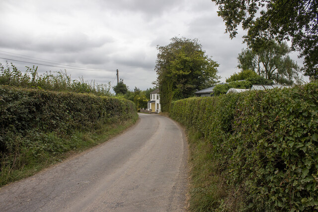
Brooks Wood is a stunning woodland located in Herefordshire, England. Covering an extensive area of land, the wood is renowned for its natural beauty and diverse ecosystem. It is a popular destination for nature lovers, hikers, and wildlife enthusiasts.
The wood is characterized by its dense canopy of deciduous and evergreen trees, including oak, beech, birch, and pine. The tall trees provide ample shade, creating a cool and tranquil atmosphere within the wood. The forest floor is covered with a thick layer of moss and fallen leaves, offering a soft and cushioned path for visitors to explore.
Brooks Wood is home to a wide variety of plant and animal species. The wood provides a habitat for numerous bird species, including woodpeckers, owls, and thrushes. Squirrels and rabbits are commonly spotted darting among the trees, while deer and foxes can occasionally be seen roaming the forest. In the spring, the wood is adorned with vibrant wildflowers, adding a burst of color to the landscape.
The wood offers several walking trails, varying in length and difficulty, allowing visitors to explore its natural wonders at their own pace. The paths wind through the trees, offering breathtaking views of the surrounding countryside. There are also designated picnic areas and benches, providing an opportunity for visitors to relax and enjoy the peaceful ambiance.
Overall, Brooks Wood in Herefordshire is a picturesque and enchanting woodland, offering a tranquil escape from the hustle and bustle of everyday life. Its natural beauty, diverse wildlife, and well-maintained trails make it a must-visit destination for nature enthusiasts and those seeking a peaceful retreat in the heart of the English countryside.
If you have any feedback on the listing, please let us know in the comments section below.
Brooks Wood Images
Images are sourced within 2km of 51.949727/-2.8422054 or Grid Reference SO4228. Thanks to Geograph Open Source API. All images are credited.


Brooks Wood is located at Grid Ref: SO4228 (Lat: 51.949727, Lng: -2.8422054)
Unitary Authority: County of Herefordshire
Police Authority: West Mercia
What 3 Words
///lungs.sprays.footballers. Near Ewyas Harold, Herefordshire
Nearby Locations
Related Wikis
River Dore
The River Dore (Welsh: Afon Aur lit: 'the river of gold') is a tributary of the River Monnow in Herefordshire, England. It rises on Cusop Hill, in the...

Kenderchurch
Kenderchurch is a village and former civil parish, now in the parish of Kilpeck, in the county of Herefordshire, England. In 2001 the parish had a population...

Kentchurch Court
Kentchurch Court is a Grade I listed stately home 1,200 yards (1,000 m) east from the village of Kentchurch in Herefordshire, England. == History == It...

Pontrilas railway station
Pontrilas railway station is a former station which served the Herefordshire villages of Pontrilas and Ewyas Harold, and was a little distance from Grosmont...

Bagwyllydiart
Bagwyllydiart is a hamlet in Herefordshire, England 16 kilometres (10 mi) south west of Hereford near the Welsh border. It lies between the villages of...

Kentchurch
Kentchurch is a small village and civil parish in Herefordshire, England. It is located some 13 miles (21 km) south-west of Hereford and 13 miles (21...

Pontrilas
Pontrilas (English: Bridge over Three Rivers) is a village in south Herefordshire, England, half a mile from the border with Wales. It is in the parish...

Pontrilas Court
Pontrilas Court situated at the west end of the village Pontrilas in Herefordshire is a large stone Grade II* listed mansion and is marked on the 1904...
Nearby Amenities
Located within 500m of 51.949727,-2.8422054Have you been to Brooks Wood?
Leave your review of Brooks Wood below (or comments, questions and feedback).