Batts Coppices

Wood, Forest in Dorset

England

Batts Coppices

Trees near Templeman's Ash The trees catching the morning sunlight are alongside a small tributary of the River Char which drops down from Pilsdon Pen. Taken from the gateway in <a href="https://www.geograph.org.uk/photo/562679">ST4000 : Bridleway to Templeman's Ash</a> on the Wessex Ridgeway Trail a little south of Templeman's Ash.
Trees near Templeman's Ash Credit: Derek Harper

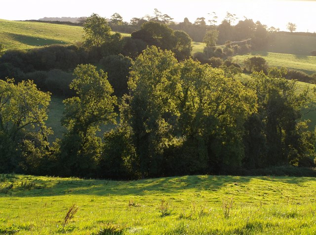
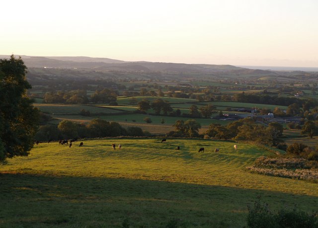
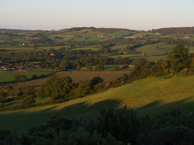
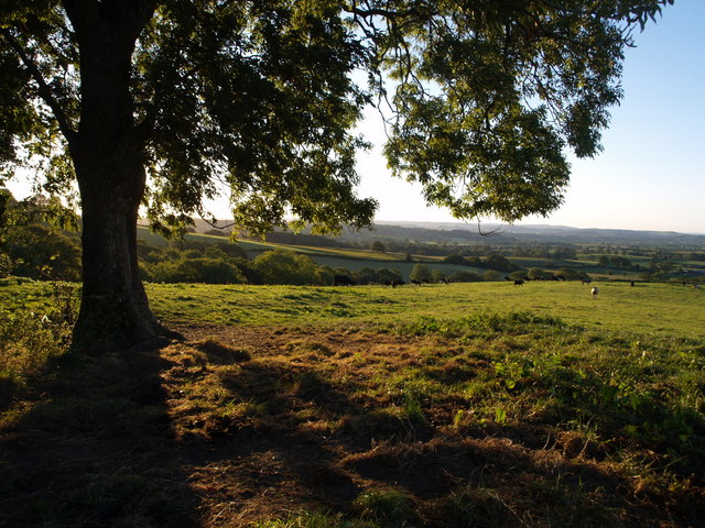
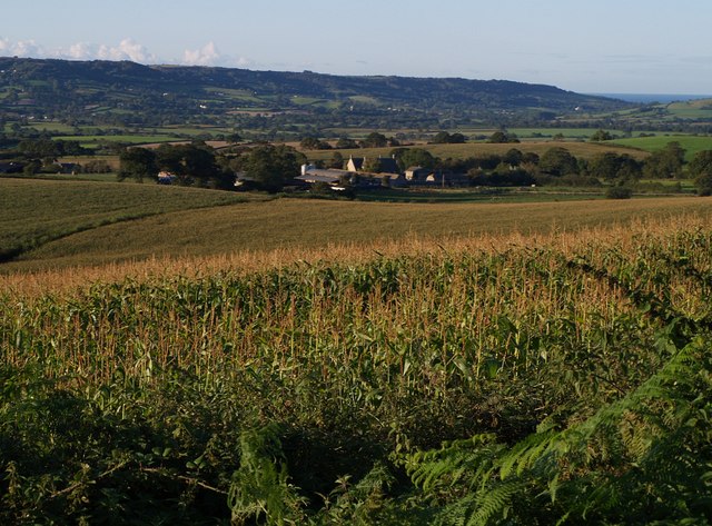
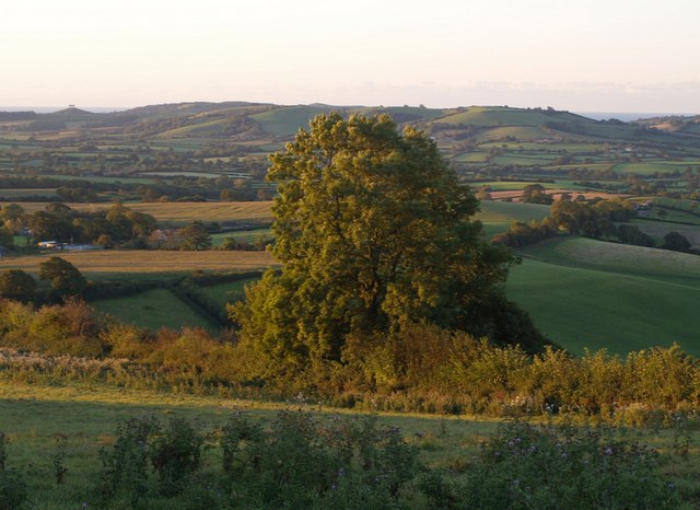
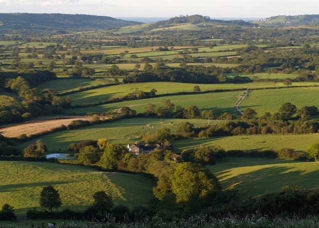
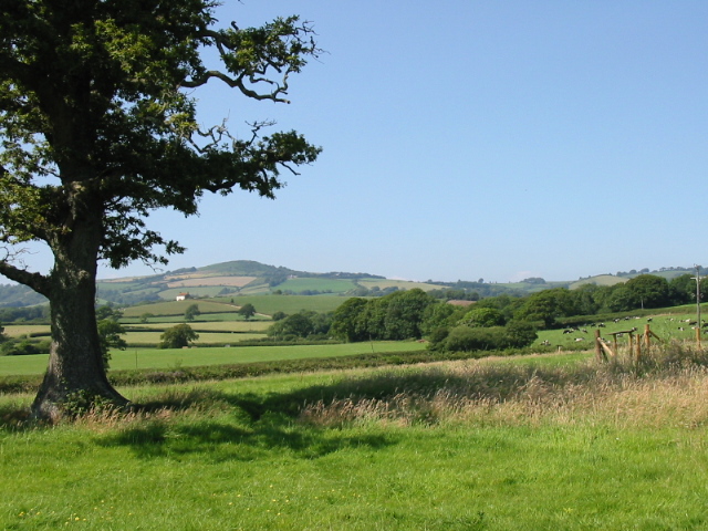
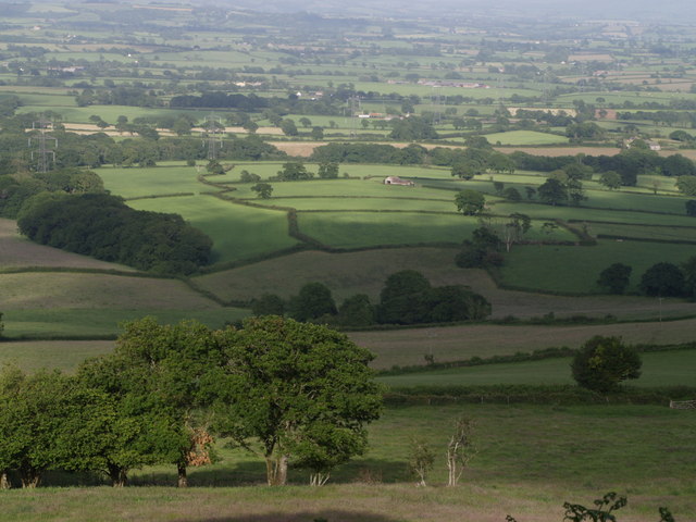
Batts Coppices is a picturesque woodland area located in Dorset, England. Covering an area of approximately 50 acres, this beautiful forest is renowned for its diverse range of flora and fauna, making it a popular destination for nature enthusiasts and hikers.

The woodland consists mainly of native broadleaf trees such as oak, beech, and ash, which create a dense canopy that provides shade and shelter for a variety of wildlife. The forest floor is carpeted with an array of wildflowers, including bluebells, primroses, and wood anemones, adding vibrant colors to the landscape during springtime.

Batts Coppices is home to a rich and diverse range of animal species. Birdwatchers can spot common woodland birds such as woodpeckers, owls, and warblers, while lucky visitors may even catch a glimpse of rarer species like the nightjar. The forest is also inhabited by mammals such as badgers, foxes, and deer, which can often be seen grazing or foraging in the undergrowth.

In addition to its natural beauty and wildlife, Batts Coppices offers several well-maintained walking trails that wind through the woodland, providing visitors with the opportunity to explore and discover the enchanting scenery. These trails vary in length and difficulty, catering to both casual strollers and more experienced hikers.

Overall, Batts Coppices is a serene and captivating forest that offers a tranquil escape from the hustle and bustle of everyday life. With its stunning landscapes, abundant wildlife, and well-established walking trails, it is a must-visit destination for anyone seeking a connection with nature in the heart of Dorset.

If you have any feedback on the listing, please let us know in the comments section below.

Batts Coppices Images

Images are sourced within 2km of 50.78492/-2.8382337 or Grid Reference SY4198. Thanks to Geograph Open Source API. All images are credited.

Trees near Templeman's Ash The trees catching the morning sunlight are alongside a small tributary of the River Char which drops down from Pilsdon Pen. Taken from the gateway in <a href="https://www.geograph.org.uk/photo/562679">ST4000 : Bridleway to Templeman's Ash</a> on the Wessex Ridgeway Trail a little south of Templeman's Ash.
Trees near Templeman's Ash
The trees catching the morning sunlight are alongside a small tributary of the River Char which drops down from Pilsdon Pen. Taken from the gateway in ST4000 : Bridleway to Templeman's Ash on the Wessex Ridgeway Trail a little south of Templeman's Ash.
First light above Pilsdon Early morning sunlight catching segments of the landscape. The ridge running down the foreground carries the Wessex Ridgeway past the grazing cattle. The farms visible to the right are across a myriad boundary at Pilsdon, in <a href="https://www.geograph.org.uk/gridref/SY4199">SY4199</a>. Beyond is the Marshwood Vale, and past the hills on the far side is the sea.
First light above Pilsdon
Early morning sunlight catching segments of the landscape. The ridge running down the foreground carries the Wessex Ridgeway past the grazing cattle. The farms visible to the right are across a myriad boundary at Pilsdon, in SY4199. Beyond is the Marshwood Vale, and past the hills on the far side is the sea.
Country northeast of Bettiscombe The northern edge of the Marshwood Vale meets the hills - Sliding Hill is to the right. Taken from a similar spot to <a href="https://www.geograph.org.uk/photo/562668">ST4000 : Revelshay Farm</a>, and a few minutes earlier (7:19 am). On the left is Lower House Farm, in <a href="https://www.geograph.org.uk/gridref/SY4099">SY4099</a>. The hill in the distance is Coney's Castle - see <a href="https://www.geograph.org.uk/photo/475785">SY3797 : Northeast from Coney's Castle</a> for a corresponding view in this direction.
Country northeast of Bettiscombe
The northern edge of the Marshwood Vale meets the hills - Sliding Hill is to the right. Taken from a similar spot to ST4000 : Revelshay Farm, and a few minutes earlier (7:19 am). On the left is Lower House Farm, in SY4099. The hill in the distance is Coney's Castle - see SY3797 : Northeast from Coney's Castle for a corresponding view in this direction.
Ash tree by the Wessex Ridgeway This is the tree that appears on the left of <a href="https://www.geograph.org.uk/photo/561156">ST4100 : First light above Pilsdon</a>. The footpath heads out across the field towards Pilsdon.
Ash tree by the Wessex Ridgeway
This is the tree that appears on the left of ST4100 : First light above Pilsdon. The footpath heads out across the field towards Pilsdon.
Signpost above Pilsdon I think someone has been altering the directions on this signpost, although this junction (where Yard Lane, left, meets Pilsdon Lane, right) is not the best place to start out for Lyme or Bridport. If you want to reach the farm on the left, it's on Pilsdon Lane. A maize field behind the sign.
Signpost above Pilsdon
I think someone has been altering the directions on this signpost, although this junction (where Yard Lane, left, meets Pilsdon Lane, right) is not the best place to start out for Lyme or Bridport. If you want to reach the farm on the left, it's on Pilsdon Lane. A maize field behind the sign.
Farm at Pilsdon A less blurred view of the group of buildings seen in the background of <a href="https://www.geograph.org.uk/photo/561677">ST4100 : Signpost above Pilsdon</a>. This is shown on the 1:25000 map as "Pilsdon Cottages", but larger scale maps identify it as "Gables". The view is across a maize field from the junction of Yard Lane and Pilsdon Lane. Forming the backdrop beyond Marshwood Vale are Stonebarrow Hill and the sea at Charmouth.
Farm at Pilsdon
A less blurred view of the group of buildings seen in the background of ST4100 : Signpost above Pilsdon. This is shown on the 1:25000 map as "Pilsdon Cottages", but larger scale maps identify it as "Gables". The view is across a maize field from the junction of Yard Lane and Pilsdon Lane. Forming the backdrop beyond Marshwood Vale are Stonebarrow Hill and the sea at Charmouth.
Tree above Pilsdon A large tree - an ash, I think - catching the first of the sunlight on the slopes below Templeman's Ash. The buildings on the left are at Pilsdon. The sea can be seen either side of the hills north of Chideock. Taken from roughly the same spot as <a href="https://www.geograph.org.uk/photo/561156">ST4100 : First light above Pilsdon</a>.
Tree above Pilsdon
A large tree - an ash, I think - catching the first of the sunlight on the slopes below Templeman's Ash. The buildings on the left are at Pilsdon. The sea can be seen either side of the hills north of Chideock. Taken from roughly the same spot as ST4100 : First light above Pilsdon.
Revelshay Farm Looking down on the farm from a field close to Farthings Brake Coppice. The field forms a conservation walk adjacent to bridleway W32W22W38/7, which carries the Wessex Ridgeway down from Templeman's Ash into the Marshwood Vale. This forms the backdrop to the picture, with Conegar Hill rising beyond, and the sea visible on either side of it.
Revelshay Farm
Looking down on the farm from a field close to Farthings Brake Coppice. The field forms a conservation walk adjacent to bridleway W32W22W38/7, which carries the Wessex Ridgeway down from Templeman's Ash into the Marshwood Vale. This forms the backdrop to the picture, with Conegar Hill rising beyond, and the sea visible on either side of it.
Higher Doghill Coppice From its junction with Pilsdon Lane, Yard Lane drops down to the left, towards Blackney. Higher Doghill Coppice is the wood to the right of the maize field (the same field as in <a href="https://www.geograph.org.uk/photo/561794">ST4100 : Farm at Pilsdon</a>).
Higher Doghill Coppice
From its junction with Pilsdon Lane, Yard Lane drops down to the left, towards Blackney. Higher Doghill Coppice is the wood to the right of the maize field (the same field as in ST4100 : Farm at Pilsdon).
Bettiscombe: September 2013
Ploughed field near Bettiscombe
A superb example of the thatcher's art Shave Cross in the Marshwood Vale
A superb example of the thatcher's art
Shave Cross in the Marshwood Vale
Pilsdon Church
Pilsdon Church
Fields near Paddock's Cross
Shave Cross Inn, Shave Cross The Shave Cross Inn, (which by my reckoning is just inside SY2379 by a few feet) seen from the lane leading to Bluntshay and looking north.
Shave Cross Inn, Shave Cross
The Shave Cross Inn, (which by my reckoning is just inside SY2379 by a few feet) seen from the lane leading to Bluntshay and looking north.
Bluntshay Lane looking south Bluntshay Lane, about 100m south of the Shave Cross Inn, looking south towards Coppet Hill. <a href="https://www.geograph.org.uk/gridref/SY4195">SY4195</a>
Bluntshay Lane looking south
Bluntshay Lane, about 100m south of the Shave Cross Inn, looking south towards Coppet Hill. SY4195
Pilsdon: parish church of St. Mary
Bettiscombe: parish church of St. Stephen
Show me another place!

Batts Coppices is located at Grid Ref: SY4198 (Lat: 50.78492, Lng: -2.8382337)

Unitary Authority: Dorset

Police Authority: Dorset

What 3 Words

///earphones.trades.husbands. Near Charmouth, Dorset

Related Wikis

Marshwood Vale

The Marshwood Vale (or Vale of Marshwood) is a low-lying, bowl-shaped valley of Lower Lias clay, in the western tip of the county of Dorset in south-west...

Pilsdon

Pilsdon is a hamlet and civil parish in the Dorset unitary authority area of Dorset, England. Dorset County Council's 2013 mid-year estimate of the parish...

Marshwood Castle

Marshwood Castle was a motte-and-bailey castle in Marshwood, Dorset, within the Vale of Marshwood. It was built by William de Mandeville following his...

Bettiscombe

Bettiscombe is a small village and civil parish in west Dorset, England, situated in the Marshwood Vale four miles (6.4 km) west of Beaminster. Dorset...

Pilsdon Pen

Pilsdon Pen is a 277-metre (909 ft) hill in Dorset in South West England, situated at the north end of the Marshwood Vale, approximately 4.5 miles (7.2...

St Mary's Church, Marshwood

St Mary's Church is a Church of England church in Marshwood, Dorset, England. The earliest part of the church is the tower, which dates to 1840, while...

Marshwood

Marshwood is a village and civil parish in west Dorset, England, situated on the northern edge of the Marshwood Vale approximately 5.5 miles (8.9 km) northeast...

The Bottle Inn

The Bottle Inn is a 16th-century public house at Marshwood in Dorset, England which hosts the World Nettle Eating Championship. It is Grade II listed....

Nearby Amenities

Located within 500m of 50.78492,-2.8382337
A Place at Pilsdon
Addr City: Bridport
Addr Housename: Purcombe Farm
Addr Postcode: DT6 5NY
Addr Street: Batts Lane
Tourism: guest_house
Lat/Long: 50.7878358/-2.8368918
The data included in this document is from www.openstreetmap.org. The data is made available under ODbL.

Have you been to Batts Coppices?

Leave your review of Batts Coppices below (or comments, questions and feedback).