Coedsaeson

Settlement in Glamorgan

Wales

Coedsaeson

Walled Enclosure at Glanbran
Walled Enclosure at Glanbran Credit: Adrian Dust

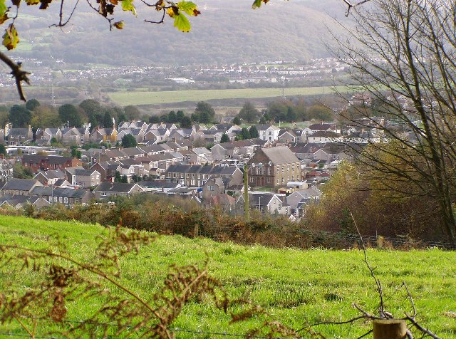
Coedcaeson is a small village located in Glamorgan, a historic county in South Wales, United Kingdom. Nestled amidst picturesque green landscapes, Coedcaeson is known for its tranquil atmosphere and beautiful natural surroundings. The village is situated near the scenic Vale of Glamorgan, which offers stunning views and opportunities for outdoor activities.

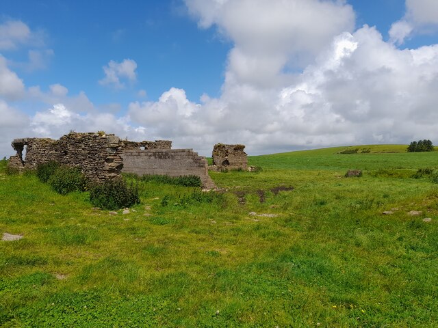
With a population of around 500 residents, Coedcaeson is a tight-knit community where locals take pride in their village and its heritage. The village features a quaint, traditional architecture with stone cottages and well-preserved historic buildings, showcasing its rich history.

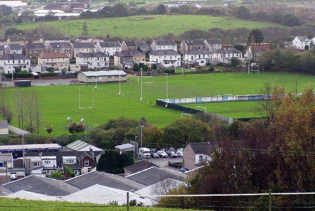
Coedcaeson offers a range of amenities to its residents, including a village hall, a primary school, a local pub, and a post office. The village is well-connected to nearby towns and cities, with good transport links allowing easy access to essential services and employment opportunities.

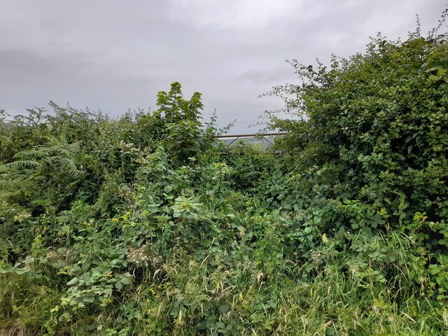
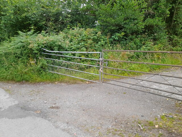
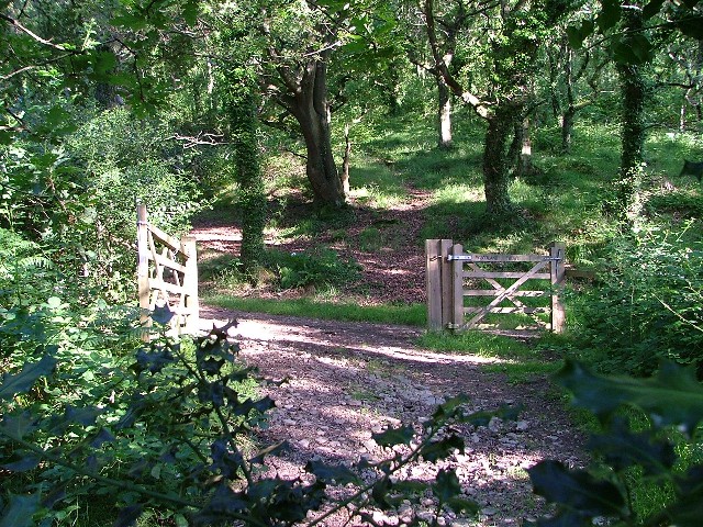
Nature enthusiasts and outdoor lovers are drawn to Coedcaeson due to its proximity to breathtaking landscapes. The village is surrounded by rolling hills, forests, and meadows, making it an ideal location for walking, hiking, and cycling. Additionally, Coedcaeson is located just a short distance from the stunning Glamorgan Heritage Coast, where visitors can enjoy sandy beaches, rocky cliffs, and coastal walks.

In conclusion, Coedcaeson is a charming village in Glamorgan, Wales, offering a peaceful and idyllic lifestyle. Its natural beauty, rich history, and close-knit community make it an attractive place to live or visit for those seeking a serene retreat in the heart of the Welsh countryside.

If you have any feedback on the listing, please let us know in the comments section below.
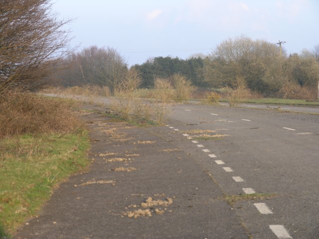
Coedsaeson Images

Images are sourced within 2km of 51.662159/-3.869007 or Grid Reference SS7097. Thanks to Geograph Open Source API. All images are credited.

Walled Enclosure at Glanbran
Ordnance Survey Rivet This damaged OS rivet can be found on the flat rock at the track junction. It marked a point 228.628m above mean sea level.
Ordnance Survey Rivet
This damaged OS rivet can be found on the flat rock at the track junction. It marked a point 228.628m above mean sea level.
Ordnance Survey Cut Mark This OS cut mark can be found on the gatepost NE side of the rack. It marks a point 111.944m above mean sea level.
Ordnance Survey Cut Mark
This OS cut mark can be found on the gatepost NE side of the rack. It marks a point 111.944m above mean sea level.
Ordnance Survey Cut Mark This OS cut mark can be found on the concrete retaining wall north side of Drumau Road. It marks a point 101.675m above mean sea level.
Ordnance Survey Cut Mark
This OS cut mark can be found on the concrete retaining wall north side of Drumau Road. It marks a point 101.675m above mean sea level.
Ordnance Survey Cut Mark This OS cut mark can be found on the wall south side of Drumau Road. It marks a point 105.153m above mean sea level.
Ordnance Survey Cut Mark
This OS cut mark can be found on the wall south side of Drumau Road. It marks a point 105.153m above mean sea level.
Pen-lan Farm Building (Ruin)
Gateway High in Hedge
Gateway at Glyn-derwen
Heol Las Park, Birchgrove, Swansea
Skewen View from the north west
Skewen
View from the north west
Playing fields, Skewen. View from the north.
Playing fields, Skewen.
View from the north.
M4 Motorway at Skewen near Junction 43
Railway cutting near Skewen
Woodland Path The path starts at Drumau Road, goes through Darren Wood to the top of Drumau Mountain.
Woodland Path
The path starts at Drumau Road, goes through Darren Wood to the top of Drumau Mountain.
Abandoned section of the A48 Once part of the trunk route from London to South Wales, this 500m section of the A48 has been handed back for farm use since the M4 opened (running just parallel) in the early 1990s. On the corner, two petrol stations, long since stripped of their pumps and kiosks now have trees growing through the tarmac where once impatient drivers would pull up to fill up.

The farmer told me that they were given the land when a similar sized tract of land was taken from them for the building of the M4.  He also asked me to mention that despite being listed on all ordnance survey maps as such, there is absolutely NO right of way through this stretch any more.  Apparently a footpath used to run down their lane and then under this road via a route taken by an abandoned railway.  There's little evidence of the footpath today apart from an old staircase completely encased in vegetation (I'd have missed it if he hadn't shown it to me). 

I have since confirmed that the map is incorrect by checking the council's definitive map - the public right of way to this location appears to have been revoked when the motorway was built and never reinstated.

Since this picture was taken, the area has undergone redevelopment and over half of this abandoned road is currently being converted into housing.
Abandoned section of the A48
Once part of the trunk route from London to South Wales, this 500m section of the A48 has been handed back for farm use since the M4 opened (running just parallel) in the early 1990s. On the corner, two petrol stations, long since stripped of their pumps and kiosks now have trees growing through the tarmac where once impatient drivers would pull up to fill up. The farmer told me that they were given the land when a similar sized tract of land was taken from them for the building of the M4. He also asked me to mention that despite being listed on all ordnance survey maps as such, there is absolutely NO right of way through this stretch any more. Apparently a footpath used to run down their lane and then under this road via a route taken by an abandoned railway. There's little evidence of the footpath today apart from an old staircase completely encased in vegetation (I'd have missed it if he hadn't shown it to me). I have since confirmed that the map is incorrect by checking the council's definitive map - the public right of way to this location appears to have been revoked when the motorway was built and never reinstated. Since this picture was taken, the area has undergone redevelopment and over half of this abandoned road is currently being converted into housing.
Public footpath?! Marked on an OS map, this staircase (with barely visible handrails) is where things go pear-shaped if you're intent on following this public footpath that's marked on current maps. I must admit I didn't see the weed covered hand rails at first because of the BARBED WIRE fence in front.

Still - if I'd have continued on the original route, the M4 motorway would have soon put a stop to my tracks.

I was told by the land owner after a rather uncomfortable discussion as to why I was there in the first place that this path had been discontinued when the M4 opened in the early 1990s, which begs the question as to why it's still on current maps.
Public footpath?!
Marked on an OS map, this staircase (with barely visible handrails) is where things go pear-shaped if you're intent on following this public footpath that's marked on current maps. I must admit I didn't see the weed covered hand rails at first because of the BARBED WIRE fence in front. Still - if I'd have continued on the original route, the M4 motorway would have soon put a stop to my tracks. I was told by the land owner after a rather uncomfortable discussion as to why I was there in the first place that this path had been discontinued when the M4 opened in the early 1990s, which begs the question as to why it's still on current maps.
Disused cats-eye On a stretch of road that's been unused for over 15 years, road lines and indeed the features to allow drivers to navigate at night are still in place at this location.
Disused cats-eye
On a stretch of road that's been unused for over 15 years, road lines and indeed the features to allow drivers to navigate at night are still in place at this location.
Disused sliproad This sliproad used to lead to a petrol station.  Since then the M4 took over the role of A48 and the A48 was rerouted and this stretch of road was abandoned and ignored!
Disused sliproad
This sliproad used to lead to a petrol station. Since then the M4 took over the role of A48 and the A48 was rerouted and this stretch of road was abandoned and ignored!
Show me another place!

Coedsaeson is located at Grid Ref: SS7097 (Lat: 51.662159, Lng: -3.869007)

Unitary Authority: Swansea

Police Authority: South Wales

What 3 Words

///clocking.gurgled.trimmer. Near Clydach, Swansea

Related Wikis

Llansamlet railway station

Llansamlet railway station is a minor station in Llansamlet, Swansea, south Wales. The station is located below street level at Frederick Place in Peniel...

Birchgrove, Swansea

Birchgrove (Welsh: Y Gellifedw) is a suburb and community in Swansea, Wales, United Kingdom. It is situated about 4.5 miles (7 km) north-east of Swansea...

Coedffranc Central

Coedffranc Central is an electoral ward of Neath Port Talbot county borough, Wales. Coedffranc Central is a part of the Coedffranc community and falls...

Llansamlet railway station (MR)

Llansamlet railway station served the suburb of Llansamlet, in the historical county of Glamorganshire, Wales, from 1860 to 1875 on the Swansea Vale Railway...

Nearby Amenities

Located within 500m of 51.662159,-3.869007
Motorway Junction
Lôn-las
Exit To: A48 Swansea East
Layer: 2
Ref: 44
Lat/Long: 51.6601848/-3.8753467
Bus Stop
Rhiwderyn (NW)
Bus: yes
Naptan AtcoCode: 5810AWC52220
Naptan Bearing: NW
Naptan CommonName: Rhiwderyn (NW)
Naptan Crossing: Rhiwderyn
Naptan NaptanCode: swadaja
Naptan Street: Ffordd-y-Mynydd
Naptan Verified: no
Public Transport: platform
Source: naptan_import
Lat/Long: 51.6658846/-3.8681643
Bus Stop
Birchgrove Stores (N)
Bus: yes
Naptan AtcoCode: 5810AWC52223
Naptan Bearing: N
Naptan CommonName: Birchgrove Stores (N)
Naptan Crossing: Trewen Road
Naptan NaptanCode: swadagm
Naptan Street: Birchgrove Road
Naptan Verified: no
Public Transport: platform
Source: naptan_import
Lat/Long: 51.6647733/-3.8741342
Bus Stop
Birchgrove Stores (S)
Bus: yes
Naptan AtcoCode: 5810AWC52225
Naptan Bearing: S
Naptan CommonName: Birchgrove Stores (S)
Naptan Crossing: Parc-yr-helig Road
Naptan NaptanCode: swadagp
Naptan Street: Birchgrove Road
Naptan Verified: no
Public Transport: platform
Source: naptan_import
Lat/Long: 51.6644154/-3.8740182
Bus Stop
Lon-las PO (NW)
Bus: yes
Naptan AtcoCode: 5810AWC52226
Naptan Bearing: W
Naptan CommonName: Lon-las PO (NW)
Naptan Crossing: Back Drive
Naptan Landmark: Bowens Arms PH
Naptan NaptanCode: swagwgp
Naptan PlusbusZoneRef: NEATH
Naptan ShortCommonName: Bowens Arms
Naptan Street: Birchgrove Road
Naptan Verified: no
Public Transport: platform
Source: naptan_import
Lat/Long: 51.6592128/-3.8698129
Bus Stop
Lon-las PO (SE)
Bus: yes
Naptan AtcoCode: 5810AWC52227
Naptan Bearing: SE
Naptan CommonName: Lon-las PO (SE)
Naptan Crossing: Back Drive
Naptan Landmark: Bowens Arms PH
Naptan NaptanCode: swagwgt
Naptan PlusbusZoneRef: NEATH
Naptan ShortCommonName: Bowens Arms
Naptan Street: Birchgrove Road
Naptan Verified: no
Public Transport: platform
Source: naptan_import
Lat/Long: 51.6592976/-3.8695706
Bus Stop
Bowens Arms
Bus: yes
Naptan AtcoCode: 5810AWC52228
Naptan Bearing: SE
Naptan CommonName: Bowens Arms (SE)
Naptan Crossing: Birchgrove Road
Naptan Landmark: Bowens Arms PH
Naptan NaptanCode: swagwgw
Naptan PlusbusZoneRef: NEATH
Naptan Street: Peniel Green Road
Naptan Verified: no
Public Transport: platform
Source: naptan_import
Lat/Long: 51.6593216/-3.8708873
Bus Stop
Bowens Arms
Bus: yes
Naptan AtcoCode: 5810AWC52229
Naptan Bearing: NW
Naptan CommonName: Bowens Arms (NW)
Naptan Crossing: Birchgrove Road
Naptan Landmark: Bowens Arms PH
Naptan NaptanCode: swagwja
Naptan PlusbusZoneRef: SWANSEA
Naptan Street: Peniel Green Road
Naptan Verified: no
Public Transport: platform
Source: naptan_import
Lat/Long: 51.6593784/-3.8718908
Bus Stop
Peniel Green Roundabout
Bus: yes
Naptan AtcoCode: 5810AWC52231
Naptan Bearing: SE
Naptan CommonName: Peniel Green Roundabout (SE)
Naptan NaptanCode: swapdma
Naptan PlusbusZoneRef: SWANSEA
Naptan Street: Peniel Green Road
Naptan Verified: no
Physically Present: no
Public Transport: platform
Source: naptan_import
Lat/Long: 51.6612979/-3.8760874
Bus Stop
Heol y Cyw
Bus: yes
Naptan AtcoCode: 5810AWO26245
Naptan Bearing: NE
Naptan CommonName: Heol y Cyw
Naptan Crossing: Heol y Cyw
Naptan NaptanCode: swagwjd
Naptan PlusbusZoneRef: NEATH
Naptan Street: Ffordd-y-Mynydd
Naptan Verified: no
Public Transport: platform
Source: naptan_import
Lat/Long: 51.6639462/-3.867911
Bus Stop
Rhiwderyn (SE)
Bus: yes
Naptan AtcoCode: 5810AWO26328
Naptan Bearing: SE
Naptan CommonName: Rhiwderyn (SE)
Naptan Crossing: Rhiwderyn
Naptan NaptanCode: swadajd
Naptan Street: Ffordd-y-Mynydd
Naptan Verified: no
Public Transport: platform
Source: naptan_import
Lat/Long: 51.6658954/-3.8680491
Mini Roundabout
Direction: clockwise
Lat/Long: 51.6638628/-3.8680337
Power: tower
Lat/Long: 51.6588798/-3.87396
Skewen East Junction
Railway: junction
Lat/Long: 51.6580816/-3.8667097
Bowens Arms
Bus: yes
Public Transport: stop_position
Lat/Long: 51.6592637/-3.8709173
Street Lamp
Lamp Model: Philips MA60
Lamp Type: low_pressure_sodium
Light Count: 2
Light Power: 180
Source: Mapillary (2019-03-21)
Lat/Long: 51.6589627/-3.8709893
Street Lamp
Lamp Model: Philips MA60
Lamp Type: low_pressure_sodium
Light Count: 2
Light Power: 180
Source: Mapillary (2019-03-21)
Lat/Long: 51.6590437/-3.8715362
Street Lamp
Lamp Model: Philips MA60
Lamp Type: low_pressure_sodium
Light Count: 2
Light Power: 180
Source: Mapillary (2019-03-21)
Lat/Long: 51.6591414/-3.8721012
Street Lamp
Lamp Model: Philips MA60
Lamp Type: low_pressure_sodium
Light Count: 2
Light Power: 180
Source: Mapillary (2019-03-21)
Lat/Long: 51.6592501/-3.8726045
Street Lamp
Lamp Model: Philips MA60
Lamp Type: low_pressure_sodium
Light Count: 2
Light Power: 180
Source: Mapillary (2019-03-21)
Lat/Long: 51.6593894/-3.8731404
Street Lamp
Lamp Model: Philips MA60
Lamp Type: low_pressure_sodium
Light Count: 2
Light Power: 180
Source: Mapillary (2019-03-21)
Lat/Long: 51.6595432/-3.8736333
Street Lamp
Lamp Model: Philips MA60
Lamp Type: low_pressure_sodium
Light Count: 2
Light Power: 180
Source: Mapillary (2019-03-21)
Lat/Long: 51.6597418/-3.8741724
Street Lamp
Lamp Model: Philips MA60
Lamp Type: low_pressure_sodium
Light Count: 2
Light Power: 180
Source: Mapillary (2019-03-21)
Lat/Long: 51.6599481/-3.874668
Street Lamp
Lamp Model: Philips MA60
Lamp Type: low_pressure_sodium
Light Count: 2
Light Power: 180
Source: Mapillary (2019-03-21)
Lat/Long: 51.6601764/-3.8751286
Street Lamp
Lamp Model: Philips MA60
Lamp Type: low_pressure_sodium
Light Count: 2
Light Power: 180
Source: Mapillary (2019-03-21)
Lat/Long: 51.6604067/-3.8755466
Street Lamp
Lamp Model: Philips MA60
Lamp Type: low_pressure_sodium
Light Count: 2
Light Power: 180
Source: Mapillary (2019-03-21)
Lat/Long: 51.6588897/-3.8704108
Street Lamp
Lamp Model: Philips MA60
Lamp Type: low_pressure_sodium
Light Count: 2
Light Power: 180
Source: Mapillary (2019-03-21)
Lat/Long: 51.658822/-3.8698258
Street Lamp
Lamp Model: Philips MA60
Lamp Type: low_pressure_sodium
Light Count: 2
Light Power: 180
Source: Mapillary (2019-03-21)
Lat/Long: 51.6587519/-3.8692421
Street Lamp
Lamp Model: Philips MA60
Lamp Type: low_pressure_sodium
Light Count: 2
Light Power: 180
Source: Mapillary (2019-03-21)
Lat/Long: 51.658678/-3.868651
Street Lamp
Lamp Model: Philips MA60
Lamp Type: low_pressure_sodium
Light Count: 2
Light Power: 180
Source: Mapillary (2019-03-21)
Lat/Long: 51.6586188/-3.868078
Street Lamp
Lamp Model: Philips MA60
Lamp Type: low_pressure_sodium
Light Count: 2
Light Power: 180
Source: Mapillary (2019-03-21)
Lat/Long: 51.6585506/-3.8674799
Street Lamp
Lamp Model: Philips MA60
Lamp Type: low_pressure_sodium
Light Count: 2
Light Power: 180
Source: Mapillary (2019-03-21)
Lat/Long: 51.6584957/-3.8668844
Street Lamp
Lamp Model: Philips MA60
Lamp Type: low_pressure_sodium
Light Count: 2
Light Power: 180
Source: Mapillary (2019-03-21)
Lat/Long: 51.6584341/-3.8663131
Street Lamp
Lamp Model: Philips MA60
Lamp Type: low_pressure_sodium
Light Count: 2
Light Power: 180
Source: Mapillary (2019-03-21)
Lat/Long: 51.6583776/-3.8657284
Street Lamp
Lamp Model: Philips MA60
Lamp Type: low_pressure_sodium
Light Count: 1
Light Power: 180
Source: Mapillary (2019-03-21)
Lat/Long: 51.6606438/-3.8755654
Street Lamp
Lamp Model: Philips MA60
Lamp Type: low_pressure_sodium
Light Count: 1
Light Power: 180
Source: Mapillary (2019-03-21)
Lat/Long: 51.6597353/-3.8737873
Street Lamp
Lamp Model: Philips MA60
Lamp Type: low_pressure_sodium
Light Count: 1
Light Power: 180
Source: Mapillary (2019-03-21)
Lat/Long: 51.6604159/-3.8752035
Street Lamp
Lamp Model: Philips MA60
Lamp Type: low_pressure_sodium
Light Count: 1
Light Power: 180
Source: Mapillary (2019-03-21)
Lat/Long: 51.6609017/-3.8759355
Street Lamp
Lamp Model: Philips MA60
Lamp Type: low_pressure_sodium
Light Count: 1
Light Power: 180
Source: Mapillary (2019-03-21)
Lat/Long: 51.6599848/-3.8743718
Street Lamp
Lamp Model: Philips MA60
Lamp Type: low_pressure_sodium
Light Count: 1
Light Power: 180
Source: Mapillary (2019-03-21)
Lat/Long: 51.6602078/-3.8748224
Street Lamp
Lamp Model: Philips MA60
Lamp Type: low_pressure_sodium
Light Count: 1
Light Power: 180
Source: Mapillary (2019-03-21)
Lat/Long: 51.659732/-3.8745464
Street Lamp
Lamp Model: Philips MA60
Lamp Type: low_pressure_sodium
Light Count: 1
Light Power: 180
Source: Mapillary (2019-03-21)
Lat/Long: 51.6601679/-3.8754852
Street Lamp
Lamp Model: Philips MA60
Lamp Type: low_pressure_sodium
Light Count: 1
Light Power: 180
Source: Mapillary (2019-03-21)
Lat/Long: 51.659935/-3.8750346
Direction: SSE
Generator Method: photovoltaic
Generator Output Electricity: yes
Generator Solar Modules: 2
Generator Source: solar
Generator Type: solar_photovoltaic_panel
Location: roof
Power: generator
Lat/Long: 51.6656701/-3.8673823
Direction: SSE
Generator Method: photovoltaic
Generator Output Electricity: yes
Generator Solar Modules: 8
Generator Source: solar
Generator Type: solar_photovoltaic_panel
Location: roof
Power: generator
Lat/Long: 51.6656433/-3.8674101
Direction: SSE
Generator Method: photovoltaic
Generator Output Electricity: yes
Generator Solar Modules: 4
Generator Source: solar
Generator Type: solar_photovoltaic_panel
Location: roof
Power: generator
Lat/Long: 51.665625/-3.8674745
Direction: 145
Generator Method: photovoltaic
Generator Output Electricity: yes
Generator Solar Modules: 16
Generator Source: solar
Generator Type: solar_photovoltaic_panel
Location: roof
Power: generator
Lat/Long: 51.664456/-3.8698506
Direction: 195
Generator Method: photovoltaic
Generator Output Electricity: yes
Generator Solar Modules: 12
Generator Source: solar
Generator Type: solar_photovoltaic_panel
Location: roof
Power: generator
Lat/Long: 51.6633291/-3.8671741
Direction: ESE
Generator Method: photovoltaic
Generator Output Electricity: yes
Generator Solar Modules: 14
Generator Source: solar
Generator Type: solar_photovoltaic_panel
Location: roof
Power: generator
Lat/Long: 51.6617454/-3.8675992
Direction: SSE
Generator Method: photovoltaic
Generator Output Electricity: yes
Generator Solar Modules: 13
Generator Source: solar
Generator Type: solar_photovoltaic_panel
Location: roof
Power: generator
Lat/Long: 51.6635757/-3.872332
Direction: 235
Generator Method: photovoltaic
Generator Output Electricity: yes
Generator Solar Modules: 14
Generator Source: solar
Generator Type: solar_photovoltaic_panel
Location: roof
Power: generator
Lat/Long: 51.6643342/-3.8705607
Direction: 85
Generator Method: photovoltaic
Generator Output Electricity: yes
Generator Solar Modules: 13
Generator Source: solar
Generator Type: solar_photovoltaic_panel
Location: roof
Power: generator
Lat/Long: 51.662424/-3.8729392
Direction: 175
Generator Method: photovoltaic
Generator Output Electricity: yes
Generator Solar Modules: 10
Generator Source: solar
Generator Type: solar_photovoltaic_panel
Location: roof
Power: generator
Lat/Long: 51.6624654/-3.8730585
Direction: 260
Generator Method: photovoltaic
Generator Output Electricity: yes
Generator Solar Modules: 8
Generator Source: solar
Generator Type: solar_photovoltaic_panel
Location: roof
Power: generator
Lat/Long: 51.6611862/-3.8734424
Direction: 170
Generator Method: photovoltaic
Generator Output Electricity: yes
Generator Solar Modules: 8
Generator Source: solar
Generator Type: solar_photovoltaic_panel
Location: roof
Power: generator
Lat/Long: 51.6611722/-3.8733412
Direction: 170
Generator Method: photovoltaic
Generator Output Electricity: yes
Generator Solar Modules: 8
Generator Source: solar
Generator Type: solar_photovoltaic_panel
Location: roof
Power: generator
Lat/Long: 51.6594882/-3.8654471
Direction: 175
Generator Method: photovoltaic
Generator Output Electricity: yes
Generator Solar Modules: 10
Generator Source: solar
Generator Type: solar_photovoltaic_panel
Location: roof
Power: generator
Lat/Long: 51.6597211/-3.8653314
Direction: 265
Generator Method: photovoltaic
Generator Output Electricity: yes
Generator Solar Modules: 5
Generator Source: solar
Generator Type: solar_photovoltaic_panel
Location: roof
Power: generator
Lat/Long: 51.659737/-3.8654025
Direction: 85
Generator Method: photovoltaic
Generator Output Electricity: yes
Generator Solar Modules: 14
Generator Source: solar
Generator Type: solar_photovoltaic_panel
Location: roof
Power: generator
Lat/Long: 51.6622926/-3.8719156
Direction: 195
Generator Method: photovoltaic
Generator Output Electricity: yes
Generator Solar Modules: 10
Generator Source: solar
Generator Type: solar_photovoltaic_panel
Location: roof
Power: generator
Lat/Long: 51.6601895/-3.871235
Direction: S
Generator Method: photovoltaic
Generator Output Electricity: yes
Generator Solar Modules: 19
Generator Source: solar
Generator Type: solar_photovoltaic_panel
Location: roof
Power: generator
Lat/Long: 51.6589283/-3.8658383
The data included in this document is from www.openstreetmap.org. The data is made available under ODbL.

Have you been to Coedsaeson?

Leave your review of Coedsaeson below (or comments, questions and feedback).