Wilds Wood

Wood, Forest in Herefordshire

England

Wilds Wood

Ewyas Harold Memorial Hall, Herefordshire Nice building.
Ewyas Harold Memorial Hall, Herefordshire Credit: Jeremy Bolwell

Wilds Wood is a picturesque woodland located in Herefordshire, a county in the West Midlands region of England. Covering an area of approximately 500 acres, this enchanting forest is renowned for its natural beauty and rich biodiversity. It is situated on the eastern edge of the county, near the town of Ross-on-Wye.

Wilds Wood boasts a diverse range of tree species, including oak, beech, ash, and birch, which create a lush and vibrant canopy. The woodland is also home to various wildlife, such as deer, badgers, foxes, and numerous bird species, making it a haven for nature enthusiasts and wildlife photographers.

Visitors to Wilds Wood can explore its extensive network of walking trails, which offer stunning views of the surrounding countryside and the River Wye. The wood is often buzzing with activities like birdwatching, nature walks, and picnics. The tranquil atmosphere and the soothing sound of rustling leaves make it an ideal place for relaxation and unwinding.

Managed by the Forestry Commission, Wilds Wood ensures the conservation of its natural resources and the protection of its wildlife. The forest also plays a crucial role in carbon sequestration, contributing to the fight against climate change.

With its idyllic setting and abundance of flora and fauna, Wilds Wood provides a captivating experience for visitors seeking a peaceful retreat amidst nature's splendor. It is undoubtedly a gem in Herefordshire's natural landscape and a testament to the county's commitment to preserving its natural heritage.

If you have any feedback on the listing, please let us know in the comments section below.

Wilds Wood Images

Images are sourced within 2km of 51.948108/-2.8609005 or Grid Reference SO4028. Thanks to Geograph Open Source API. All images are credited.

Ewyas Harold Memorial Hall, Herefordshire Nice building.
Ewyas Harold Memorial Hall, Herefordshire
Nice building.
Road signs in Pontrilas
Air Training Corps hall, Ewyas Harold Set back from Pontrilas Road on the north side of Ewyas Harold Memorial Hall. <a title="https://www.geograph.org.uk/photo/5616636" href="https://www.geograph.org.uk/photo/5616636">Link</a>
The nameboard <a title="https://www.geograph.org.uk/photo/5616629" href="https://www.geograph.org.uk/photo/5616629">Link</a> shows AIR TRAINING CORPS 1246 (EWYAS HAROLD) SQN
Air Training Corps hall, Ewyas Harold
Set back from Pontrilas Road on the north side of Ewyas Harold Memorial Hall. Link The nameboard Link shows AIR TRAINING CORPS 1246 (EWYAS HAROLD) SQN
Air Training Corps 1246 (Ewyas Harold) Squadron nameboard On the wall here. <a title="https://www.geograph.org.uk/photo/5616628" href="https://www.geograph.org.uk/photo/5616628">Link</a>
Air Training Corps 1246 (Ewyas Harold) Squadron nameboard
On the wall here. Link
Ewyas Harold Memorial Hall, Pontrilas Road, Ewyas Harold, Herefordshire  The Memorial Hall for the parishes of Dulas, Ewyas Harold, Kentchurch and Kenderchurch was opened on Easter Sunday April 10th 1955. It had taken ten years of very hard work by the people of the four villages to complete. The hall is dedicated to the memory of the fallen in the two World Wars.

The recently built Air Training Corps 1246 (Ewyas Harold) Squadron's hall is in the background. <a title="https://www.geograph.org.uk/photo/5616628" href="https://www.geograph.org.uk/photo/5616628">Link</a> 
Viewed in December 2017.
Ewyas Harold Memorial Hall, Pontrilas Road, Ewyas Harold, Herefordshire
The Memorial Hall for the parishes of Dulas, Ewyas Harold, Kentchurch and Kenderchurch was opened on Easter Sunday April 10th 1955. It had taken ten years of very hard work by the people of the four villages to complete. The hall is dedicated to the memory of the fallen in the two World Wars. The recently built Air Training Corps 1246 (Ewyas Harold) Squadron's hall is in the background. Link Viewed in December 2017.
Sheep in a field, Ewyas Harold, Herefordshire  The field on a bank of Dulas Brook is behind these <a title="https://www.geograph.org.uk/photo/5616636" href="https://www.geograph.org.uk/photo/5616636">Link</a> two halls.
Sheep in a field, Ewyas Harold, Herefordshire
The field on a bank of Dulas Brook is behind these Link two halls.
Clothing bank in Ewyas Harold, Herefordshire In a corner of Ewyas Harold Memorial Hall <a title="https://www.geograph.org.uk/photo/5616636" href="https://www.geograph.org.uk/photo/5616636">Link</a> car park. The bank is for donations of clean & dry clothing, paired shoes, handbags and belts. Proceeds from the sale of donated items help fund the Memorial Hall.
Clothing bank in Ewyas Harold, Herefordshire
In a corner of Ewyas Harold Memorial Hall Link car park. The bank is for donations of clean & dry clothing, paired shoes, handbags and belts. Proceeds from the sale of donated items help fund the Memorial Hall.
Cherry Tree Close, Ewyas Harold Cul-de-sac on the west side of Pontrilas Road.
Cherry Tree Close, Ewyas Harold
Cul-de-sac on the west side of Pontrilas Road.
Molehills in a Ewyas Harold field Viewed from a Pontrilas Road field gate on December 3rd 2017.
Molehills in a Ewyas Harold field
Viewed from a Pontrilas Road field gate on December 3rd 2017.
Ivy-clad house in Ewyas Harold Viewed from a Pontrilas Road field gate on December 3rd 2017. Ivy (Hedera helix) is an evergreen.
Ivy-clad house in Ewyas Harold
Viewed from a Pontrilas Road field gate on December 3rd 2017. Ivy (Hedera helix) is an evergreen.
Queen Elizabeth II postbox in a Pontrilas Road hedge, Ewyas Harold Viewed across the B4347 Pontrilas Road. <a title="https://www.geograph.org.uk/photo/5616725" href="https://www.geograph.org.uk/photo/5616725">Link</a> to a closer view.
Queen Elizabeth II postbox in a Pontrilas Road hedge, Ewyas Harold
Viewed across the B4347 Pontrilas Road. Link to a closer view.
Queen Elizabeth II postbox detail, Pontrilas Road, Ewyas Harold Located here. <a title="https://www.geograph.org.uk/photo/5616720" href="https://www.geograph.org.uk/photo/5616720">Link</a>
Queen Elizabeth II postbox detail, Pontrilas Road, Ewyas Harold
Located here. Link
Orchard Grove, Ewyas Harold Cul-de-sac on the west side of Pontrilas Road.
Orchard Grove, Ewyas Harold
Cul-de-sac on the west side of Pontrilas Road.
Salcombe House, Ewyas Harold Set back from Pontrilas Road behind twin corrugated metal buildings.
Salcombe House, Ewyas Harold
Set back from Pontrilas Road behind twin corrugated metal buildings.
CQ Car Sales, Ewyas Harold Set back from the B4347 opposite Orchard Grove. <a title="https://www.geograph.org.uk/photo/5616730" href="https://www.geograph.org.uk/photo/5616730">Link</a>
CQ Car Sales, Ewyas Harold
Set back from the B4347 opposite Orchard Grove. Link
E.W.Morgan & Sons and Morgy's Place, Ewyas Harold Garage, filling station and shop alongside the B4347 Pontrilas Road.
E.W.Morgan & Sons and Morgy's Place, Ewyas Harold
Garage, filling station and shop alongside the B4347 Pontrilas Road.
Pace fuel pump, Ewyas Harold The three-hose Pace pump is in the E.W.Morgan garage site alongside the B4347 viewed on December 3rd 2017. The most recent sale shown on the pump was 16.01 litres for exactly £20. A calculation using the nearby price display <a title="https://www.geograph.org.uk/photo/5616902" href="https://www.geograph.org.uk/photo/5616902">Link</a> shows that the sale was petrol at 124.9 pence per litre. Diesel is 123.9 pence per litre here today.
A pink Amazon Parcel Shop sign is on the left.
Pace fuel pump, Ewyas Harold
The three-hose Pace pump is in the E.W.Morgan garage site alongside the B4347 viewed on December 3rd 2017. The most recent sale shown on the pump was 16.01 litres for exactly £20. A calculation using the nearby price display Link shows that the sale was petrol at 124.9 pence per litre. Diesel is 123.9 pence per litre here today. A pink Amazon Parcel Shop sign is on the left.
December 3rd 2017 Pace fuel prices, Ewyas Harold  In the E.W.Morgan & Sons garage alongside Pontrilas Road,
unleaded petrol is 124.9 pence per litre and diesel 123.9 pence per litre.
December 3rd 2017 Pace fuel prices, Ewyas Harold
In the E.W.Morgan & Sons garage alongside Pontrilas Road, unleaded petrol is 124.9 pence per litre and diesel 123.9 pence per litre.
Show me another place!

Wilds Wood is located at Grid Ref: SO4028 (Lat: 51.948108, Lng: -2.8609005)

Unitary Authority: County of Herefordshire

Police Authority: West Mercia

What 3 Words

///headings.enveloped.chimp. Near Ewyas Harold, Herefordshire

Nearby Locations

Wilds Wood Sawpit Brake

Related Wikis

River Dore

The River Dore (Welsh: Afon Aur lit: 'the river of gold') is a tributary of the River Monnow in Herefordshire, England. It rises on Cusop Hill, in the...

Kenderchurch

Kenderchurch is a village and former civil parish, now in the parish of Kilpeck, in the county of Herefordshire, England. In 2001 the parish had a population...

Pontrilas railway station

Pontrilas railway station is a former station which served the Herefordshire villages of Pontrilas and Ewyas Harold, and was a little distance from Grosmont...

Pontrilas

Pontrilas (English: Bridge over Three Rivers) is a village in south Herefordshire, England, half a mile from the border with Wales. It is in the parish...

Pontrilas Court

Pontrilas Court situated at the west end of the village Pontrilas in Herefordshire is a large stone Grade II* listed mansion and is marked on the 1904...
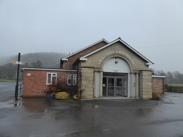
Ewyas Harold

Ewyas Harold () is a village and civil parish in the Golden Valley in Herefordshire, England, near the Wales-England border about halfway between Abergavenny...

Pontrilas Army Training Area

Pontrilas Army Training Area is a British Army training camp, located just north of the village of Ewyas Harold near to Pontrilas in Herefordshire, England...

Monmouth Cap

Monmouth Cap is a hamlet in the north of the county of Monmouthshire, Wales. It stands to the north of the village of Grosmont, and to the south of the...

Nearby Amenities

Located within 500m of 51.948108,-2.8609005
Power: pole
Lat/Long: 51.9465333/-2.8659779
Power: tower
Lat/Long: 51.9477435/-2.8681451
Power: tower
Lat/Long: 51.9511193/-2.864154
The data included in this document is from www.openstreetmap.org. The data is made available under ODbL.

Have you been to Wilds Wood?

Leave your review of Wilds Wood below (or comments, questions and feedback).