Bernard's Wood

Wood, Forest in Cumberland Eden

England

Bernard's Wood

Forest road at the heart of Greystoke Forest Gillcambon Beck and its tributaries drain Greystoke Forest carrying water to the north. The road is seen heading near to north having climbed away from the main stream and will cross side streams as it continues towards the minor feature named as Tippy Hills.
Forest road at the heart of Greystoke Forest Credit: Trevor Littlewood

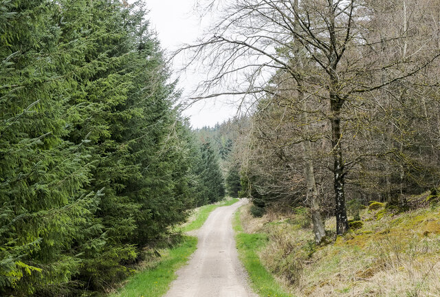
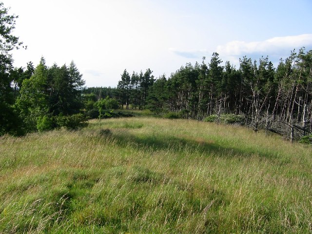
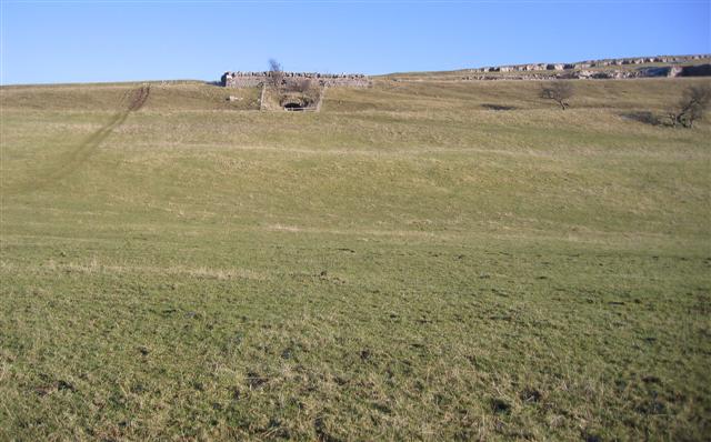
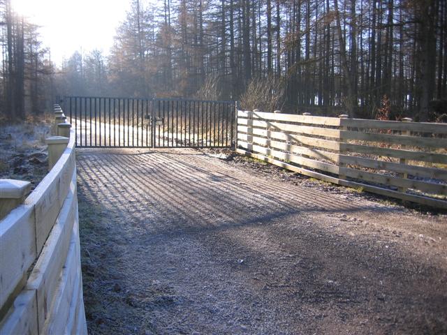
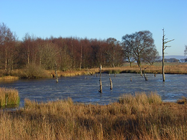
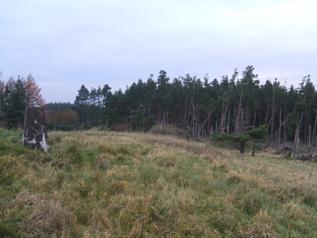
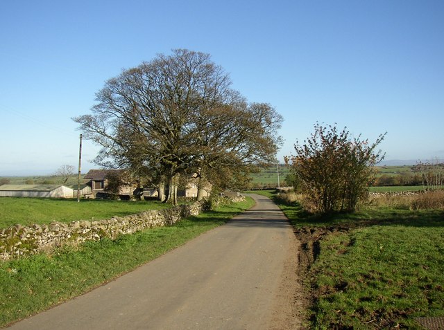
Bernard's Wood, located in Cumberland, is a picturesque forest renowned for its natural beauty and diverse ecosystem. Encompassing an area of approximately 500 acres, this wood is a haven for nature enthusiasts and offers a peaceful retreat from the hustle and bustle of urban life.

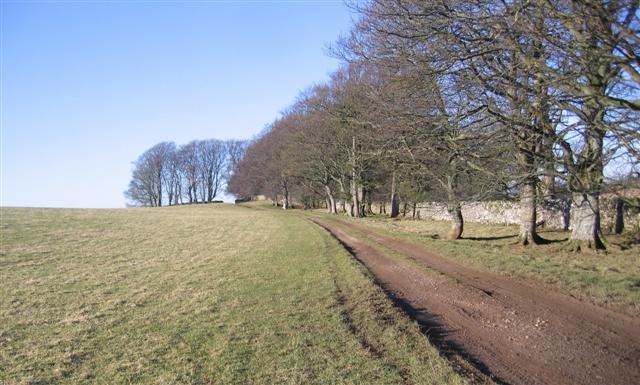
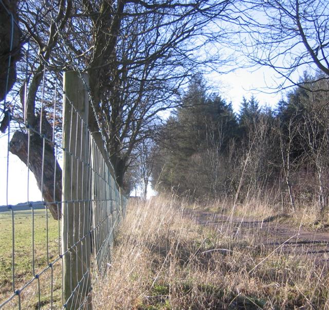
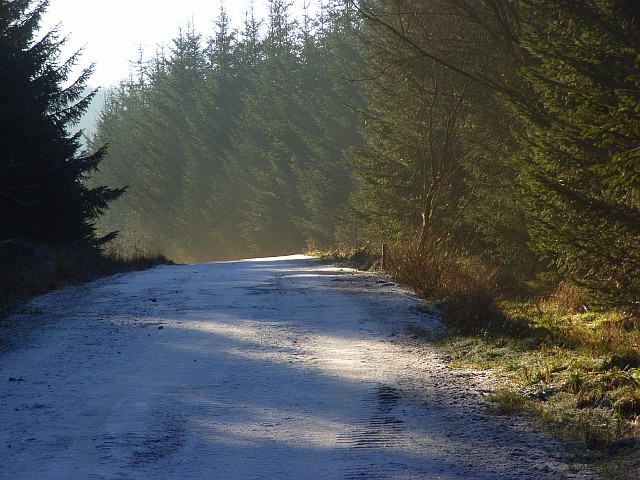
The wood is characterized by a mix of deciduous and coniferous trees, including oak, beech, pine, and spruce, creating a rich tapestry of colors throughout the seasons. The dense canopy provides a cool and shady environment, making it an ideal spot for a leisurely stroll on a hot summer's day.

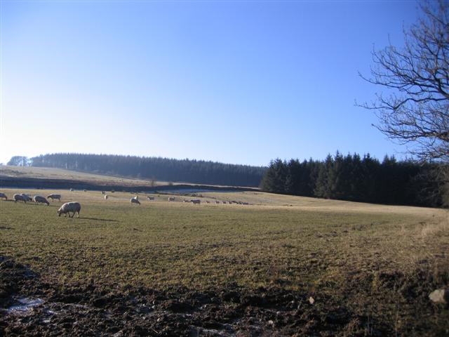
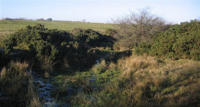
The forest is home to a wide variety of flora and fauna, including numerous species of birds, mammals, and insects. Birdwatchers can spot a range of species, such as woodpeckers, warblers, and owls, while keen-eyed visitors may catch a glimpse of squirrels, deer, and even the elusive red fox.

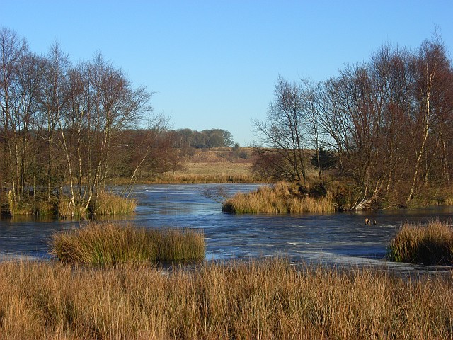
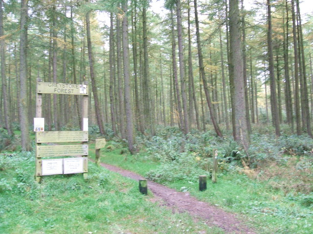
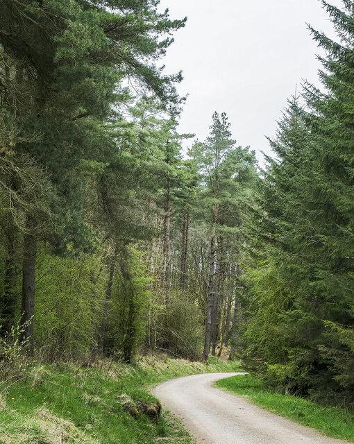
Bernard's Wood is crisscrossed with well-maintained trails, allowing visitors to explore its hidden treasures. These trails cater to different levels of hiking expertise, from easy walks suitable for families with young children to more challenging routes for experienced adventurers. Along the way, hikers can discover serene ponds, babbling brooks, and ancient ruins, adding to the charm and mystery of the wood.

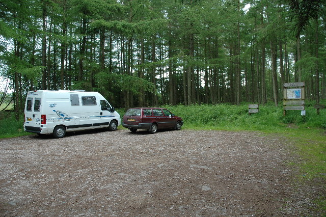
The wood is open to the public year-round and offers various amenities for visitors, including picnic areas, benches, and informative signposts. Additionally, guided nature walks and educational programs are organized periodically, providing visitors with an opportunity to learn more about the forest's ecology and conservation efforts.

In summary, Bernard's Wood is a captivating forest in Cumberland, offering a delightful escape into nature. With its diverse flora and fauna, scenic trails, and peaceful ambiance, it is a must-visit destination for nature lovers and those seeking tranquility amidst the beauty of the natural world.

If you have any feedback on the listing, please let us know in the comments section below.

Bernard's Wood Images

Images are sourced within 2km of 54.695355/-2.9181058 or Grid Reference NY4033. Thanks to Geograph Open Source API. All images are credited.

Forest road at the heart of Greystoke Forest Gillcambon Beck and its tributaries drain Greystoke Forest carrying water to the north. The road is seen heading near to north having climbed away from the main stream and will cross side streams as it continues towards the minor feature named as Tippy Hills.
Forest road at the heart of Greystoke Forest
Gillcambon Beck and its tributaries drain Greystoke Forest carrying water to the north. The road is seen heading near to north having climbed away from the main stream and will cross side streams as it continues towards the minor feature named as Tippy Hills.
Greystoke Forest A butterfly infested clearing in Greystoke Forest
Greystoke Forest
A butterfly infested clearing in Greystoke Forest
Greystoke Forest The Larches car park in Greystoke Forest, Cumbria. Situated at the north east of the forest, one of two main car parks for accessing the walks there which are well waymarked and offer nice and easy walks for unfit people like me.
Greystoke Forest
The Larches car park in Greystoke Forest, Cumbria. Situated at the north east of the forest, one of two main car parks for accessing the walks there which are well waymarked and offer nice and easy walks for unfit people like me.
Rolling Parkland in Greystoke Park. A shepherds work building lies at the top of the photo barely visible.
Rolling Parkland in Greystoke Park.
A shepherds work building lies at the top of the photo barely visible.
Limekiln and quad bike tracks. Such is diversity although to be fair the limekilns have not been used for some time.
Limekiln and quad bike tracks.
Such is diversity although to be fair the limekilns have not been used for some time.
Parkland trees and track. Must be a very different view in summer when the trees are in leaf.
Parkland trees and track.
Must be a very different view in summer when the trees are in leaf.
Farm track on the side of the wood. Recently fenced looking at the high quality of the fencing.
Farm track on the side of the wood.
Recently fenced looking at the high quality of the fencing.
Old wood new wood. Sheep seem oblivious to the timber growing around them but they have plenty of grass.
Old wood new wood.
Sheep seem oblivious to the timber growing around them but they have plenty of grass.
An entrance to Greystoke Forest. Brand new this one may be something to do with the new owner.
An entrance to Greystoke Forest.
Brand new this one may be something to do with the new owner.
Ditch Field Sheep and gorse. Other than this blemish this is a good field and it may provide some shelter.
Ditch Field Sheep and gorse.
Other than this blemish this is a good field and it may provide some shelter.
Browns Barn A barn conversion at Town Head Farm
Browns Barn
A barn conversion at Town Head Farm
Gillcambon Tarn The frozen waters of the tarn sit amid sparse deciduous woodland and low altitude moorland.
Gillcambon Tarn
The frozen waters of the tarn sit amid sparse deciduous woodland and low altitude moorland.
Gillcambon Tarn This is the southern end of the tarn. The stumps show that it has grown. It sits in boggy surroundings.
Gillcambon Tarn
This is the southern end of the tarn. The stumps show that it has grown. It sits in boggy surroundings.
Greystoke Forest A frosty forest road heading SSW from a crossroads.
Greystoke Forest
A frosty forest road heading SSW from a crossroads.
Path into Greystoke Forest The sign has a helpful 6 figure grid ref.
Path into Greystoke Forest
The sign has a helpful 6 figure grid ref.
Clearing in Greystoke Forest This area does not appear on the map so it must be a recent development.
I missed the trig. pillar also.
Clearing in Greystoke Forest
This area does not appear on the map so it must be a recent development. I missed the trig. pillar also.
Trig Pillar in Greystoke Forest
Forest road descending in vicinity of Craggs Gate Wood The road is heading north, towards the northern edge of Greystoke Forest. The location is close to the highest point within the forest which is a few hundred metres away at the trig point known to the OS as Greystoke Park, 365 metres.
Forest road descending in vicinity of Craggs Gate Wood
The road is heading north, towards the northern edge of Greystoke Forest. The location is close to the highest point within the forest which is a few hundred metres away at the trig point known to the OS as Greystoke Park, 365 metres.
Show me another place!

Bernard's Wood is located at Grid Ref: NY4033 (Lat: 54.695355, Lng: -2.9181058)

Administrative County: Cumbria

District: Eden

Police Authority: Cumbria

What 3 Words

///outings.spenders.twinkled. Near Penrith, Cumbria

Related Wikis

Lamonby

Lamonby is an agricultural hamlet in the Eden district, in the county of Cumbria, England, about 2 km from the edge of the Lake District National Park...

Ellonby

Ellonby is a hamlet in the parish of Skelton, in the Eden district, in the English county of Cumbria. To the north of the hamlet, at Hardrigg Hall, a ruined...

Johnby

Johnby is a hamlet in the Eden District, in the English county of Cumbria. It is about 6 miles (9.7 km) from the large town of Penrith and about 1 mile...

Johnby Hall

Johnby Hall is a fortified manor house near Greystoke, Cumbria. It was built in 1583, incorporating the fabric of a medieval tower house, and has been...

Skelton, Cumbria

Skelton is a small village and civil parish about 7 miles (11 km) north west of Penrith in the English county of Cumbria. It is on the former route of...

Hutton Roof, Eden

Hutton Roof is a hamlet and former civil parish, now in the parish of Mungrisdale, in the Westmorland and Furness district, in the ceremonial county of...
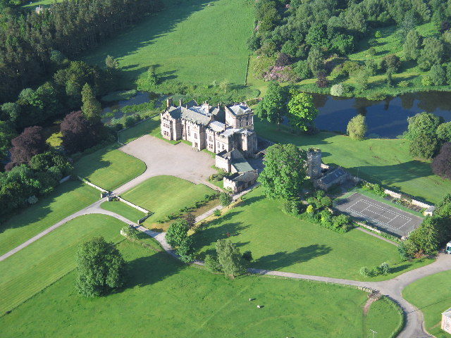
Greystoke Castle

Greystoke Castle is in the village of Greystoke 8 kilometres (5.0 mi) west of Penrith in the county of Cumbria in northern England. (grid reference NY435309...

Greystoke, Cumbria

Greystoke is a village and civil parish on the edge of the Lake District National Park in Cumbria, England, about 4 miles (6.4 km) west of Penrith. At...

Nearby Amenities

Located within 500m of 54.695355,-2.9181058
Bernards Wood
Natural: wood
Lat/Long: 54.6936595/-2.9177718
Greystoke Park
Description: OS trig pillar
Ele: 365.6
Man Made: survey_point
Note: Accurate location import for imagery offset calibration. Please do not move.
Ref: S6953
Source: Ordnance Survey (OGL)
Survey Point: pillar
Lat/Long: 54.6954688/-2.9225555
Greystoke Forest
Ele: 365.2
Natural: peak
Source: https://www.hill-bagging.co.uk/mountaindetails.php?qu=S&rf=7693
Lat/Long: 54.6954949/-2.9225727
The data included in this document is from www.openstreetmap.org. The data is made available under ODbL.

Have you been to Bernard's Wood?

Leave your review of Bernard's Wood below (or comments, questions and feedback).