Beckisland Wood

Wood, Forest in Westmorland South Lakeland

England

Beckisland Wood

Shell Garage forecourt. Troutbeck Bridge
Shell Garage forecourt. Troutbeck Bridge Credit: Eirian Evans

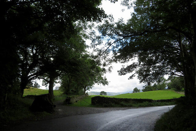
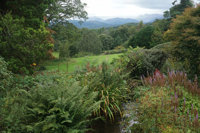
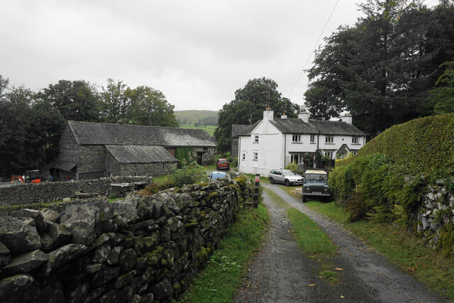
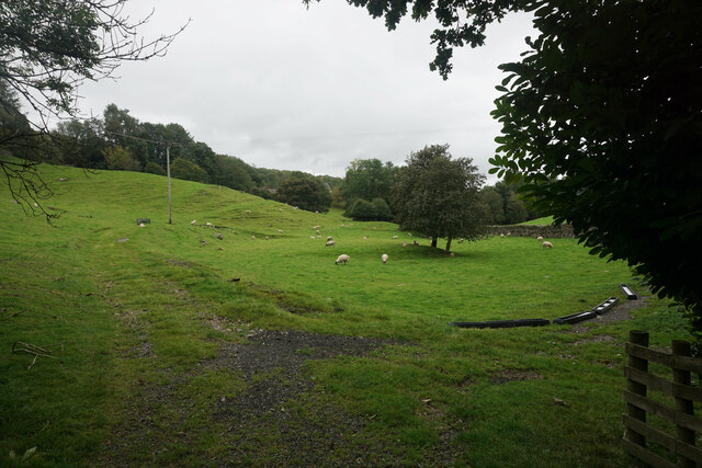
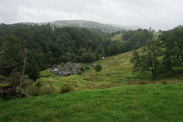
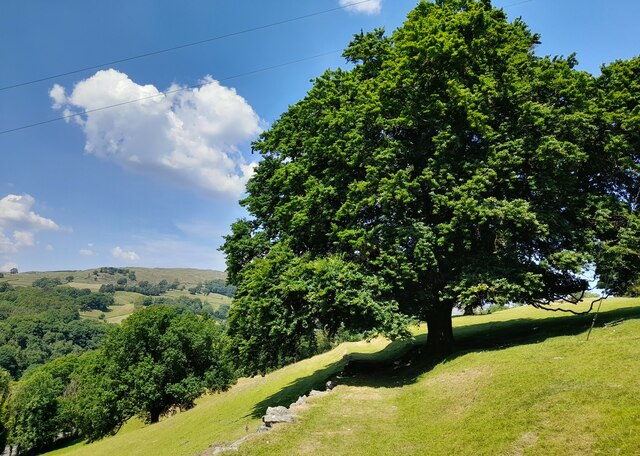
Beckisland Wood is a picturesque woodland located in the county of Westmorland in England. Covering an area of approximately 50 acres, this enchanting forest is nestled in the beautiful countryside, offering a tranquil retreat for nature lovers and outdoor enthusiasts alike.

The wood is predominantly composed of broadleaf trees, including oak, birch, and beech, creating a diverse and vibrant ecosystem. The dense canopy of leaves provides a haven for various species of birds, such as woodpeckers, owls, and thrushes, making it a popular spot for birdwatchers throughout the year.

A network of well-maintained footpaths meanders through Beckisland Wood, allowing visitors to explore its natural beauty at their own pace. The paths wind their way through ancient woodland, revealing hidden clearings, babbling streams, and carpets of wildflowers in the spring and summer months.

The wood is also home to a rich assortment of wildlife. Deer, foxes, and badgers can often be spotted roaming among the trees, while smaller creatures like squirrels and rabbits dart in and out of the undergrowth. The underbrush teems with insects, providing a vital food source for the woodland inhabitants.

Beckisland Wood is a popular destination for families, offering a range of recreational activities. Visitors can enjoy peaceful picnics, build dens, or participate in guided nature walks and educational programs organized by local conservation groups.

Overall, Beckisland Wood in Westmorland is a captivating woodland that showcases the beauty and diversity of the British countryside, providing a haven for both wildlife and humans to connect with nature.

If you have any feedback on the listing, please let us know in the comments section below.

Beckisland Wood Images

Images are sourced within 2km of 54.393565/-2.923982 or Grid Reference NY4000. Thanks to Geograph Open Source API. All images are credited.

Shell Garage forecourt. Troutbeck Bridge
Fields and footpath near a bend in the road
Car park and beer garden for the Sun Inn, Troutbeck Bridge
Hydrangeas at Holehird Holehird Gardens maintain several National Collections. The hydrangeas held this status for a while but the local climate proved a bit too challenging for some varieties. The gardens now concentrate on varieties which can thrive locally.
Hydrangeas at Holehird
Holehird Gardens maintain several National Collections. The hydrangeas held this status for a while but the local climate proved a bit too challenging for some varieties. The gardens now concentrate on varieties which can thrive locally.
Holehird Care Home This was for many years a Leonard Cheshire care home but it has been closed for about a year. The local council is trying to dispose of the building.
Holehird Care Home
This was for many years a Leonard Cheshire care home but it has been closed for about a year. The local council is trying to dispose of the building.
Holehird Gardens An excellent fellside garden from where you can see up to Langdale.
Holehird Gardens
An excellent fellside garden from where you can see up to Langdale.
Walled garden at Holehird The gardens are managed by the Lakeland Horticultural Society through its volunteers.
Walled garden at Holehird
The gardens are managed by the Lakeland Horticultural Society through its volunteers.
Rock garden at Holehird The gardens are run by volunteers of the Lakeland Horticultural Society and have several National Plant Collections.
Rock garden at Holehird
The gardens are run by volunteers of the Lakeland Horticultural Society and have several National Plant Collections.
Lane above Trout Beck Looking up the valley. The cottages on the right have a good view to the Coniston and Langdale fells.
Lane above Trout Beck
Looking up the valley. The cottages on the right have a good view to the Coniston and Langdale fells.
Boot Cottages Traditional Cumbrian architecture as seen from Dodd's Lane.
Boot Cottages
Traditional Cumbrian architecture as seen from Dodd's Lane.
Sheep grazing off Dodd's Lane The eastern side of the Trout Beck valley.
Sheep grazing off Dodd's Lane
The eastern side of the Trout Beck valley.
Mill House A small cluster of dwellings by Trout Beck, viewed from Patterdale Road.
Mill House
A small cluster of dwellings by Trout Beck, viewed from Patterdale Road.
Bus stop at Troutbeck Bridge
Start of Footpath at Boot Start of a good footpath which continues to Thickholme Bridge.
Start of Footpath at Boot
Start of a good footpath which continues to Thickholme Bridge.
The Priory, Windermere Victorian Gothic house, Grade II listed.
The Priory, Windermere
Victorian Gothic house, Grade II listed.
Lakes Lodge Bed&Breakfast, Windermere
Phoenix Playing Field at night Looking over Phoenix Playing Field at night, glowing with bright yellow lights. It was flurrying snow and yet a determined few were jogging around the path.
Phoenix Playing Field at night
Looking over Phoenix Playing Field at night, glowing with bright yellow lights. It was flurrying snow and yet a determined few were jogging around the path.
Houses opposite the playing field at night A row of terraced houses with many character features opposite Phoenix Playing Field.
Houses opposite the playing field at night
A row of terraced houses with many character features opposite Phoenix Playing Field.
Show me another place!

Beckisland Wood is located at Grid Ref: NY4000 (Lat: 54.393565, Lng: -2.923982)

Administrative County: Cumbria

District: South Lakeland

Police Authority: Cumbria

What 3 Words

///tonality.barn.applauded. Near Windermere, Cumbria

Related Wikis

The Lakes School

The Lakes School is a coeducational secondary school and sixth form located in Troutbeck Bridge, Windermere, in the English county of Cumbria.It is a comprehensive...

Troutbeck Bridge

Troutbeck Bridge is a village in the civil parish of Windermere and Bowness, in the Westmorland and Furness district, in the ceremonial county of Cumbria...

Windermere School

Windermere School is an independent, coeducational boarding and day school in the English Lake District. Founded in 1863, it has approximately 360 pupils...

Windermere and Troutbeck

Windermere and Troutbeck (including Bridge House) is a National Trust property consisting of land around Windermere, a lake in Cumbria, England. This National...
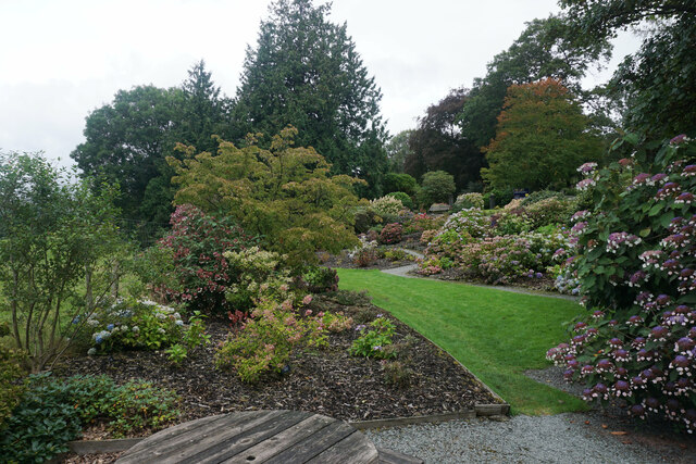
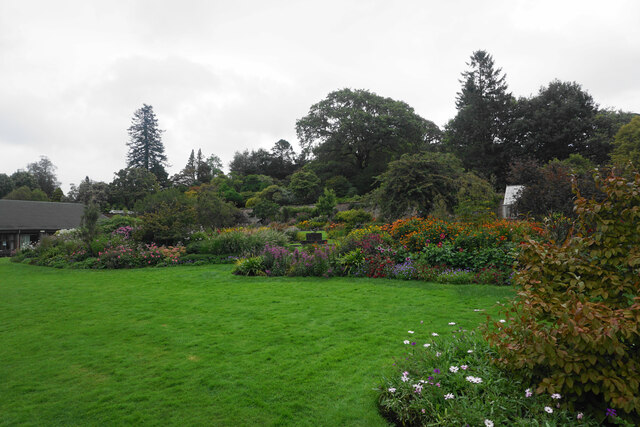
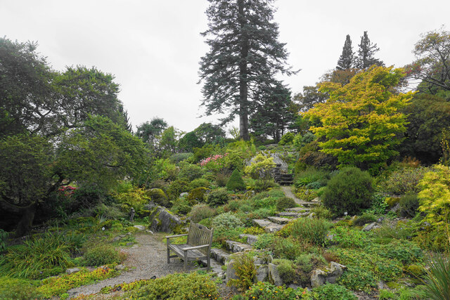
Holehird Gardens

Holehird Gardens is an extensive 10-acre site located near Windermere, Cumbria, England. It is the home of the Lakeland Horticultural Society. The garden...

Brockhole

The Brockhole Lake District Visitor Centre, also known as the Brockhole National Park Visitor Centre, is a visitor centre and tourist attraction managed...

Orrest Head

Orrest Head is a hill in the English Lake District on the eastern shores of Windermere. It is the subject of a chapter in Wainwright's The Outlying Fells...

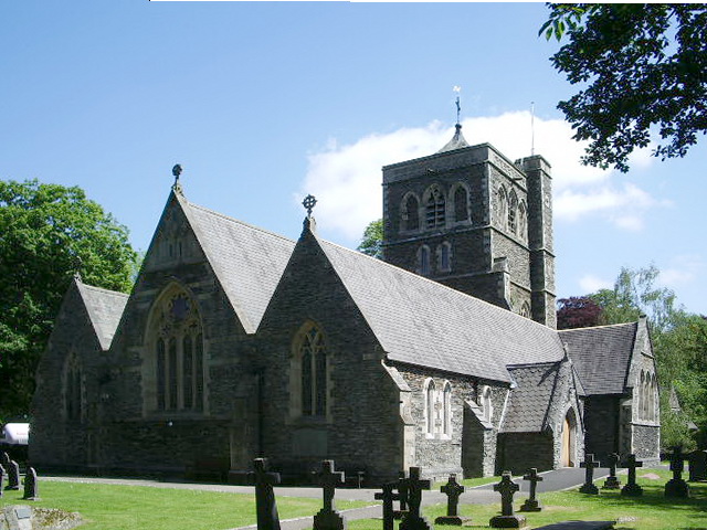
St Mary's Church, Windermere

St Mary's Church is in the town of Windermere, Cumbria, England. It is an active Anglican parish church in the deanery of Windermere, the archdeaconry...

Nearby Amenities

Located within 500m of 54.393565,-2.923982
Telephone
Booth: KX100
Covered: booth
Lat/Long: 54.39333/-2.9187131
Bus Stop
Lakes School
Bus: yes
Naptan AtcoCode: 090079731123
Naptan Bearing: N
Naptan BusStopType: CUS
Naptan CommonName: Lakes School
Naptan Indicator: o/s
Naptan Landmark: School
Naptan NaptanCode: cumdmjwj
Naptan PlusbusZoneRef: WMER
Naptan Street: Lakes School Road
Naptan Verified: no
Public Transport: platform
Source: naptan_import
Lat/Long: 54.3934974/-2.9204518
Bus Stop
Troutbeck Bridge
Bench: no
Bin: no
Bus: yes
Naptan AtcoCode: 090079731798
Naptan Bearing: S
Naptan BusStopType: MKD
Naptan CommonName: The Sun Hotel
Naptan Indicator: near
Naptan Landmark: The Sun Hotel
Naptan LocalityCode: E0006467
Naptan NaptanCode: cumdmpdg
Naptan PlusbusZoneRef: WMER
Naptan Street: A591
Naptan Verified: yes
Public Transport: platform
Ref: cumdmpdg
Shelter: no
Source: naptan_import
Lat/Long: 54.3933789/-2.9187886
Bus Stop
Troutbeck Bridge
Bench: yes
Bin: yes
Bus: yes
Covered: no
Naptan AtcoCode: 090079732143
Naptan Bearing: NW
Naptan BusStopType: MKD
Naptan CommonName: Troutbeck Bridge
Naptan Indicator: o/s
Naptan Landmark: Troutbeck Bridge Garage
Naptan LocalityCode: E0006467
Naptan NaptanCode: cumdmpjt
Naptan PlusbusZoneRef: WMER
Naptan Street: A591
Naptan Verified: yes
Public Transport: platform
Ref: cumdmpjt
Shelter: no
Source: naptan_import
Tactile Paving: no
Lat/Long: 54.3944795/-2.920244
Troutbeck Bridge
Place: village
Wikidata: Q29440404
Wikipedia: en:Troutbeck Bridge
Lat/Long: 54.393221/-2.9190385
Post Box
Brand: Royal Mail
Brand Wikidata: Q638098
Operator: Royal Mail
Operator Wikidata: Q638098
Post Box Mounting: pier
Post Box Type: lamp
Ref: LA23 84
Source: survey
Lat/Long: 54.3948542/-2.9208415
Give Way
Direction: backward
Lat/Long: 54.394962/-2.9231337
Barrier: chain
Lat/Long: 54.3958614/-2.9270687
Barrier: lift_gate
Lat/Long: 54.3930117/-2.9223399
Recycling
Recycling Cardboard: yes
Recycling Clothes: no
Recycling Glass: no
Recycling Glass Bottles: no
Recycling Paper: yes
Recycling Plastic: no
Lat/Long: 54.3928745/-2.9227406
Gordon Greaves Slate
Addr City: Windermere
Craft: stonemason
Lat/Long: 54.3961935/-2.9201162
Waste Basket
Lat/Long: 54.3933488/-2.9187478
Defibrillator
Emergency: defibrillator
Indoor: no
Lat/Long: 54.3926352/-2.9217166
Give Way
Direction: backward
Lat/Long: 54.39515/-2.9217356
Crossing
Button Operated: yes
Crossing: traffic_signals
Crossing Island: no
Kerb: flush
Tactile Paving: yes
Lat/Long: 54.3940513/-2.9197621
Bench
Backrest: yes
Lat/Long: 54.3952289/-2.9218461
Leisure: picnic_table
Lat/Long: 54.394845/-2.920876
Bicycle Parking
Bicycle Parking: wall_loops
Capacity: 4
Lat/Long: 54.3948311/-2.9208756
Waste Basket
Lat/Long: 54.394468/-2.9202371
Give Way
Direction: backward
Lat/Long: 54.3932881/-2.9187851
Give Way
Direction: backward
Lat/Long: 54.3934619/-2.918955
Bench
Backrest: yes
Lat/Long: 54.3932119/-2.9189477
Bench
Backrest: yes
Lat/Long: 54.3932723/-2.9189929
Give Way
Direction: forward
Lat/Long: 54.3938838/-2.9197172
Give Way
Direction: forward
Lat/Long: 54.3945938/-2.9203446
Give Way
Direction: backward
Lat/Long: 54.3946169/-2.9201663
Give Way
Direction: backward
Lat/Long: 54.3949486/-2.920777
Troutbeck Bridge
Bus: yes
Public Transport: stop_position
Lat/Long: 54.3945219/-2.9201297
Troutbeck Bridge
Bus: yes
Public Transport: stop_position
Lat/Long: 54.3933495/-2.9189354
Low Ibbotsholme
Place: neighbourhood
Lat/Long: 54.3957493/-2.9208926
Traffic Calming: bump
Lat/Long: 54.3937356/-2.9266213
Turning Circle
Lat/Long: 54.3955837/-2.9297327
Atm
Check Date: 2023-08-03
Fee: no
Lat/Long: 54.3946319/-2.9210227
The data included in this document is from www.openstreetmap.org. The data is made available under ODbL.

Have you been to Beckisland Wood?

Leave your review of Beckisland Wood below (or comments, questions and feedback).