Walford's Rough

Wood, Forest in Shropshire

England

Walford's Rough

Walkers on the 2023 Pontesbury Potter cross a field The walk is a fixture in my calendar most years. You always meet nice, interesting, friendly, engaging and memorable walking companions. 

Plus we laugh 90% of the way round.
Walkers on the 2023 Pontesbury Potter cross a field Credit: Jeremy Bolwell

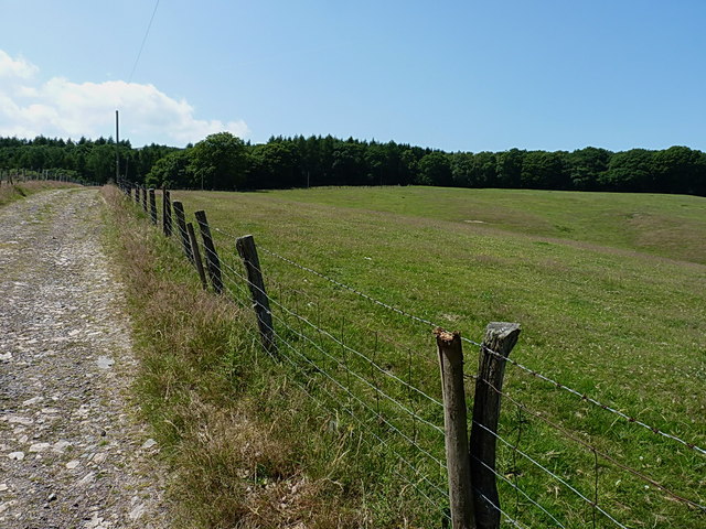
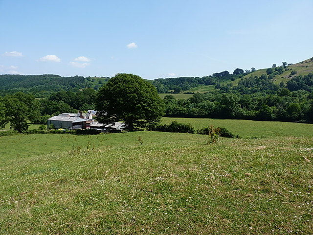
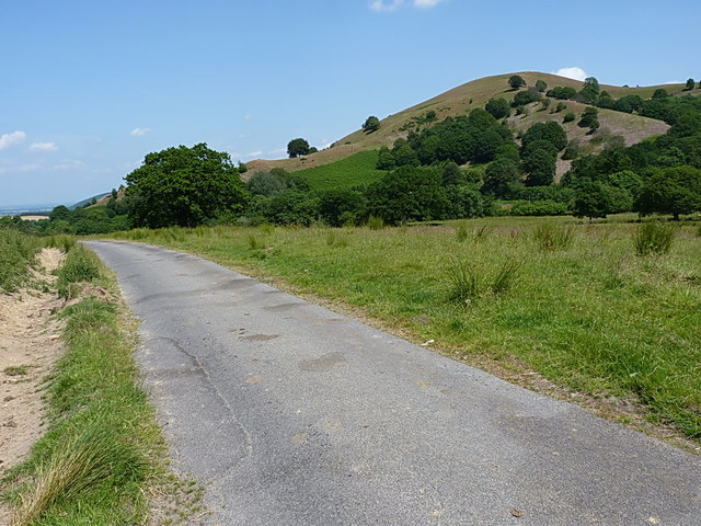
Walford's Rough is a picturesque woodland area located in the county of Shropshire, England. Situated in the heart of the county, it is known for its dense and enchanting forests, making it a popular destination for nature enthusiasts and hikers alike.

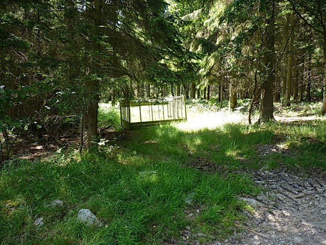
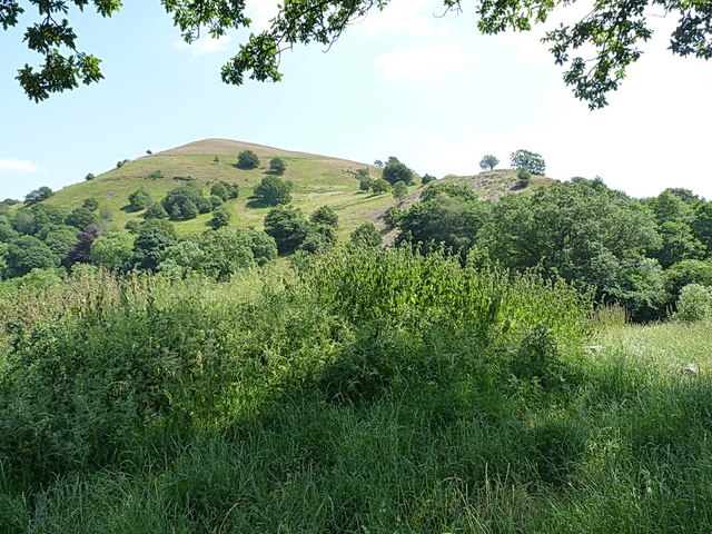
Covering an expansive area, Walford's Rough is home to a diverse range of flora and fauna. The woodland is predominantly composed of oak, beech, and birch trees, creating a lush and green environment. Various species of wildflowers, such as bluebells and primroses, can also be found carpeting the forest floor during the spring months.

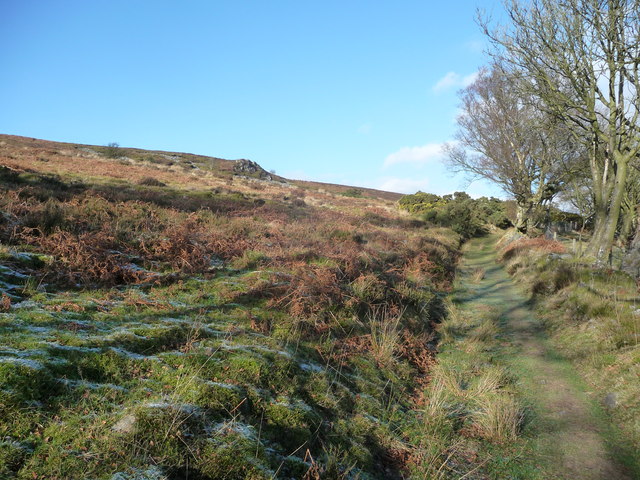
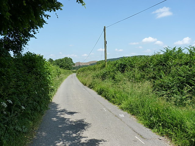
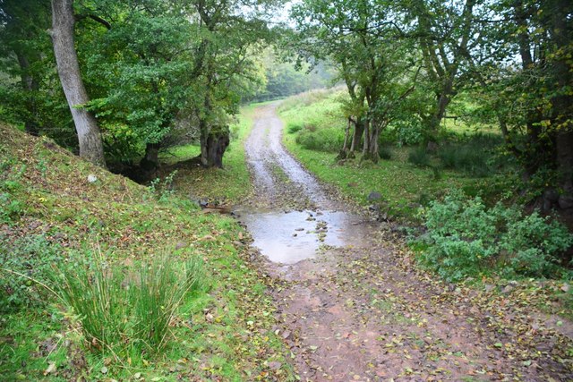
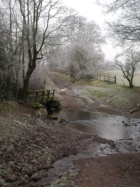
The woodland is crisscrossed by numerous footpaths and trails, allowing visitors to explore its natural beauty at their own pace. These paths lead to hidden gems, including babbling brooks, small waterfalls, and tranquil ponds. The area is also home to a variety of wildlife, including deer, foxes, badgers, and a wide array of bird species, making it a haven for nature lovers and birdwatchers.

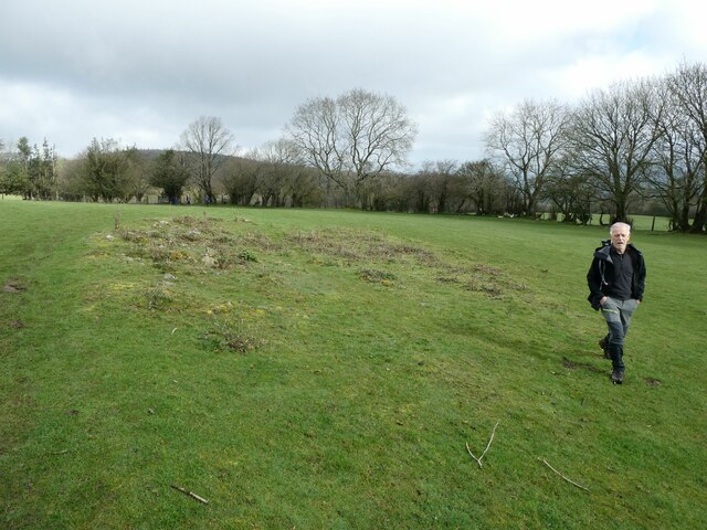
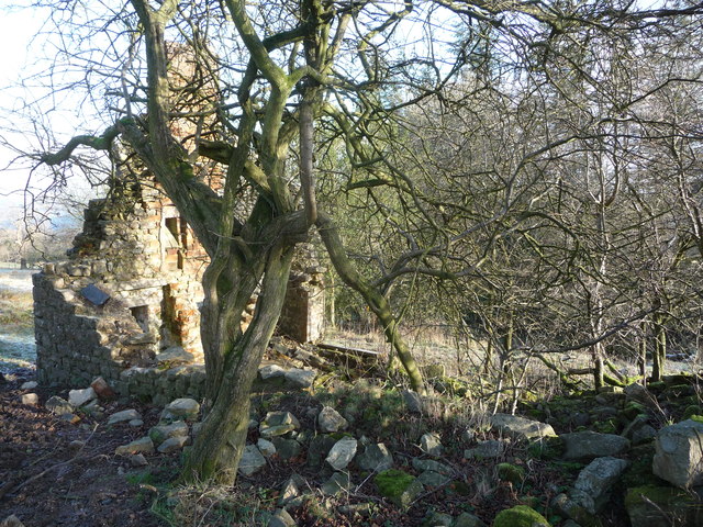
Walford's Rough holds historical significance, with evidence of Iron Age settlements and Roman activity found within the vicinity. Archaeological enthusiasts can explore these ancient remnants, offering a glimpse into the area's rich past.

Overall, Walford's Rough, Shropshire, offers a perfect escape from the hustle and bustle of everyday life. Its stunning woodlands, abundant wildlife, and historical importance make it an ideal destination for those seeking a serene and natural retreat.

If you have any feedback on the listing, please let us know in the comments section below.

Walford's Rough Images

Images are sourced within 2km of 52.596647/-2.8914699 or Grid Reference SJ3900. Thanks to Geograph Open Source API. All images are credited.

Walkers on the 2023 Pontesbury Potter cross a field The walk is a fixture in my calendar most years. You always meet nice, interesting, friendly, engaging and memorable walking companions. 

Plus we laugh 90% of the way round.
Walkers on the 2023 Pontesbury Potter cross a field
The walk is a fixture in my calendar most years. You always meet nice, interesting, friendly, engaging and memorable walking companions. Plus we laugh 90% of the way round.
Path towards Brook Vessons off Stiperstones ridge This area was once settled, like Blakemoorgate on the other side of the ridge, by miners and their families and ahead the ruins of a few cottages can still be seen.
Path towards Brook Vessons off Stiperstones ridge
This area was once settled, like Blakemoorgate on the other side of the ridge, by miners and their families and ahead the ruins of a few cottages can still be seen.
Cottage ruins off the Stiperstones ridge A tumbledown cottage ruin beside the path.
Cottage ruins off the Stiperstones ridge
A tumbledown cottage ruin beside the path.
Path around the Stiperstones ridge A good walk route contouring around the ridge at a sheltered level - advantageous in winter when a bitter easterly cuts through the high ground like an icy blade.
Path around the Stiperstones ridge
A good walk route contouring around the ridge at a sheltered level - advantageous in winter when a bitter easterly cuts through the high ground like an icy blade.
Pheasant pen at the entrance to Brook Coppice Not much used just recently by the look of things, and there were few birds in the woods on this hot afternoon.
Pheasant pen at the entrance to Brook Coppice
Not much used just recently by the look of things, and there were few birds in the woods on this hot afternoon.
Above Brook Vessons to Brook Coppice
Brook Vessons Farm from above The farm sits in the valley of the Habberley Brook; Westcott Hill forms the skyline here.
Brook Vessons Farm from above
The farm sits in the valley of the Habberley Brook; Westcott Hill forms the skyline here.
Along the lane towards Habberley A quiet country lane from Bridges to Habberley.
Along the lane towards Habberley
A quiet country lane from Bridges to Habberley.
Steeply up onto Paulith Bank
From Walford's Rough to Paulith Bank This little-used lane runs along the bottom of the steep, grassy Paulith Bank hill.
From Walford's Rough to Paulith Bank
This little-used lane runs along the bottom of the steep, grassy Paulith Bank hill.
Ford at Walford's Rough This ford is found on the track leading to Walford's Rough.
Ford at Walford's Rough
This ford is found on the track leading to Walford's Rough.
Property below Stiperstones near Brook Vessons What a lovely isolated spot.
Property below Stiperstones near Brook Vessons
What a lovely isolated spot.
Track through the plantation Walkers on the 2020 Pontesbury Potter amble down this section.
Track through the plantation
Walkers on the 2020 Pontesbury Potter amble down this section.
View down to Brook Vessons Farm A small farm sheltered in the hills.
View down to Brook Vessons Farm
A small farm sheltered in the hills.
Hill from a field gate Never been here before.
Hill from a field gate
Never been here before.
Cothercott Barytes Mill Barium mining was once an industry in the Stiperstones area. I don't know what they used this heavy mineral for, today it is used to make the 'mud' used to control oil wells. As its name suggests it is dense.
Cothercott Barytes Mill
Barium mining was once an industry in the Stiperstones area. I don't know what they used this heavy mineral for, today it is used to make the 'mud' used to control oil wells. As its name suggests it is dense.
Cothercott Hill View from the barytes mill.
Cothercott Hill
View from the barytes mill.
New gate, Cothercott Hill Irony that it is as awkward to get up the steps from the road as it would be to get over a traditional stile. Very encouraging to see that Shropshire County Council is still looking after its path network - they have earned a fine reputation over the years.
New gate, Cothercott Hill
Irony that it is as awkward to get up the steps from the road as it would be to get over a traditional stile. Very encouraging to see that Shropshire County Council is still looking after its path network - they have earned a fine reputation over the years.
Show me another place!

Walford's Rough is located at Grid Ref: SJ3900 (Lat: 52.596647, Lng: -2.8914699)

Unitary Authority: Shropshire

Police Authority: West Mercia

What 3 Words

///comforted.themes.midwinter. Near Minsterley, Shropshire

Related Wikis

Snailbeach Countryside Site

Snailbeach Countryside Site is an industrial archeology site in Shropshire. It is located three 3 miles (4.8 km) south of the village of Pontesbury and...

Snailbeach

Snailbeach is a village in Shropshire, England, located near Shrewsbury at grid reference SJ375025. The population details taken at the 2011 census can...

Eastridge Mountain Bike Trail Centre

Eastridge Mountain Bike Trail Centre is a free mountain biking venue in Shropshire, UK. The venue is developed and maintained by volunteers, and features...
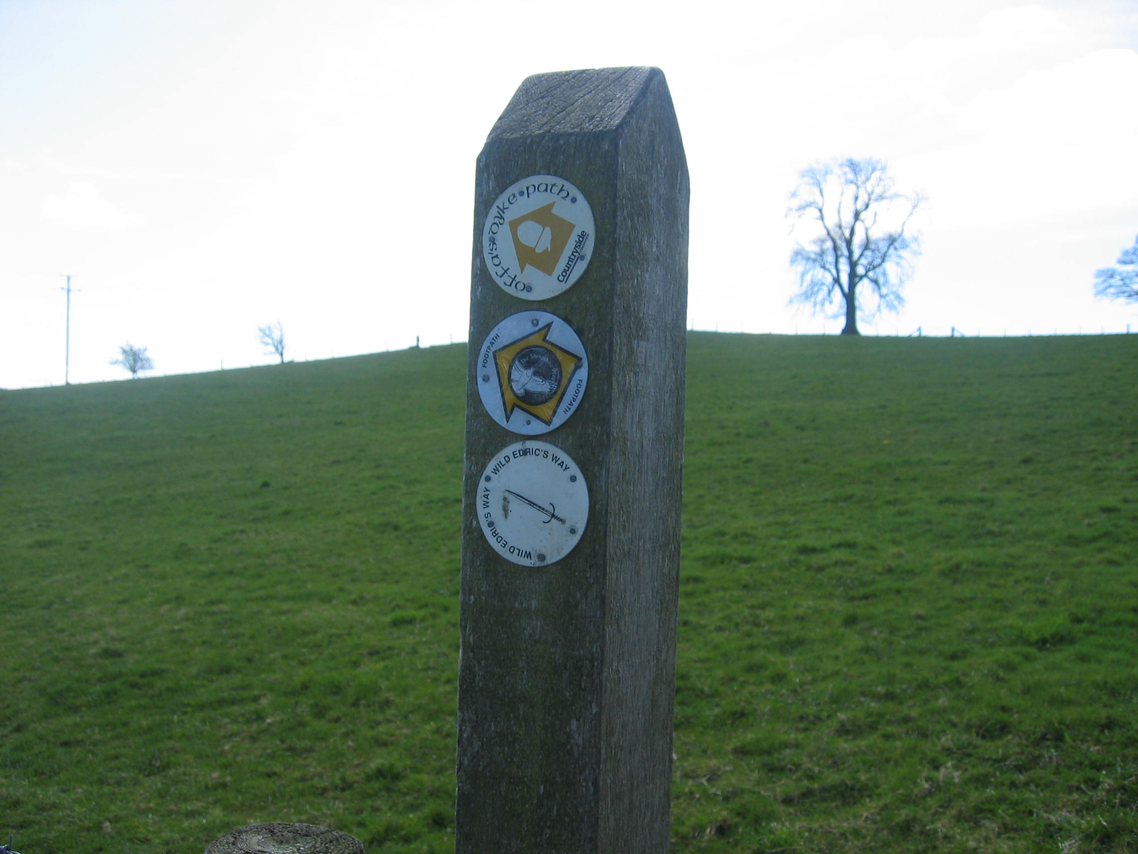
Wild Edric's Way

Wild Edric's Way is a waymarked long distance footpath running wholly within the county of Shropshire in England. The path runs for 49 miles (79 km), mostly...

Habberley, Shropshire

Habberley is a small village and former civil parish, now in the parish of Pontesbury, in the Shropshire district, in the ceremonial county of Shropshire...
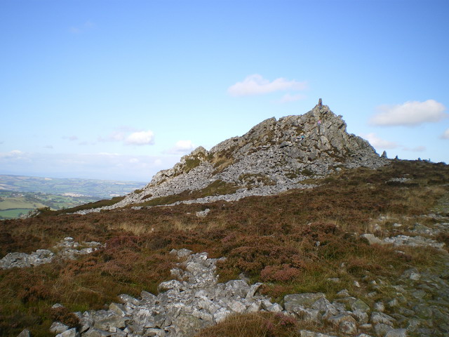
Stiperstones

The Stiperstones (Welsh: Carneddau Teon) is a distinctive hill in the county of Shropshire, England. The quartzite rock of the ridge formed some 480 million...

Ratlinghope

Ratlinghope (, locally also RAT-chəp) is a hamlet and civil parish in Shropshire, England. The population of the civil parish at the 2011 census was 138...

Picklescott

Picklescott is a village in Shropshire, England. It is located in the northern foothills of the Long Mynd, approximately 5 kilometres (3 miles) northwest...

Nearby Amenities

Located within 500m of 52.596647,-2.8914699
Ford: yes
Lat/Long: 52.5941487/-2.8961715
Barrier: cattle_grid
Lat/Long: 52.5996576/-2.8951417
Bench: yes
Leisure: picnic_table
Lit: no
Material: wood
Lat/Long: 52.5942077/-2.89634
Information: board
Tourism: information
Lat/Long: 52.5946922/-2.8955016
Artwork Type: sculpture
Material: wood
Tourism: artwork
Lat/Long: 52.5940101/-2.8961719
Bench
Material: wood
Lat/Long: 52.5936314/-2.8967576
Board Type: nature
Direction: 300
Information: board
Tourism: information
Lat/Long: 52.5938114/-2.8958125
Barrier: cattle_grid
Lat/Long: 52.5941287/-2.8968223
Paulith Bank
Ele: 383
Natural: peak
Lat/Long: 52.5999917/-2.8870982
The data included in this document is from www.openstreetmap.org. The data is made available under ODbL.

Have you been to Walford's Rough?

Leave your review of Walford's Rough below (or comments, questions and feedback).