Marsh Copse

Wood, Forest in Dorset

England

Marsh Copse

Footpath gateway on Golden Cap, Dorset Footpath gateway near the summit of Golden Cap on the Dorset coast.
Footpath gateway on Golden Cap, Dorset Credit: Alex Passmore

Marsh Copse is a picturesque woodland located in the county of Dorset, England. Situated in the heart of the beautiful countryside, it covers an area of approximately 100 hectares and is known for its diverse range of flora and fauna.

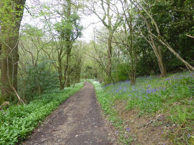
The copse is primarily composed of deciduous trees such as oak, beech, and ash, which provide a lush and vibrant canopy during the summer months. The forest floor is covered with a variety of wildflowers, including bluebells and primroses, creating a colorful carpet that attracts many visitors.

Numerous walking trails wind their way through the copse, offering visitors the chance to explore its natural beauty. These paths are well-maintained and suitable for all levels of walkers, making it a popular destination for families and nature enthusiasts alike.

Marsh Copse is also home to a variety of wildlife, including deer, rabbits, and a wide range of bird species. The woodland provides a vital habitat for these animals, offering shelter and a plentiful food supply.

In addition to its natural wonders, Marsh Copse also has historical significance. The wood has been managed for centuries and was once used as a source of timber for shipbuilding. Remnants of this history can still be seen in the form of old boundary markers and ancient trees.

Overall, Marsh Copse is a tranquil and captivating woodland that offers visitors a chance to immerse themselves in nature and experience the enchanting beauty of Dorset's countryside.

If you have any feedback on the listing, please let us know in the comments section below.

Marsh Copse Images

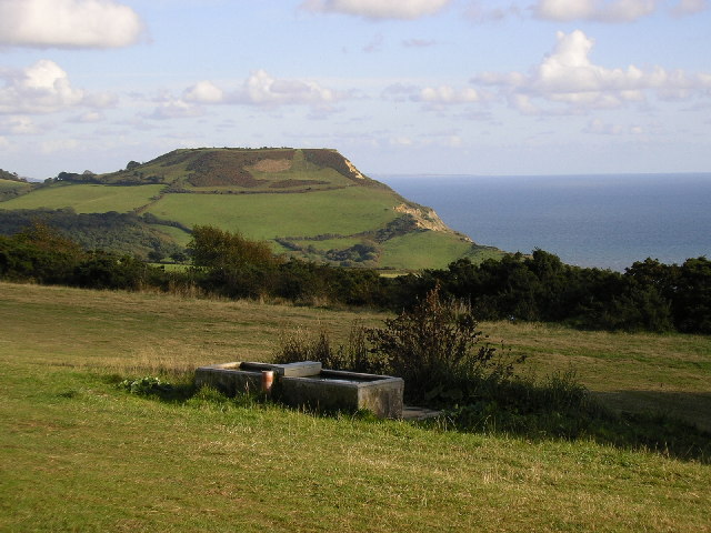
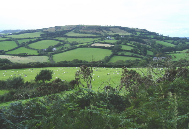
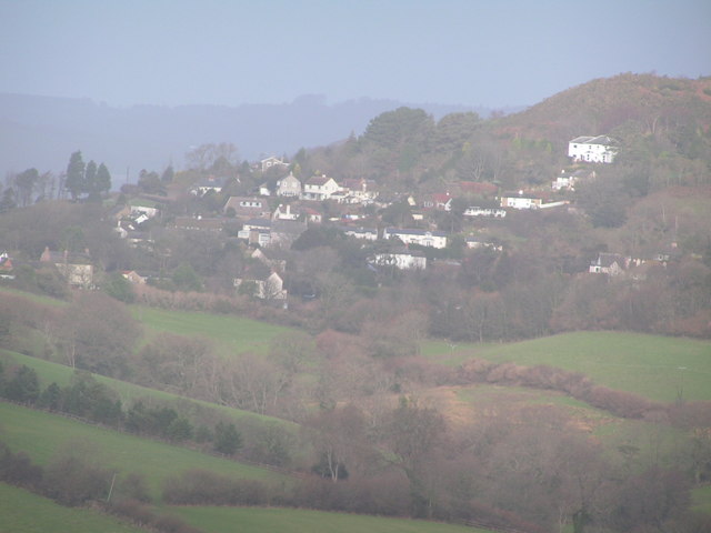
Images are sourced within 2km of 50.735486/-2.8604489 or Grid Reference SY3993. Thanks to Geograph Open Source API. All images are credited.

Footpath gateway on Golden Cap, Dorset Footpath gateway near the summit of Golden Cap on the Dorset coast.
Footpath gateway on Golden Cap, Dorset
Footpath gateway near the summit of Golden Cap on the Dorset coast.
Triangulation pillar, Golden Cap The triangulation pillar on the summit of Golden Cap.
The flush bracket benchmark number S3752 on the east face of the pillar marks a height of 190.9487m above sea level (Ordnance Datum Newlyn) last levelled in 1953 (photograph <a href="https://www.geograph.org.uk/photo/7095474">SY4092 : Flush Bracket benchmark, Golden Cap</a>).
This triangulation pillar is on the route of the England Coast Path.
Triangulation pillar, Golden Cap
The triangulation pillar on the summit of Golden Cap. The flush bracket benchmark number S3752 on the east face of the pillar marks a height of 190.9487m above sea level (Ordnance Datum Newlyn) last levelled in 1953 (photograph SY4092 : Flush Bracket benchmark, Golden Cap). This triangulation pillar is on the route of the England Coast Path.
Flush Bracket benchmark, Golden Cap Detail of the Ordnance Survey flush bracket benchmark on the triangulation pillar on the summit of Golden Cap (photograph <a href="https://www.geograph.org.uk/photo/7095263">SY4092 : Triangulation pillar, Golden Cap</a>).  The benchmark marks a height of 190.9487m above sea level (Ordnance Datum Newlyn) last levelled in 1953.
Flush Bracket benchmark, Golden Cap
Detail of the Ordnance Survey flush bracket benchmark on the triangulation pillar on the summit of Golden Cap (photograph SY4092 : Triangulation pillar, Golden Cap). The benchmark marks a height of 190.9487m above sea level (Ordnance Datum Newlyn) last levelled in 1953.
Path through St Gabriel's Wood, May Day 2023
Golden Cap Viewed from Lyme Regis.
Golden Cap
Viewed from Lyme Regis.
Looking ENE from Hardown Hill, Morcombelake In the middle distance is the short range of low hills that includes Copper Hill and Jan's Hill. Hardown Hill, 207m, is one of Dorset's five Marilyns.
Looking ENE from Hardown Hill, Morcombelake
In the middle distance is the short range of low hills that includes Copper Hill and Jan's Hill. Hardown Hill, 207m, is one of Dorset's five Marilyns.
View to Chardown Hill  From Felicity's Farm Shop
View to Chardown Hill
From Felicity's Farm Shop
Junction on the A35
Junction on the A35
The Dorset coast east of Charmouth In the foreground is Westhay Farm. Conspicuous beyond the farm is the flat-topped Golden Cap, at 191m the highest point on the south coast of England. Though a few argue that as the cliff is not vertical, the summit is about 250m inland from the sea itself. I have been known to be pedantic, but this must be pedantry gone mad! 

On the horizon, right, is the outline of Portland Bill.
The Dorset coast east of Charmouth
In the foreground is Westhay Farm. Conspicuous beyond the farm is the flat-topped Golden Cap, at 191m the highest point on the south coast of England. Though a few argue that as the cliff is not vertical, the summit is about 250m inland from the sea itself. I have been known to be pedantic, but this must be pedantry gone mad! On the horizon, right, is the outline of Portland Bill.
Golden Cap The trig point at the highest point on the south coast, looking east over Seatown towards Doghouse Hill
Golden Cap
The trig point at the highest point on the south coast, looking east over Seatown towards Doghouse Hill
Ship Inn, Morcombelake Situated on the main A35 at the west end of the village.
Ship Inn, Morcombelake
Situated on the main A35 at the west end of the village.
Golden Cap from the west As the highest point on the southern coast of England, Golden Cap gets lots of visitors.  Most walk up from Seatown and miss out on this great view of the hill from the west.
Golden Cap from the west
As the highest point on the southern coast of England, Golden Cap gets lots of visitors. Most walk up from Seatown and miss out on this great view of the hill from the west.
View from Stonebarrow Hill Looking towards Golden Cap.
View from Stonebarrow Hill
Looking towards Golden Cap.
St. Gabriel's Mouth
St. Gabriel's Mouth
Cattle grazing at Westhay Farm
Cliff and seashore below Golden Cap
Remains of Stanton St. Gabriel's church featured in the novel "The Treasure of Golden Cap" by Bennet Copplestone
Remains of Stanton St. Gabriel's church
featured in the novel "The Treasure of Golden Cap" by Bennet Copplestone
Cain's Folly (higher slopes)
Show me another place!

Marsh Copse is located at Grid Ref: SY3993 (Lat: 50.735486, Lng: -2.8604489)

Unitary Authority: Dorset

Police Authority: Dorset

What 3 Words

///ordeals.puts.bookshelf. Near Charmouth, Dorset

Related Wikis

Chardown Hill

Chardown Hill is a prominent, rounded hill, 194 metres (636 ft) high, just to the southwest of the village of Morcombelake in the county of Dorset in southern...

Stonebarrow Hill

Stonebarrow Hill is a hill, east of Charmouth, near the Dorset coast in southern England. It has a height of 148 metres (486 ft) and forms the west-southwestern...

Stanton St Gabriel

Stanton St Gabriel is a civil parish in west Dorset, England. It lies approximately midway between the towns of Lyme Regis and Bridport on the Jurassic...

Morcombelake

Morcombelake (also spelled Morecombelake) is a small village near Bridport in Dorset, England, within the ancient parish of Whitchurch Canonicorum. Golden...

Nearby Amenities

Located within 500m of 50.735486,-2.8604489
Parking
Chardown Hill
Lat/Long: 50.7380111/-2.8654809
Bench
Lat/Long: 50.7377708/-2.8655939
The data included in this document is from www.openstreetmap.org. The data is made available under ODbL.

Have you been to Marsh Copse?

Leave your review of Marsh Copse below (or comments, questions and feedback).