Burs Lears Copse

Wood, Forest in Somerset South Somerset

England

Burs Lears Copse

Fingerpost, Cricket Sᵀ Thomas In the junction with A30 a sign indicating the private road to the Hotel and church etc.

Inscription: Cricket Sᵀ Thomas / (Private Road)

Milestone Society National ID: SO_ST3608
Fingerpost, Cricket Sᵀ Thomas Credit: Mr Red

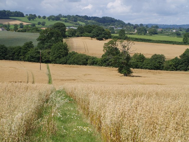
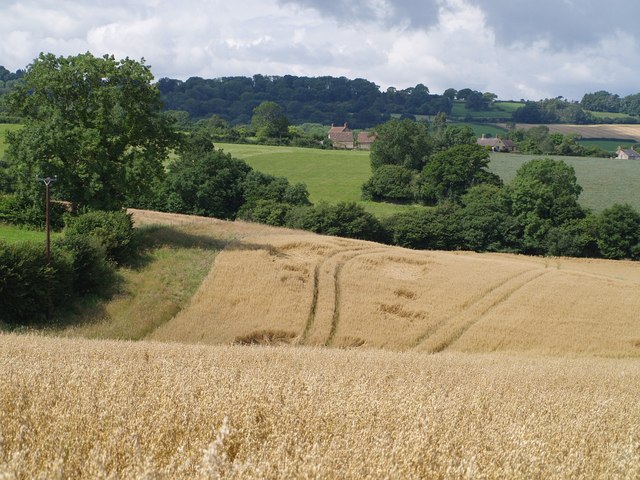
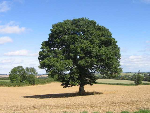
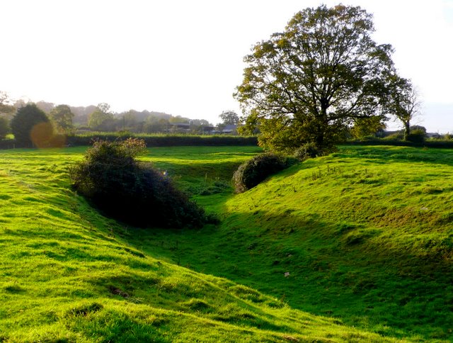
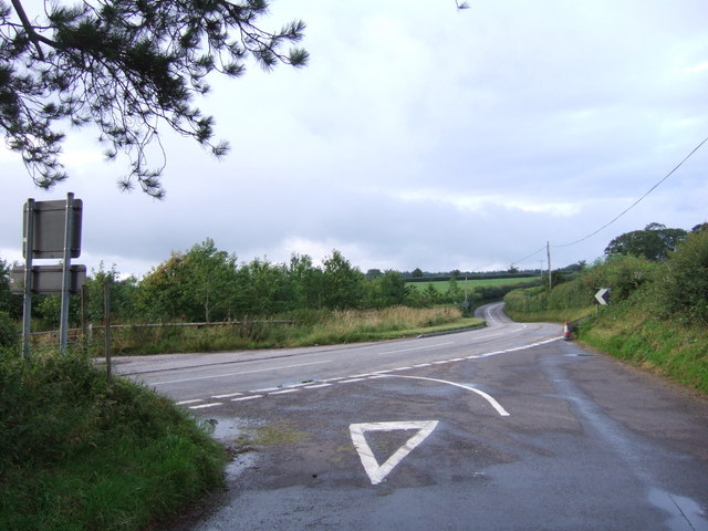
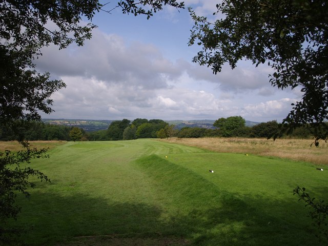
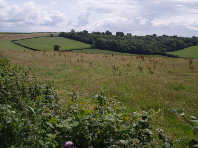
Burs Lears Copse is a picturesque wood located in the county of Somerset, England. Covering an area of approximately 30 hectares, this forest is a popular destination for nature enthusiasts and those seeking a tranquil retreat.

The wood features a diverse range of tree species, including oak, ash, beech, and birch. The dense canopy provides a welcome shade in the summer months, creating a cool and refreshing atmosphere for visitors. The forest floor is rich with a variety of flora, such as bluebells, primroses, and wood anemones, which create a vibrant carpet of color in the spring.

Burs Lears Copse is also home to a plethora of wildlife. It is a haven for birdwatchers, with species such as woodpeckers, owls, and warblers frequently spotted amongst the branches. The wood is also inhabited by mammals like badgers, foxes, and deer, making it an ideal location for wildlife enthusiasts.

The wood offers several walking trails, providing visitors with the opportunity to explore its natural beauty. These paths wind through ancient trees, offering breathtaking views of the surrounding countryside. There are also designated picnic areas and benches, allowing visitors to relax and enjoy the peaceful ambiance of the forest.

Burs Lears Copse is easily accessible, located just a short distance from the village of Burscombe. It is a beloved spot for locals and tourists alike, offering a unique opportunity to immerse oneself in the beauty of nature in the heart of Somerset.

If you have any feedback on the listing, please let us know in the comments section below.

Burs Lears Copse Images

Images are sourced within 2km of 50.877555/-2.8795087 or Grid Reference ST3809. Thanks to Geograph Open Source API. All images are credited.

Fingerpost, Cricket Sᵀ Thomas In the junction with A30 a sign indicating the private road to the Hotel and church etc.

Inscription: Cricket Sᵀ Thomas / (Private Road)

Milestone Society National ID: SO_ST3608
Fingerpost, Cricket Sᵀ Thomas
In the junction with A30 a sign indicating the private road to the Hotel and church etc. Inscription: Cricket Sᵀ Thomas / (Private Road) Milestone Society National ID: SO_ST3608
St. Thomas', Cricket St. Thomas, Somerset West wall, Porch and Tower. The original was built in the 14th Century but was almost completely rebuilt for Lord Bridport in 1819-1820.
St. Thomas', Cricket St. Thomas, Somerset
West wall, Porch and Tower. The original was built in the 14th Century but was almost completely rebuilt for Lord Bridport in 1819-1820.
St. Thomas', Cricket St. Thomas, Somerset Originally from the 14th Century but almost completely rebuilt for Lord Bridport in 1819-1820.
St. Thomas', Cricket St. Thomas, Somerset
Originally from the 14th Century but almost completely rebuilt for Lord Bridport in 1819-1820.
St. Thomas', Cricket St. Thomas, Somerset South-East corner.
St. Thomas', Cricket St. Thomas, Somerset
South-East corner.
St. Thomas', Cricket St. Thomas, Somerset All 19th Century Nave.
St. Thomas', Cricket St. Thomas, Somerset
All 19th Century Nave.
St. Thomas', Cricket St. Thomas, Somerset The Font.
St. Thomas', Cricket St. Thomas, Somerset
The Font.
Across Stretford Water Footpath CH6/16 crosses a field of oats and descends, dividing as it does so, to cross the stream. Both branches lead to Cudworth; the nearer buildings in the photo are part of the hamlet at the east end of the village centred around Ware Farm and the former school. The two pairs of trees in the middle of the green field on the far hillside to the left are the field boundary remnants mentioned in <a href="https://www.geograph.org.uk/photo/507996">ST3610 : View above Cudworth</a>.
Across Stretford Water
Footpath CH6/16 crosses a field of oats and descends, dividing as it does so, to cross the stream. Both branches lead to Cudworth; the nearer buildings in the photo are part of the hamlet at the east end of the village centred around Ware Farm and the former school. The two pairs of trees in the middle of the green field on the far hillside to the left are the field boundary remnants mentioned in ST3610 : View above Cudworth.
View northwest from Heber's Lane Heber's Lane climbs Windwhistle Ridge, giving good views over the Somerset countryside. This view is from the start of footpath CH6/10, looking down across Fisherway Lane which connects the two parts of Chillington - the lower hamlet is just to the left of the large tree. Some way beyond is Dowlish Wake, to the left of the row of poplars.
View northwest from Heber's Lane
Heber's Lane climbs Windwhistle Ridge, giving good views over the Somerset countryside. This view is from the start of footpath CH6/10, looking down across Fisherway Lane which connects the two parts of Chillington - the lower hamlet is just to the left of the large tree. Some way beyond is Dowlish Wake, to the left of the row of poplars.
Cudworth from the east A view towards Cudworth from roughly the same spot as <a href="https://www.geograph.org.uk/photo/508131">ST3810 : Across Stretford Water</a>, looking further south.
Cudworth from the east
A view towards Cudworth from roughly the same spot as ST3810 : Across Stretford Water, looking further south.
After the harvest A favourite view towards Chillington after the corn was harvested.
After the harvest
A favourite view towards Chillington after the corn was harvested.
Moat near Cudworth This moat just to the south of the church at Cudworth  is probably the remains of a fortified manor house although there is very little in the way of remains inside the moat. The moat is approximately circular and is approximately 75m to 80m in diameter. The interior is slightly higher than the surrounding field. This is the west side of the moat looking north west from just outside the moat on the southern side. There are the remains of fishponds in the adjacent field. Further details can be found here <span class="nowrap"><a title="http://www.gatehouse-gazetteer.info/English%20sites/3867.html" rel="nofollow ugc noopener" href="http://www.gatehouse-gazetteer.info/English%20sites/3867.html">Link</a><img style="margin-left:2px;" alt="External link" title="External link - shift click to open in new window" src="https://s1.geograph.org.uk/img/external.png" width="10" height="10"/></span>
Moat near Cudworth
This moat just to the south of the church at Cudworth is probably the remains of a fortified manor house although there is very little in the way of remains inside the moat. The moat is approximately circular and is approximately 75m to 80m in diameter. The interior is slightly higher than the surrounding field. This is the west side of the moat looking north west from just outside the moat on the southern side. There are the remains of fishponds in the adjacent field. Further details can be found here LinkExternal link
Cricket St Thomas, wildlife park Flamingoes in the landscaped grounds of the Cricket St Thomas estate in Somerset
Cricket St Thomas, wildlife park
Flamingoes in the landscaped grounds of the Cricket St Thomas estate in Somerset
Cricket St Thomas Wildlife Park Deer in the pools at Cricket St Thomas wildlife park
Cricket St Thomas Wildlife Park
Deer in the pools at Cricket St Thomas wildlife park
Fosse Way at Goldenhaye The main road here is the B3167, and at this double bend it veers away from the line of the Roman Road. The lane joining it has come from Whatley. On the left of the road is an entrance to a quarry.
Fosse Way at Goldenhaye
The main road here is the B3167, and at this double bend it veers away from the line of the Roman Road. The lane joining it has come from Whatley. On the left of the road is an entrance to a quarry.
The Windwhistle Inn A pub on the A30, which here follows the line of the Fosse Way. Three communications masts are in the immediate vicinity, emphasising the ridgetop nature of the site, and there are several shelter belts of trees, presumably to stop the wind whistling.
The Windwhistle Inn
A pub on the A30, which here follows the line of the Fosse Way. Three communications masts are in the immediate vicinity, emphasising the ridgetop nature of the site, and there are several shelter belts of trees, presumably to stop the wind whistling.
Old Wood from New Lane The field is on the steep northern slopes of the Windwhistle Ridge, and the lane curves around the edge of an embayment in the ridge where the Wall Brook rises. Old Wood, on the right at the foot of the field, follows this curve. The wood beyond, in the centre, is Middle Wood.
Old Wood from New Lane
The field is on the steep northern slopes of the Windwhistle Ridge, and the lane curves around the edge of an embayment in the ridge where the Wall Brook rises. Old Wood, on the right at the foot of the field, follows this curve. The wood beyond, in the centre, is Middle Wood.
Windwhistle Golf Course The course occupies a wide area on the north side of Swan Down. This view is of a tee beside the lane from the A30 to Cudworth, although as the club website lacks a course plan, I am unable to say for which hole. Beyond the hedge on the right runs the lane to Chaffcombe, dropping from the Windhwistle Ridge past Whatley Pit, the dark clump of trees in the centre.

Taken from footpath CH9/20 which crosses the course.
Windwhistle Golf Course
The course occupies a wide area on the north side of Swan Down. This view is of a tee beside the lane from the A30 to Cudworth, although as the club website lacks a course plan, I am unable to say for which hole. Beyond the hedge on the right runs the lane to Chaffcombe, dropping from the Windhwistle Ridge past Whatley Pit, the dark clump of trees in the centre. Taken from footpath CH9/20 which crosses the course.
Eighteen Acre Plantation The plantation, at the head of the Cricket St Thomas valley on the Windwhistle ridge, is actually not as extensive as appears from the photo; the upper part at the back is an open field surrounded by a hedge of trees, as can be seen from the satellite views. Taken from a layby on the A30.
Eighteen Acre Plantation
The plantation, at the head of the Cricket St Thomas valley on the Windwhistle ridge, is actually not as extensive as appears from the photo; the upper part at the back is an open field surrounded by a hedge of trees, as can be seen from the satellite views. Taken from a layby on the A30.
Show me another place!

Burs Lears Copse is located at Grid Ref: ST3809 (Lat: 50.877555, Lng: -2.8795087)

Administrative County: Somerset

District: South Somerset

Police Authority: Avon and Somerset

What 3 Words

///nuptials.overruns.displays. Near Ilminster, Somerset

Related Wikis

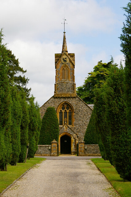
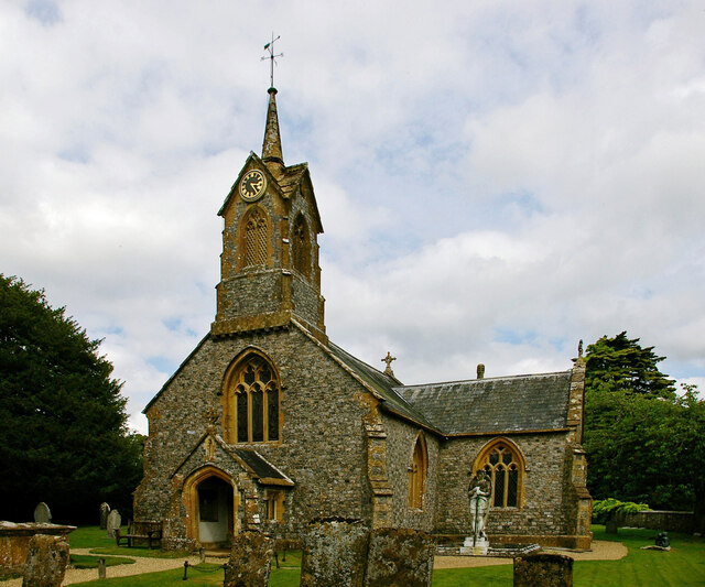
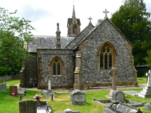
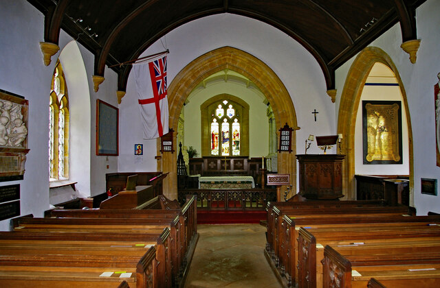
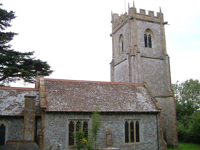
Church of St Thomas, Cricket St Thomas

The Church of St Thomas in Cricket St Thomas, Somerset, England was built in the 14th century and rebuilt in 1868. It is a Grade II* listed building....
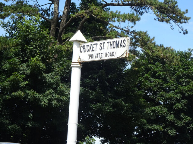
Cricket St Thomas

Cricket St Thomas is a parish in Somerset, England, situated in a valley between Chard and Crewkerne within the South Somerset administrative district...

Cudworth, Somerset

Cudworth (English: ) is a village and parish in Somerset, England, situated 5 miles (8.0 km) north east of Chard in the South Somerset district. The village...

Church of St Michael, Cudworth

The Anglican Church of St Michael in Cudworth, Somerset, England was built in the 12th century. It is a Grade II* listed building. == History == The church...

Chillington, Somerset

Chillington is a village and parish in Somerset, England, situated 3 miles (5 km) west of Crewkerne and 5 miles (8 km) east of Chard in the South Somerset...

Winsham

Winsham is a village and civil parish 4 miles (6 km) south-east of Chard and 6 miles (10 km) from Crewkerne, in the South Somerset district of Somerset...

Church of St Stephen, Winsham

The Anglican Church of St Stephen in Winsham, Somerset, England, was built in the 13th century. It is a Grade II* listed building. == History == The church...

Church of St Michael and All Angels, Chaffcombe

The Anglican Church of St Michael and All Angels in Chaffcombe, Somerset, England was built in the 15th century. It is a Grade II* listed building. �...

Have you been to Burs Lears Copse?

Leave your review of Burs Lears Copse below (or comments, questions and feedback).