Whitehill Moss
Wood, Forest in Cumberland Carlisle
England
Whitehill Moss

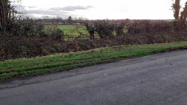
Whitehill Moss is a wooded area located in the county of Cumberland, in the picturesque region of Northwest England. Covering an expansive area, this forested landscape is a captivating sight for nature enthusiasts and visitors seeking tranquility.
The moss is characterized by its dense woodland, primarily composed of a variety of deciduous and coniferous trees. Towering oak, ash, and beech trees provide a majestic canopy, while the aromatic scent of pine fills the air. The forest floor is adorned with a rich tapestry of vibrant ferns, mosses, and wildflowers, creating a breathtaking display of color throughout the seasons.
The forest is home to a diverse range of wildlife species, making it an ideal habitat for nature lovers and ecologists. Deer, rabbits, and squirrels can be spotted among the trees, while the melodious songs of various bird species fill the air. The moss is also home to a plethora of insects, including butterflies and dragonflies, adding to its ecological diversity.
Visitors to Whitehill Moss can enjoy a variety of recreational activities. Numerous walking trails wind through the forest, offering a chance to explore the enchanting woodland and discover hidden gems within. The peaceful atmosphere of the moss provides an ideal setting for birdwatching, photography, or simply enjoying a picnic amidst the serene surroundings.
Whitehill Moss is a true haven of natural beauty, offering a peaceful escape from the hustle and bustle of daily life. Its captivating scenery and abundant wildlife make it a must-visit destination for anyone seeking a tranquil and immersive experience in the heart of Cumberland's woodlands.
If you have any feedback on the listing, please let us know in the comments section below.
Whitehill Moss Images
Images are sourced within 2km of 54.957218/-2.968356 or Grid Reference NY3862. Thanks to Geograph Open Source API. All images are credited.


Whitehill Moss is located at Grid Ref: NY3862 (Lat: 54.957218, Lng: -2.968356)
Administrative County: Cumbria
District: Carlisle
Police Authority: Cumbria
What 3 Words
///cubes.else.shadowed. Near Longtown, Cumbria
Nearby Locations
Related Wikis

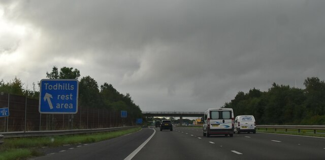
Todhills Rest Area
Todhills Rest Area is a rest area in between Junctions 44 and 45 of the M6 motorway in England. It is the last Services northbound on the M6 and the first...

Todhills, Cumbria
Todhills is a small village on the outskirts of Carlisle, Cumbria, England. The village's name is from Old English tota-hyll "look-out hill". Located north...

Lyneside railway station
Lyneside railway station served the hamlet of West Linton, Cumbria, England, from 1861 to 1964 on the Waverley Line. == History == The station opened sometime...

Blackford, Cumbria
Blackford is a village in Cumbria, England, close to Gretna, Scotland. == Etymology == Blackford means what it says, a black ford or river-crossing. However...
Nearby Amenities
Located within 500m of 54.957218,-2.968356Have you been to Whitehill Moss?
Leave your review of Whitehill Moss below (or comments, questions and feedback).