Boundary Plantation

Wood, Forest in Cumberland Carlisle

England

Boundary Plantation

Cumberland County Council signpost east of Rockcliffe The signpost has Milestone Society National ID: CU_NY3761
Cumberland County Council signpost east of Rockcliffe Credit: Roger Templeman

Boundary Plantation is a well-known woodland area located in Cumberland, a county in the northwestern part of England. This enchanting plantation is situated in the heart of the picturesque Lake District National Park, which adds to its allure and popularity among locals and tourists alike.

Covering an expansive area of woodland, Boundary Plantation is predominantly composed of a variety of trees, including oak, beech, and birch. The dense forest provides a serene and peaceful environment for visitors, making it an ideal destination for nature enthusiasts and those seeking a tranquil escape.

The plantation's name, "Boundary," originates from its historical significance as a boundary marker between different landowners' estates in the past. Today, it serves as a boundary between different regions within the Lake District National Park.

Visitors to Boundary Plantation can explore its numerous walking trails, which snake through the dense forest and offer breathtaking views of the surrounding landscape. These trails cater to all levels of hikers, from leisurely strolls to more challenging hikes, allowing everyone to experience the beauty of the plantation at their own pace.

The woodland is home to a diverse range of flora and fauna, with numerous bird species, small mammals, and plant life thriving within its boundaries. Nature enthusiasts will find delight in spotting woodland creatures and identifying various plant species throughout their visit.

Boundary Plantation, with its rich history, stunning scenery, and abundant wildlife, is a must-visit destination for anyone seeking a deep connection with nature in the heart of the Lake District National Park.

If you have any feedback on the listing, please let us know in the comments section below.

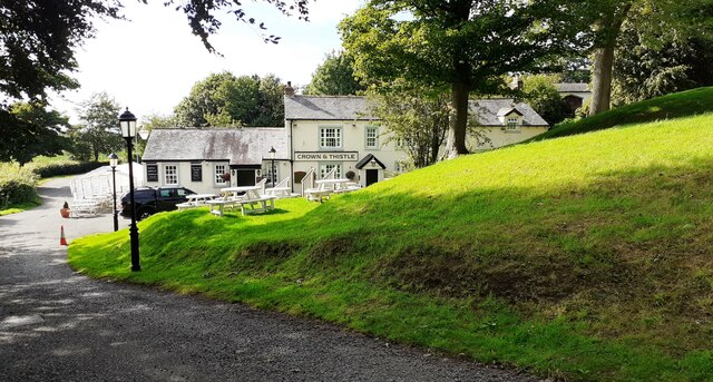
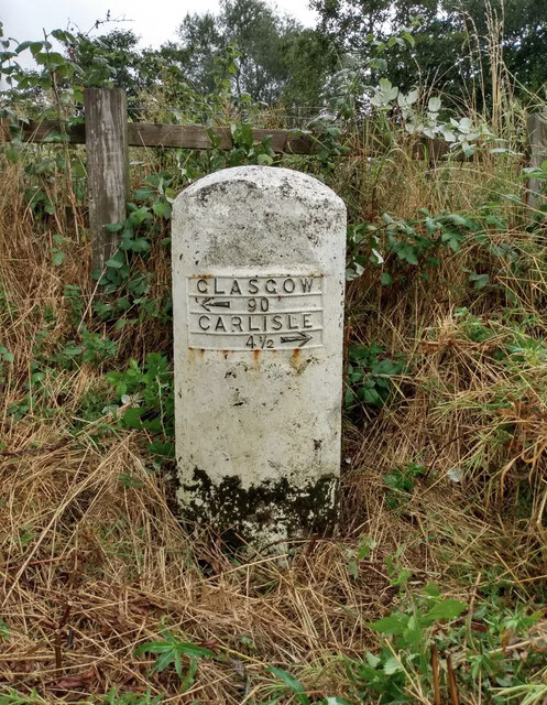
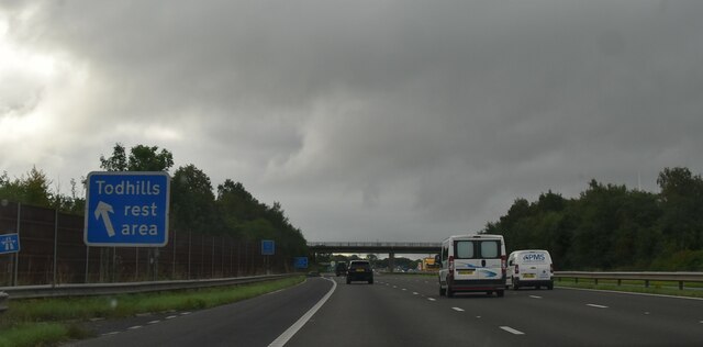
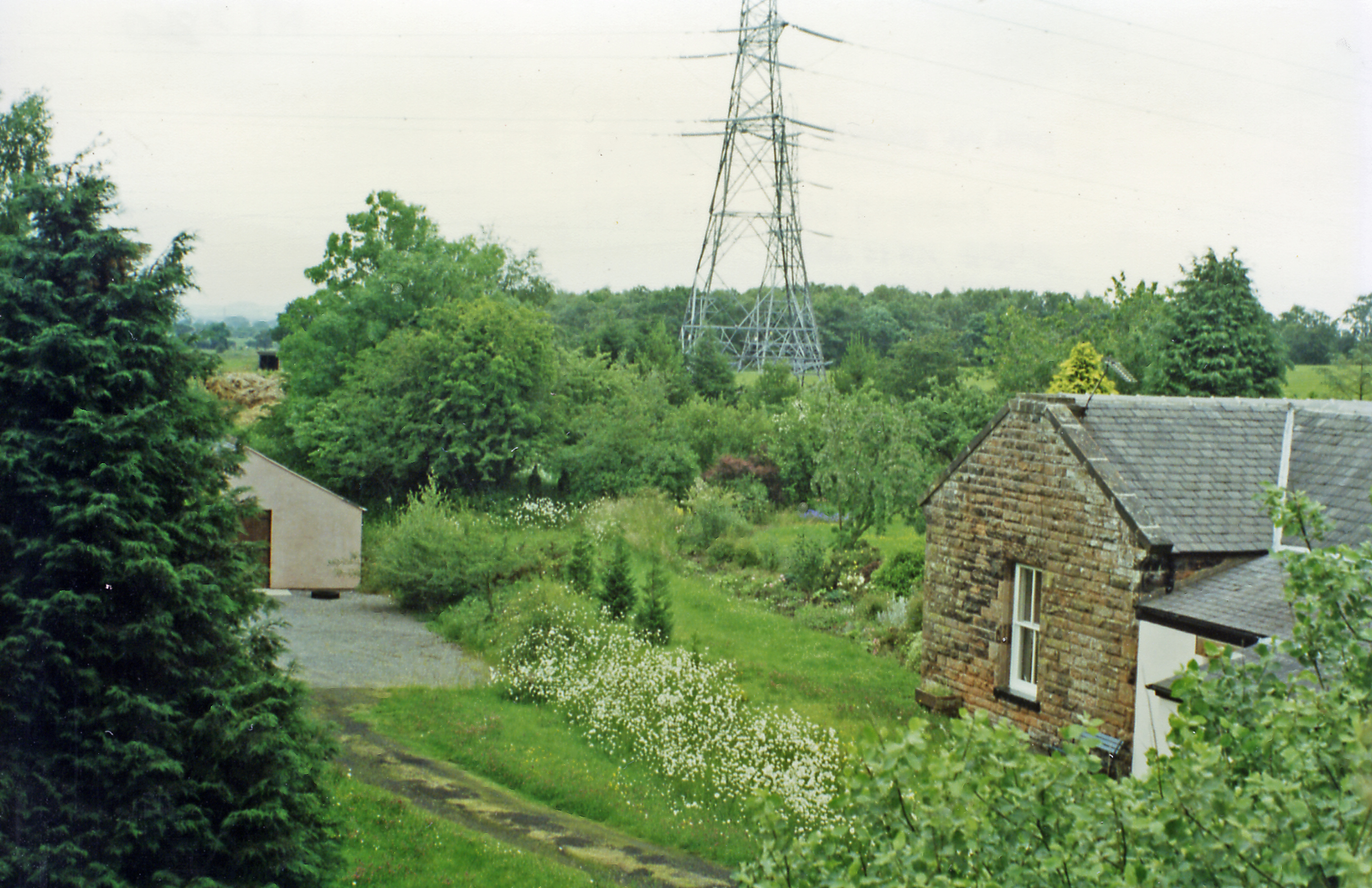
Boundary Plantation Images

Images are sourced within 2km of 54.954802/-2.9771363 or Grid Reference NY3762. Thanks to Geograph Open Source API. All images are credited.

Cumberland County Council signpost east of Rockcliffe The signpost has Milestone Society National ID: CU_NY3761
Cumberland County Council signpost east of Rockcliffe
The signpost has Milestone Society National ID: CU_NY3761
Crossroads at Harker There is a Cumberland County Council signpost <a href="https://www.geograph.org.uk/photo/6936169">NY3761 : Cumberland County Council signpost east of Rockcliffe</a> at the junction
Crossroads at Harker
There is a Cumberland County Council signpost NY3761 : Cumberland County Council signpost east of Rockcliffe at the junction
House at Crookdyke
House at Crookdyke
Two access methods into St Mary's Church churchyard Either through the metal gates or using stone steps
Two access methods into St Mary's Church churchyard
Either through the metal gates or using stone steps
Barns on south side of road at Crookdyke
Benchmark on tower of St Mary the Virgin Church Ordnance Survey cut mark benchmark described on the Bench Mark Database at <span class="nowrap"><a title="www.bench-marks.org.uk/bm107179" rel="nofollow ugc noopener" href="http://www.bench-marks.org.uk/bm107179">Link</a><img style="margin-left:2px;" alt="External link" title="External link - shift click to open in new window" src="https://s1.geograph.org.uk/img/external.png" width="10" height="10"/></span>
Benchmark on tower of St Mary the Virgin Church
Ordnance Survey cut mark benchmark described on the Bench Mark Database at LinkExternal link
Church of St Mary the Virgin There is an Ordnance Survey benchmark <a href="https://www.geograph.org.uk/photo/6938116">NY3561 : Benchmark on tower of St Mary the Virgin Church</a> at the base of the tower on its east face. The spire is an Ordnance Survey intersected station trig point, <span class="nowrap"><a title="http://trigpointing.uk/trig/11100" rel="nofollow ugc noopener" href="http://trigpointing.uk/trig/11100">Link</a><img style="margin-left:2px;" alt="External link" title="External link - shift click to open in new window" src="https://s1.geograph.org.uk/img/external.png" width="10" height="10"/></span>
Church of St Mary the Virgin
There is an Ordnance Survey benchmark NY3561 : Benchmark on tower of St Mary the Virgin Church at the base of the tower on its east face. The spire is an Ordnance Survey intersected station trig point, LinkExternal link
Crown & Thistle pub
Crown & Thistle pub
M6 passing Todhills Services
M6 Motorway near Todhills A variable message sign on the northbound carriageway of the M8 near Todhills in Cumbria.

Variable message signs (VMS), also sometimes referred to as matrix signs, are electronic traffic signs used on motorways (and some other major routes) to give drivers information about special events and to warn them about traffic congestion, accidents, incidents, roadworks or speed limits on specific sections of the route. They may also suggest (or instruct) drivers to take alternative routes, limit speed, warn of the duration and location of the incidents or just inform of the traffic conditions.
M6 Motorway near Todhills
A variable message sign on the northbound carriageway of the M8 near Todhills in Cumbria. Variable message signs (VMS), also sometimes referred to as matrix signs, are electronic traffic signs used on motorways (and some other major routes) to give drivers information about special events and to warn them about traffic congestion, accidents, incidents, roadworks or speed limits on specific sections of the route. They may also suggest (or instruct) drivers to take alternative routes, limit speed, warn of the duration and location of the incidents or just inform of the traffic conditions.
M6 Motorway at Driver Location A498.8 Driver location signs are now widely used across the motorway and A–road network. First introduced in 2003, they complement distance marker posts. Both types of marker post display the distances in kilometres from a nominal start point but driver location signs are designed to be read by motorists or their passengers when, for instance, they need to pass details to the emergency services. They give the same location information as do distance marker posts, but more visibly on larger signs. They are normally spaced at 500-metre intervals along the nearside verge but if obstacles (eg sliproads or bridges) prevent signs from being erected at these locations, then the interval is reduced to either 400 or 300 metres.

Driver location signs have three pieces of information:
• The road identifier (eg M6)
• The carriageway identifier – The letter on the second line of the signs, usually “A” or “B”, tells the emergency services or the Highways Agency in which direction you are travelling. The letter “A” ("Away from London") normally denotes carriageways leaving London (or clockwise in the case of the M25) and "B" ("Back to London") is used for carriageways going to London (anticlockwise on the M25). 
• The location (which is identical to the location given on marker posts). Distances are accurate to within 20 metres and are generally quoted from the beginning of the motorway.
<span class="nowrap"><a title="http://www.dft.gov.uk/ha/standards/ians/pdfs/ian93r1.pdf" rel="nofollow ugc noopener" href="http://www.dft.gov.uk/ha/standards/ians/pdfs/ian93r1.pdf">Link</a><img style="margin-left:2px;" alt="External link" title="External link - shift click to open in new window" src="https://s1.geograph.org.uk/img/external.png" width="10" height="10"/></span>  DFT Interim Advice Note (December 2010)
<span class="nowrap"><a title="http://www.theaa.com/motoring_advice/breakdown_advice/driver-location-signs.html" rel="nofollow ugc noopener" href="http://www.theaa.com/motoring_advice/breakdown_advice/driver-location-signs.html">Link</a><img style="margin-left:2px;" alt="External link" title="External link - shift click to open in new window" src="https://s1.geograph.org.uk/img/external.png" width="10" height="10"/></span>  The AA
<span class="nowrap"><a title="http://www.sabre-roads.org.uk/wiki/index.php?title=Driver_Location_Signs" rel="nofollow ugc noopener" href="http://www.sabre-roads.org.uk/wiki/index.php?title=Driver_Location_Signs">Link</a><img style="margin-left:2px;" alt="External link" title="External link - shift click to open in new window" src="https://s1.geograph.org.uk/img/external.png" width="10" height="10"/></span>  SABRE
M6 Motorway at Driver Location A498.8
Driver location signs are now widely used across the motorway and A–road network. First introduced in 2003, they complement distance marker posts. Both types of marker post display the distances in kilometres from a nominal start point but driver location signs are designed to be read by motorists or their passengers when, for instance, they need to pass details to the emergency services. They give the same location information as do distance marker posts, but more visibly on larger signs. They are normally spaced at 500-metre intervals along the nearside verge but if obstacles (eg sliproads or bridges) prevent signs from being erected at these locations, then the interval is reduced to either 400 or 300 metres. Driver location signs have three pieces of information: • The road identifier (eg M6) • The carriageway identifier – The letter on the second line of the signs, usually “A” or “B”, tells the emergency services or the Highways Agency in which direction you are travelling. The letter “A” ("Away from London") normally denotes carriageways leaving London (or clockwise in the case of the M25) and "B" ("Back to London") is used for carriageways going to London (anticlockwise on the M25). • The location (which is identical to the location given on marker posts). Distances are accurate to within 20 metres and are generally quoted from the beginning of the motorway. LinkExternal link DFT Interim Advice Note (December 2010) LinkExternal link The AA LinkExternal link SABRE
Todhills Rest Area Yet another roadside halt along the M6.
Todhills Rest Area
Yet another roadside halt along the M6.
Study of a Gasoline Station BP, Todhills Rest Area (Southbound).

 This photograph is part of a series taken in homage to the American artist Ed Ruscha's 1963 publication of 'Twentysix Gasoline Stations'.
 More properly known as filling stations in the UK, I am attempting to photograph as many as possible to mark the sixty year anniversary.
Study of a Gasoline Station
BP, Todhills Rest Area (Southbound). This photograph is part of a series taken in homage to the American artist Ed Ruscha's 1963 publication of 'Twentysix Gasoline Stations'. More properly known as filling stations in the UK, I am attempting to photograph as many as possible to mark the sixty year anniversary.
Old Milestone by the former A74 Metal plate attached to stone post by the UC road (was A74), in parish of ROCKCLIFFE (CARLISLE District), newly constructed road for non-motorway traffic, back of Shell petrol station; M74 carriageway, on the verge at back of garage, on East side of road. Glasgow Road plate, erected by the Carlisle to Glasgow turnpike trust in the 19th century. An earlier photograph can be found here: <a title="https://www.geograph.org.uk/photo/5622988" href="https://www.geograph.org.uk/photo/5622988">Link</a>

Inscription reads:-
GLASGOW
{arrow to left} 90
CARLISLE
4½ {arrow to right}

Milestone Society National ID: CU_CLGG04.
Old Milestone by the former A74
Metal plate attached to stone post by the UC road (was A74), in parish of ROCKCLIFFE (CARLISLE District), newly constructed road for non-motorway traffic, back of Shell petrol station; M74 carriageway, on the verge at back of garage, on East side of road. Glasgow Road plate, erected by the Carlisle to Glasgow turnpike trust in the 19th century. An earlier photograph can be found here: Link Inscription reads:- GLASGOW {arrow to left} 90 CARLISLE 4½ {arrow to right} Milestone Society National ID: CU_CLGG04.
Old Milestone by the former A74 Metal plate attached to stone post by the UC road (was A74), in parish of ROCKCLIFFE (CARLISLE District), newly constructed road for non-motorway traffic, back of Shell petrol station; M74 carriageway, on the verge at back of garage, on East side of road. Glasgow Road plate, erected by the Carlisle to Glasgow turnpike trust in the 19th century. A close up photograph can be found here: <a title="https://www.geograph.org.uk/photo/7556456" href="https://www.geograph.org.uk/photo/7556456">Link</a>

Inscription reads:-
GLASGOW
{arrow to left} 90
CARLISLE
4½ {arrow to right}

Milestone Society National ID: CU_CLGG04.
Old Milestone by the former A74
Metal plate attached to stone post by the UC road (was A74), in parish of ROCKCLIFFE (CARLISLE District), newly constructed road for non-motorway traffic, back of Shell petrol station; M74 carriageway, on the verge at back of garage, on East side of road. Glasgow Road plate, erected by the Carlisle to Glasgow turnpike trust in the 19th century. A close up photograph can be found here: Link Inscription reads:- GLASGOW {arrow to left} 90 CARLISLE 4½ {arrow to right} Milestone Society National ID: CU_CLGG04.
M6 at Todhill The M6 motorway runs from junction 19 of the M1 at the Catthorpe Interchange, near Rugby to the Gretna junction (J45). Here it becomes the A74(M) and M74 which continues to Glasgow.

The M6 is the longest motorway in the United Kingdom (232 miles) and one of the busiest. It incorporates the first length of motorway opened in the UK (the Preston bypass in 1958) and forms part of a motorway "Backbone of Britain", running north-south between London and Glasgow via the industrial north of England. It is also part of the east-west route between the Midlands and the east coast ports.
M6 at Todhill
The M6 motorway runs from junction 19 of the M1 at the Catthorpe Interchange, near Rugby to the Gretna junction (J45). Here it becomes the A74(M) and M74 which continues to Glasgow. The M6 is the longest motorway in the United Kingdom (232 miles) and one of the busiest. It incorporates the first length of motorway opened in the UK (the Preston bypass in 1958) and forms part of a motorway "Backbone of Britain", running north-south between London and Glasgow via the industrial north of England. It is also part of the east-west route between the Midlands and the east coast ports.
Todhill Bridge, M6 The M6 motorway runs from junction 19 of the M1 at the Catthorpe Interchange, near Rugby to the Gretna junction (J45). Here it becomes the A74(M) and M74 which continues to Glasgow.

The M6 is the longest motorway in the United Kingdom (232 miles) and one of the busiest. It incorporates the first length of motorway opened in the UK (the Preston bypass in 1958) and forms part of a motorway "Backbone of Britain", running north-south between London and Glasgow via the industrial north of England. It is also part of the east-west route between the Midlands and the east coast ports.
Todhill Bridge, M6
The M6 motorway runs from junction 19 of the M1 at the Catthorpe Interchange, near Rugby to the Gretna junction (J45). Here it becomes the A74(M) and M74 which continues to Glasgow. The M6 is the longest motorway in the United Kingdom (232 miles) and one of the busiest. It incorporates the first length of motorway opened in the UK (the Preston bypass in 1958) and forms part of a motorway "Backbone of Britain", running north-south between London and Glasgow via the industrial north of England. It is also part of the east-west route between the Midlands and the east coast ports.
M6, southbound The M6 motorway runs from junction 19 of the M1 at the Catthorpe Interchange, near Rugby to the Gretna junction (J45). Here it becomes the A74(M) and M74 which continues to Glasgow.

The M6 is the longest motorway in the United Kingdom (232 miles) and one of the busiest. It incorporates the first length of motorway opened in the UK (the Preston bypass in 1958) and forms part of a motorway "Backbone of Britain", running north-south between London and Glasgow via the industrial north of England. It is also part of the east-west route between the Midlands and the east coast ports.
M6, southbound
The M6 motorway runs from junction 19 of the M1 at the Catthorpe Interchange, near Rugby to the Gretna junction (J45). Here it becomes the A74(M) and M74 which continues to Glasgow. The M6 is the longest motorway in the United Kingdom (232 miles) and one of the busiest. It incorporates the first length of motorway opened in the UK (the Preston bypass in 1958) and forms part of a motorway "Backbone of Britain", running north-south between London and Glasgow via the industrial north of England. It is also part of the east-west route between the Midlands and the east coast ports.
Show me another place!

Boundary Plantation is located at Grid Ref: NY3762 (Lat: 54.954802, Lng: -2.9771363)

Administrative County: Cumbria

District: Carlisle

Police Authority: Cumbria

What 3 Words

///frock.lions.notifying. Near Longtown, Cumbria

Related Wikis

Todhills Rest Area

Todhills Rest Area is a rest area in between Junctions 44 and 45 of the M6 motorway in England. It is the last Services northbound on the M6 and the first...

Todhills, Cumbria

Todhills is a small village on the outskirts of Carlisle, Cumbria, England. The village's name is from Old English tota-hyll "look-out hill". Located north...

Rockcliffe railway station

Rockcliffe railway station, later Rockcliffe Halt was a station which served the rural area around Rockcliffe, Rockcliffe parish, north of Carlisle in...

Rockcliffe, Cumbria

Rockcliffe is a village and civil parish in the City of Carlisle district of Cumbria, England. Part of the parish is a marshy peninsula between the mouths...

Harker railway station

Harker railway station served the settlement of Harker, Cumbria, England, between 1861 and 1969 on the Waverley Line. == History == The first station was...

Lyneside railway station

Lyneside railway station served the hamlet of West Linton, Cumbria, England, from 1861 to 1964 on the Waverley Line. == History == The station opened sometime...

Blackford, Cumbria

Blackford is a village in Cumbria, England, close to Gretna, Scotland. == Etymology == Blackford means what it says, a black ford or river-crossing. However...

Floriston railway station

Floriston railway station was a station which served the rural area around Floristonrigg, Rockcliffe Parish, south of Gretna in the English county of Cumberland...

Nearby Amenities

Located within 500m of 54.954802,-2.9771363
Phone
Check Date: 2022-08-15
Emergency: phone
Lat/Long: 54.9509746/-2.9790968
Phone
Check Date: 2022-08-15
Emergency: phone
Lat/Long: 54.9511256/-2.9786999
Power: pole
Lat/Long: 54.9540499/-2.9704231
Power: pole
Lat/Long: 54.9546172/-2.9734924
Power: pole
Lat/Long: 54.9550744/-2.9752476
Power: pole
Lat/Long: 54.9554392/-2.9764417
Power: pole
Lat/Long: 54.9563149/-2.9769597
Power: pole
Lat/Long: 54.9571892/-2.9775304
Power: pole
Lat/Long: 54.9580594/-2.9780435
Power: pole
Lat/Long: 54.9587285/-2.9790914
Power: pole
Lat/Long: 54.9587712/-2.9808058
Power: pole
Lat/Long: 54.9578873/-2.9785495
Power: pole
Lat/Long: 54.9577923/-2.9788108
Power: pole
Lat/Long: 54.9540073/-2.9734828
Power: pole
Lat/Long: 54.9530654/-2.9732382
Power: pole
Lat/Long: 54.9525725/-2.9729984
Power: pole
Lat/Long: 54.9520465/-2.9727371
Power: pole
Lat/Long: 54.9514681/-2.9722599
Power: pole
Lat/Long: 54.9516719/-2.9742741
Power: pole
Lat/Long: 54.9517821/-2.9758423
Power: pole
Lat/Long: 54.9518275/-2.9769429
The data included in this document is from www.openstreetmap.org. The data is made available under ODbL.

Have you been to Boundary Plantation?

Leave your review of Boundary Plantation below (or comments, questions and feedback).