Cookshill Plantation

Wood, Forest in Somerset South Somerset

England

Cookshill Plantation

Fingerpost, Cricket Sᵀ Thomas In the junction with A30 a sign indicating the private road to the Hotel and church etc.

Inscription: Cricket Sᵀ Thomas / (Private Road)

Milestone Society National ID: SO_ST3608
Fingerpost, Cricket Sᵀ Thomas Credit: Mr Red

Cookshill Plantation is a sprawling woodland located in Somerset, England. Spanning an area of approximately 500 acres, it is known for its diverse range of flora and fauna, making it a popular destination for nature enthusiasts and hikers alike.

The plantation predominantly consists of deciduous and coniferous trees, creating a picturesque landscape throughout the year. Oak, beech, and ash trees dominate the area, providing a dense canopy that offers shade and shelter to a variety of wildlife. The forest floor is carpeted with an array of wildflowers, ferns, and mosses, adding to the overall beauty and ecological diversity of the plantation.

The woodland is home to a wide range of animal species, including deer, foxes, badgers, and numerous bird species. Birdwatchers can often spot owls, woodpeckers, and various songbirds, making it a haven for bird enthusiasts. The plantation also boasts a small lake, attracting waterfowl and providing a tranquil spot for visitors to enjoy.

For recreational activities, there are several well-marked trails that cater to both casual walkers and experienced hikers. These trails wind through the plantation, offering breathtaking views and opportunities to spot wildlife. Visitors can also engage in activities such as picnicking, camping, and photography, ensuring an enjoyable experience for all.

With its natural beauty and abundant wildlife, Cookshill Plantation is a haven for nature lovers seeking a peaceful retreat in the heart of Somerset. Whether for a leisurely stroll or an immersive outdoor adventure, this woodland offers a unique and enriching experience for visitors of all ages.

If you have any feedback on the listing, please let us know in the comments section below.

Cookshill Plantation Images

Images are sourced within 2km of 50.861751/-2.8907773 or Grid Reference ST3707. Thanks to Geograph Open Source API. All images are credited.

Fingerpost, Cricket Sᵀ Thomas In the junction with A30 a sign indicating the private road to the Hotel and church etc.

Inscription: Cricket Sᵀ Thomas / (Private Road)

Milestone Society National ID: SO_ST3608
Fingerpost, Cricket Sᵀ Thomas
In the junction with A30 a sign indicating the private road to the Hotel and church etc. Inscription: Cricket Sᵀ Thomas / (Private Road) Milestone Society National ID: SO_ST3608
St. Stephen's, Winsham, Somerset North-Eastern corner.
St. Stephen's, Winsham, Somerset
North-Eastern corner.
St. Stephen's, Winsham, Somerset South wall, Tower, Porch and detached Vestry.
St. Stephen's, Winsham, Somerset
South wall, Tower, Porch and detached Vestry.
St. Stephen's, Winsham, Somerset The Nave
St. Stephen's, Winsham, Somerset
The Nave
St. Stephen's, Winsham, Somerset The High Altar and Reredos.
St. Stephen's, Winsham, Somerset
The High Altar and Reredos.
St. Stephen's, Winsham, Somerset Church residents in the porch!
St. Stephen's, Winsham, Somerset
Church residents in the porch!
St. Thomas', Cricket St. Thomas, Somerset West wall, Porch and Tower. The original was built in the 14th Century but was almost completely rebuilt for Lord Bridport in 1819-1820.
St. Thomas', Cricket St. Thomas, Somerset
West wall, Porch and Tower. The original was built in the 14th Century but was almost completely rebuilt for Lord Bridport in 1819-1820.
St. Thomas', Cricket St. Thomas, Somerset Originally from the 14th Century but almost completely rebuilt for Lord Bridport in 1819-1820.
St. Thomas', Cricket St. Thomas, Somerset
Originally from the 14th Century but almost completely rebuilt for Lord Bridport in 1819-1820.
St. Thomas', Cricket St. Thomas, Somerset South-East corner.
St. Thomas', Cricket St. Thomas, Somerset
South-East corner.
St. Thomas', Cricket St. Thomas, Somerset All 19th Century Nave.
St. Thomas', Cricket St. Thomas, Somerset
All 19th Century Nave.
St. Thomas', Cricket St. Thomas, Somerset The Font.
St. Thomas', Cricket St. Thomas, Somerset
The Font.
Old Milestone by B3162, opposite Whatley Farm, Whatley The Milestone is located on grass verge (now collapsed onto grass verge) on the South of the road.  Parish of Winsham (South Somerset District). Carved stone post, Chard limestone post design, erected by the Chard turnpike trust in the 19th Century. An earlier photograph can be found here: <a title="https://www.geograph.org.uk/photo/6050947" href="https://www.geograph.org.uk/photo/6050947">Link</a> 

Inscription reads:-   
CHARD / 3 / WINSHAM / 1 

Grade II listed. List Entry Number: 1056139 <span class="nowrap"><a title="https://historicengland.org.uk/listing/the-list/list-entry/1056139" rel="nofollow ugc noopener" href="https://historicengland.org.uk/listing/the-list/list-entry/1056139">Link</a><img style="margin-left:2px;" alt="External link" title="External link - shift click to open in new window" src="https://s1.geograph.org.uk/img/external.png" width="10" height="10"/></span> 

Milestone Society National ID: SO_CHWN03
Old Milestone by B3162, opposite Whatley Farm, Whatley
The Milestone is located on grass verge (now collapsed onto grass verge) on the South of the road.  Parish of Winsham (South Somerset District). Carved stone post, Chard limestone post design, erected by the Chard turnpike trust in the 19th Century. An earlier photograph can be found here: Link  Inscription reads:- CHARD / 3 / WINSHAM / 1 Grade II listed. List Entry Number: 1056139 LinkExternal link Milestone Society National ID: SO_CHWN03
Old Milestone by the B3162, Church Street, Winsham Carved stone post by the B3162, in parish of WINSHAM (SOUTH SOMERSET District), Church Street, in East wall of churchyard, South side of churchyard gate, set in stone wall of churchyard, on West side of road. Chard limestone post, erected by the Chard turnpike trust in the 19th century. An earlier photograph can be found here <a title="https://www.geograph.org.uk/photo/6050386" href="https://www.geograph.org.uk/photo/6050386">Link</a>.

Inscription reads:-
CHARD
4

Grade II listed. 
List Entry Number: 1177805 <span class="nowrap"><a title="https://historicengland.org.uk/listing/the-list/list-entry/1177805" rel="nofollow ugc noopener" href="https://historicengland.org.uk/listing/the-list/list-entry/1177805">Link</a><img style="margin-left:2px;" alt="External link" title="External link - shift click to open in new window" src="https://s1.geograph.org.uk/img/external.png" width="10" height="10"/></span>

Milestone Society National ID: SO_CHWN04
Old Milestone by the B3162, Church Street, Winsham
Carved stone post by the B3162, in parish of WINSHAM (SOUTH SOMERSET District), Church Street, in East wall of churchyard, South side of churchyard gate, set in stone wall of churchyard, on West side of road. Chard limestone post, erected by the Chard turnpike trust in the 19th century. An earlier photograph can be found here Link. Inscription reads:- CHARD 4 Grade II listed. List Entry Number: 1177805 LinkExternal link Milestone Society National ID: SO_CHWN04
St Stephen's Church, Winsham Somerset
St Stephen's Church, Winsham Somerset The pre-Reformation Rood Screen behind the bell ropes.
St Stephen's Church, Winsham Somerset
The pre-Reformation Rood Screen behind the bell ropes.
St Stephen's Church, Winsham Somerset The Chancel and the Sanctuary.
St Stephen's Church, Winsham Somerset
The Chancel and the Sanctuary.
St Stephen's Church, Winsham, Somerset Installed in 1880, the East window is in memory of the parents of Henry Cornish Henley, the donor.
St Stephen's Church, Winsham, Somerset
Installed in 1880, the East window is in memory of the parents of Henry Cornish Henley, the donor.
Show me another place!

Cookshill Plantation is located at Grid Ref: ST3707 (Lat: 50.861751, Lng: -2.8907773)

Administrative County: Somerset

District: South Somerset

Police Authority: Avon and Somerset

What 3 Words

///curl.navigate.gossiped. Near Chard, Somerset

Related Wikis

Winsham

Winsham is a village and civil parish 4 miles (6 km) south-east of Chard and 6 miles (10 km) from Crewkerne, in the South Somerset district of Somerset...

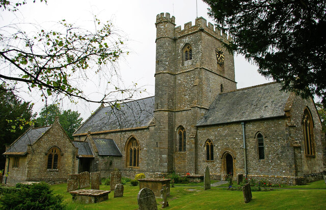
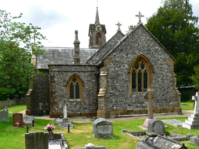
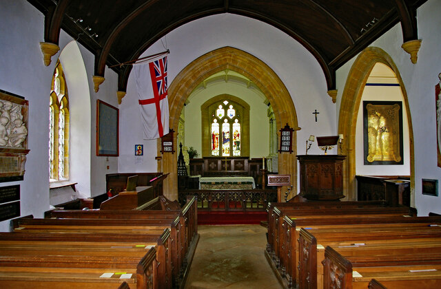
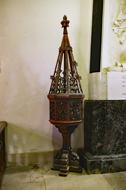
Church of St Stephen, Winsham

The Anglican Church of St Stephen in Winsham, Somerset, England, was built in the 13th century. It is a Grade II* listed building. == History == The church...
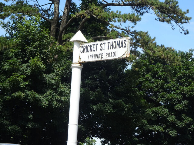
Cricket St Thomas

Cricket St Thomas is a parish in Somerset, England, situated in a valley between Chard and Crewkerne within the South Somerset administrative district...

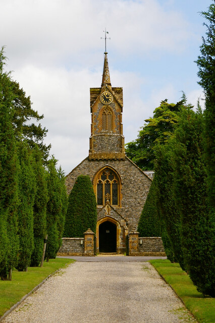
Church of St Thomas, Cricket St Thomas

The Church of St Thomas in Cricket St Thomas, Somerset, England was built in the 14th century and rebuilt in 1868. It is a Grade II* listed building....
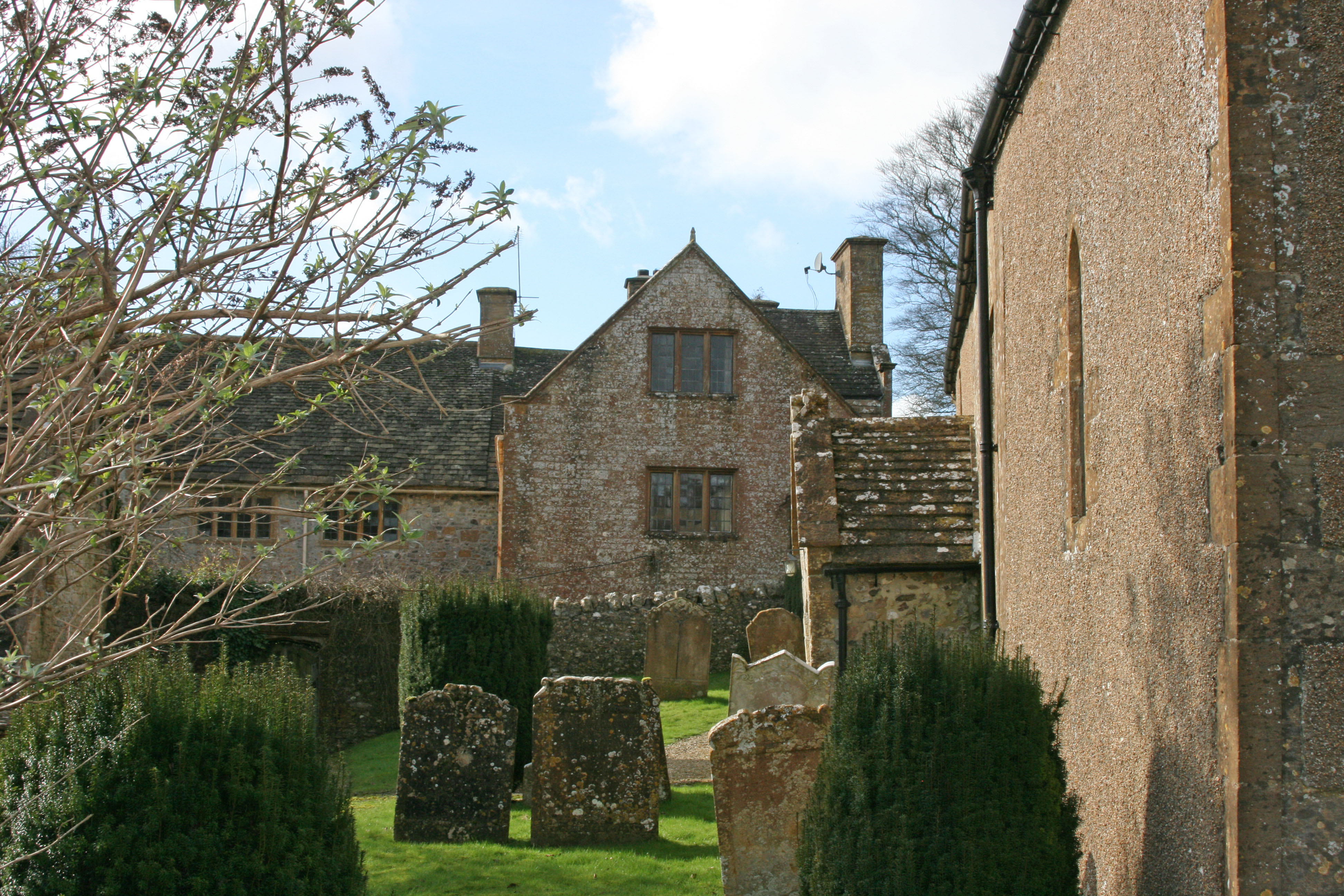
Leigh House

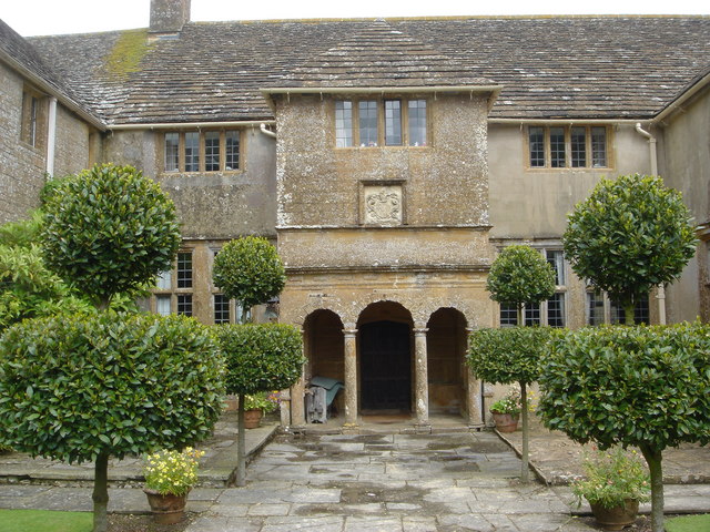
Leigh House is 16th- or 17th-century house in Winsham, Somerset, England. It is a Grade II* listed building.The site was previously part of the Forde Abbey...

Forde Abbey

Forde Abbey is a privately owned former Cistercian monastery in Dorset, England, with a postal address in Chard, Somerset. The house and gardens are run...

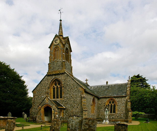
Church of St Michael, Wayford

The Anglican Church of St Michael in Wayford, Somerset, England was built in the 13th century. It is a Grade II* listed building. == History == The church...

Wayford

Wayford is a village and civil parish on the River Axe, 3 miles (5 km) south-west of Crewkerne, in the South Somerset district of Somerset, England....

Have you been to Cookshill Plantation?

Leave your review of Cookshill Plantation below (or comments, questions and feedback).