Hollow Grove
Wood, Forest in Somerset South Somerset
England
Hollow Grove
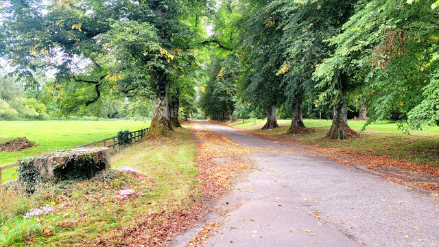
Hollow Grove, located in Somerset, England, is a picturesque woodland area known for its enchanting beauty and rich biodiversity. Spanning over a vast expanse, the grove is nestled amidst rolling hills and serene countryside, offering visitors a tranquil escape from the hustle and bustle of everyday life.
The forest is predominantly composed of a variety of deciduous trees, including oak, beech, and birch, which provide a stunning display of colors during the autumn season. The dense canopy formed by these towering giants creates a shaded and cool atmosphere, making it an ideal destination for nature enthusiasts and hikers.
Hollow Grove is home to a diverse array of wildlife, showcasing the region's ecological significance. Visitors may come across deer, foxes, badgers, and a multitude of bird species, including woodpeckers and owls. The grove also boasts a vibrant population of butterflies and insects, adding to its ecological diversity.
Traversing the grove, visitors can explore a network of well-maintained walking trails, allowing them to immerse themselves in the natural wonders of the forest. These trails meander through ancient woodlands, across babbling brooks, and alongside moss-covered rock formations, offering breathtaking views and photo opportunities at every turn.
Furthermore, Hollow Grove is also known for its historical significance. The forest has served as a source of inspiration for local folklore and legends, with tales of mythical creatures and hidden treasures captivating the imagination of generations.
Overall, Hollow Grove in Somerset is a haven of natural beauty, offering a peaceful retreat for those seeking solace in the midst of nature's embrace. Whether it's a leisurely stroll, birdwatching, or simply basking in the serenity of the forest, Hollow Grove promises an unforgettable experience for all who venture its trails.
If you have any feedback on the listing, please let us know in the comments section below.
Hollow Grove Images
Images are sourced within 2km of 50.8585/-2.9054063 or Grid Reference ST3606. Thanks to Geograph Open Source API. All images are credited.
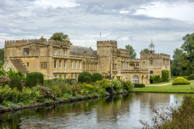


![Forde Abbey and Gardens [1] The entrance avenue, looking out towards the entrance gate.
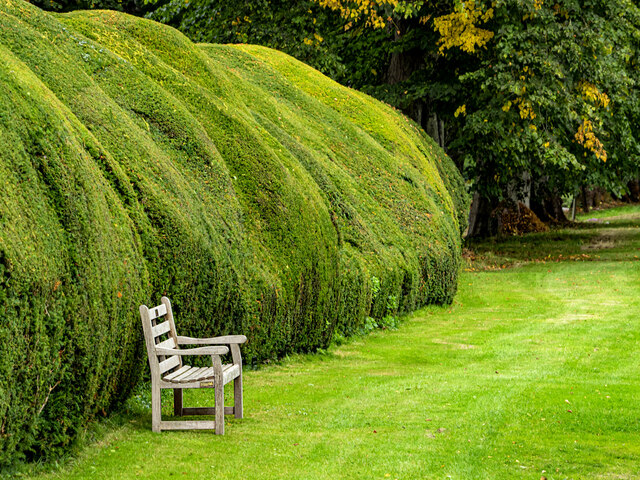
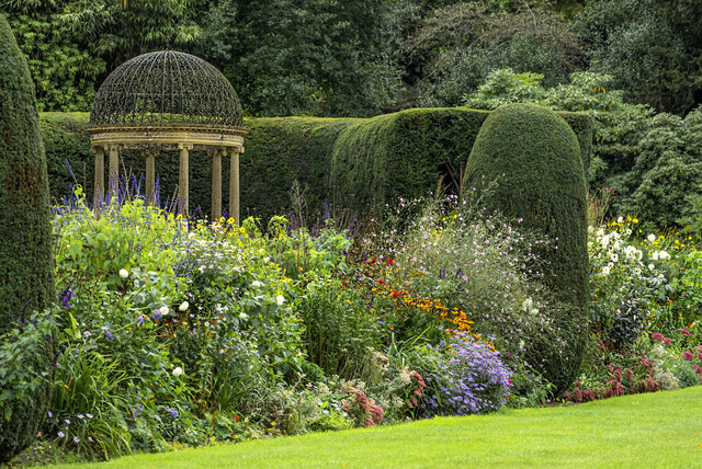
Forde Abbey and Gardens is situated in Dorset, on the south bank of the River Axe, some 5½ miles northeast of Axminster and about 3 miles southeast of Chard. A Cistercian Abbey was founded in 1136, and after dissolution in 1539, it was partly converted into a Country House. Parts of the monastic buildings of the 12th, 13th, 15th and 16th centuries survive with alterations, extensions and restorations in the 17th, 19th and 20th centuries. The house is constructed of rubble stone with Ham stone ashlar and dressings under roofs of slate and lead. The house is listed, grade I, with details at: <span class="nowrap"><a title="https://historicengland.org.uk/listing/the-list/list-entry/1153362" rel="nofollow ugc noopener" href="https://historicengland.org.uk/listing/the-list/list-entry/1153362">Link</a><img style="margin-left:2px;" alt="External link" title="External link - shift click to open in new window" src="https://s1.geograph.org.uk/img/external.png" width="10" height="10"/></span> Part of the gardens, in which the abbey church and northern cloister survive as buried structures, are a Scheduled Ancient Monument with details at: <span class="nowrap"><a title="https://historicengland.org.uk/listing/the-list/list-entry/1002347" rel="nofollow ugc noopener" href="https://historicengland.org.uk/listing/the-list/list-entry/1002347">Link</a><img style="margin-left:2px;" alt="External link" title="External link - shift click to open in new window" src="https://s1.geograph.org.uk/img/external.png" width="10" height="10"/></span> The site has some 15 acres of formal gardens and pleasure grounds, and about 65 acres of parkland. The grounds are on the Register of Historic Parks and Gardens, grade II*, with details at: <span class="nowrap"><a title="https://historicengland.org.uk/listing/the-list/list-entry/1000717" rel="nofollow ugc noopener" href="https://historicengland.org.uk/listing/the-list/list-entry/1000717">Link</a><img style="margin-left:2px;" alt="External link" title="External link - shift click to open in new window" src="https://s1.geograph.org.uk/img/external.png" width="10" height="10"/></span>](https://s0.geograph.org.uk/geophotos/07/56/74/7567492_92989d94.jpg)
![Forde Abbey and Gardens [2] The seven bays of arches are the north alley of the former cloister.
Forde Abbey and Gardens is situated in Dorset, on the south bank of the River Axe, some 5½ miles northeast of Axminster and about 3 miles southeast of Chard. A Cistercian Abbey was founded in 1136, and after dissolution in 1539, it was partly converted into a Country House. Parts of the monastic buildings of the 12th, 13th, 15th and 16th centuries survive with alterations, extensions and restorations in the 17th, 19th and 20th centuries. The house is constructed of rubble stone with Ham stone ashlar and dressings under roofs of slate and lead. The house is listed, grade I, with details at: <span class="nowrap"><a title="https://historicengland.org.uk/listing/the-list/list-entry/1153362" rel="nofollow ugc noopener" href="https://historicengland.org.uk/listing/the-list/list-entry/1153362">Link</a><img style="margin-left:2px;" alt="External link" title="External link - shift click to open in new window" src="https://s1.geograph.org.uk/img/external.png" width="10" height="10"/></span> Part of the gardens, in which the abbey church and northern cloister survive as buried structures, are a Scheduled Ancient Monument with details at: <span class="nowrap"><a title="https://historicengland.org.uk/listing/the-list/list-entry/1002347" rel="nofollow ugc noopener" href="https://historicengland.org.uk/listing/the-list/list-entry/1002347">Link</a><img style="margin-left:2px;" alt="External link" title="External link - shift click to open in new window" src="https://s1.geograph.org.uk/img/external.png" width="10" height="10"/></span> The site has some 15 acres of formal gardens and pleasure grounds, and about 65 acres of parkland. The grounds are on the Register of Historic Parks and Gardens, grade II*, with details at: <span class="nowrap"><a title="https://historicengland.org.uk/listing/the-list/list-entry/1000717" rel="nofollow ugc noopener" href="https://historicengland.org.uk/listing/the-list/list-entry/1000717">Link</a><img style="margin-left:2px;" alt="External link" title="External link - shift click to open in new window" src="https://s1.geograph.org.uk/img/external.png" width="10" height="10"/></span>](https://s1.geograph.org.uk/geophotos/07/56/74/7567497_3e4cc0be.jpg)
Hollow Grove is located at Grid Ref: ST3606 (Lat: 50.8585, Lng: -2.9054063)
Administrative County: Somerset
District: South Somerset
Police Authority: Avon and Somerset
What 3 Words
///treatable.waitress.offline. Near Chard, Somerset
Nearby Locations
Related Wikis

Leigh House
Leigh House is 16th- or 17th-century house in Winsham, Somerset, England. It is a Grade II* listed building. The site was previously part of the Forde...

Winsham
Winsham is a village and civil parish 4 miles (6 km) south-east of Chard and 6 miles (10 km) from Crewkerne, in the South Somerset district of Somerset...

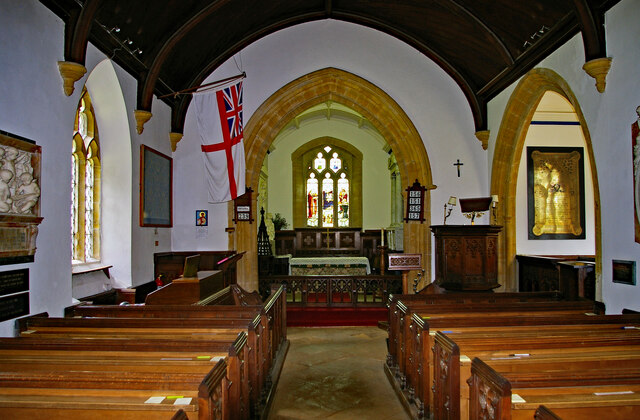
Church of St Stephen, Winsham
The Anglican Church of St Stephen in Winsham, Somerset, England, was built in the 13th century. It is a Grade II* listed building. == History == The church...

Cricket St Thomas
Cricket St Thomas is a parish in Somerset, England, situated in a valley between Chard and Crewkerne within the South Somerset administrative district...
Nearby Amenities
Located within 500m of 50.8585,-2.9054063Have you been to Hollow Grove?
Leave your review of Hollow Grove below (or comments, questions and feedback).