The Birches

Wood, Forest in Herefordshire

England

The Birches

Byton Common Some years ago, grazing ceased on Byton Common, although there were ponies on the common when this picture was taken. The common has now changed from downland to dense woodland complete with the dreaded bracken. The first trees to appear were hawthorn followed by oak ash and hazel.
Byton Common Credit: Richard Webb

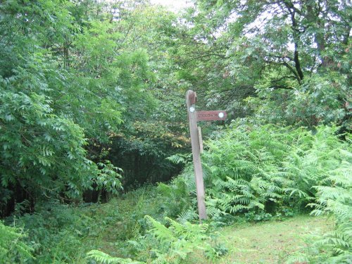
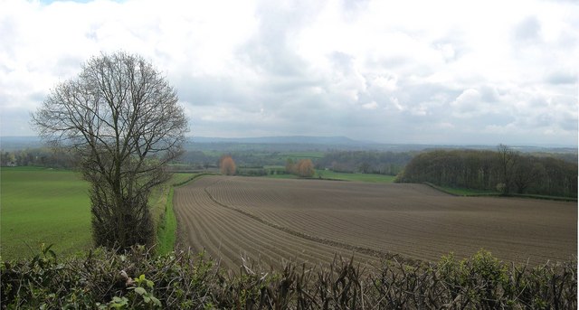
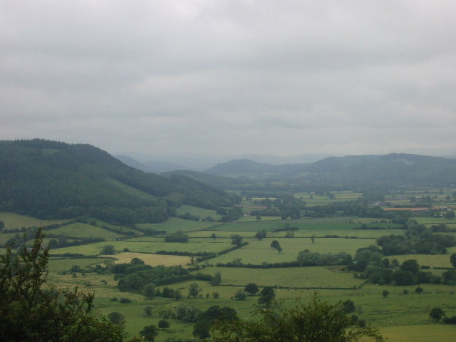
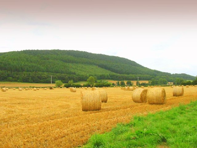
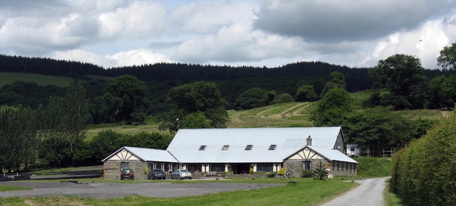
The Birches, located in Herefordshire, is a charming woodland area known for its abundant birch trees. Situated in the western part of England, Herefordshire is known for its picturesque landscapes and natural beauty, and The Birches stands as a testament to this.

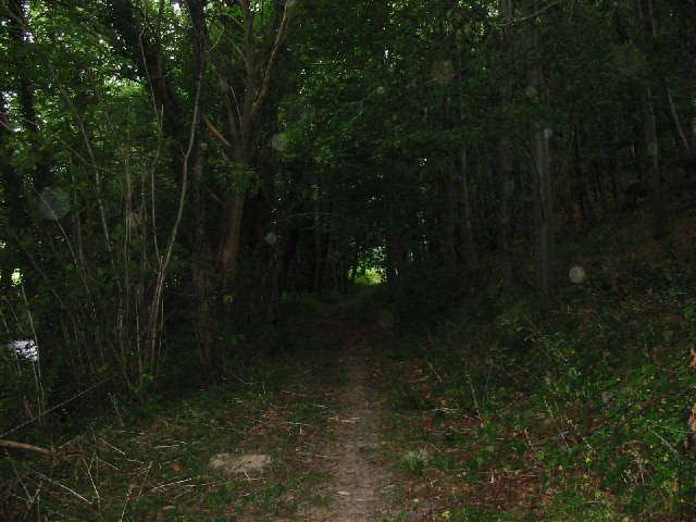
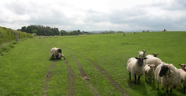
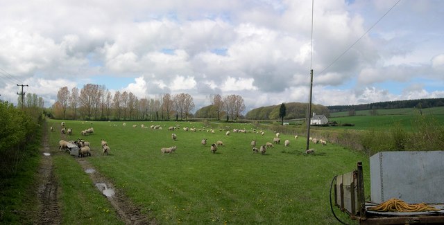
Covering a vast area, The Birches is home to a variety of flora and fauna. The forest is primarily dominated by birch trees, which create a stunning sight with their slender trunks and distinctive white bark. The canopy formed by the birches provides a cool and serene atmosphere, offering a respite from the hustle and bustle of everyday life.

The woodland is a haven for nature enthusiasts and outdoor lovers, offering numerous walking trails to explore its beauty. These trails wind through the forest, allowing visitors to immerse themselves in the tranquil surroundings. The forest floor is carpeted with a rich variety of vegetation, including ferns, mosses, and wildflowers, enhancing the natural charm of The Birches.

Wildlife thrives within the woodland, with a diverse range of species making it their home. Squirrels can be spotted scampering through the branches, while birds serenade visitors with their melodious songs. The Birches also provides a habitat for deer, badgers, and foxes, adding to the allure of this natural sanctuary.

Whether you are seeking solace in nature or simply want to explore the beauty of Herefordshire, The Birches is a must-visit destination. Its breathtaking scenery, abundance of wildlife, and peaceful ambiance make it a true gem within the region.

If you have any feedback on the listing, please let us know in the comments section below.

The Birches Images

Images are sourced within 2km of 52.257448/-2.9337748 or Grid Reference SO3662. Thanks to Geograph Open Source API. All images are credited.

Byton Common Some years ago, grazing ceased on Byton Common, although there were ponies on the common when this picture was taken. The common has now changed from downland to dense woodland complete with the dreaded bracken. The first trees to appear were hawthorn followed by oak ash and hazel.
Byton Common
Some years ago, grazing ceased on Byton Common, although there were ponies on the common when this picture was taken. The common has now changed from downland to dense woodland complete with the dreaded bracken. The first trees to appear were hawthorn followed by oak ash and hazel.
Upper Lugg valley Looking West towards the Welsh border along the upper Lugg valley from about SO367643 just to the north of Byton. The closest point of the border is only a mile or so from here
Upper Lugg valley
Looking West towards the Welsh border along the upper Lugg valley from about SO367643 just to the north of Byton. The closest point of the border is only a mile or so from here
Herefordshire Trail leading to Wapley Hillfort This is taken looking North from the Herefordshire Trail towards Combe Moor and Byton Moor from the ridge above Brandhill Wood
Herefordshire Trail leading to Wapley Hillfort
This is taken looking North from the Herefordshire Trail towards Combe Moor and Byton Moor from the ridge above Brandhill Wood
Wapley Hill Wood - Herefordshire Trail A large part of this square is woodland. This is part of the Herefordshire trail leading through the lower part of the wood to Stansbatch
Wapley Hill Wood - Herefordshire Trail
A large part of this square is woodland. This is part of the Herefordshire trail leading through the lower part of the wood to Stansbatch
The Lugg Valley to the West of Byton The river is just out of shot to the left - Byton in the distance
The Lugg Valley to the West of Byton
The river is just out of shot to the left - Byton in the distance
Mortimer Trail Looking east from the path at about SO 357626
Mortimer Trail
Looking east from the path at about SO 357626
Combe From close to the Lugg looking south to Wapley Hill
Combe
From close to the Lugg looking south to Wapley Hill
Mortimer Trail Just below Waply Hill Wood and above Stansbatch - looking south
Mortimer Trail
Just below Waply Hill Wood and above Stansbatch - looking south
Combe Moor and Byton Moor Taken on a wet July day looking west from the hill above Park Wood just outside the square - Wapley Hill on the left
Combe Moor and Byton Moor
Taken on a wet July day looking west from the hill above Park Wood just outside the square - Wapley Hill on the left
Ryland's Wood
Ryland's Wood
Pond at Lower Woodhouse Small pond adjacent to Lower Woodhouse farm. The historic farmhouse and farm buildings have been recently renovated and converted into dwellings.
Pond at Lower Woodhouse
Small pond adjacent to Lower Woodhouse farm. The historic farmhouse and farm buildings have been recently renovated and converted into dwellings.
Wapley Hill Fort And Walks
Entrance to Stocklow Manor Farm An old millstone and a traffic cone mark the entrance to this farm. Wild flowers grow from the top of the plastic cone.
Entrance to Stocklow Manor Farm
An old millstone and a traffic cone mark the entrance to this farm. Wild flowers grow from the top of the plastic cone.
Residents, Stocklow Manor Farm
Ploughed farmland below Wapley Hill Burton Hill above Weobley in the background.
Ploughed farmland below Wapley Hill
Burton Hill above Weobley in the background.
Sheep near Staunton Green
Dovecote, Staunton Park Six sided, I believe - I forgot to count. No roof, but the nesting holes were still occupied, as I found out when I ventured inside. Late 18th century, I would guess.
Dovecote, Staunton Park
Six sided, I believe - I forgot to count. No roof, but the nesting holes were still occupied, as I found out when I ventured inside. Late 18th century, I would guess.
Stansbatch House Large 18th/19th century house at the foot of Wapley Hill, with commanding views.
Stansbatch House
Large 18th/19th century house at the foot of Wapley Hill, with commanding views.
Show me another place!

The Birches is located at Grid Ref: SO3662 (Lat: 52.257448, Lng: -2.9337748)

Unitary Authority: County of Herefordshire

Police Authority: West Mercia

What 3 Words

///seagulls.raking.standard. Near Kinsham, Herefordshire

Nearby Locations

The Birches

Related Wikis

Combe Moor

Combe Moor, also known as Coombes Moor, is a linear hamlet in the civil parish of Byton in Herefordshire, England, to the south-east of the Welsh town...

Byton, Herefordshire

Byton is a village and civil parish in Herefordshire, England. Byton is situated on the River Lugg, near the border with Wales. According to the 2001...

Wapley Hill

Wapley Hill is an Iron Age hill fort in Herefordshire, England, 3 km south-east of Presteigne. == Location == Wapley Hill stands in mixed woodland on a...

Kinsham

Kinsham is a civil parish which lies in the wooded hills of Herefordshire, England in the Marches near to the border with Wales, about 3 miles (5 km) east...

Combe, Herefordshire

Combe is a small village and civil parish in the English county of Herefordshire. The village lies 4 km (2 mi) east of Presteigne near the confluence...

Staunton on Arrow

Staunton on Arrow is a village and civil parish in the county of Herefordshire, England. The village is 17 miles (27 km) north-west of Hereford and 8 miles...

Kinsham Grange

Kinsham Grange may have been a priory near the River Lugg in Herefordshire, England at grid reference SO380652. It now seems likely that an error by John...

Limebrook Priory

Limebrook Priory was a priory in Lingen, Herefordshire, England at grid reference SO37386604. == History == === Origins === Situated in Lingen, Herefordshire...

Nearby Amenities

Located within 500m of 52.257448,-2.9337748
Barrier: stile
Material: wood
Source: survey;gps
Stile: stepover
Lat/Long: 52.2601726/-2.9356381
Barrier: stile
Material: wood
Source: survey;gps
Stile: stepover
Lat/Long: 52.2602246/-2.9351813
Information: board
Source: survey;gps
Tourism: information
Lat/Long: 52.2609834/-2.9299134
The data included in this document is from www.openstreetmap.org. The data is made available under ODbL.

Have you been to The Birches?

Leave your review of The Birches below (or comments, questions and feedback).