Bleaberry Fell
Wood, Forest in Lancashire South Lakeland
England
Bleaberry Fell

Bleaberry Fell is a picturesque woodland area located in Lancashire, England. Covering an approximate area of 100 square kilometers, it is known for its diverse range of flora and fauna, making it a popular destination for nature enthusiasts and hikers.
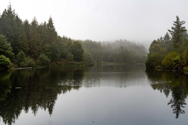
The fell is characterized by its dense forest of broadleaf and coniferous trees, including oak, birch, and pine. These trees create a tranquil and serene atmosphere, providing shade and shelter to a variety of wildlife. Bleaberry Fell is home to numerous species of birds, such as woodpeckers, owls, and various songbirds, making it a prime spot for birdwatching.
The forest floor is adorned with a rich carpet of wildflowers during the spring and summer months, including bluebells, primroses, and foxgloves, adding vibrant colors to the landscape. Additionally, the fell is crisscrossed with several walking trails and paths, offering visitors the opportunity to explore the area's natural beauty.
One of the key attractions within Bleaberry Fell is a serene lake, which provides a tranquil setting for leisure activities such as fishing or simply enjoying a picnic by the water's edge. The lake is also home to a variety of waterfowl, including ducks and swans.
Overall, Bleaberry Fell offers a peaceful retreat from the hustle and bustle of urban life, providing visitors with a chance to reconnect with nature and immerse themselves in the beauty of Lancashire's woodlands.
If you have any feedback on the listing, please let us know in the comments section below.
Bleaberry Fell Images
Images are sourced within 2km of 54.320979/-2.9801617 or Grid Reference SD3692. Thanks to Geograph Open Source API. All images are credited.


Bleaberry Fell is located at Grid Ref: SD3692 (Lat: 54.320979, Lng: -2.9801617)
Administrative County: Cumbria
District: South Lakeland
Police Authority: Cumbria
What 3 Words
///massaged.sticky.panting. Near Windermere, Cumbria
Nearby Locations
Related Wikis
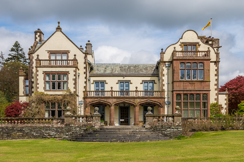
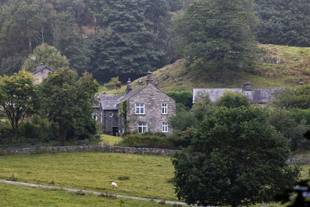
Graythwaite Hall
Graythwaite Hall, in Ulverston, Cumbria in the Lake District of England is the home of the Sandys family. One of the more famous members of the family...

Satterthwaite
Satterthwaite is a small village (and civil parish) with around 50 dwellings situated in Grizedale, a valley in the Lake District, England, about four...

Cunsey Beck
Cunsey Beck is one of several rivers and streams that replenish the lake of Windermere in the English Lake District. Being just over two miles (3.2 km...

Satterthwaite & Rusland School
Satterthwaite & Rusland School was a Church of England Primary school near Force Forge in the Rusland Valley. The school was established in 1840 for children...

Moor Crag
Moor Crag (sometimes Moorcrag) is a Grade I listed house near Bowness-on-Windermere in South Lakeland, Cumbria, England, overlooking Windermere. It lies...

Broad Leys
Broad Leys is a house located in Ghyll Head, near Bowness-on-Windermere, South Lakeland, Cumbria, England. It is in the northern part of the parish of...

Windermere Motor Boat Racing Club
The Windermere Motor Boat Racing Club is a British boating club based at Bowness-on-Windermere, Cumbria. The Club was founded in the 1920s. Its present...

Esthwaite Water
Esthwaite Water is one of the smaller and lesser known lakes in the Lake District National Park in northern England. It is situated between the much larger...
Nearby Amenities
Located within 500m of 54.320979,-2.9801617Have you been to Bleaberry Fell?
Leave your review of Bleaberry Fell below (or comments, questions and feedback).