Billy Brow's Coppice

Wood, Forest in Lancashire South Lakeland

England

Billy Brow's Coppice

Gated track in the morning frost
Gated track in the morning frost Credit: Anthony Parkes

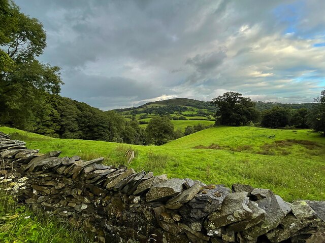
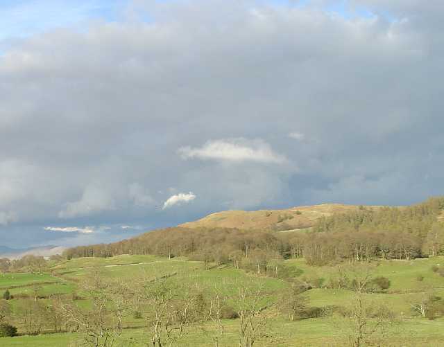
Billy Brow's Coppice is a picturesque woodland located in Lancashire, England. Spanning over an area of approximately 50 acres, it is known for its natural beauty and diverse ecosystem. The coppice is situated on the outskirts of a small village, surrounded by rolling hills and lush green fields.

The woodland is primarily composed of oak, beech, and birch trees, which provide a dense canopy that filters sunlight, creating a serene and tranquil atmosphere. The forest floor is covered with a variety of wildflowers, ferns, and mosses, adding to the enchanting ambiance of the area.

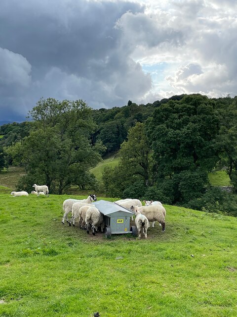
Billy Brow's Coppice is a haven for wildlife, attracting a wide range of species. Visitors can often spot red squirrels darting between the trees, and if lucky, catch a glimpse of the elusive roe deer grazing in the open meadows. The woodland is also home to a plethora of bird species, including woodpeckers, owls, and thrushes, making it a popular spot for birdwatching enthusiasts.

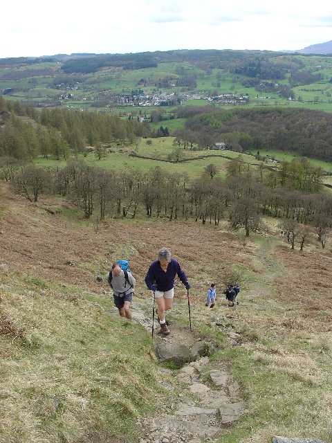
The coppice is accessible via several well-maintained walking trails, which wind through the forest, offering visitors the opportunity to explore its hidden corners and discover its natural treasures. There are also designated picnic areas and benches scattered throughout the woodland, providing a perfect spot for visitors to relax and soak in the peaceful surroundings.

Billy Brow's Coppice is not only a place of natural beauty but also holds historical significance. It has been managed as a coppice woodland for centuries, with evidence of traditional woodland management techniques still visible today. This makes it an excellent destination for those interested in learning about the history of land management practices in the region.

Overall, Billy Brow's Coppice is a captivating woodland that showcases the beauty of Lancashire's natural landscape and offers visitors a chance to connect with nature in a tranquil setting.

If you have any feedback on the listing, please let us know in the comments section below.

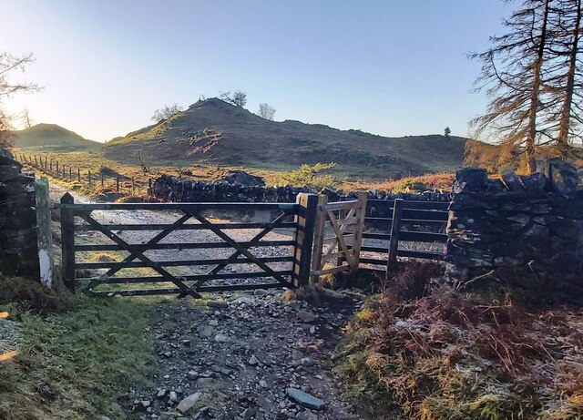
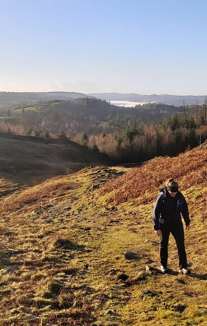
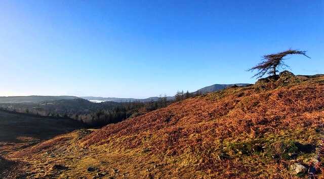
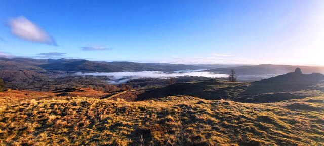
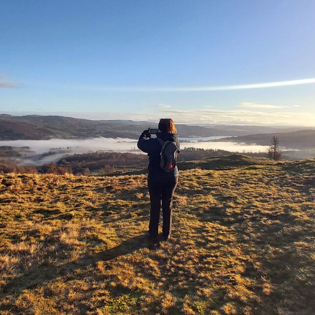
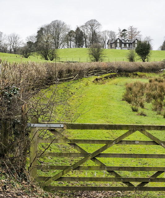
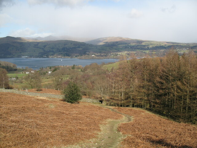
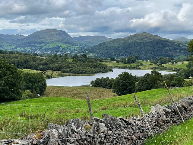
Billy Brow's Coppice Images

Images are sourced within 2km of 54.395927/-2.994347 or Grid Reference NY3500. Thanks to Geograph Open Source API. All images are credited.

Gated track in the morning frost
Track on Iron Keld - Fog on Coniston Water in distance
Arnside Plantation
Arnside Plantation
View from Black Crag with fog over Windermere distant
Photographer on Black Crag
Black Crag Trig Point
Hedge rising at edge of field The B5285 descends alongside the trimmed hedge which appears to have been grown alongside a fence which it is demolishing as it grows. Highfield House is the large residence at the top of the slope.
Hedge rising at edge of field
The B5285 descends alongside the trimmed hedge which appears to have been grown alongside a fence which it is demolishing as it grows. Highfield House is the large residence at the top of the slope.
Path above Waterson Intake The path is the public footpath from Latterbarrow to High Wray.
Windermere is in the middle distance and there is a snow shower over the Kentmere Fells.
Path above Waterson Intake
The path is the public footpath from Latterbarrow to High Wray. Windermere is in the middle distance and there is a snow shower over the Kentmere Fells.
Wall and fields above Blelham Tarn
Farmland near Outgate The distant hill is Latterbarrow.
Farmland near Outgate
The distant hill is Latterbarrow.
Dinner time! An evening meal for these sheep near Outgate.
Dinner time!
An evening meal for these sheep near Outgate.
Outgate Inn Public house & restaurant in Outgate
Outgate Inn
Public house & restaurant in Outgate
Garden near Knipe Fold
Western Slopes of Latterbarrow, Near Hawkshead, Cumbria This grid square is dominated by the small hill of Latterbarrow. The photo shows a group of walkers ascending Latterbarrow from the west.
In the background, the small town of Hawkshead can be seen.
Western Slopes of Latterbarrow, Near Hawkshead, Cumbria
This grid square is dominated by the small hill of Latterbarrow. The photo shows a group of walkers ascending Latterbarrow from the west. In the background, the small town of Hawkshead can be seen.
Latterbarrow. View from Hawkshead Latterbarrow is a local viewpoint for the village of Hawkshead. Accessible by foot after a short walk, the views from the top are excellent in almost 360 degrees. On a good day the Howgills can be seen.
Latterbarrow. View from Hawkshead
Latterbarrow is a local viewpoint for the village of Hawkshead. Accessible by foot after a short walk, the views from the top are excellent in almost 360 degrees. On a good day the Howgills can be seen.
Summit of Latterbarrow
Hawkshead Courthouse The Manor of Hawkshead was created by the monks of Furness Abbey to administer the land that has been granted to them by Stephen, Count of Boulogne and Mortain, in 1127. The extent of this land was established in 1167 as being between Coniston Water and the River Crake on the west side, and Windermere on the east side, and is known as the Furness Fells.  The Grange (administrative centre) of the manor was Hawkshead Hall, and the Gatehouse or Courthouse is all that remains of the medieval buildings.  There is a fireplace with dog-tooth moulding in the style of the 13C, but the tracery in the windows suggests the 15C.  There is a niche over the archway that contained a statue of the Virgin Mary until 1834.  A stone to the left of the arch is inscribed "J. THOMPSON/BOLTON 1849".  The building was restored in 1932, after being given to the National Trust by Henry Swainson Cowper.  It contains a Folk Museum (enquire at the NT shop in Hawkshead).
Hawkshead Courthouse
The Manor of Hawkshead was created by the monks of Furness Abbey to administer the land that has been granted to them by Stephen, Count of Boulogne and Mortain, in 1127. The extent of this land was established in 1167 as being between Coniston Water and the River Crake on the west side, and Windermere on the east side, and is known as the Furness Fells. The Grange (administrative centre) of the manor was Hawkshead Hall, and the Gatehouse or Courthouse is all that remains of the medieval buildings. There is a fireplace with dog-tooth moulding in the style of the 13C, but the tracery in the windows suggests the 15C. There is a niche over the archway that contained a statue of the Virgin Mary until 1834. A stone to the left of the arch is inscribed "J. THOMPSON/BOLTON 1849". The building was restored in 1932, after being given to the National Trust by Henry Swainson Cowper. It contains a Folk Museum (enquire at the NT shop in Hawkshead).
log pile near High Wray A pile of logs left just below the woodland above High Wray, view towards the north end of Windermere.
log pile near High Wray
A pile of logs left just below the woodland above High Wray, view towards the north end of Windermere.
Show me another place!

Billy Brow's Coppice is located at Grid Ref: NY3500 (Lat: 54.395927, Lng: -2.994347)

Administrative County: Cumbria

District: South Lakeland

Police Authority: Cumbria

What 3 Words

///else.encoding.salads. Near Ambleside, Cumbria

Related Wikis

Blelham Tarn

Blelham Tarn is a large valley tarn in the Lake District of England, to the north of the hill Latterbarrow. The settlements of Outgate, Low Wray and High...

Brathay

Brathay is a parish in Cumbria, England. Brathay Hall and the surrounding estate belong to a charity, Brathay Trust. == See also == Listed buildings in...

Black Fell (Lake District)

Black Fell is a fell in the English Lake District. It rises to the north of Tarn Hows, between Coniston and Hawkshead. == Topography == Black Fell is the...

Latterbarrow

Latterbarrow is a hill in the English Lake District, east of Hawkshead, Cumbria. It is the subject of a chapter of Wainwright's book The Outlying Fells...

RMS Wray Castle

RMS Wray Castle was a training college for Merchant Navy radio officers based at Wray Castle in the Lake District, from 1958 to 1998.At 11:40 p.m., on...

Wray Castle

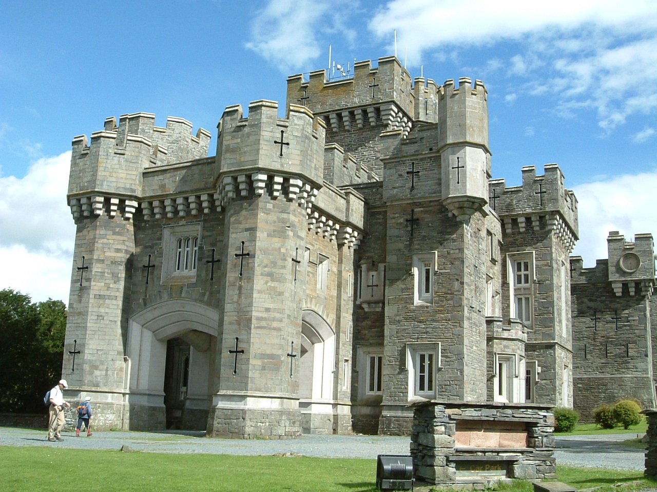
Wray Castle is a Victorian neo-gothic building at Claife in Cumbria within the boundaries of the historic county of Lancashire. The house and grounds have...

Beatrix Potter Gallery

The Beatrix Potter Gallery is a gallery run by the National Trust in a 17th-century stone-built house in Hawkshead, Cumbria, England. It is dedicated to...

Hawkshead

Hawkshead is a village and civil parish in Westmorland and Furness, Cumbria, England. Within the boundaries of the historic county of Lancashire, the parish...

Related Videos

Walking around Hawkshead and the surrounding countryside. The Lake District, Cumbria, England.

We spent two days walking around the Village of Hawkshead and the surrounding countryside. Hawkshead is a beautiful village ...

Wray Castle - Lake District, England historic building tour with walk in Windermere [4K UHD]

Exploring the enourmous Wray Castle, Lake District, England which was a Victorian neo-gothic building at Claife in the English ...

Hiking in Lake District | Long Scenic Drive | Wray Castle Visit | Places to visit in UK

Hiking in Lake District Long Scenic Drive Wray Castle Visit Ambleside Lake District UK Visit to Wray Castle Ambleside | Hiking in ...

English Tourism Week 2021 at Skelwith Fold

As we celebrate the 2021 English Tourism Week, park owner Henry Wild gives us a quick tour around Skelwith Fold. Among the ...

Nearby Amenities

Located within 500m of 54.395927,-2.994347
High Crag
Ele: 156.7
Is In Country Code: GB
Is In County: Cumbria
Is In National Park: Lake District National Park
Man Made: survey_point
Natural: peak
Source: npe
Lat/Long: 54.3995936/-2.9952685
Parking
Lat/Long: 54.3941994/-2.9934344
Power: pole
Lat/Long: 54.3915905/-2.9963046
Power: pole
Lat/Long: 54.3916736/-2.9945024
Power: pole
Lat/Long: 54.3915677/-2.9936895
The data included in this document is from www.openstreetmap.org. The data is made available under ODbL.

Have you been to Billy Brow's Coppice?

Leave your review of Billy Brow's Coppice below (or comments, questions and feedback).