Coalway

Settlement in Gloucestershire Forest of Dean

England

Coalway

Southern end of Cannop Ponds
Southern end of Cannop Ponds Credit: David Martin

Coalway is a quaint village located in the Forest of Dean district of Gloucestershire, England. Nestled in the heart of the beautiful countryside, this small community is known for its serene and tranquil atmosphere. Situated just a few miles north-west of Coleford, Coalway offers residents and visitors a peaceful retreat away from the hustle and bustle of urban life.

The village is primarily residential, with picturesque houses and cottages dotting the landscape. The architecture reflects the traditional style of the region, showcasing the area's rich history. The local community is close-knit and friendly, creating a warm and welcoming ambiance for all who visit.

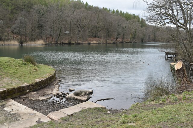
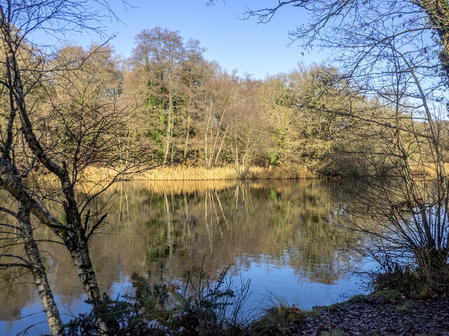
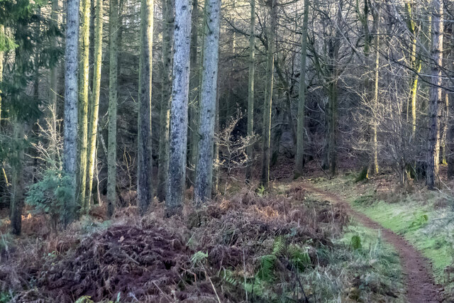
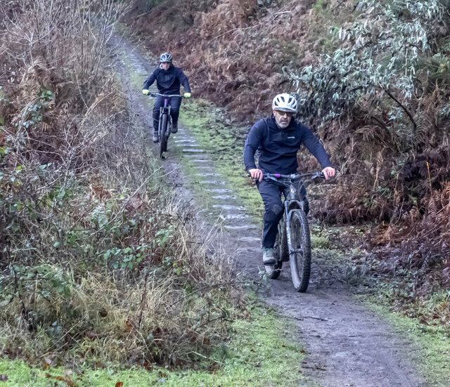
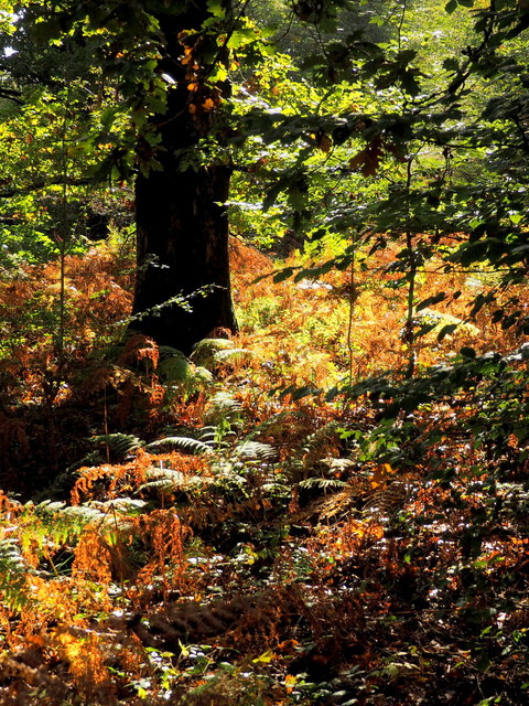
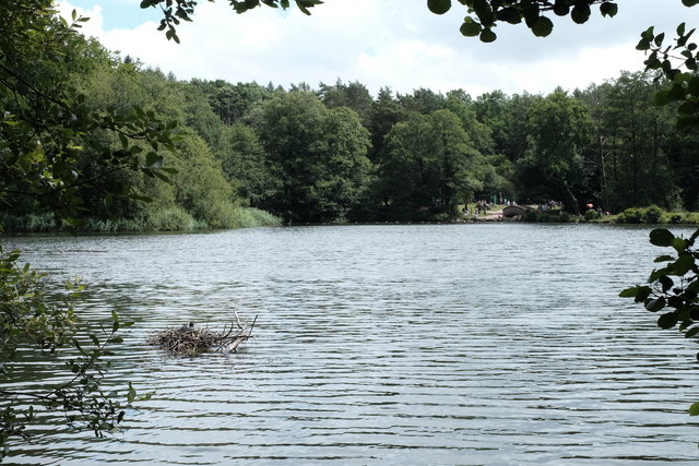
Surrounded by lush greenery and rolling hills, Coalway presents an ideal location for nature enthusiasts and outdoor lovers. The Forest of Dean, a vast woodland area, is easily accessible from the village. Visitors can enjoy hiking, cycling, and exploring the numerous trails that wind through the forest, immersing themselves in the beauty of the natural surroundings.

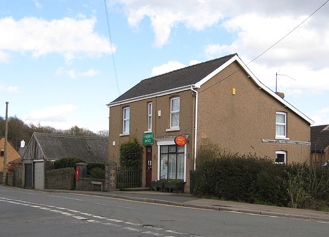
Coalway also boasts a range of amenities, including a village shop, a post office, and a well-regarded primary school. The nearby town of Coleford provides additional services and facilities, such as supermarkets, restaurants, and healthcare facilities, ensuring that residents have all they need within reach.

Overall, Coalway offers a charming and idyllic setting for those seeking a peaceful lifestyle amidst the stunning landscapes of Gloucestershire. Its combination of natural beauty and community spirit make it a desirable place to live or visit for those looking to escape the fast pace of city living.

If you have any feedback on the listing, please let us know in the comments section below.

Coalway Images

Images are sourced within 2km of 51.789067/-2.598753 or Grid Reference SO5810. Thanks to Geograph Open Source API. All images are credited.

Southern end of Cannop Ponds
Winter reflections, Cannop Ponds, 1 A bright Boxing Day morning.
Winter reflections, Cannop Ponds, 1
A bright Boxing Day morning.
Barnhill Plantation On steeply sloping land to the west of Cannop Upper Pond.
Barnhill Plantation
On steeply sloping land to the west of Cannop Upper Pond.
Steep footpath The forested hillside to the west of Cannop Upper Pond.
Steep footpath
The forested hillside to the west of Cannop Upper Pond.
Forest path Looking eastwards into a stand of mature conifers.
Forest path
Looking eastwards into a stand of mature conifers.
Cyclists on the old tramway The Bix Slade porting of the Forest of Dean is full of old stone and coal workings.
This remnant of a horse-drawn tramway was finally decommissioned in 1946 and is now part of the extensive path and cycleway network in the forest.
Cyclists on the old tramway
The Bix Slade porting of the Forest of Dean is full of old stone and coal workings. This remnant of a horse-drawn tramway was finally decommissioned in 1946 and is now part of the extensive path and cycleway network in the forest.
West Dean : Speech House Road B4226 Looking along the B4226.
West Dean : Speech House Road B4226
Looking along the B4226.
Speech House Road The bus stop here is convenient for Hopwell Colliery, now a museum dedicated to the Forest of Dean's once important industry. Unfortunately no timetable information is displayed.
Speech House Road
The bus stop here is convenient for Hopwell Colliery, now a museum dedicated to the Forest of Dean's once important industry. Unfortunately no timetable information is displayed.
Hopewell Colliery This is a free mine that is still worked in the winter. In the summer one of the old worked out sections is used as a museum. The narrow gauge line goes down the drift into the mine and the haulage rope is seen. The device on the right allows coal to be tipped out of the tubs/drams. This is a typical small scale mine as found in the forest. The seam is about 30 " thick and worked longwall with undercutting by a pneumatic pick. The two miners have to work on their backs or sides. On the plus side, the mines in the Forest of Dean are free of methane (firedamp) but carbon dioxide (choke damp) is a real danger.
Hopewell Colliery
This is a free mine that is still worked in the winter. In the summer one of the old worked out sections is used as a museum. The narrow gauge line goes down the drift into the mine and the haulage rope is seen. The device on the right allows coal to be tipped out of the tubs/drams. This is a typical small scale mine as found in the forest. The seam is about 30 " thick and worked longwall with undercutting by a pneumatic pick. The two miners have to work on their backs or sides. On the plus side, the mines in the Forest of Dean are free of methane (firedamp) but carbon dioxide (choke damp) is a real danger.
Hopewell colliery - pump Preserved in an open fronted shelter is this Worthington-Simpson horizontal duplex non-rotative pump. Although built to run on steam it would also run on compressed air. It is believed to have originated locally but our guide at the mine did not know its provenance. It appears to be portable and could well have been used underground on compressed air.

Hopewell Colliery is a working free mine in the winter and a colliery museum with an underground trip in the summer.
Hopewell colliery - pump
Preserved in an open fronted shelter is this Worthington-Simpson horizontal duplex non-rotative pump. Although built to run on steam it would also run on compressed air. It is believed to have originated locally but our guide at the mine did not know its provenance. It appears to be portable and could well have been used underground on compressed air. Hopewell Colliery is a working free mine in the winter and a colliery museum with an underground trip in the summer.
Hopewell Colliery - re-erected head gear This is not a feature of this working free mine but rather a visible indicator for the colliery museum that operates in the summer months. I am not sure if this is a complete relica or whether some of the timbers are from an original head gear.
Hopewell Colliery - re-erected head gear
This is not a feature of this working free mine but rather a visible indicator for the colliery museum that operates in the summer months. I am not sure if this is a complete relica or whether some of the timbers are from an original head gear.
Hopewell Colliery - looking towards the working mine This is a working free mine where two free miners hew coal in the winter. In the summer a disused part of the workings is used as a museum. The narrow gauge track leads down the drift mine and drams of coal are hauled out by the wire rope. A guide roller is seen between the rails in the foreground. In the centre background towards the top of the picture you can see a vertical post carrying a pulley and a thin wire rope. This is the signalling system to the pit top and is mechanical (the wire is just given a good tug to signal via a bell). It is hard to believe that this is the 21st century.

Free mining is an ancient tradition reputed to date to a royal charter from Edward 1. To be a free miner a person must have been born in and live in the Hundred of St Briavels, be at least 21 and have worked underground in a mine in the forest for at least one year and a day. Although traditionally a male preserve there is one registered female free miner, a decision that was not without controversy.
Hopewell Colliery - looking towards the working mine
This is a working free mine where two free miners hew coal in the winter. In the summer a disused part of the workings is used as a museum. The narrow gauge track leads down the drift mine and drams of coal are hauled out by the wire rope. A guide roller is seen between the rails in the foreground. In the centre background towards the top of the picture you can see a vertical post carrying a pulley and a thin wire rope. This is the signalling system to the pit top and is mechanical (the wire is just given a good tug to signal via a bell). It is hard to believe that this is the 21st century. Free mining is an ancient tradition reputed to date to a royal charter from Edward 1. To be a free miner a person must have been born in and live in the Hundred of St Briavels, be at least 21 and have worked underground in a mine in the forest for at least one year and a day. Although traditionally a male preserve there is one registered female free miner, a decision that was not without controversy.
Hopewell Colliery - museum entrance Hopewell is a working free mine in the winter but in the summer it operates as a museum. Visitors are taken down this steep drift to a largely worked out coal face. This shows the seam that is about 30" deep and was worked to the rise by a miner lying on his side or back and undercutting with a pick. It was worked long wall rather than pillar and stall.

 We exited the mine via a drainage level (actually on a slight decline rather than level). The drainage level also contained a ventilation furnace that would only have been used when the temperatures inside and outside were such as to slow or prevent natural convection. The mine is free of firedamp (methane) because the coal outcrops and that allows the lighter than air methane to vent. 

This trip is recommended as opportunities for underground visits are pretty rare now.
Hopewell Colliery - museum entrance
Hopewell is a working free mine in the winter but in the summer it operates as a museum. Visitors are taken down this steep drift to a largely worked out coal face. This shows the seam that is about 30" deep and was worked to the rise by a miner lying on his side or back and undercutting with a pick. It was worked long wall rather than pillar and stall. We exited the mine via a drainage level (actually on a slight decline rather than level). The drainage level also contained a ventilation furnace that would only have been used when the temperatures inside and outside were such as to slow or prevent natural convection. The mine is free of firedamp (methane) because the coal outcrops and that allows the lighter than air methane to vent. This trip is recommended as opportunities for underground visits are pretty rare now.
Going Underground About to start a tour down the mine at Hopewell Colliery Mining Museum, one of the handful of mines still producing coal in the Forest of Dean.
Access to the coal face is down a steeply sloping tunnel rather than down a vertical shaft.
Going Underground
About to start a tour down the mine at Hopewell Colliery Mining Museum, one of the handful of mines still producing coal in the Forest of Dean. Access to the coal face is down a steeply sloping tunnel rather than down a vertical shaft.
Fallen tree, Cannop Ponds The once mighty tree is gradually disintegrating into the water.
See: <a href="https://www.geograph.org.uk/photo/3952862">SO6010 : Fallen tree in Cannop Ponds</a> from 2014.
Fallen tree, Cannop Ponds
The once mighty tree is gradually disintegrating into the water. See: SO6010 : Fallen tree in Cannop Ponds from 2014.
Autumnal undergrowth The forest floor near Cannop Ponds is reflecting autumnal shades.
Autumnal undergrowth
The forest floor near Cannop Ponds is reflecting autumnal shades.
Cannop Ponds picnic area A view through a window in the foliage to the picnic area at Cannop Ponds, busy with families on this sunny June day. In the foreground is a coot nest (not moorhen, as I initially thought). This is yet another Forest of Dean location whose idyllic present belies its industrial past: the ponds themselves are old gravel workings and near here was a wood distillation works and at least one colliery, served by a railway which ran along the flat area of land visible in the clearing behind the people.
Cannop Ponds picnic area
A view through a window in the foliage to the picnic area at Cannop Ponds, busy with families on this sunny June day. In the foreground is a coot nest (not moorhen, as I initially thought). This is yet another Forest of Dean location whose idyllic present belies its industrial past: the ponds themselves are old gravel workings and near here was a wood distillation works and at least one colliery, served by a railway which ran along the flat area of land visible in the clearing behind the people.
A pithead mine wheel A pithead mine wheel at Hopewell Colliery Museum.
A pithead mine wheel
A pithead mine wheel at Hopewell Colliery Museum.
Show me another place!

Coalway is located at Grid Ref: SO5810 (Lat: 51.789067, Lng: -2.598753)

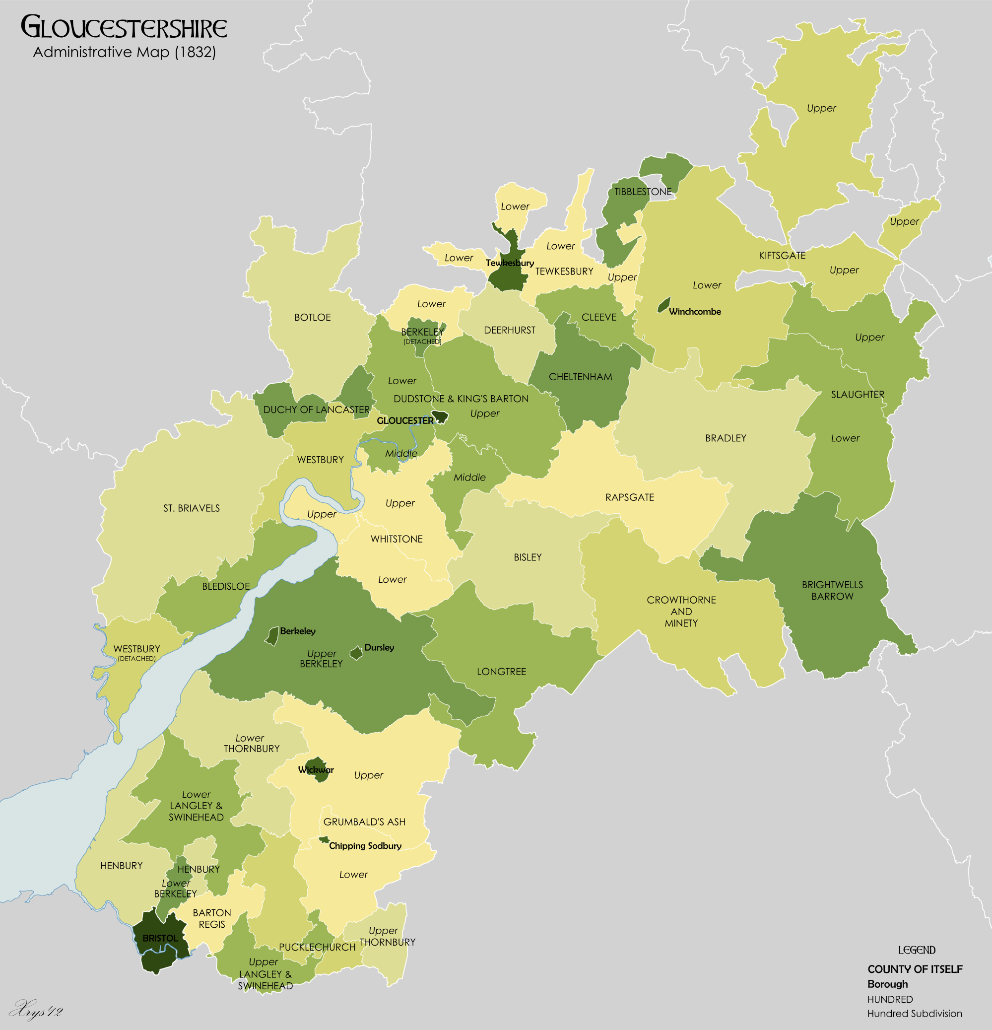
Administrative County: Gloucestershire

District: Forest of Dean

Police Authority: Gloucestershire

What 3 Words

///laser.raven.tensions. Near Coleford, Gloucestershire

Related Wikis

Coalway

Coalway is a village in the West Forest of Dean region of Gloucestershire, England, approximately one mile south-east of the town of Coleford. Within the...

St Briavels Hundred

St Briavels was an ancient hundred of Gloucestershire, England. It comprised the extra-parochial area of the Forest of Dean, and the ancient parishes...

Oakiron railway station

Oakiron railway station is the terminus of the 15 in (381 mm) gauge Perrygrove Railway. The line was opened in 1996 and is now open as a heritage railway...

Broadwell, Forest of Dean

Broadwell is a village about 1 mile (1.6 km) east of Coleford, Gloucestershire, England. It is at the western edge of the Forest of Dean, in the civil...

Gorsty Knoll

Gorsty Knoll is a small hamlet, located in the Forest of Dean, Gloucestershire, England. The internationally important remains of Darkhill Ironworks and...

Milkwall railway station

Milkwall railway station is a disused station on the former Severn and Wye Railway. It served the village of Milkwall, Gloucestershire, England. The station...

Heywood railway station (Perrygrove Railway)

Heywood railway station is a request stop on the 15 in (381 mm) gauge Perrygrove Railway. The line was opened in 1996 and is a heritage railway. There...

Spion Kop Quarry

Spion Kop Quarry (grid reference SO598103) is a 0.7-hectare (1.7-acre) nature reserve in Gloucestershire in the Forest of Dean.The site is managed by the...

Nearby Amenities

Located within 500m of 51.789067,-2.598753
Bus Stop
Eskimarket
Bus: yes
Naptan AtcoCode: 1600GL1379
Naptan Bearing: S
Naptan CommonName: Eskimarket
Naptan Indicator: Opp
Naptan NaptanCode: gloagaja
Naptan Street: New Rd
Naptan Verified: no
Public Transport: platform
Source: naptan_import
Lat/Long: 51.7905311/-2.598736
Bus Stop
Eskimarket
Bus: yes
Naptan AtcoCode: 1600GL1380
Naptan Bearing: N
Naptan CommonName: Eskimarket
Naptan NaptanCode: gloagagw
Naptan Street: New Rd
Naptan Verified: no
Public Transport: platform
Source: naptan_import
Lat/Long: 51.7904037/-2.5990243
Bus Stop
Mormon Church
Naptan AtcoCode: 1600GL5406
Naptan Bearing: E
Naptan CommonName: Mormon Church
Naptan NaptanCode: gloadwtd
Naptan Street: Wynols Rd
Naptan Verified: no
Source: naptan_import
Lat/Long: 51.7931231/-2.6000173
Bus Stop
Coalway Jnr School
Bus: yes
Naptan AtcoCode: 1600GL9171
Naptan Bearing: W
Naptan CommonName: Coalway Jnr School
Naptan Indicator: Opp
Naptan NaptanCode: gloadwtg
Naptan Street: Coalway Rd
Naptan Verified: no
Public Transport: platform
Source: naptan_import
Lat/Long: 51.7904625/-2.6016059
Bus Stop
Coalway Jnr School
Bus: yes
Naptan AtcoCode: 1600GL9172
Naptan Bearing: E
Naptan CommonName: Coalway Jnr School
Naptan NaptanCode: gloagadj
Naptan Street: Coalway Rd
Naptan Verified: no
Public Transport: platform
Source: naptan_import
Lat/Long: 51.7902824/-2.5998926
Bus Stop
Crown Meadow
Bus: yes
Naptan AtcoCode: 1600GLA06084
Naptan Bearing: N
Naptan CommonName: Crown Meadow
Naptan NaptanCode: glogpdmp
Naptan Street: Edenwall Rd
Naptan Verified: no
Public Transport: platform
Source: naptan_import
Lat/Long: 51.7887184/-2.5997994
Bus Stop
Palmers Flat
Bus: yes
Naptan AtcoCode: 1600GLA06085
Naptan Bearing: S
Naptan CommonName: Palmers Flat
Naptan NaptanCode: glogpdmt
Naptan Street: Edenwall Rd
Naptan Verified: no
Public Transport: platform
Source: naptan_import
Lat/Long: 51.785796/-2.5998331
Bus Stop
Queensway
Naptan AtcoCode: 1600GLF206
Naptan Bearing: N
Naptan CommonName: Queensway
Naptan NaptanCode: gloagajg
Naptan Street: South Rd
Naptan Verified: no
Source: naptan_import
Lat/Long: 51.7934749/-2.598021
Bus Stop
Crown Meadow
Bus: yes
Naptan AtcoCode: 1600GLF207
Naptan Bearing: S
Naptan CommonName: Crown Meadow
Naptan NaptanCode: gloagadm
Naptan Street: Edenwall Rd
Naptan Verified: no
Public Transport: platform
Source: naptan_import
Lat/Long: 51.788719/-2.5996834
Bus Stop
Palmers Flat
Bus: yes
Naptan AtcoCode: 1600GLF208
Naptan Bearing: N
Naptan CommonName: Palmers Flat
Naptan NaptanCode: gloagada
Naptan Street: Edenwall Rd
Naptan Verified: no
Public Transport: platform
Source: naptan_import
Lat/Long: 51.7858135/-2.5999348
Bus Stop
Parkend Rd
Bus: yes
Naptan AtcoCode: 1600GLF624
Naptan Bearing: SE
Naptan CommonName: Parkend Rd
Naptan NaptanCode: gloagagj
Naptan Street: B4431
Naptan Verified: no
Public Transport: platform
Source: naptan_import
Lat/Long: 51.7899907/-2.5989173
Coalway Convenience Store
Brand: Premier
Brand Wikidata: Q7240340
Opening Hours: Mo-Sa 07:00-20:00; Su 08:00-20:00
Operator: Premier
Shop: convenience
Lat/Long: 51.7930263/-2.5980347
Addr Housename: Winnows House
Lat/Long: 51.7933158/-2.5976511
Addr Housenumber: 1
Lat/Long: 51.7929602/-2.5974065
Addr Housenumber: 1
Lat/Long: 51.793111/-2.5980241
Waste Basket
Lat/Long: 51.7929685/-2.5980299
Golf: pin
Lat/Long: 51.786516/-2.6028872
Golf: pin
Lat/Long: 51.7850791/-2.6017149
Golf: pin
Lat/Long: 51.7899204/-2.6029947
Golf: pin
Lat/Long: 51.7889162/-2.6057431
Golf: pin
Lat/Long: 51.7866263/-2.603739
Give Way
Direction: backward
Lat/Long: 51.7901016/-2.5991691
Give Way
Direction: forward
Lat/Long: 51.7900249/-2.5992293
Post Box
Brand: Royal Mail
Brand Wikidata: Q638098
Operator: Royal Mail
Operator Wikidata: Q638098
Post Box Type: wall
Royal Cypher: GR
Royal Cypher Wikidata: Q33102273
Lat/Long: 51.7899989/-2.5993422
Give Way
Direction: backward
Lat/Long: 51.7889061/-2.5996969
Give Way
Direction: forward
Lat/Long: 51.7860499/-2.5996742
Give Way
Direction: forward
Lat/Long: 51.7890795/-2.5981161
Give Way
Direction: backward
Lat/Long: 51.7894662/-2.5983752
Give Way
Direction: forward
Lat/Long: 51.7903082/-2.5989533
Power: pole
Lat/Long: 51.786197/-2.593389
Power: pole
Lat/Long: 51.7877193/-2.5933206
Power: pole
Lat/Long: 51.7885953/-2.5933018
Power: pole
Lat/Long: 51.7894812/-2.5932241
Power: pole
Lat/Long: 51.7903622/-2.5931543
Power: pole
Lat/Long: 51.7912448/-2.5929907
The data included in this document is from www.openstreetmap.org. The data is made available under ODbL.

Have you been to Coalway?

Leave your review of Coalway below (or comments, questions and feedback).