Coalville

Settlement in Leicestershire North West Leicestershire

England

Coalville

Site of planned Grange View Building Development Photograph from Grange Road of fields that will be developed into the Grange View housing estate. Taken approx 2018.  On the left is the Hugglescote Surgery.  This view is roughly where the entrance to Percival Road will be built in 2020.
Site of planned Grange View Building Development Credit: Google Maps

Coalville is a town located in the district of North West Leicestershire, in the county of Leicestershire, England. Situated approximately 12 miles northwest of the city of Leicester, Coalville is known for its rich industrial heritage and its significant role in the coal mining industry.

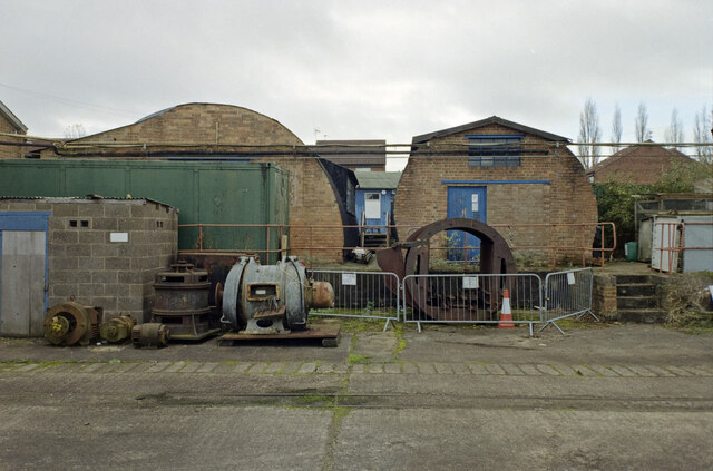
Originally a small village, Coalville experienced rapid growth during the 19th century with the opening of several coal mines in the area. This led to a substantial increase in population, and the town became a major center for coal mining and related industries. However, with the decline of the coal industry in the mid-20th century, Coalville faced economic challenges and a restructuring of its economy.

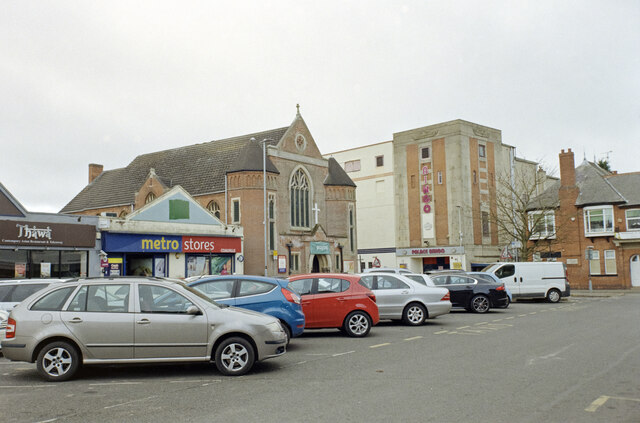
Today, Coalville is a bustling town with a diverse range of industries, including manufacturing, logistics, and retail. The town center offers a variety of shops, restaurants, and amenities, catering to both residents and visitors. It is also home to a number of well-known retail parks, attracting shoppers from the surrounding areas.

Coalville boasts a number of cultural and leisure facilities, including museums, art galleries, and sports centers. The town is surrounded by picturesque countryside, providing opportunities for outdoor activities such as hiking and cycling.

With good transport links, including proximity to major roads and the M1 motorway, Coalville is easily accessible. The town also benefits from regular bus services and a railway station, connecting it to other parts of Leicestershire and beyond.

Overall, Coalville is a town that has evolved from its coal mining roots to become a vibrant and diverse community, offering a mix of industrial heritage, modern amenities, and natural beauty.

If you have any feedback on the listing, please let us know in the comments section below.
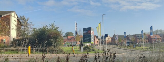
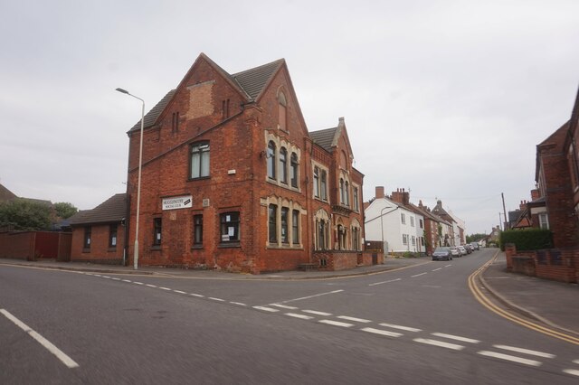
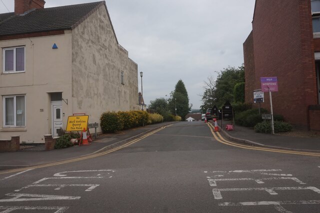
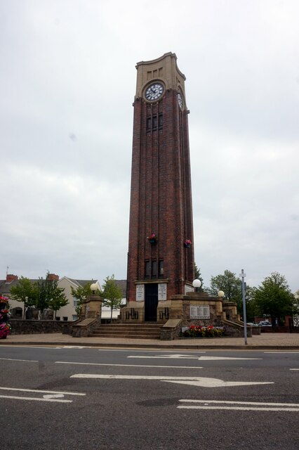
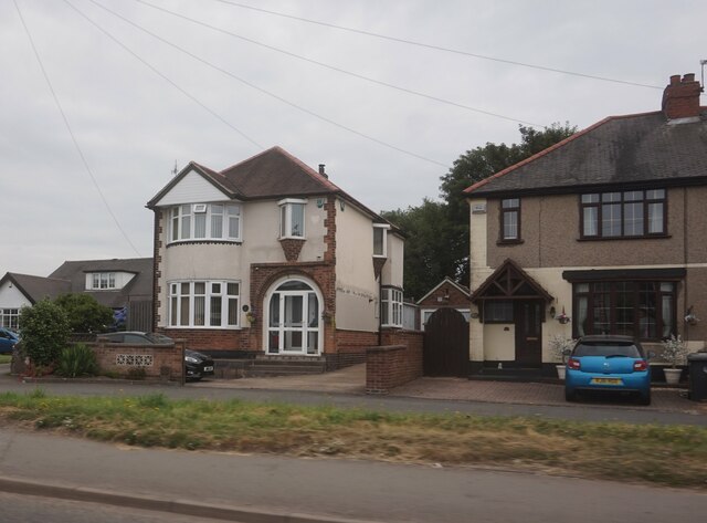
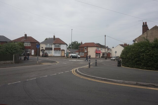
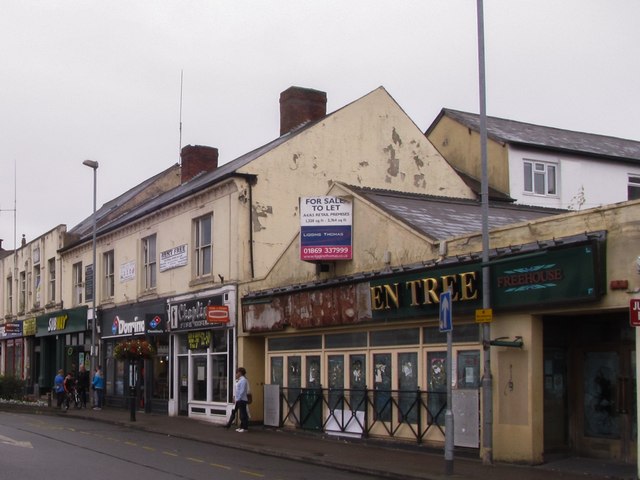
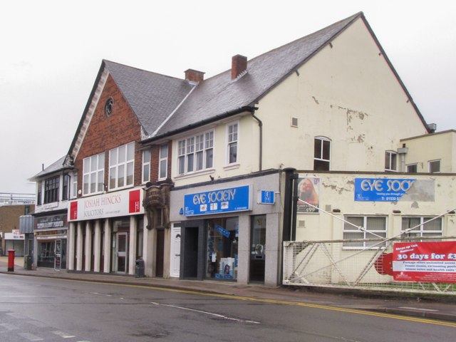
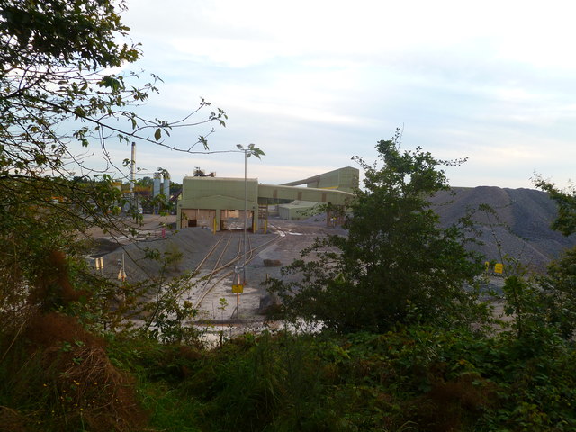
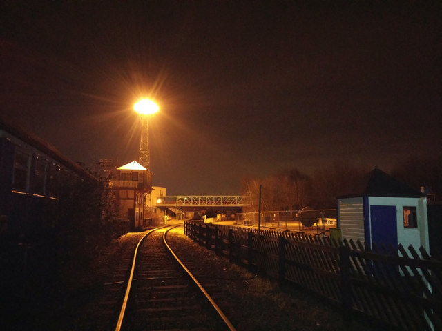
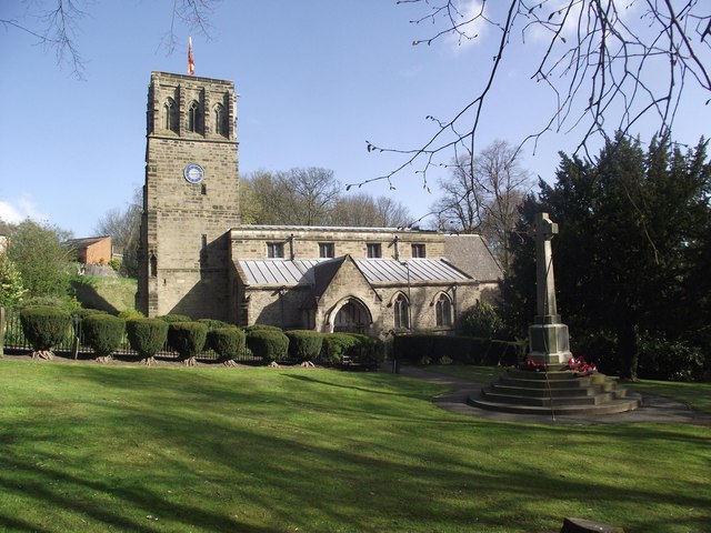
Coalville Images

Images are sourced within 2km of 52.724122/-1.355882 or Grid Reference SK4314. Thanks to Geograph Open Source API. All images are credited.

Site of planned Grange View Building Development Photograph from Grange Road of fields that will be developed into the Grange View housing estate. Taken approx 2018.  On the left is the Hugglescote Surgery.  This view is roughly where the entrance to Percival Road will be built in 2020.
Site of planned Grange View Building Development
Photograph from Grange Road of fields that will be developed into the Grange View housing estate. Taken approx 2018. On the left is the Hugglescote Surgery. This view is roughly where the entrance to Percival Road will be built in 2020.
Grange View Housing Development Photograph taken on Grange Road, Hugglescote. October 2021. Taken from as near as possible to the viewpoint of a previous picture in July 2018 when all that was visible was Hugglesote Surgery (on the left ) and farming land.
Grange View Housing Development
Photograph taken on Grange Road, Hugglescote. October 2021. Taken from as near as possible to the viewpoint of a previous picture in July 2018 when all that was visible was Hugglesote Surgery (on the left ) and farming land.
Hugglescote Social Club On Station Road, Coalville.
Hugglescote Social Club
On Station Road, Coalville.
Peggs Grange of Central Road, Coalville
The Memorial Clock Tower Memorial Square, Coalville.
The Memorial Clock Tower
Memorial Square, Coalville.
Houses on Thornborough Road, Coalville
Mini roundabout on Green Lane, Whitwick
Marlborough Square (the square of many cinemas), Coalville Showing the Marlborough Square Methodist Church and a bingo hall, converted from what was previously the Regal Cinema (1933). A second former-cinema (REX Cinema, 1938) is located along the road to the right, meeting with the other cinema in an L-shape. A third former cinema, the Coalville Electric Theatre (1910), still exists in another use at the opposite end of the square. Rather a lot of cinemas for such a small town! Only the Century Theatre remains operational today.

Camera: Olympus Mju II
Film: Kodak Gold 200
Scanner: Nikon D7200
Conversion software: Grain2Pixel (unedited)
Marlborough Square (the square of many cinemas), Coalville
Showing the Marlborough Square Methodist Church and a bingo hall, converted from what was previously the Regal Cinema (1933). A second former-cinema (REX Cinema, 1938) is located along the road to the right, meeting with the other cinema in an L-shape. A third former cinema, the Coalville Electric Theatre (1910), still exists in another use at the opposite end of the square. Rather a lot of cinemas for such a small town! Only the Century Theatre remains operational today. Camera: Olympus Mju II Film: Kodak Gold 200 Scanner: Nikon D7200 Conversion software: Grain2Pixel (unedited)
Structures resembling Nissen Huts, Snibston Colliery, Coalville Two former Military huts, presumably in use until recently as maintenance huts for the Snibston Colliery. The left hut in particular resembles a typical (albeit modified) Nissen Hut, featuring the characteristic dormer windows. The right hut appears to be a completely different specification.
Taken from the former railway for the Snibston Discovery Park, recently demolished and converted into a footpath.

Camera: Olympus Mju II
Film: Kodak Gold 200
Scanner: Nikon D7200
Conversion software: Grain2Pixel (unedited)
Structures resembling Nissen Huts, Snibston Colliery, Coalville
Two former Military huts, presumably in use until recently as maintenance huts for the Snibston Colliery. The left hut in particular resembles a typical (albeit modified) Nissen Hut, featuring the characteristic dormer windows. The right hut appears to be a completely different specification. Taken from the former railway for the Snibston Discovery Park, recently demolished and converted into a footpath. Camera: Olympus Mju II Film: Kodak Gold 200 Scanner: Nikon D7200 Conversion software: Grain2Pixel (unedited)
A dreary wasteland off Wolsey Road, Coalville Looking towards the disused factory building off Baker Street, recently damaged by fire. The wasteland in the foreground was previously the site of another substantial factory building.

Camera: Olympus Mju II
Film: Kodak Gold 200
Scanner: Nikon D7200
Conversion software: Grain2Pixel (unedited)
A dreary wasteland off Wolsey Road, Coalville
Looking towards the disused factory building off Baker Street, recently damaged by fire. The wasteland in the foreground was previously the site of another substantial factory building. Camera: Olympus Mju II Film: Kodak Gold 200 Scanner: Nikon D7200 Conversion software: Grain2Pixel (unedited)
Jackson Street, Coalville Showing the former REX Cinema on the left, more recently a "Dunelm Mill" - even that has closed now. Unlike many cases of closed cinema buildings, this one's architecture seems relatively well-preserved.

Camera: Olympus Mju II
Film: Kodak Gold 200
Scanner: Nikon D7200
Conversion software: Grain2Pixel (unedited)
Jackson Street, Coalville
Showing the former REX Cinema on the left, more recently a "Dunelm Mill" - even that has closed now. Unlike many cases of closed cinema buildings, this one's architecture seems relatively well-preserved. Camera: Olympus Mju II Film: Kodak Gold 200 Scanner: Nikon D7200 Conversion software: Grain2Pixel (unedited)
Former Rex Cinema, Coalville
Former Litten Tree and chain fastfood stores, Marlborough Square, Coalville
Shops & old Level Crossing gates, Belvoir Road, Coalville The railway line which formerly crossed this road was a spur mineral line serving Snibston Colliery. A cycletrack leads along the former rail route behind the gate in the image. On the other side of the road the gates enclose a patio dining area for an italian restaurant.
Shops & old Level Crossing gates, Belvoir Road, Coalville
The railway line which formerly crossed this road was a spur mineral line serving Snibston Colliery. A cycletrack leads along the former rail route behind the gate in the image. On the other side of the road the gates enclose a patio dining area for an italian restaurant.
Belvoir Square, a modern shopping precinct, Coalville
Bardon Quarry A view of the loading conveyors and tracks of the quarry in Bardon, Coalville.
Bardon Quarry
A view of the loading conveyors and tracks of the quarry in Bardon, Coalville.
Snibston Colliery Railway, night The railway that leads towards Snibston Colliery. The Snibston Discovery Park (its outdoor area seen to the far right) has been abandoned and is due for demolition. Apart from the Century Theatre and the key colliery buildings (e.g. the winding towers: one can be made out just to the left of the control box), the whole site will be turned into housing.
Snibston Colliery Railway, night
The railway that leads towards Snibston Colliery. The Snibston Discovery Park (its outdoor area seen to the far right) has been abandoned and is due for demolition. Apart from the Century Theatre and the key colliery buildings (e.g. the winding towers: one can be made out just to the left of the control box), the whole site will be turned into housing.
Saint John the Baptist church
Show me another place!

Coalville is located at Grid Ref: SK4314 (Lat: 52.724122, Lng: -1.355882)

Administrative County: Leicestershire

District: North West Leicestershire

Police Authority: Leicestershire

What 3 Words

///lodge.issues.gifts. Near Coalville, Leicestershire

Nearby Locations

Coalville

Related Wikis

Coalville East railway station

Coalville East railway station was a station on the Charnwood Forest Railway. It served the town of Coalville, Leicestershire, England. == History == The...

Town Ground, Coalville

The Town Ground was a cricket ground in Coalville, Leicestershire. The ground was used as an outground by Leicestershire in 1950, with Leicestershire playing...

Fox and Goose Ground

The Fox and Goose Ground was a cricket ground in Coalville, Leicestershire. Linked with the nearby Fox & Goose public house (now demolished), the ground...

Coalville

Coalville is a town in the district of North West Leicestershire, Leicestershire in the East Midlands of England. In 2011, it had a population of 34,575...

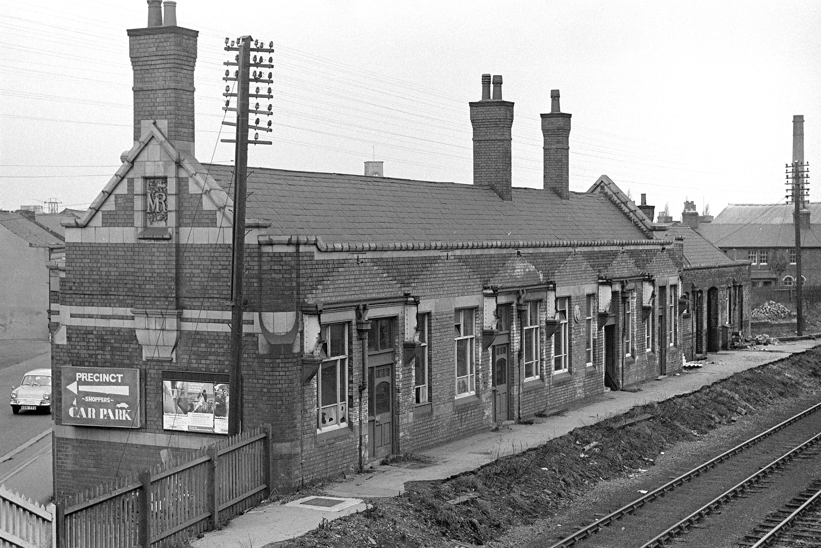
Coalville Town railway station

Coalville Town was a railway station at Coalville in Leicestershire on the Leicester to Burton upon Trent Line. Passenger business was carried out at the...

The Emporium, Leicestershire

The Emporium is a club located in Coalville, Leicestershire established under that name in 1995. Passion was launched in 1995 by the then club owners Mark...

North West Leicestershire

North West Leicestershire is a local government district in Leicestershire, England. The council is based in Coalville, the area's largest town. The district...
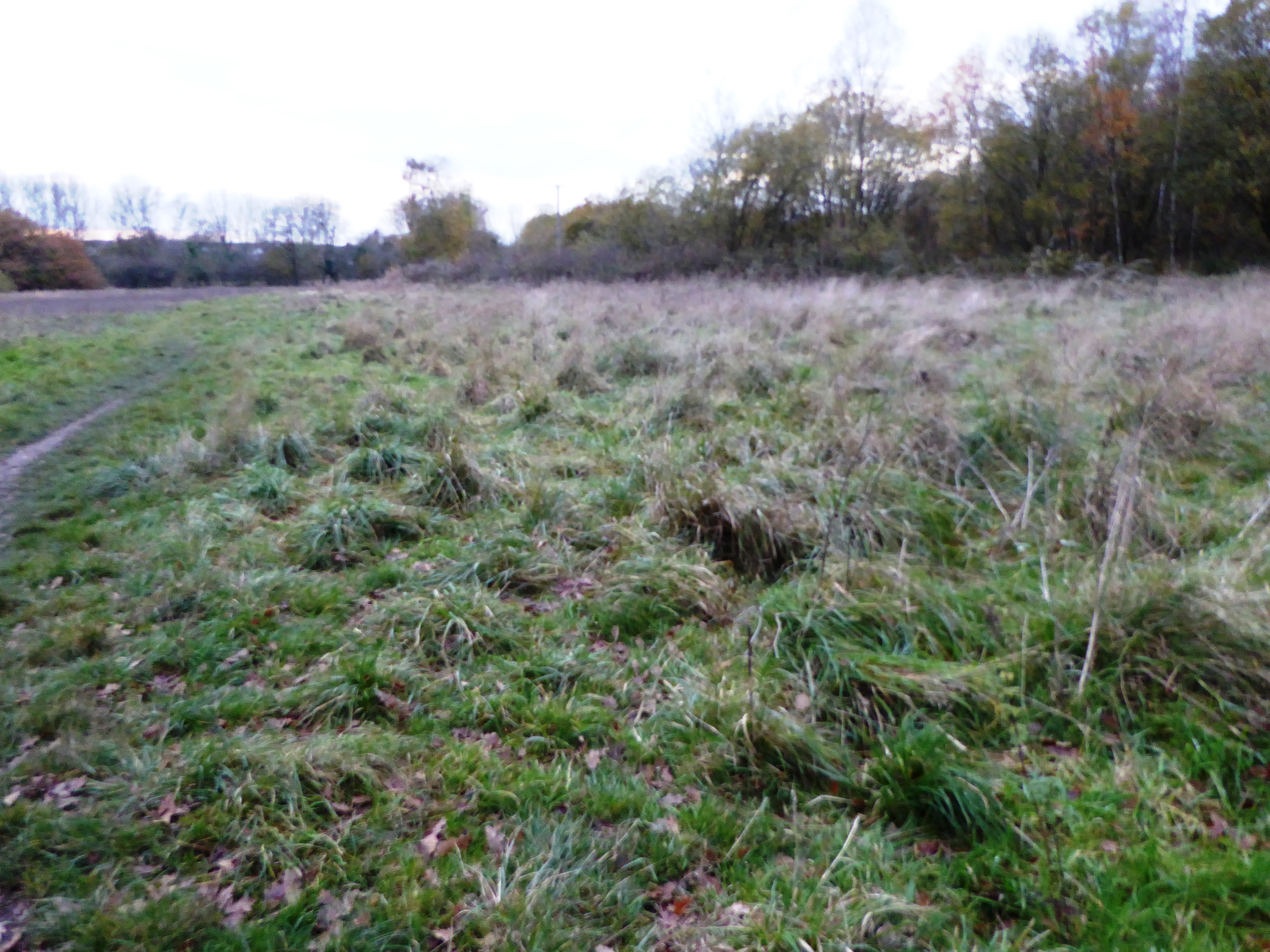
Coalville Meadows

Coalville Meadows is a 6.0 hectares (15 acres) biological Site of Special Scientific Interest between Whitwick and Coalville in Leicestershire. It is managed...

Nearby Amenities

Located within 500m of 52.724122,-1.355882
Traffic Signals
Lat/Long: 52.7207519/-1.3600592
Bus Stop
Broom Leys Road
Alt Name: Coalville District Hospital
Bus: yes
Naptan AltCommonName: Coalville District Hospital
Naptan AltIndicator: Near to
Naptan AltLandmark: Hospital
Naptan AltShortCommonName: Coalville District Hospital
Naptan AltStreet: Broom Leys Road
Naptan AtcoCode: 260013933
Naptan Bearing: W
Naptan CommonName: Broom Leys Road
Naptan Indicator: adj
Naptan Landmark: 82 Broom Leys Road
Naptan NaptanCode: leijdwtj
Naptan Notes: Hourly - County
Naptan Street: Broom Leys Road
Naptan Verified: no
Public Transport: platform
Source: naptan_import
Lat/Long: 52.7222342/-1.3531683
Bus Stop
London Road
Bus: yes
Naptan AtcoCode: 260013934
Naptan Bearing: NE
Naptan CommonName: London Road
Naptan Indicator: adjacent
Naptan Landmark: London Road
Naptan NaptanCode: leijdwtm
Naptan Notes: Hourly - County
Naptan Street: Broom Leys Road
Naptan Verified: no
Public Transport: platform
Source: naptan_import
Lat/Long: 52.7210567/-1.3598335
Bus Stop
Broom Leys Road
Bus: yes
Naptan AtcoCode: 260013935
Naptan Bearing: E
Naptan CommonName: Broom Leys Road
Naptan Indicator: opposite
Naptan Landmark: 82 Broom Leys Road
Naptan NaptanCode: leijdwtp
Naptan Notes: Hourly - County
Naptan Street: Broom Leys Road
Naptan Verified: no
Public Transport: platform
Source: naptan_import
Lat/Long: 52.7223851/-1.3528107
Bus Stop
Forest Road
Bus: yes
Naptan AtcoCode: 260013936
Naptan Bearing: NW
Naptan CommonName: Forest Road
Naptan Indicator: adjacent
Naptan Landmark: Forest Road
Naptan NaptanCode: leijdwtw
Naptan Notes: Hourly - County
Naptan Street: London Road
Naptan Verified: no
Public Transport: platform
Source: naptan_import
Lat/Long: 52.7211545/-1.3612978
Bus Stop
Forest Road
Bus: yes
Naptan AtcoCode: 260013996
Naptan Bearing: SE
Naptan CommonName: Forest Road
Naptan Indicator: opposite
Naptan Landmark: Forest Road
Naptan NaptanCode: leijgatd
Naptan Notes: Hourly - County
Naptan Street: London Road
Naptan Verified: no
Public Transport: platform
Source: naptan_import
Lat/Long: 52.7205417/-1.3593524
Bus Stop
Long Lane Surgery
Bus: yes
Naptan AtcoCode: 260014076
Naptan Bearing: NE
Naptan CommonName: Long Lane Surgery
Naptan Indicator: outside
Naptan Landmark: Long Lane Surgery
Naptan NaptanCode: leijgdtm
Naptan Notes: Hourly - County
Naptan Street: Broom Leys Road
Naptan Verified: no
Public Transport: platform
Source: naptan_import
Lat/Long: 52.7216561/-1.3576186
Spar
Addr City: Coalville
Addr Housenumber: 2
Addr Postcode: LE67 4DA
Addr Street: Broom Leys Road
Brand: Spar
Brand Wikidata: Q610492
Brand Wikipedia: en:Spar (retailer)
Fhrs Id: 575899
Opening Hours: Mo-Su 07:00-23:00
Shop: convenience
Source: survey
Source Addr: FHRS Open Data
Website: https://www.spar.co.uk/store-locator/afb14486-spar-coalville/
Lat/Long: 52.7214918/-1.3591171
Traffic Signals
Lat/Long: 52.7220555/-1.3552568
Addr Housenumber: 82
Addr Street: Broom Leys Road
Source: Naptan
Lat/Long: 52.7220892/-1.3531191
Generator Method: photovoltaic
Generator Output Electricity: yes
Generator Source: solar
Generator Type: solar_photovoltaic_panel
Location: roof
Power: generator
Lat/Long: 52.724012/-1.3570172
Generator Method: photovoltaic
Generator Output Electricity: yes
Generator Source: solar
Generator Type: solar_photovoltaic_panel
Location: roof
Power: generator
Lat/Long: 52.7222657/-1.3578487
Generator Method: photovoltaic
Generator Output Electricity: yes
Generator Source: solar
Generator Type: solar_photovoltaic_panel
Location: roof
Power: generator
Lat/Long: 52.7243751/-1.3576938
Generator Method: photovoltaic
Generator Output Electricity: yes
Generator Source: solar
Generator Type: solar_photovoltaic_panel
Location: roof
Power: generator
Lat/Long: 52.7250647/-1.3588786
Generator Method: photovoltaic
Generator Output Electricity: yes
Generator Source: solar
Generator Type: solar_photovoltaic_panel
Location: roof
Power: generator
Lat/Long: 52.7258006/-1.358949
Generator Method: photovoltaic
Generator Output Electricity: yes
Generator Source: solar
Generator Type: solar_photovoltaic_panel
Location: roof
Power: generator
Lat/Long: 52.7205479/-1.360243
Generator Method: photovoltaic
Generator Output Electricity: yes
Generator Source: solar
Generator Type: solar_photovoltaic_panel
Location: roof
Power: generator
Lat/Long: 52.7215157/-1.3613714
Generator Method: photovoltaic
Generator Output Electricity: yes
Generator Source: solar
Generator Type: solar_photovoltaic_panel
Location: roof
Power: generator
Lat/Long: 52.7220693/-1.3533048
Generator Method: photovoltaic
Generator Output Electricity: yes
Generator Source: solar
Generator Type: solar_photovoltaic_panel
Location: roof
Power: generator
Lat/Long: 52.7218828/-1.3598416
Coalville East
Abandoned Railway: station
Railway: site
Wikidata: Q104868217
Wikipedia: en:Coalville East railway station
Lat/Long: 52.7234261/-1.3592384
Post Office
Addr City: Coalville
Addr Housenumber: 2
Addr Postcode: LE67 4DA
Addr Street: Broom Leys Road
Brand: Post Office
Brand Wikidata: Q1783168
Operator: Spar
Operator Wikidata: Q610492
Ref Pol Id: 129508
Lat/Long: 52.7215283/-1.3590914
The data included in this document is from www.openstreetmap.org. The data is made available under ODbL.

Have you been to Coalville?

Leave your review of Coalville below (or comments, questions and feedback).