Burnt Coppice

Wood, Forest in Herefordshire

England

Burnt Coppice

Arthur's Stone The remains of a Neolithic chambered tomb. It is named after King Arthur but it pre-dates this legendary king by thousands of years.  It is thought to date from between 3,700BC and 2,700BC.  It is situated almost 1000ft up on top of a hill between Bredwardine and Dorstone.
Arthur's Stone Credit: Philip Halling

Burnt Coppice is a serene woodland located in the county of Herefordshire, England. This enchanting forest covers an area of approximately 500 acres and is renowned for its natural beauty and rich biodiversity.

The woodland is predominantly composed of coppiced trees, which are periodically cut down and allowed to regrow, creating a diverse habitat for various species of flora and fauna. The main tree species found here include oak, ash, birch, and beech, which provide a stunning display of colors throughout the seasons.

Burnt Coppice is a haven for wildlife enthusiasts, as it is home to a wide range of animals. Birdwatchers can spot species such as woodpeckers, jays, and owls, while mammal lovers may encounter foxes, badgers, and deer. The forest floor is adorned with a plethora of wildflowers, including bluebells, primroses, and orchids, adding to the picturesque ambiance.

Visitors to Burnt Coppice can explore the woodland through a network of well-maintained trails that meander through the trees. These paths offer a chance to immerse oneself in the peaceful atmosphere and appreciate the natural wonders that this woodland has to offer. The forest is also a popular spot for picnics, nature photography, and forest bathing, providing a serene escape from the hustle and bustle of everyday life.

Burnt Coppice is not only a place of natural beauty but also an important ecological site. Its conservation efforts ensure the preservation of its unique ecosystem and contribute to the overall well-being of the Herefordshire countryside.

If you have any feedback on the listing, please let us know in the comments section below.

Burnt Coppice Images

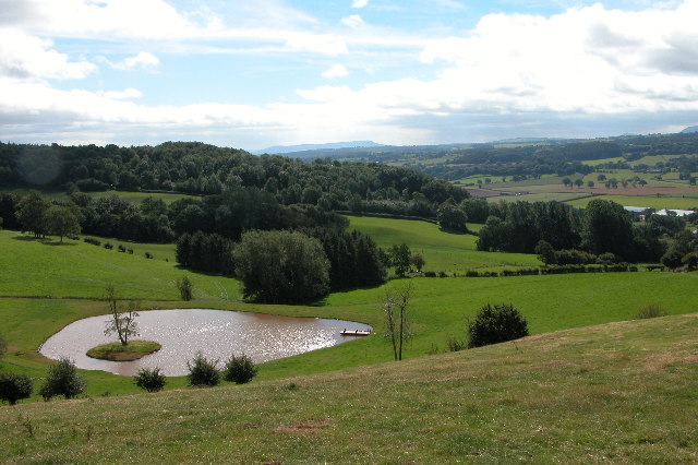
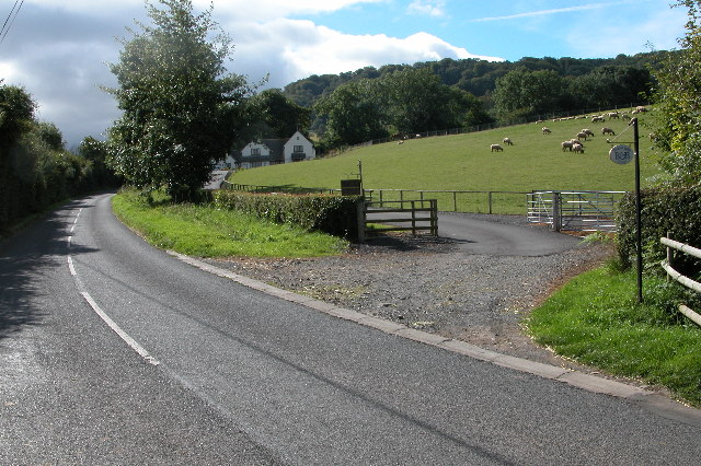
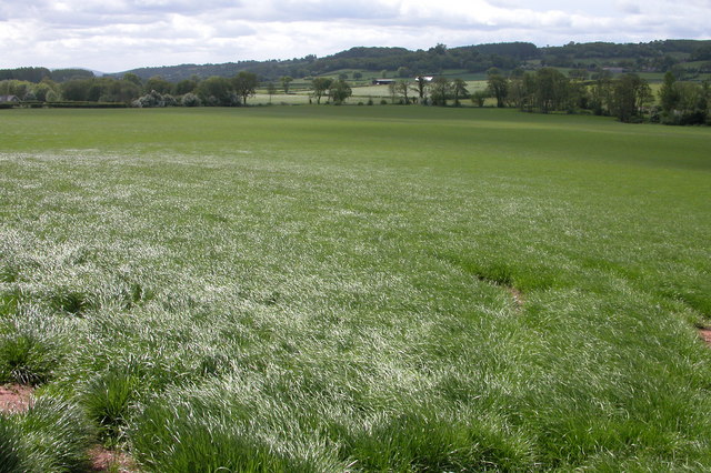
Images are sourced within 2km of 52.072723/-2.9728832 or Grid Reference SO3342. Thanks to Geograph Open Source API. All images are credited.

Arthur's Stone The remains of a Neolithic chambered tomb. It is named after King Arthur but it pre-dates this legendary king by thousands of years.  It is thought to date from between 3,700BC and 2,700BC.  It is situated almost 1000ft up on top of a hill between Bredwardine and Dorstone.
Arthur's Stone
The remains of a Neolithic chambered tomb. It is named after King Arthur but it pre-dates this legendary king by thousands of years. It is thought to date from between 3,700BC and 2,700BC. It is situated almost 1000ft up on top of a hill between Bredwardine and Dorstone.
Hay Bluff and Black Mountains Silage stacked in the corner of a field on the side of Arthur's Stone Lane near Upper Barn above the village of Dorstone in the Golden Valley.  On the horizon is Hay Bluff and the Black Mountains.
Hay Bluff and Black Mountains
Silage stacked in the corner of a field on the side of Arthur's Stone Lane near Upper Barn above the village of Dorstone in the Golden Valley. On the horizon is Hay Bluff and the Black Mountains.
New farm track to Upper Bodcott Farm Farm track to Upper Bodcott Farm, beyond is the countryside of north Herefordshire, and on the horizon Cleehill in Shropshire.
New farm track to Upper Bodcott Farm
Farm track to Upper Bodcott Farm, beyond is the countryside of north Herefordshire, and on the horizon Cleehill in Shropshire.
Dorstone Hill Dorstone Hill viewed from the footpath descending from Arthur's Stone to the village of Dorstone
Dorstone Hill
Dorstone Hill viewed from the footpath descending from Arthur's Stone to the village of Dorstone
The Golden Valley View south down the Golden Valley from the footpath which descends from Arthur's Stone to the village of Dorstone
The Golden Valley
View south down the Golden Valley from the footpath which descends from Arthur's Stone to the village of Dorstone
Bodcott Lodge B&B guest house about half a mile south of Bredwardine on the B4352.
Bodcott Lodge
B&B guest house about half a mile south of Bredwardine on the B4352.
Snowy fields in the Golden Valley
The River Wye Typical shot of the River Wye, this could really be anywhere in Herefordshire.
The River Wye
Typical shot of the River Wye, this could really be anywhere in Herefordshire.
Moccas Deer Park This privately owned deer park covers 90% of this square. In 1876 Reverend Francis Kilvert described many old and gnarled oaks. I'm not sure if these are the same ones.
Moccas Deer Park
This privately owned deer park covers 90% of this square. In 1876 Reverend Francis Kilvert described many old and gnarled oaks. I'm not sure if these are the same ones.
The Golden Valley, Dorstone The Golden Valley is so named after the River Dore which flows through it. These fields are located to the south-east of Dorstone.
The Golden Valley, Dorstone
The Golden Valley is so named after the River Dore which flows through it. These fields are located to the south-east of Dorstone.
Dorstone Church Dorstone church is dedicated to St Faith, though dating from medieval times the church was largely rebuilt in 1889.
Dorstone Church
Dorstone church is dedicated to St Faith, though dating from medieval times the church was largely rebuilt in 1889.
Arthur's Stone
Arthur's Stone
Track to Cross Lodge By the B4348 Golden Valley road between Dorstone and Peterchurch.
Track to Cross Lodge
By the B4348 Golden Valley road between Dorstone and Peterchurch.
Moccas deer park Old and young trees in late winter setting south of the Wye.
Moccas deer park
Old and young trees in late winter setting south of the Wye.
Sheep by Cross End Farm View north of the B4352 opposite Moccas Park.
Sheep by Cross End Farm
View north of the B4352 opposite Moccas Park.
Bodcott lane, near Bredwardine Track, and right of way between lower Bodcott Farm and Upper Bodcott Farm.
Bodcott lane, near Bredwardine
Track, and right of way between lower Bodcott Farm and Upper Bodcott Farm.
Woodbury Hill Wood The ridge which terminates at Merbach Hill is mostly wooded on this northern side.
Woodbury Hill Wood
The ridge which terminates at Merbach Hill is mostly wooded on this northern side.
Mistletoe harvest An old cider orchard at Woodbury Farm yields a sustainable cash-crop at this time of year.
Mistletoe harvest
An old cider orchard at Woodbury Farm yields a sustainable cash-crop at this time of year.
Show me another place!

Burnt Coppice is located at Grid Ref: SO3342 (Lat: 52.072723, Lng: -2.9728832)

Unitary Authority: County of Herefordshire

Police Authority: West Mercia

What 3 Words

///grownup.crackled.shortcuts. Near Dorstone, Herefordshire

Nearby Locations

Burnt Coppice

Related Wikis

Dorstone railway station

Dorstone railway station was a station in Dorstone, Herefordshire, England. The station was opened in 1881, closed to passengers in 1941 and closed completely...

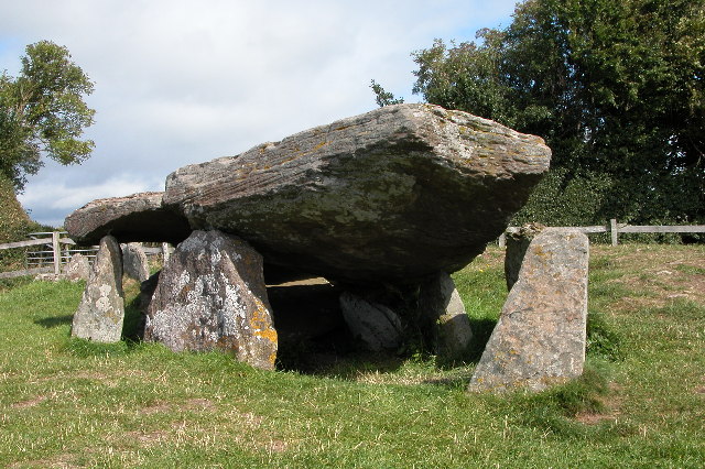
Arthur's Stone, Herefordshire

Arthur's Stone is a Neolithic chambered tomb, or dolmen, in Herefordshire, England. It is situated on the ridge line of a hill overlooking both the Golden...

Dorstone

Dorstone is a village within the Golden Valley, Herefordshire, England. There is a church and public house with restaurant. The Golden Valley area offers...

Snodhill Castle

Snodhill Castle is a ruined motte-and-bailey castle, about 1 mi (1.6 km) south of the village of Dorstone in west Herefordshire, England. It is recognized...

Nearby Amenities

Located within 500m of 52.072723,-2.9728832
Archaeological Site: tumulus
Historic: archaeological_site
Lat/Long: 52.0694677/-2.9751705
Power: pole
Source: Bing
Lat/Long: 52.0695385/-2.9773729
Power: pole
Source: Bing
Lat/Long: 52.0693952/-2.9752862
Power: pole
Source: Bing
Lat/Long: 52.0694694/-2.9763295
Power: pole
Source: Bing
Lat/Long: 52.0688757/-2.974967
Power: pole
Source: Bing
Lat/Long: 52.0687834/-2.9730546
Bench
Material: stone
Lat/Long: 52.0735468/-2.9731637
Parking
Surface: gravel
Lat/Long: 52.0760804/-2.9756653
The data included in this document is from www.openstreetmap.org. The data is made available under ODbL.

Have you been to Burnt Coppice?

Leave your review of Burnt Coppice below (or comments, questions and feedback).