Ball Copse

Wood, Forest in Somerset Sedgemoor

England

Ball Copse

Harp Road looking to the rear of the Fox & Goose Inn
Harp Road looking to the rear of the Fox & Goose Inn Credit: Adrian and Janet Quantock

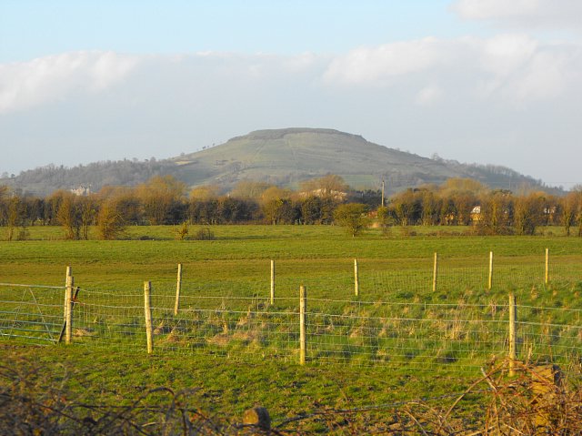
Ball Copse is a small but enchanting woodland located in Somerset, England. Nestled in the heart of the county, it offers visitors a tranquil escape from the hustle and bustle of everyday life. Covering an area of approximately 10 acres, Ball Copse boasts a diverse range of trees and plant species, creating a rich and vibrant ecosystem.

The woodland is predominantly made up of deciduous trees, including oak, beech, and ash, which provide a stunning display of colors throughout the seasons. In spring, the forest floor comes alive with a carpet of bluebells, offering a breathtaking sight for nature enthusiasts and photographers alike.

Numerous walking trails wind their way through Ball Copse, allowing visitors to explore its hidden treasures. As they meander through the woods, visitors may spot a variety of wildlife, such as deer, foxes, and a myriad of bird species. It is also not uncommon to encounter squirrels darting through the treetops or rabbits scurrying across the forest floor.

For those seeking a peaceful spot to relax and soak in the natural beauty, there are several picnic areas scattered throughout the woodland. These spots offer the perfect opportunity to enjoy a packed lunch amidst the serenity of the trees.

Ball Copse is easily accessible, located just a short drive from the town of Somerset. It is a popular destination for nature lovers, hikers, and families looking to reconnect with nature. With its picturesque scenery and abundant wildlife, Ball Copse is a true gem in the Somerset countryside.

If you have any feedback on the listing, please let us know in the comments section below.
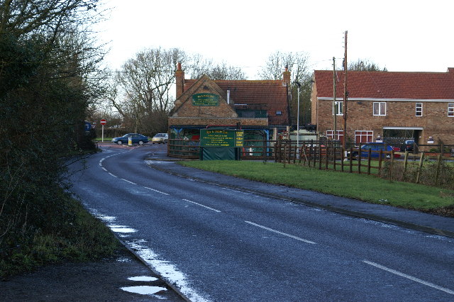
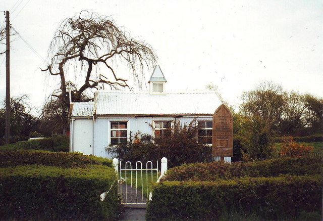
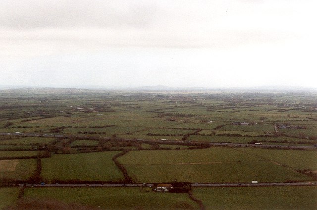
Ball Copse Images

Images are sourced within 2km of 51.256224/-2.9562186 or Grid Reference ST3351. Thanks to Geograph Open Source API. All images are credited.

Harp Road looking to the rear of the Fox & Goose Inn
Field looking toward Brent Knoll from the B3140
Water feature at Sanders Gardenworld The central feature of the outdoor plant area, looking towards the rear of the garden centre with Brent Knoll in the background.
Water feature at Sanders Gardenworld
The central feature of the outdoor plant area, looking towards the rear of the garden centre with Brent Knoll in the background.
View to the Fox and Goose Inn Looking towards the A38 junction.
View to the Fox and Goose Inn
Looking towards the A38 junction.
Sheep pasture between the M5 and A38 View south-west from the Harp Road.
Sheep pasture between the M5 and A38
View south-west from the Harp Road.
Brent Knoll Looking over lush green fields to Brent Knoll
Brent Knoll
Looking over lush green fields to Brent Knoll
Edithmead Church Galvanised iron churches became popular towards the end of the Victorian period.  They came in kit form from catalogues, and in a choice of styles and sizes; this is one of the smaller ones.  Being cheap and easy to erect they were usually seen as a temporary measure, and were replaced by a 'proper' church when finances allowed.  This is a late one, built somewhere around 1920, and is also one of the relatively few remaining in use.
Edithmead Church
Galvanised iron churches became popular towards the end of the Victorian period. They came in kit form from catalogues, and in a choice of styles and sizes; this is one of the smaller ones. Being cheap and easy to erect they were usually seen as a temporary measure, and were replaced by a 'proper' church when finances allowed. This is a late one, built somewhere around 1920, and is also one of the relatively few remaining in use.
Edithmead church, Somerset
Northbound M5 with a glimpse of the Mendips in the distance
They won't see much of the sun down there Looking down from the lofty Brent Knoll the flat landscapes of north Somerset are still bathed in morning frost and fog. The 'big top' visible is the annual Christmas circus that visits Sanders garden centre.
They won't see much of the sun down there
Looking down from the lofty Brent Knoll the flat landscapes of north Somerset are still bathed in morning frost and fog. The 'big top' visible is the annual Christmas circus that visits Sanders garden centre.
Brent Knoll : M5 Motorway Heading north on the M5 Motorway.
Brent Knoll : M5 Motorway
Heading north on the M5 Motorway.
Towards Glastonbury Tor from Brent Knoll The view across the Somerset Levels with (in my original picture) Glastonbury Tor in the distance.
Towards Glastonbury Tor from Brent Knoll
The view across the Somerset Levels with (in my original picture) Glastonbury Tor in the distance.
Brent Knoll with M5 Signage
East Brent: Crook Peak and East Brent Church The spire of East Brent church on the right. Across the Somerset Levels, Crook Peak, 620', one of the Mendip hills, on the left. This was a beacon hill at the time of the Spanish Armada: Banwell churchwardens’ accounts for 1580 record payment for a load of wood ‘for the beakon’ to ‘Croke peke’. The M5 Motorway runs past to its left.
East Brent: Crook Peak and East Brent Church
The spire of East Brent church on the right. Across the Somerset Levels, Crook Peak, 620', one of the Mendip hills, on the left. This was a beacon hill at the time of the Spanish Armada: Banwell churchwardens’ accounts for 1580 record payment for a load of wood ‘for the beakon’ to ‘Croke peke’. The M5 Motorway runs past to its left.
East Brent: Brent Knoll from the north An Iron Age hillfort was built at the top of the hill, the interior - an area of 1.6 hectares - now lost to archaeological investigation, quarried for its Lias sandstone. Before the monks of Glastonbury Abbey drained the Somerset Levels in medieval times, the hill must have been virtually isolated, an island surrounded by marsh. It now belongs to the National Trust.
East Brent: Brent Knoll from the north
An Iron Age hillfort was built at the top of the hill, the interior - an area of 1.6 hectares - now lost to archaeological investigation, quarried for its Lias sandstone. Before the monks of Glastonbury Abbey drained the Somerset Levels in medieval times, the hill must have been virtually isolated, an island surrounded by marsh. It now belongs to the National Trust.
St Michael's Church in Brent Knoll The 75' tower is embellished with a number of gargoyles. Behind the church starts a footpath that takes you to the top of Brent Knoll
St Michael's Church in Brent Knoll
The 75' tower is embellished with a number of gargoyles. Behind the church starts a footpath that takes you to the top of Brent Knoll
Field of Sheep In the background to the right is Crooks Peak.
This picture is dedicated to Dominic Paterson, fellow 'squarer' (a name we call ourselves when out collecting geographs)
Field of Sheep
In the background to the right is Crooks Peak. This picture is dedicated to Dominic Paterson, fellow 'squarer' (a name we call ourselves when out collecting geographs)
Railway bridge near Ham
Show me another place!

Ball Copse is located at Grid Ref: ST3351 (Lat: 51.256224, Lng: -2.9562186)

Administrative County: Somerset

District: Sedgemoor

Police Authority: Avon and Somerset

What 3 Words

///thinks.distorts.travels. Near Brent Knoll, Somerset

Nearby Locations

Giles's Copse Ball Copse

Related Wikis

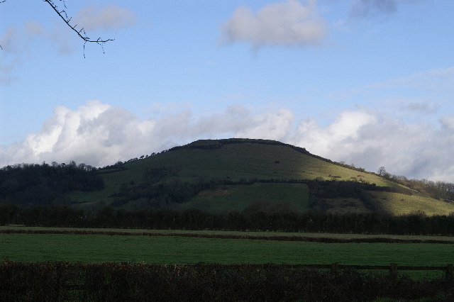
Brent Knoll (village)

Brent Knoll, formerly known as South Brent, is a village and civil parish in Somerset, England, which lies on the southern edge of Brent Knoll – a hill...

Brent Knoll

Brent Knoll is a 137-metre-high (449 ft) hill on the Somerset Levels, in Somerset, England. It is located roughly halfway between Weston-super-Mare and...

Brent Knoll Camp

Brent Knoll Camp is an Iron Age hillfort at Brent Knoll, 3 kilometres (1.9 mi) from Burnham-on-Sea, Somerset, England. It has been designated as a Scheduled...

East Brent

East Brent is a village and civil parish, on the eastern edge of a hill that dominates the surrounding level countryside—Brent Knoll—close to the M5 motorway...

Hill Brow Preparatory School for Boys

Hill Brow Preparatory School for Boys was a small English preparatory school, initially based in Eastbourne, East Sussex, but subsequently relocated to...

Burnham Without

Burnham Without is a civil parish in the main located to the east of Burnham-on-Sea and to the north and northeast of Highbridge in Somerset, England....

Sedgemoor services

Sedgemoor services is a motorway service station on the M5 motorway near the village of Rooks Bridge in Somerset, England. The location of the services...

Oaktree Arena

The Oaktree Arena was a speedway racing track located near Highbridge, Somerset, England, and is built alongside the M5 motorway. The track, which was...

Nearby Amenities

Located within 500m of 51.256224,-2.9562186
Woodlands Country House Hotel
Building: yes
Tourism: hotel
Lat/Long: 51.2548197/-2.9549291
Barrier: stile
Lat/Long: 51.2528601/-2.9533859
Barrier: stile
Lat/Long: 51.2588933/-2.9593435
Post Box
Brand: Royal Mail
Brand Wikidata: Q638098
Operator: Royal Mail
Operator Wikidata: Q638098
Post Box Type: lamp
Ref: TA9 71D
Royal Cypher: EIIR
Royal Cypher Wikidata: Q33102113
Lat/Long: 51.253454/-2.9592906
Power: pole
Transformer: distribution
Lat/Long: 51.2524872/-2.9594344
The data included in this document is from www.openstreetmap.org. The data is made available under ODbL.

Have you been to Ball Copse?

Leave your review of Ball Copse below (or comments, questions and feedback).