Long Covert

Wood, Forest in Shropshire

England

Long Covert

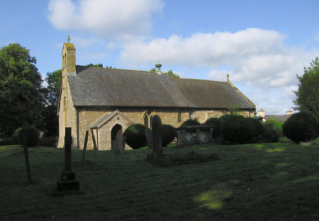
Church Farm, More
Church Farm, More Credit: Chris Andrews

Long Covert is a picturesque woodland area located in Shropshire, England. Situated in the heart of the county, this forested region is known for its serene beauty and rich biodiversity. Covering an expansive area, Long Covert is a haven for nature enthusiasts and outdoor adventurers.

The woodland is characterized by a dense canopy of towering trees, including oak, beech, and ash, which provide a habitat for a diverse range of flora and fauna. Wildflowers such as bluebells and primroses adorn the forest floor during the spring season, creating a vibrant and colorful landscape. Additionally, Long Covert is home to various species of birds, including woodpeckers, owls, and thrushes, making it a popular spot for birdwatchers.

The forest offers numerous walking trails and paths, allowing visitors to explore the area and enjoy its natural beauty. There are also designated picnic areas where visitors can relax and soak in the peaceful atmosphere. Long Covert is well-maintained, with well-marked trails and informative signage providing information about the local flora, fauna, and history of the area.

Due to its secluded location and tranquil surroundings, Long Covert provides an ideal escape from the hustle and bustle of city life. It is a popular destination for nature lovers, hikers, and families seeking a peaceful retreat. Whether one is looking to reconnect with nature, observe wildlife, or simply enjoy a leisurely stroll, Long Covert offers a truly immersive and enriching woodland experience.

If you have any feedback on the listing, please let us know in the comments section below.

Long Covert Images

Images are sourced within 2km of 52.505131/-2.9850866 or Grid Reference SO3390. Thanks to Geograph Open Source API. All images are credited.

Church Farm, More
Church Farm, More
LDWA 2011 Houseman 100 Lydham Village Hall at 55.5 miles and the breakfast stop for the walkers.  It's 11-15pm and the first runner is in.
LDWA 2011 Houseman 100
Lydham Village Hall at 55.5 miles and the breakfast stop for the walkers. It's 11-15pm and the first runner is in.
LDWA 2011 Houseman 100 It's 7-30am and 211/2 hours into the walk. This is checkpoint 7 out of 12. At this checkpoint around 30 helpers see to the walkers every need before they set off again to walk the 45miles to the finish.
LDWA 2011 Houseman 100
It's 7-30am and 211/2 hours into the walk. This is checkpoint 7 out of 12. At this checkpoint around 30 helpers see to the walkers every need before they set off again to walk the 45miles to the finish.
LDWA 2011 Houseman 100 55.5 miles done only 45 to go.  Walkers leave Lydham on the LDWA Houseman 100 mile walk.
LDWA 2011 Houseman 100
55.5 miles done only 45 to go. Walkers leave Lydham on the LDWA Houseman 100 mile walk.
LDWA 2011 Houseman 100, waiting for their owners Lydham Village Hall. Each walker is allowed a bag that is delivered to them at the breakfast checkpoint.
LDWA 2011 Houseman 100, waiting for their owners
Lydham Village Hall. Each walker is allowed a bag that is delivered to them at the breakfast checkpoint.
Looking down the A488 Love Lane near Bishop's Castle
A minor road towards Eyton
A footpath to Bishop's Castle
Turn left for Lea
Turn left for Lea
Entering Bishop's Castle
Newton Farm
Newton Farm
Joining the A489 at Lydham Heath
The A489 towards Lydham
The A489 joins the A488 at Lydham
LDWA 2011 Houseman 100 It's 9-55pm and the checkpoint staff are having a rest after spending the last 10 hours getting the hall ready for the first of the 500 walkers and runners who have entered this years hundred.  Most of these helpers will be here working for 24 hours without much rest.
LDWA 2011 Houseman 100
It's 9-55pm and the checkpoint staff are having a rest after spending the last 10 hours getting the hall ready for the first of the 500 walkers and runners who have entered this years hundred. Most of these helpers will be here working for 24 hours without much rest.
Lily and Rose cottages in Lydham
Station Street, Bishop's Castle The distant hill being bathed in some late evening sunshine could be Sunnyhill near Clunton.
Station Street, Bishop's Castle
The distant hill being bathed in some late evening sunshine could be Sunnyhill near Clunton.
Show me another place!

Long Covert is located at Grid Ref: SO3390 (Lat: 52.505131, Lng: -2.9850866)

Unitary Authority: Shropshire

Police Authority: West Mercia

What 3 Words

///sharpened.pairings.rinsed. Near Lydham, Shropshire

Nearby Locations

Long Covert Lydham

Related Wikis

Lydham

Lydham is a small village and civil parish in Shropshire, England. Lydham is situated on the junction of the A488 and the A489 main roads, about 2 miles...

Lydham Heath railway station

Lydham Heath railway station was a station in Lydham, Shropshire, England. The station was opened on 1 February 1866 and closed on 20 April 1935.As of...

Bishop's Castle Town Hall

Bishop's Castle Town Hall is a municipal building in the High Street in Bishop's Castle, Shropshire, England. The building, which is the meeting place...

Bishop's Castle

Bishop's Castle is a market town in the south west of Shropshire, England. According to the 2011 Census it had a population of 1,893. Bishop's Castle is...

Bishop's Castle railway station

Bishop's Castle railway station was a station in Bishop's Castle, Shropshire, England. The station was opened on 1 February 1866 and closed on 20 April...

More, Shropshire

More is a small village and civil parish in Shropshire, England. It lies near the border with Wales and the nearest town is Bishop's Castle. There is a...

Cabin, Shropshire

Cabin is a village in Shropshire, England.

Bishop's Castle Community College

Bishop's Castle Community College is a coeducational secondary school located in Bishop's Castle in the English county of Shropshire.Established in 1922...

Nearby Amenities

Located within 500m of 52.505131,-2.9850866
Power: pole
Source: bing
Lat/Long: 52.5023317/-2.9807764
Power: pole
Ref: 841374
Source: wpd_open_data
Transformer: distribution
Voltage: 11000
Lat/Long: 52.5042306/-2.9876241
Power: pole
Source: bing
Lat/Long: 52.5034746/-2.9855803
Power: pole
Source: bing
Lat/Long: 52.5031367/-2.9846469
Power: pole
Source: bing
Lat/Long: 52.5029407/-2.9836625
Power: pole
Source: bing
Lat/Long: 52.5028068/-2.9830188
Power: pole
Source: bing
Lat/Long: 52.505473/-2.9821283
Power: pole
Ref: 841378
Source: wpd_open_data
Transformer: distribution
Voltage: 11000
Lat/Long: 52.5059726/-2.9833084
Power: pole
Source: bing
Lat/Long: 52.5075056/-2.9796553
Power: pole
Source: bing
Lat/Long: 52.506877/-2.9799664
Power: pole
Source: bing
Lat/Long: 52.5062795/-2.9802615
Power: pole
Source: bing
Lat/Long: 52.5056167/-2.9806048
Power: pole
Source: bing
Lat/Long: 52.5049571/-2.9809105
Power: pole
Source: bing
Lat/Long: 52.5043759/-2.9812378
Power: pole
Source: bing
Lat/Long: 52.5037783/-2.9815489
Power: pole
Source: bing
Lat/Long: 52.5031318/-2.9818761
Power: pole
Source: bing
Lat/Long: 52.5026126/-2.9821122
Power: pole
Source: bing
Lat/Long: 52.501659/-2.9825896
Power: pole
Source: bing
Lat/Long: 52.5008884/-2.9830188
The data included in this document is from www.openstreetmap.org. The data is made available under ODbL.

Have you been to Long Covert?

Leave your review of Long Covert below (or comments, questions and feedback).