Lord's Wood
Wood, Forest in Somerset Somerset West and Taunton
England
Lord's Wood

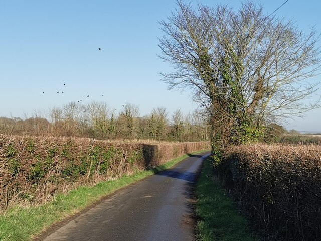
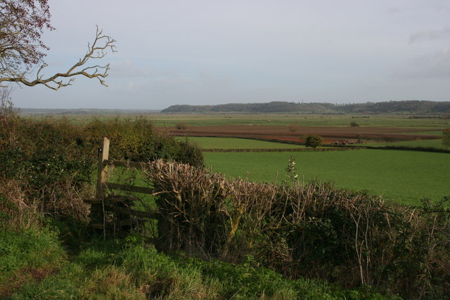
Lord's Wood is a picturesque woodland located in Somerset, England. Situated near the village of West Lyng, it covers an area of approximately 50 acres, making it a significant natural landscape in the region. The wood is part of the wider Somerset Levels and Moors, an area renowned for its stunning landscapes and rich biodiversity.
Lord's Wood is primarily composed of deciduous trees, including oak, ash, beech, and birch, creating a diverse and vibrant woodland habitat. The trees provide a dense canopy, offering shelter and food sources for a variety of wildlife species. The forest floor is covered in a thick layer of leaf litter, which supports a range of plants and fungi.
The wood is crisscrossed by a network of well-maintained footpaths, allowing visitors to explore the area and appreciate its natural beauty. These paths lead to small clearings, where visitors can rest and enjoy the tranquility of the surroundings. Lord's Wood also features a small stream that meanders through the woodland, adding to the charm and providing a water source for the local wildlife.
The wood is managed sustainably, with periodic selective thinning of trees to promote growth and maintain a healthy ecosystem. This careful management ensures the long-term health and vitality of the woodland while preserving its natural character.
Lord's Wood is a haven for wildlife enthusiasts and nature lovers, attracting a variety of bird species, including woodpeckers, thrushes, and owls. Mammals such as badgers, foxes, and deer also call this woodland home. The diverse range of flora and fauna makes Lord's Wood a valuable ecological resource and an important part of Somerset's natural heritage.
If you have any feedback on the listing, please let us know in the comments section below.
Lord's Wood Images
Images are sourced within 2km of 51.002587/-2.9562951 or Grid Reference ST3223. Thanks to Geograph Open Source API. All images are credited.


Lord's Wood is located at Grid Ref: ST3223 (Lat: 51.002587, Lng: -2.9562951)
Administrative County: Somerset
District: Somerset West and Taunton
Police Authority: Avon and Somerset
What 3 Words
///sitting.translate.structure. Near Creech St Michael, Somerset
Nearby Locations
Related Wikis

Fivehead Woods and Meadow
Fivehead Woods and Meadow (grid reference ST331231) is a 62.4 hectare (154.2 acre) biological Site of Special Scientific Interest near the village of Fivehead...
Fivehead Arable Fields
Fivehead Arable Fields (grid reference ST337224) is a 10.3 hectare (25.4 acre) biological Site of Special Scientific Interest near the village of Fivehead...

Curry Mallet
Curry Mallet (anciently "Cory Mallett") is a village and parish in Somerset, England. It is on the Fivehead River (also known as the River Ile), 7 miles...
Church of St James, Curry Mallet
The Church of St James is a Church of England parish church in Curry Mallet, Somerset. It has 13th-century origins and has been designated as a Grade I...
North Curry Meadow
North Curry Meadow (grid reference ST330253) is a 1.3 hectare (3.1 acre) biological Site of Special Scientific Interest in North Curry, Somerset, England...

St Martin's Church, Fivehead
The Anglican Church of St Martin in Fivehead, Somerset, England dates from the 13th century and has been designated as a Grade I listed building.The church...

North Curry
North Curry is a village and civil parish in Somerset, England, 5 miles (8.0 km) east of Taunton. The parish, which includes several hamlets, had a population...
Fivehead
Fivehead is a village and civil parish in Somerset, England, situated on the Fivehead River, 8 miles (12.9 km) east of Taunton in the South Somerset district...
Nearby Amenities
Located within 500m of 51.002587,-2.9562951Have you been to Lord's Wood?
Leave your review of Lord's Wood below (or comments, questions and feedback).