Benson Coppice

Wood, Forest in Lancashire South Lakeland

England

Benson Coppice

Tom Ghyll Waterfalls
Tom Ghyll Waterfalls Credit: Anthony Parkes

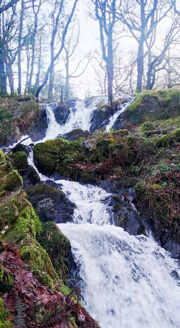
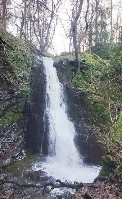
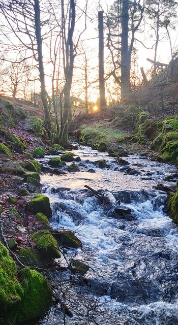
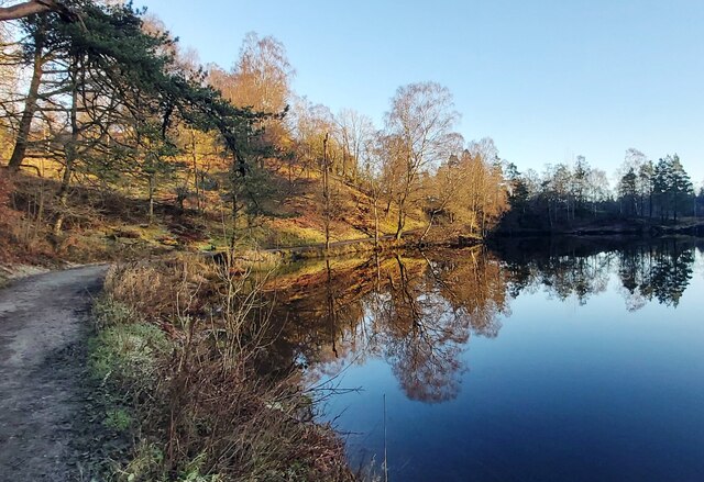
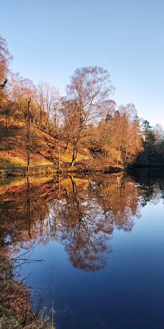
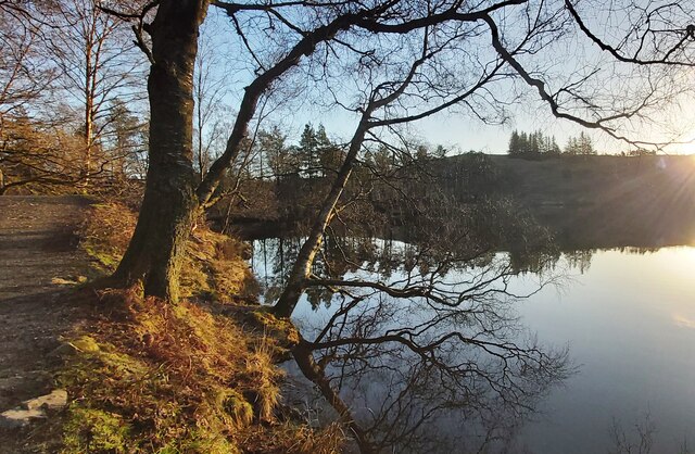
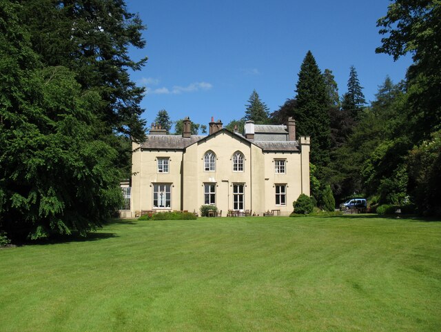
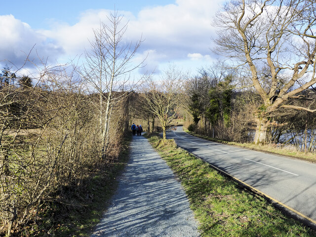
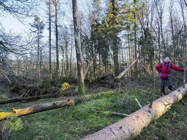
Benson Coppice is a picturesque woodland located in the county of Lancashire, England. Spanning over an area of approximately 100 acres, this forested area is a haven for nature enthusiasts and those seeking tranquility amidst the beauty of the outdoors.

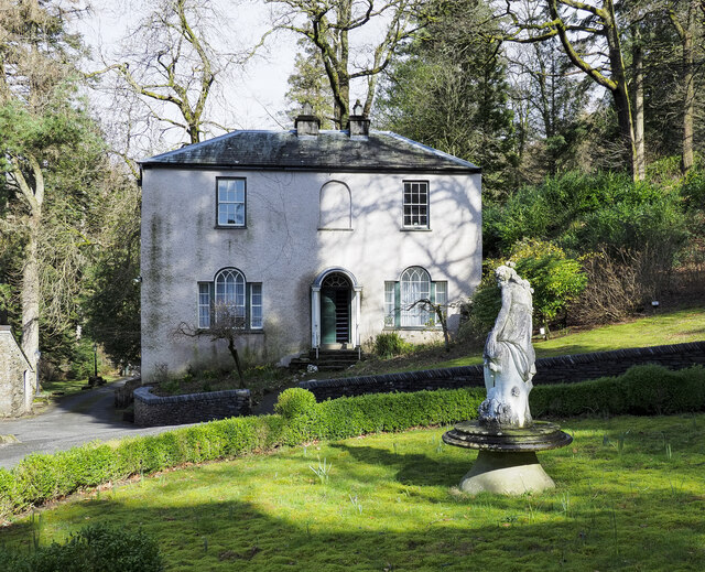
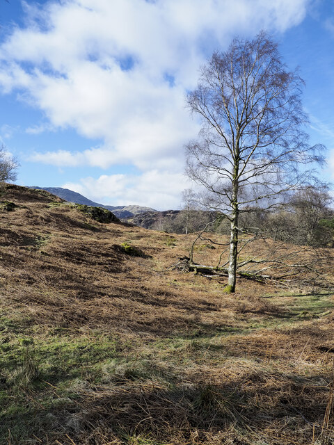
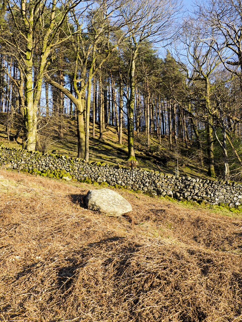
Situated near the village of Benson, the coppice is characterized by its dense growth of predominantly deciduous trees, including oak, ash, and beech. These towering trees create a lush canopy that provides shade and shelter for a diverse range of flora and fauna.

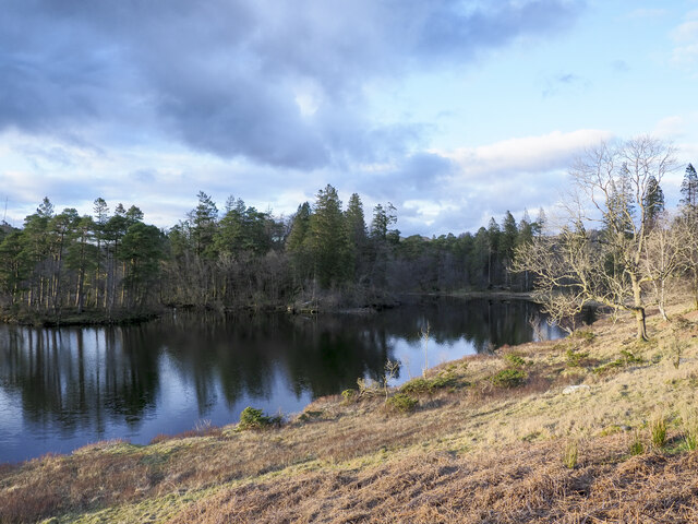
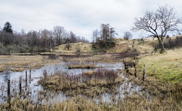
The woodland is crisscrossed by a network of well-maintained footpaths, allowing visitors to explore the area at their leisure. These trails wind through the forest, leading to hidden clearings, babbling brooks, and even a small pond, adding to the charm and allure of the coppice.

Benson Coppice is not only a haven for nature lovers but also serves as an important habitat for a variety of wildlife. Birdwatchers can spot numerous species of birds, including woodpeckers, owls, and various songbirds. The forest is also home to small mammals like rabbits, squirrels, and foxes, which can sometimes be spotted darting across the woodland floor.

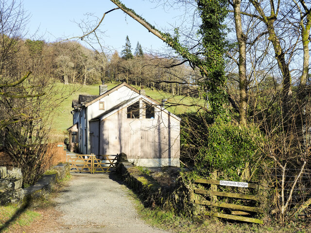
In addition to its natural beauty, Benson Coppice also offers recreational opportunities such as picnicking, photography, and even camping. The tranquil atmosphere and breathtaking scenery make it an ideal destination for those looking to escape the hustle and bustle of everyday life and reconnect with nature.

If you have any feedback on the listing, please let us know in the comments section below.

Benson Coppice Images

Images are sourced within 2km of 54.374531/-3.0418143 or Grid Reference SD3298. Thanks to Geograph Open Source API. All images are credited.

Tom Ghyll Waterfalls
Tom Ghyll Waterfall
Tom Ghyll Waterfall
Tom Ghyll at Dawn
Tom Ghyll at Dawn
Morning Reflections in Tarn Hows
Tarn Hows Reflections
Tarn Hows
Tarn Hows
Sheep grazing near Tarn Hows Woods
Yewdale Valley Yewdale Crag to the right
Yewdale Valley
Yewdale Crag to the right
Yewdale Valley Poor grazing land here
Yewdale Valley
Poor grazing land here
Monk Coniston Hall Monk Coniston Hall is a National Trust property privately leased to HF Holidays as one of their Country Houses.
Monk Coniston Hall
Monk Coniston Hall is a National Trust property privately leased to HF Holidays as one of their Country Houses.
Counting House at Monk Coniston Monk Coniston is a National Trust Property leased by HF Holidays and operated as a country house hotel. There are several buildings on the site; this is the Counting House.
Counting House at Monk Coniston
Monk Coniston is a National Trust Property leased by HF Holidays and operated as a country house hotel. There are several buildings on the site; this is the Counting House.
Eastern side of Tarn Hows Tarn Hows is an archetypal Lake District location close to the village of Coniston. It's partly an artificial creation, the result of damming one of three tarns to create a larger feature.
Eastern side of Tarn Hows
Tarn Hows is an archetypal Lake District location close to the village of Coniston. It's partly an artificial creation, the result of damming one of three tarns to create a larger feature.
Birch tree on bracken-strewn slope The tree is on a hill slope south-west of Tarn Hows. The bracken is of course dead, the residue of the previous year's growth.
Wetherlam just shows above knolls at the left side horizon.
Birch tree on bracken-strewn slope
The tree is on a hill slope south-west of Tarn Hows. The bracken is of course dead, the residue of the previous year's growth. Wetherlam just shows above knolls at the left side horizon.
Heading back to Monk Coniston A walking party on the grit-path heading for the HF country hotel at Monk Coniston. The path is unusual in that it's mapped specifically as a bridleway rather than it being assumed to be a path conventionally adjacent to a motor road.
Heading back to Monk Coniston
A walking party on the grit-path heading for the HF country hotel at Monk Coniston. The path is unusual in that it's mapped specifically as a bridleway rather than it being assumed to be a path conventionally adjacent to a motor road.
Wharton Tarn The tarn is a small area of water lying just over a kilometre south of Tarn Hows. It appears to be infilling with vegetation.
Wharton Tarn
The tarn is a small area of water lying just over a kilometre south of Tarn Hows. It appears to be infilling with vegetation.
Shepherds Bridge Shepherds Bridge carries a public footpath over Yewdale Beck on the outskirts of Coniston village; it's part of the route of the Cumbria Way. The bridge also serves as access for the cottage.
Shepherds Bridge
Shepherds Bridge carries a public footpath over Yewdale Beck on the outskirts of Coniston village; it's part of the route of the Cumbria Way. The bridge also serves as access for the cottage.
Guards Wood Most of the trees seen here in the wood remain standing but over the summit area of the hill devastation was caused by Storm Arwen at the end of November 2021 and probably by subsequent winter storms. Ramorum disease had already affected trees there which were being removed by the National Trust.
Guards Wood
Most of the trees seen here in the wood remain standing but over the summit area of the hill devastation was caused by Storm Arwen at the end of November 2021 and probably by subsequent winter storms. Ramorum disease had already affected trees there which were being removed by the National Trust.
Damage to trees  at summit of High Guards High Guards is a low, wooded hill close to Coniston. The hillwalker is at its summit which was devastated by Storm Arwen at the end of November 2021 and probably by subsequent winter storms. A path crosses the hill going close to the summit but its route is blocked by many windthrown trees; much detouring and clambering is required to make the crossing.
Damage to trees at summit of High Guards
High Guards is a low, wooded hill close to Coniston. The hillwalker is at its summit which was devastated by Storm Arwen at the end of November 2021 and probably by subsequent winter storms. A path crosses the hill going close to the summit but its route is blocked by many windthrown trees; much detouring and clambering is required to make the crossing.
Show me another place!

Benson Coppice is located at Grid Ref: SD3298 (Lat: 54.374531, Lng: -3.0418143)

Administrative County: Cumbria

District: South Lakeland

Police Authority: Cumbria

What 3 Words

///resting.view.domain. Near Ambleside, Cumbria

Related Wikis

Tarn Hows

Tarn Hows is an area of the Lake District National Park in North West England, It contains a picturesque tarn, approximately 2 miles (3.2 km) northeast...

Hawkshead Hill

Hawkshead Hill is a hamlet in the South Lakeland district, in the county of Cumbria, England. It is in the Lake District National Park. == Location... ==

SY Gondola

The steam yacht Gondola is a rebuilt Victorian, screw-propelled, steam-powered passenger vessel on Coniston Water, England. Originally launched in 1859...

Yewdale Beck

Yewdale Beck is a river in Lake District, Cumbria, England. The Yewdale Beck arises from the confluence of Henfoot Beck and Swallow Scar Beck, as well...

Coniston, Cumbria

Coniston is a village and civil parish in the Westmorland and Furness district of Cumbria, England. In the 2001 census the parish had a population of 1...

John Ruskin School

John Ruskin School (JRS) is an 11–16 school on Lake Road in Coniston, Cumbria. The school is part of the Rural Academy, a group of nine small schools in...

Ruskin Museum

The Ruskin Museum is a small local museum in Coniston, Cumbria, northern England. It was established in 1901 by W. G. Collingwood, an artist and antiquarian...

Yew Tree Tarn

Yew Tree Tarn is a small lake in the English Lake District situated in between the towns of Ambleside and Coniston. The tarn was formed when the local...

Nearby Amenities

Located within 500m of 54.374531,-3.0418143
Bus Stop
Holling Brow (E bound)
Naptan AtcoCode: 090079151207
Naptan Bearing: E
Naptan CommonName: Holling Brow (E bound)
Naptan Indicator: near
Naptan Landmark: Holling Brow
Naptan NaptanCode: cumdgtpt
Naptan Street: Main Rd
Naptan Verified: yes
Source: naptan_import
Lat/Long: 54.3774006/-3.0399797
Bus Stop
Holling Brow (Main Road)
Naptan AtcoCode: 090079153277
Naptan Bearing: W
Naptan BusStopType: CUS
Naptan CommonName: Holling Brow (Main Road)
Naptan Indicator: near
Naptan Landmark: Monk-Coniston near Holling Brow
Naptan NaptanCode: cumdgtwp
Naptan Street: Main Road
Naptan Verified: yes
Source: naptan_import
Lat/Long: 54.3773201/-3.0400636
J 1
Ele: 160.424561
Wpt Description: 20-DEC-09 14:18:48
Lat/Long: 54.3777916/-3.040414
Rowlandson Ground
Source: OS OpenData StreetView
Tourism: chalet
Wikidata: Q26401014
Lat/Long: 54.3725286/-3.0450107
Barrier: cattle_grid
Lat/Long: 54.373463/-3.0427561
Bench
Lat/Long: 54.3727053/-3.0460992
Power: pole
Lat/Long: 54.3728663/-3.0348218
Power: pole
Lat/Long: 54.3725704/-3.0360928
Power: pole
Lat/Long: 54.372209/-3.0376901
Power: pole
Lat/Long: 54.3721228/-3.0385172
Power: pole
Lat/Long: 54.3720159/-3.0394816
Power: pole
Lat/Long: 54.3718954/-3.0406421
Power: pole
Lat/Long: 54.3717396/-3.0421235
Power: pole
Lat/Long: 54.371048/-3.0447386
The data included in this document is from www.openstreetmap.org. The data is made available under ODbL.

Have you been to Benson Coppice?

Leave your review of Benson Coppice below (or comments, questions and feedback).