Far House Plantation

Wood, Forest in Lancashire South Lakeland

England

Far House Plantation

Tom Ghyll Waterfalls
Tom Ghyll Waterfalls Credit: Anthony Parkes

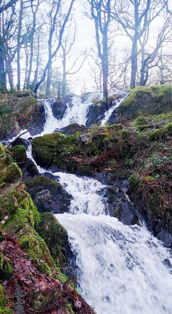
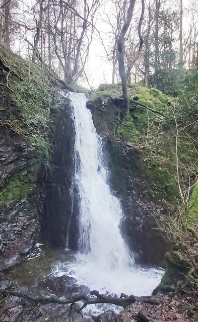
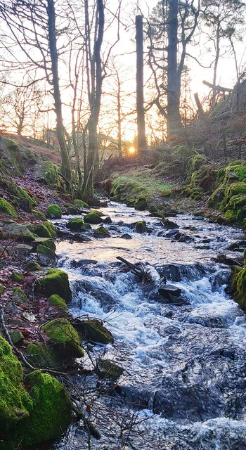
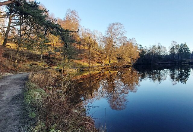
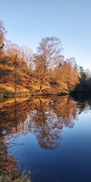
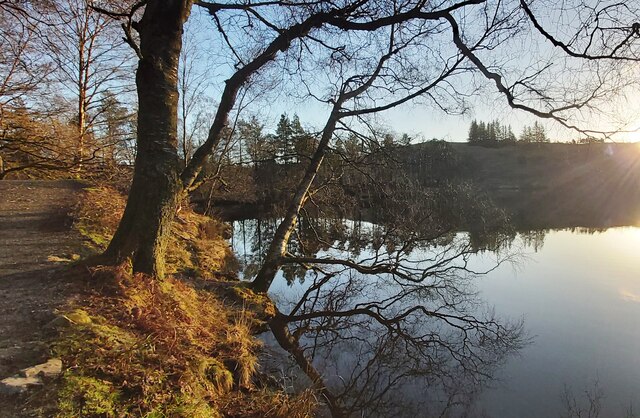
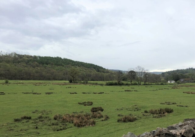
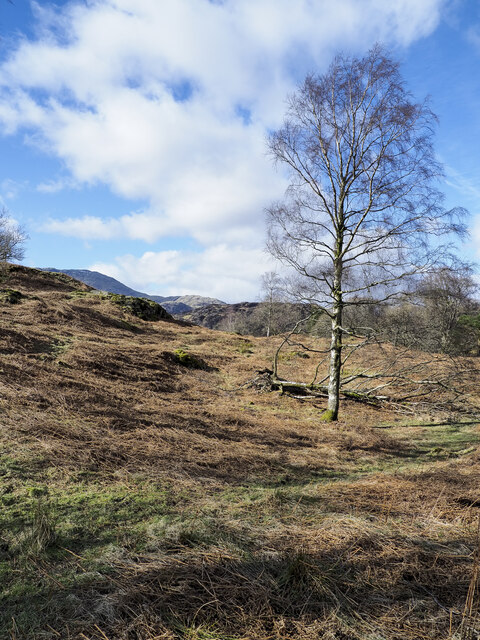
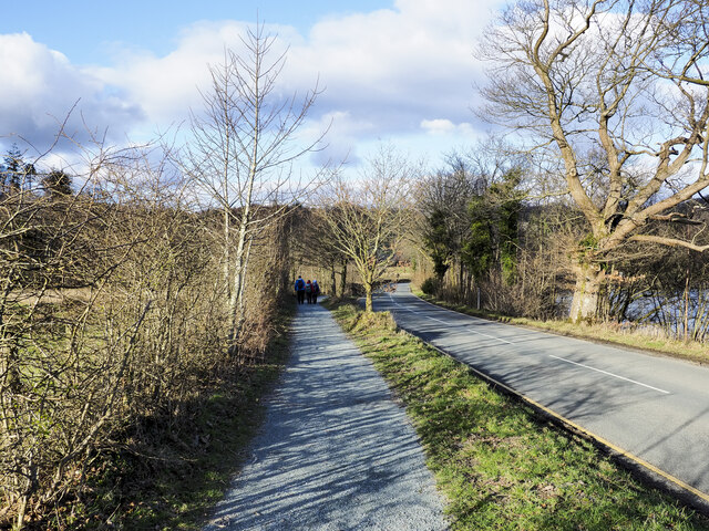
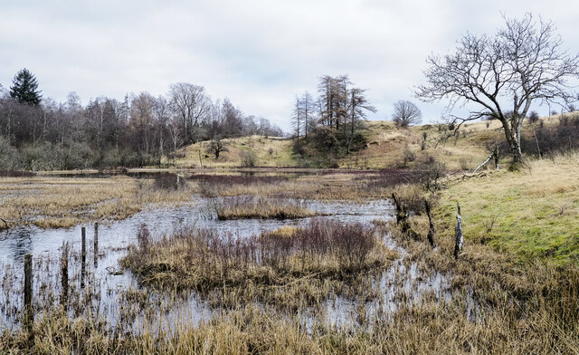
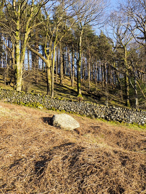
Far House Plantation is a picturesque woodland situated in Lancashire, England. Covering a vast area of lush greenery, it is renowned for its serene atmosphere and diverse range of plant species. The plantation is located near the village of Wood, surrounded by rolling hills and tranquil streams, creating a haven for nature enthusiasts and those seeking a peaceful retreat.

The woodland is primarily composed of a mixture of deciduous and coniferous trees, including oak, beech, pine, and cedar, which provide a rich tapestry of colors throughout the seasons. The dense foliage and towering trees create a canopy that filters sunlight, creating a cool and shaded environment, perfect for leisurely walks or picnics.

Far House Plantation is home to a wide variety of wildlife, including deer, rabbits, squirrels, and a plethora of bird species such as woodpeckers, owls, and thrushes. Nature lovers can often be seen observing and photographing the fauna that inhabits the area.

The plantation is well-maintained, with well-marked trails and paths that allow visitors to explore the woods at their own pace. Additionally, there are designated picnic areas and benches strategically placed throughout the plantation, providing convenient spots for visitors to relax and take in the natural beauty.

Far House Plantation is a popular destination for both locals and tourists alike, offering a tranquil escape from the hustle and bustle of everyday life. Whether it be a leisurely stroll through the woods or a moment of solitude amidst nature, this Lancashire woodland guarantees a rejuvenating experience for all who visit.

If you have any feedback on the listing, please let us know in the comments section below.

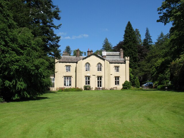
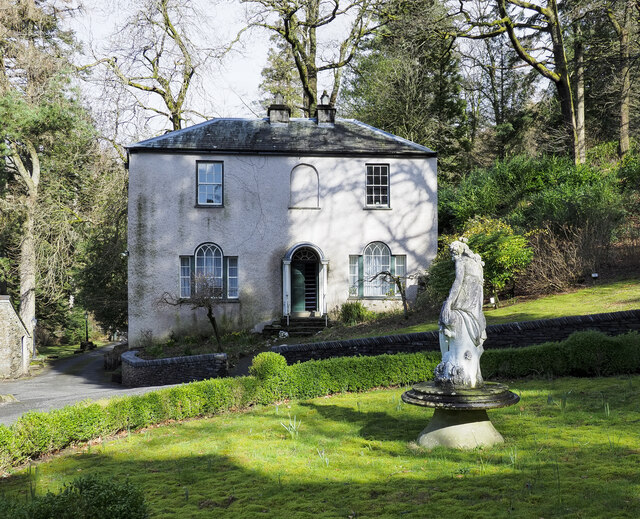
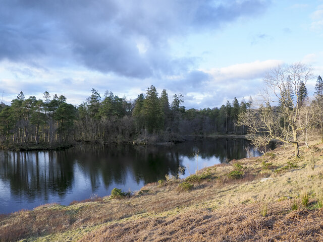
Far House Plantation Images

Images are sourced within 2km of 54.377651/-3.0458808 or Grid Reference SD3298. Thanks to Geograph Open Source API. All images are credited.

Tom Ghyll Waterfalls
Tom Ghyll Waterfall
Tom Ghyll Waterfall
Tom Ghyll at Dawn
Tom Ghyll at Dawn
Morning Reflections in Tarn Hows
Tarn Hows Reflections
Tarn Hows
Tarn Hows
Coniston Holly How Youth Hostel, 1987 Described in a 1980s YHA handbook as "Former guest house in its own beautiful grounds just north of Coniston village." It was graded "Superior" at that time. Still open.
Coniston Holly How Youth Hostel, 1987
Described in a 1980s YHA handbook as "Former guest house in its own beautiful grounds just north of Coniston village." It was graded "Superior" at that time. Still open.
Sheep grazing near Tarn Hows Woods
Yewdale Valley Yewdale Crag to the right
Yewdale Valley
Yewdale Crag to the right
Yewdale Valley Poor grazing land here
Yewdale Valley
Poor grazing land here
Monk Coniston Hall Monk Coniston Hall is a National Trust property privately leased to HF Holidays as one of their Country Houses.
Monk Coniston Hall
Monk Coniston Hall is a National Trust property privately leased to HF Holidays as one of their Country Houses.
Counting House at Monk Coniston Monk Coniston is a National Trust Property leased by HF Holidays and operated as a country house hotel. There are several buildings on the site; this is the Counting House.
Counting House at Monk Coniston
Monk Coniston is a National Trust Property leased by HF Holidays and operated as a country house hotel. There are several buildings on the site; this is the Counting House.
Eastern side of Tarn Hows Tarn Hows is an archetypal Lake District location close to the village of Coniston. It's partly an artificial creation, the result of damming one of three tarns to create a larger feature.
Eastern side of Tarn Hows
Tarn Hows is an archetypal Lake District location close to the village of Coniston. It's partly an artificial creation, the result of damming one of three tarns to create a larger feature.
Birch tree on bracken-strewn slope The tree is on a hill slope south-west of Tarn Hows. The bracken is of course dead, the residue of the previous year's growth.
Wetherlam just shows above knolls at the left side horizon.
Birch tree on bracken-strewn slope
The tree is on a hill slope south-west of Tarn Hows. The bracken is of course dead, the residue of the previous year's growth. Wetherlam just shows above knolls at the left side horizon.
Heading back to Monk Coniston A walking party on the grit-path heading for the HF country hotel at Monk Coniston. The path is unusual in that it's mapped specifically as a bridleway rather than it being assumed to be a path conventionally adjacent to a motor road.
Heading back to Monk Coniston
A walking party on the grit-path heading for the HF country hotel at Monk Coniston. The path is unusual in that it's mapped specifically as a bridleway rather than it being assumed to be a path conventionally adjacent to a motor road.
Wharton Tarn The tarn is a small area of water lying just over a kilometre south of Tarn Hows. It appears to be infilling with vegetation.
Wharton Tarn
The tarn is a small area of water lying just over a kilometre south of Tarn Hows. It appears to be infilling with vegetation.
Shepherds Bridge Shepherds Bridge carries a public footpath over Yewdale Beck on the outskirts of Coniston village; it's part of the route of the Cumbria Way. The bridge also serves as access for the cottage.
Shepherds Bridge
Shepherds Bridge carries a public footpath over Yewdale Beck on the outskirts of Coniston village; it's part of the route of the Cumbria Way. The bridge also serves as access for the cottage.
Guards Wood Most of the trees seen here in the wood remain standing but over the summit area of the hill devastation was caused by Storm Arwen at the end of November 2021 and probably by subsequent winter storms. Ramorum disease had already affected trees there which were being removed by the National Trust.
Guards Wood
Most of the trees seen here in the wood remain standing but over the summit area of the hill devastation was caused by Storm Arwen at the end of November 2021 and probably by subsequent winter storms. Ramorum disease had already affected trees there which were being removed by the National Trust.
Show me another place!

Far House Plantation is located at Grid Ref: SD3298 (Lat: 54.377651, Lng: -3.0458808)

Administrative County: Cumbria

District: South Lakeland

Police Authority: Cumbria

What 3 Words

///lighters.successor.payer. Near Ambleside, Cumbria

Related Wikis

Tarn Hows

Tarn Hows is an area of the Lake District National Park in North West England, It contains a picturesque tarn, approximately 2 miles (3.2 km) northeast...

Hawkshead Hill

Hawkshead Hill is a hamlet in the South Lakeland district, in the county of Cumbria, England. It is in the Lake District National Park. == Location... ==

SY Gondola

The steam yacht Gondola is a rebuilt Victorian, screw-propelled, steam-powered passenger vessel on Coniston Water, England. Originally launched in 1859...

Yewdale Beck

Yewdale Beck is a river in Lake District, Cumbria, England. The Yewdale Beck arises from the confluence of Henfoot Beck and Swallow Scar Beck, as well...

Yew Tree Tarn

Yew Tree Tarn is a small lake in the English Lake District situated in between the towns of Ambleside and Coniston. The tarn was formed when the local...

Coniston, Cumbria

Coniston is a village and civil parish in the Westmorland and Furness district of Cumbria, England. In the 2001 census the parish had a population of 1...

Ruskin Museum

The Ruskin Museum is a small local museum in Coniston, Cumbria, northern England. It was established in 1901 by W. G. Collingwood, an artist and antiquarian...

Holme Fell

Holme Fell or Holm Fell is a fell in the Lake District in Cumbria, England. It is located between Coniston Water and Little Langdale, almost isolated from...

Nearby Amenities

Located within 500m of 54.377651,-3.0458808
Monk Coniston
Note: National Trust - leased to HF Holidays
Tourism: attraction
Lat/Long: 54.3758833/-3.0507104
Bus Stop
Holling Brow (E bound)
Naptan AtcoCode: 090079151207
Naptan Bearing: E
Naptan CommonName: Holling Brow (E bound)
Naptan Indicator: near
Naptan Landmark: Holling Brow
Naptan NaptanCode: cumdgtpt
Naptan Street: Main Rd
Naptan Verified: yes
Source: naptan_import
Lat/Long: 54.3774006/-3.0399797
Bus Stop
Holling Brow (Main Road)
Naptan AtcoCode: 090079153277
Naptan Bearing: W
Naptan BusStopType: CUS
Naptan CommonName: Holling Brow (Main Road)
Naptan Indicator: near
Naptan Landmark: Monk-Coniston near Holling Brow
Naptan NaptanCode: cumdgtwp
Naptan Street: Main Road
Naptan Verified: yes
Source: naptan_import
Lat/Long: 54.3773201/-3.0400636
Bus Stop
Monk Coniston Hall (E bound)
Naptan AtcoCode: 090079154359
Naptan Bearing: E
Naptan BusStopType: CUS
Naptan CommonName: Monk Coniston Hall (E bound)
Naptan Indicator: near
Naptan Landmark: Monk Coniston Hall
Naptan NaptanCode: cumdtgdm
Naptan Street: High Cross
Naptan Verified: yes
Source: naptan_import
Lat/Long: 54.3766353/-3.0503675
Bus Stop
Monk Coniston Hall (W bound)
Naptan AtcoCode: 090079154360
Naptan Bearing: W
Naptan BusStopType: CUS
Naptan CommonName: Monk Coniston Hall (W bound)
Naptan Indicator: w/bound
Naptan Landmark: Monk Coniston Hall
Naptan NaptanCode: cumdtgdp
Naptan Street: High Cross
Naptan Verified: yes
Source: naptan_import
Lat/Long: 54.3765845/-3.05034
J 1
Ele: 160.424561
Wpt Description: 20-DEC-09 14:18:48
Lat/Long: 54.3777916/-3.040414
HF Holidays Monk Coniston
Accommodation: yes
Addr City: Coniston
Addr Country: GB
Addr Housename: Monk Coniston Hall
Addr Postcode: LA21 8AQ
Addr Street: Hawkshead Road
Email: reservations@hfholidays.co.uk
Fax: +44 1539 441 117
Fhrs Id: 328942
Internet Access: yes
Internet Access Fee: no
Note: National Trust - leased to HF Holidays
Operator: HF Holidays
Phone: +44 1539 441 566
Smoking: no
Tourism: hotel
Website: https://www.hfholidays.co.uk/
Wheelchair: no
Wikidata: Q26379711
Lat/Long: 54.3757418/-3.0512133
Parking
Access: customers
Lat/Long: 54.3756005/-3.0508481
Hiking: yes
Information: guidepost
Tourism: information
Lat/Long: 54.3790827/-3.0453318
Hiking: yes
Information: guidepost
Source: GPS Survey
Tourism: information
Lat/Long: 54.3765769/-3.0506225
Barrier: cattle_grid
Source: GPS Survey
Lat/Long: 54.3765308/-3.0502161
Entrance: main
Lat/Long: 54.3754245/-3.0500038
Hiking: yes
Information: guidepost
Tourism: information
Lat/Long: 54.3769577/-3.050416
Bench
Lat/Long: 54.3747201/-3.0503516
Entrance: main
Lat/Long: 54.3761416/-3.0508719
Entrance: main
Lat/Long: 54.3760612/-3.0505771
Entrance: yes
Lat/Long: 54.3758339/-3.0508826
Entrance: main
Lat/Long: 54.3759557/-3.0509023
Entrance: main
Lat/Long: 54.3756567/-3.0509502
Defibrillator
Defibrillator Location: inside near Manager's Office
Emergency: defibrillator
Lat/Long: 54.3758036/-3.050947
Entrance: main
Lat/Long: 54.3755483/-3.049756
Barrier: entrance
Lat/Long: 54.3761197/-3.0509791
Entrance: service
Lat/Long: 54.3754136/-3.0500374
Turning Circle
Lat/Long: 54.3748842/-3.050404
The data included in this document is from www.openstreetmap.org. The data is made available under ODbL.

Have you been to Far House Plantation?

Leave your review of Far House Plantation below (or comments, questions and feedback).