Bank Ground Plantation

Wood, Forest in Lancashire South Lakeland

England

Bank Ground Plantation

Ordnance Survey Cut Mark This OS cut mark can be found on the west parapet of Adam Bridge. It marks a point 74.6135m above mean sea level.
Ordnance Survey Cut Mark Credit: Adrian Dust

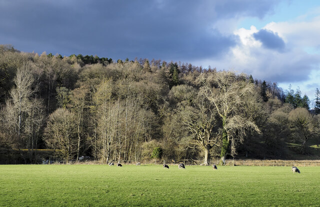
Bank Ground Plantation is a picturesque woodland located in the county of Lancashire, England. Situated in the heart of the Lake District National Park, this enchanting forest is a natural haven that covers a vast area of approximately 200 acres.

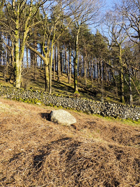
The plantation is characterized by its dense and diverse tree population, including a mix of deciduous and coniferous species. Towering oak, beech, and ash trees dominate the landscape, providing a rich canopy that filters sunlight and creates a magical atmosphere. These ancient trees are complemented by the vibrant hues of the rhododendron bushes that bloom in spring, adding bursts of color to the woodland.

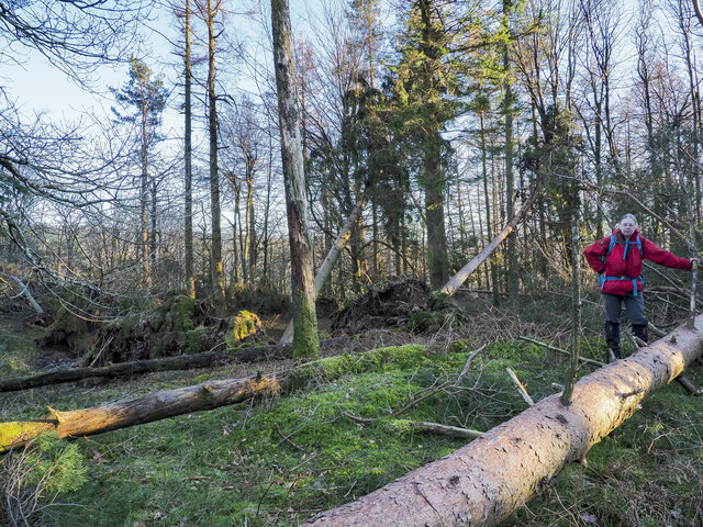
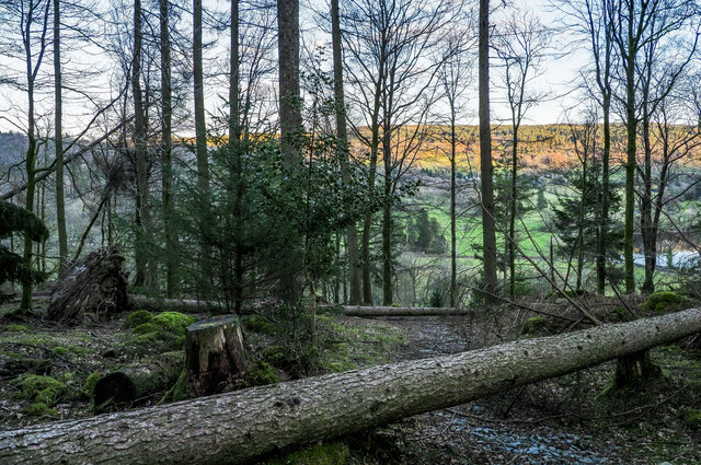
Tranquility is a hallmark of Bank Ground Plantation, with its winding trails and paths that invite visitors to explore its hidden corners. The forest is home to a variety of wildlife, including deer, foxes, badgers, and a wide range of bird species. Nature enthusiasts will also appreciate the diverse flora that thrives in the undergrowth, including ferns, wildflowers, and mosses.

The plantation offers a serene escape from the hustle and bustle of everyday life. Visitors can enjoy leisurely walks, picnics, or simply find solace in the peaceful surroundings. The plantation is also a popular destination for photographers and artists, who are drawn to its natural beauty and captivating landscapes.

Overall, Bank Ground Plantation is a captivating woodland that showcases the beauty of Lancashire's natural heritage. Its tranquil ambiance, abundant wildlife, and striking scenery make it a must-visit destination for nature lovers and those seeking a peaceful retreat.

If you have any feedback on the listing, please let us know in the comments section below.

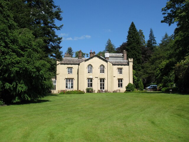
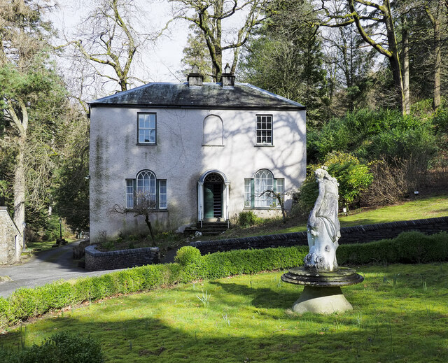
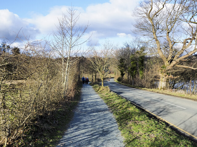
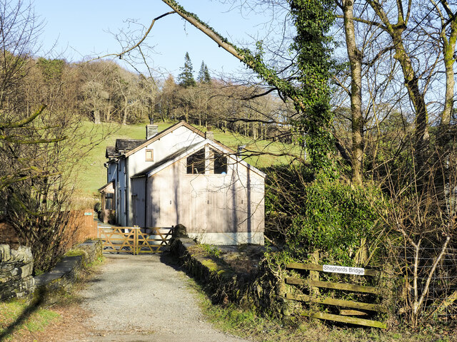
Bank Ground Plantation Images

Images are sourced within 2km of 54.361991/-3.0494534 or Grid Reference SD3196. Thanks to Geograph Open Source API. All images are credited.

Ordnance Survey Cut Mark This OS cut mark can be found on the west parapet of Adam Bridge. It marks a point 74.6135m above mean sea level.
Ordnance Survey Cut Mark
This OS cut mark can be found on the west parapet of Adam Bridge. It marks a point 74.6135m above mean sea level.
Sacred Heart RC Church
Old Bridge Marker by the A593, Adam Bridge, Bowmanstead Bridge Marker by the A593, in parish of Coniston (South Lakeland District), Adam Bridge, Bowmanstead, bridge parapet on the West side.

Inscription reads:- : C.C. ADAM BRIDGE / REBUILT 1899 :

Surveyed

Milestone Society National ID: LA_CONI01br.
Old Bridge Marker by the A593, Adam Bridge, Bowmanstead
Bridge Marker by the A593, in parish of Coniston (South Lakeland District), Adam Bridge, Bowmanstead, bridge parapet on the West side. Inscription reads:- : C.C. ADAM BRIDGE / REBUILT 1899 : Surveyed Milestone Society National ID: LA_CONI01br.
Bridge parapet with benchmark Adam Bridge on the A593 was rebuilt by Lancashire County Council in 1899 with dressed sandstone parapets.  The western parapet has an Ordnance Survey cut benchmark marking a height of 74.6135m above sea level (Ordnance Datum Newlyn) last levelled and verified in 1969 (photograph <a href="https://www.geograph.org.uk/photo/6525498">SD2996 : Benchmark, Adam Bridge</a>).
Bridge parapet with benchmark
Adam Bridge on the A593 was rebuilt by Lancashire County Council in 1899 with dressed sandstone parapets. The western parapet has an Ordnance Survey cut benchmark marking a height of 74.6135m above sea level (Ordnance Datum Newlyn) last levelled and verified in 1969 (photograph SD2996 : Benchmark, Adam Bridge).
Benchmark, Adam Bridge Detail of the Ordnance Survey cut benchmark in the sandstone parapet of Adam Bridge, marking a height of 74.6135m above sea level (Ordnance Datum) last levelled and verified in 1969 (location photograph <a href="https://www.geograph.org.uk/photo/6525494">SD2996 : Bridge parapet with benchmark</a>).
Benchmark, Adam Bridge
Detail of the Ordnance Survey cut benchmark in the sandstone parapet of Adam Bridge, marking a height of 74.6135m above sea level (Ordnance Datum) last levelled and verified in 1969 (location photograph SD2996 : Bridge parapet with benchmark).
Cat Bank, Coniston
Cat Bank, Coniston
Monk Coniston Hall Monk Coniston Hall is a National Trust property privately leased to HF Holidays as one of their Country Houses.
Monk Coniston Hall
Monk Coniston Hall is a National Trust property privately leased to HF Holidays as one of their Country Houses.
Church Beck, Coniston A tributary of Lake Coniston, looking upstream with Forge Bridge Cottages in the centre of the picture.
Church Beck, Coniston
A tributary of Lake Coniston, looking upstream with Forge Bridge Cottages in the centre of the picture.
Counting House at Monk Coniston Monk Coniston is a National Trust Property leased by HF Holidays and operated as a country house hotel. There are several buildings on the site; this is the Counting House.
Counting House at Monk Coniston
Monk Coniston is a National Trust Property leased by HF Holidays and operated as a country house hotel. There are several buildings on the site; this is the Counting House.
Heading back to Monk Coniston A walking party on the grit-path heading for the HF country hotel at Monk Coniston. The path is unusual in that it's mapped specifically as a bridleway rather than it being assumed to be a path conventionally adjacent to a motor road.
Heading back to Monk Coniston
A walking party on the grit-path heading for the HF country hotel at Monk Coniston. The path is unusual in that it's mapped specifically as a bridleway rather than it being assumed to be a path conventionally adjacent to a motor road.
Shepherds Bridge Shepherds Bridge carries a public footpath over Yewdale Beck on the outskirts of Coniston village; it's part of the route of the Cumbria Way. The bridge also serves as access for the cottage.
Shepherds Bridge
Shepherds Bridge carries a public footpath over Yewdale Beck on the outskirts of Coniston village; it's part of the route of the Cumbria Way. The bridge also serves as access for the cottage.
Guards Wood Most of the trees seen here in the wood remain standing but over the summit area of the hill devastation was caused by Storm Arwen at the end of November 2021 and probably by subsequent winter storms. Ramorum disease had already affected trees there which were being removed by the National Trust.
Guards Wood
Most of the trees seen here in the wood remain standing but over the summit area of the hill devastation was caused by Storm Arwen at the end of November 2021 and probably by subsequent winter storms. Ramorum disease had already affected trees there which were being removed by the National Trust.
Damage to trees  at summit of High Guards High Guards is a low, wooded hill close to Coniston. The hillwalker is at its summit which was devastated by Storm Arwen at the end of November 2021 and probably by subsequent winter storms. A path crosses the hill going close to the summit but its route is blocked by many windthrown trees; much detouring and clambering is required to make the crossing.
Damage to trees at summit of High Guards
High Guards is a low, wooded hill close to Coniston. The hillwalker is at its summit which was devastated by Storm Arwen at the end of November 2021 and probably by subsequent winter storms. A path crosses the hill going close to the summit but its route is blocked by many windthrown trees; much detouring and clambering is required to make the crossing.
Obstructions to path descending through Guards Wood Much damage was caused in Guards Wood by Storm Arwen at the end of November 2021 and probably by subsequent winter storms. The summit area of High Guards, the hill on which the wood grows, was badly affected and difficult to access - <a title="https://www.geograph.org.uk/photo/7115398" href="https://www.geograph.org.uk/photo/7115398">Link</a> . The path crossing the hill was equally affected by windthrown trees. The awkwardness caused by the two trees across the path in this image was trivial by comparison.
Obstructions to path descending through Guards Wood
Much damage was caused in Guards Wood by Storm Arwen at the end of November 2021 and probably by subsequent winter storms. The summit area of High Guards, the hill on which the wood grows, was badly affected and difficult to access - Link . The path crossing the hill was equally affected by windthrown trees. The awkwardness caused by the two trees across the path in this image was trivial by comparison.
Monk Coniston The south-west face of the large house at Monk Coniston which, with land was owned by Beatrix Potter who left it to the National Trust; the Trust still has it. Currently, it's leased by HF holidays who operate it as a country house hotel.
Monk Coniston
The south-west face of the large house at Monk Coniston which, with land was owned by Beatrix Potter who left it to the National Trust; the Trust still has it. Currently, it's leased by HF holidays who operate it as a country house hotel.
Sheep grazing in field beside B5285 The wooded hill, High Guards, rises beyond the field. The nearer trees are not contiguous with the woodland on the hill.
Sheep grazing in field beside B5285
The wooded hill, High Guards, rises beyond the field. The nearer trees are not contiguous with the woodland on the hill.
"Campbell" motor launch at the jetty On Coniston Water near the village of Coniston
"Campbell" motor launch at the jetty
On Coniston Water near the village of Coniston
Pier Cottage, Coniston Water The Campbell family base during preparations for water speed record attempts in the 1960's.
Pier Cottage, Coniston Water
The Campbell family base during preparations for water speed record attempts in the 1960's.
Show me another place!

Bank Ground Plantation is located at Grid Ref: SD3196 (Lat: 54.361991, Lng: -3.0494534)

Administrative County: Cumbria

District: South Lakeland

Police Authority: Cumbria

What 3 Words

///vehicle.carting.laminate. Near Windermere, Cumbria

Related Wikis

Yewdale Beck

Yewdale Beck is a river in Lake District, Cumbria, England. The Yewdale Beck arises from the confluence of Henfoot Beck and Swallow Scar Beck, as well...
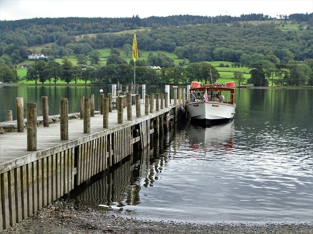
SY Gondola

The steam yacht Gondola is a rebuilt Victorian, screw-propelled, steam-powered passenger vessel on Coniston Water, England. Originally launched in 1859...
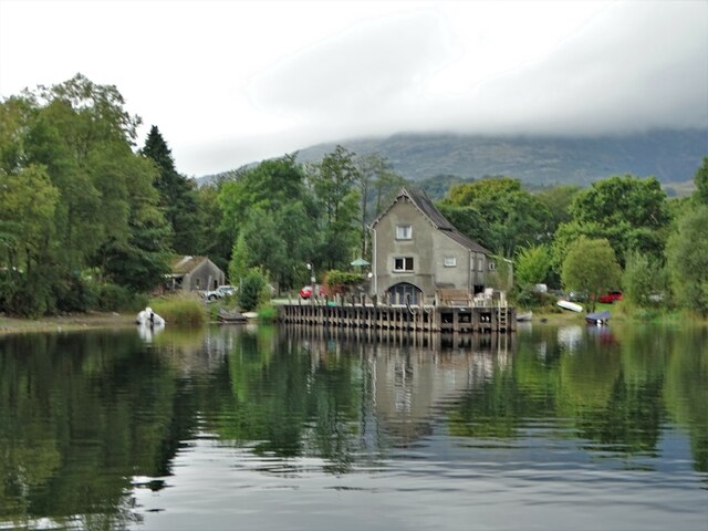
Brantwood

Brantwood is a historic house museum in Cumbria, England, overlooking Coniston Water. It has been the home of a number of prominent people. The house and...
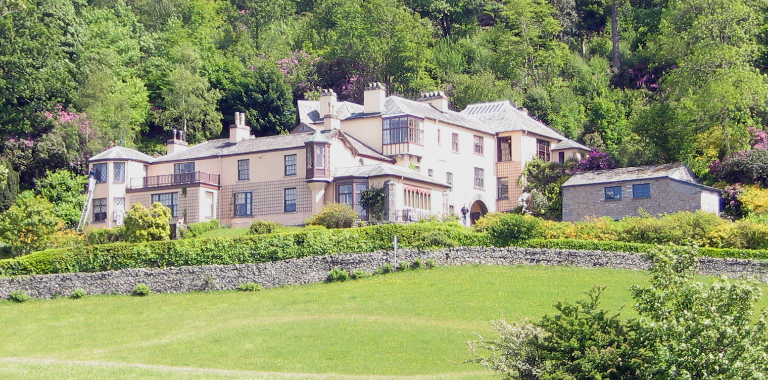
Coniston Hall

Coniston Hall is a former house on the west bank of Coniston Water in the English Lake District. It is recorded in the National Heritage List for England...

Nearby Amenities

Located within 500m of 54.361991,-3.0494534
Barrier: kissing_gate
Lat/Long: 54.3651829/-3.0488294
Hazard: cows
Lat/Long: 54.3650048/-3.0491786
Barrier: kissing_gate
Lat/Long: 54.3638665/-3.0539446
Barrier: cattle_grid
Lat/Long: 54.3640459/-3.0513104
Barrier: kissing_gate
Lat/Long: 54.3629598/-3.053906
Barrier: kissing_gate
Lat/Long: 54.3640084/-3.0537959
Barrier: kissing_gate
Lat/Long: 54.3651736/-3.0534951
Post Box
Collection Times: Mo-Fr 09:00, Sa 07:45
Post Box Type: wall
Ref: LA22 24
Royal Cypher: EVIIR
Royal Cypher Wikidata: Q33102324
Source: survey
Lat/Long: 54.3642319/-3.0511092
Cafe
Swallows and Amazons Tearoom
Lat/Long: 54.364369/-3.0542833
Barrier: entrance
Lat/Long: 54.3647203/-3.0533791
Power: pole
Lat/Long: 54.3632798/-3.0513842
Power: pole
Lat/Long: 54.3633504/-3.0523635
Power: pole
Lat/Long: 54.3633892/-3.05325
Power: pole
Lat/Long: 54.363428/-3.0538918
The data included in this document is from www.openstreetmap.org. The data is made available under ODbL.

Have you been to Bank Ground Plantation?

Leave your review of Bank Ground Plantation below (or comments, questions and feedback).