Baysbrown Wood

Wood, Forest in Westmorland South Lakeland

England

Baysbrown Wood

Looking down the western side of Lingmoor Fell Looking down the western side of Lingmoor Fell. Blea Tarn is in the distance at the bottom of the steep descent.
Looking down the western side of Lingmoor Fell Credit: Graham Robson

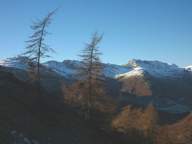
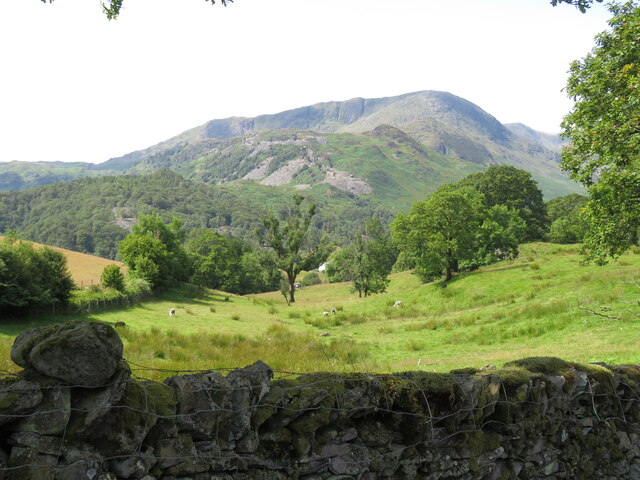
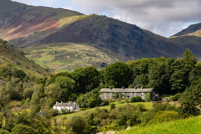
Baysbrown Wood is a picturesque forest located in the historic county of Westmorland, in the northwestern region of England. Covering an area of approximately 90 hectares, the wood is situated in the heart of the Lake District National Park, known for its stunning landscapes and natural beauty.

The wood is predominantly composed of native broadleaf trees such as oak, birch, and rowan, which provide a rich and diverse habitat for various flora and fauna. The forest floor is adorned with a carpet of bluebells during springtime, adding a burst of color to the woodland. Baysbrown Beck, a small stream, meanders through the wood, adding to its charm and tranquility.

This woodland is a haven for wildlife enthusiasts, as it teems with a wide range of bird species, including woodpeckers, tawny owls, and redstarts. Small mammals like squirrels and badgers also call Baysbrown Wood their home, while the occasional sighting of roe deer adds to the enchantment of the place.

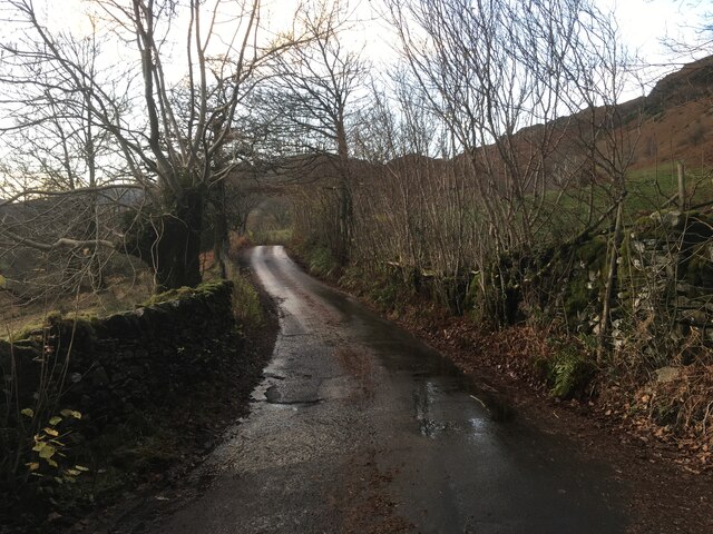
The wood offers several walking trails, providing visitors with the opportunity to explore its beauty at their own pace. The paths wind through the forest, offering glimpses of breathtaking views of the surrounding fells and valleys. The peaceful atmosphere and the sounds of nature make Baysbrown Wood a perfect retreat for those seeking solace and tranquility.

Overall, Baysbrown Wood in Westmorland is a natural gem, offering a glimpse into the beauty and diversity of the Lake District's woodlands. Its rich ecosystem, stunning vistas, and serene ambiance make it a must-visit destination for nature lovers and outdoor enthusiasts alike.

If you have any feedback on the listing, please let us know in the comments section below.

Baysbrown Wood Images

Images are sourced within 2km of 54.432664/-3.0550827 or Grid Reference NY3104. Thanks to Geograph Open Source API. All images are credited.

Looking down the western side of Lingmoor Fell Looking down the western side of Lingmoor Fell. Blea Tarn is in the distance at the bottom of the steep descent.
Looking down the western side of Lingmoor Fell
Looking down the western side of Lingmoor Fell. Blea Tarn is in the distance at the bottom of the steep descent.
Larches on Lingmoor Fell The nameless gill which descends towards Blea Tarn House is fringed by larches. Beyond, are Pike of Blisco, Crinkle Crags and Bow Fell looking very alpine under an early mantle of snow.
Larches on Lingmoor Fell
The nameless gill which descends towards Blea Tarn House is fringed by larches. Beyond, are Pike of Blisco, Crinkle Crags and Bow Fell looking very alpine under an early mantle of snow.
Wilson Place in Little Langdale One of the highlights of a delightful circular walk from Elterwater village by way of Little Langdale and Skelwith.
Wilson Place in Little Langdale
One of the highlights of a delightful circular walk from Elterwater village by way of Little Langdale and Skelwith.
View towards Tilberthwaite from Steady climb on rough path from Elterwater village reaps the reward of fine views over Little Langdale towards the scarred landscape of Tilberthwaite
View towards Tilberthwaite from
Steady climb on rough path from Elterwater village reaps the reward of fine views over Little Langdale towards the scarred landscape of Tilberthwaite
Little Langdale Autumn colours at Wilson Place viewed from the path leading to Stang End
Little Langdale
Autumn colours at Wilson Place viewed from the path leading to Stang End
Minor road towards Little Langdale
Minor road near Little Langdale
Slaters Packhorse Bridge (17c), Little Langdale The bridge dates back to the 17th century, and became a listed building in 1967. Built of slate, it consists of a 15-foot (4.6 m) segmental arch and a flatter span built of slabs, and incorporates a natural boulder in midstream. The bridge is thought to have been created by miners working in the nearby Tilberthwaite Fells.

Alfred Wainwright called it "the most picturesque footbridge in Lakeland, a slender arch constructed of slate from the quarries and built to give the quarrymen a shorter access from their homes".

<span class="nowrap"><a title="https://en.wikipedia.org/wiki/Slater%27s_Bridge" rel="nofollow ugc noopener" href="https://en.wikipedia.org/wiki/Slater%27s_Bridge">Link</a><img style="margin-left:2px;" alt="External link" title="External link - shift click to open in new window" src="https://s1.geograph.org.uk/img/external.png" width="10" height="10"/></span>
Slaters Packhorse Bridge (17c), Little Langdale
The bridge dates back to the 17th century, and became a listed building in 1967. Built of slate, it consists of a 15-foot (4.6 m) segmental arch and a flatter span built of slabs, and incorporates a natural boulder in midstream. The bridge is thought to have been created by miners working in the nearby Tilberthwaite Fells. Alfred Wainwright called it "the most picturesque footbridge in Lakeland, a slender arch constructed of slate from the quarries and built to give the quarrymen a shorter access from their homes". LinkExternal link
Black Hole Slate Quarry Looks like a recent tree fall
Black Hole Slate Quarry
Looks like a recent tree fall
View from Elterwater The section of the Cumbria Way south from Elterwater provides few views of the fells till you reach the southern end of the water, where walkers are rewarded with views towards Langdale here.
View from Elterwater
The section of the Cumbria Way south from Elterwater provides few views of the fells till you reach the southern end of the water, where walkers are rewarded with views towards Langdale here.
Bridge End Seen from across the bridge in Elterwater village - characteristic Cumbrian cottage.
Bridge End
Seen from across the bridge in Elterwater village - characteristic Cumbrian cottage.
No homes for locals Elterwater is one of many Lake District villages where the bulk of the housing stock is now utilised as self-catering holiday lets,  or as offices for the businesses  that manage the lettings. National park for all to enjoy, or a museum film-set where the workforce has to be bussed in daily from far away?
No homes for locals
Elterwater is one of many Lake District villages where the bulk of the housing stock is now utilised as self-catering holiday lets, or as offices for the businesses that manage the lettings. National park for all to enjoy, or a museum film-set where the workforce has to be bussed in daily from far away?
Fitz Steps & New Houses Fitz Steps, a row of terraced cottages and New Houses (in white) near Little Langdale.
Fitz Steps & New Houses
Fitz Steps, a row of terraced cottages and New Houses (in white) near Little Langdale.
B5343 The B5343 at Elterwater.
B5343
The B5343 at Elterwater.
Chapel Stile
Chapel Stile
Harry Place Harry Place Farm.
Harry Place
Harry Place Farm.
Chapel Stile Shop and cafe at Chapel Stile.
Chapel Stile
Shop and cafe at Chapel Stile.
Show me another place!

Baysbrown Wood is located at Grid Ref: NY3104 (Lat: 54.432664, Lng: -3.0550827)

Administrative County: Cumbria

District: South Lakeland

Police Authority: Cumbria

What 3 Words

///magpie.hails.corkscrew. Near Ambleside, Cumbria

Related Wikis

Chapel Stile

Chapel Stile is a village in Cumbria, England, located approximately 5 miles northwest of Ambleside, within the Langdale valley. It contains a school,...
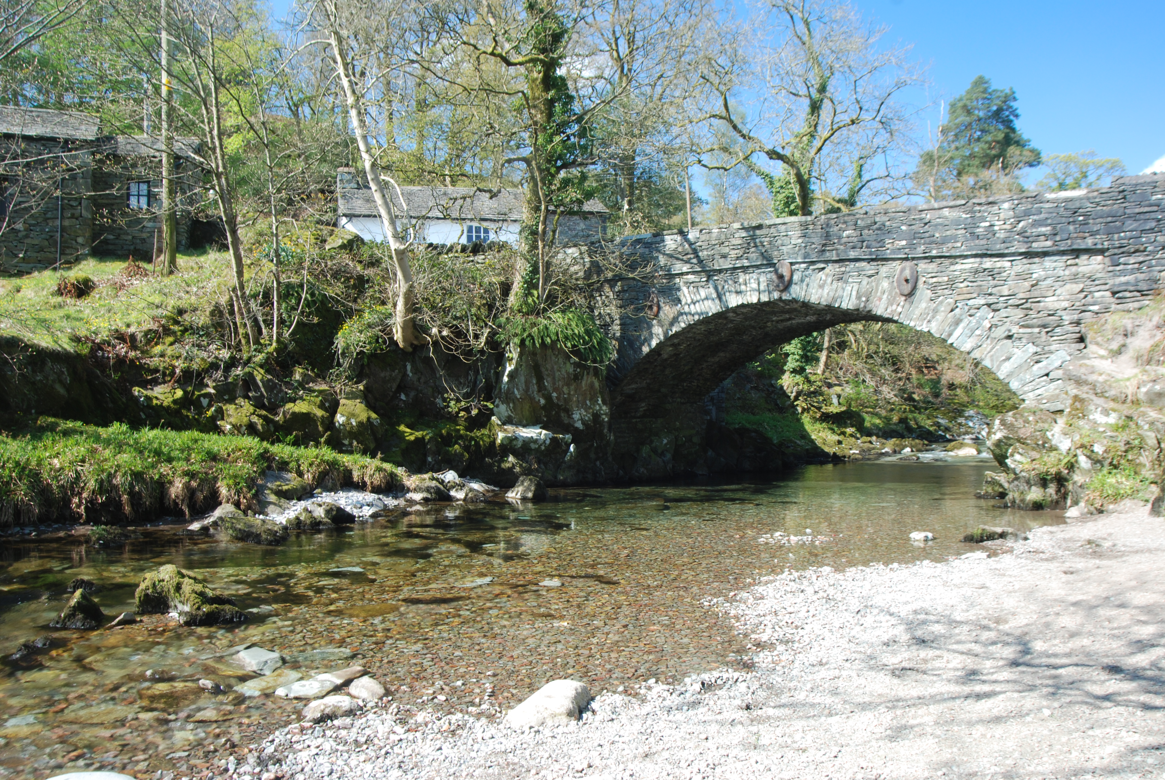
Elterwater Bridge

Elterwater Bridge is a Grade II listed single-arch bridge spanning Great Langdale Beck in Elterwater, Cumbria, England. The structure dates to 1702.The...

Elterwater

Elterwater is a village in the English Lake District and the county of Cumbria. The village lies half a mile (800 m) north-west of the lake of Elter Water...
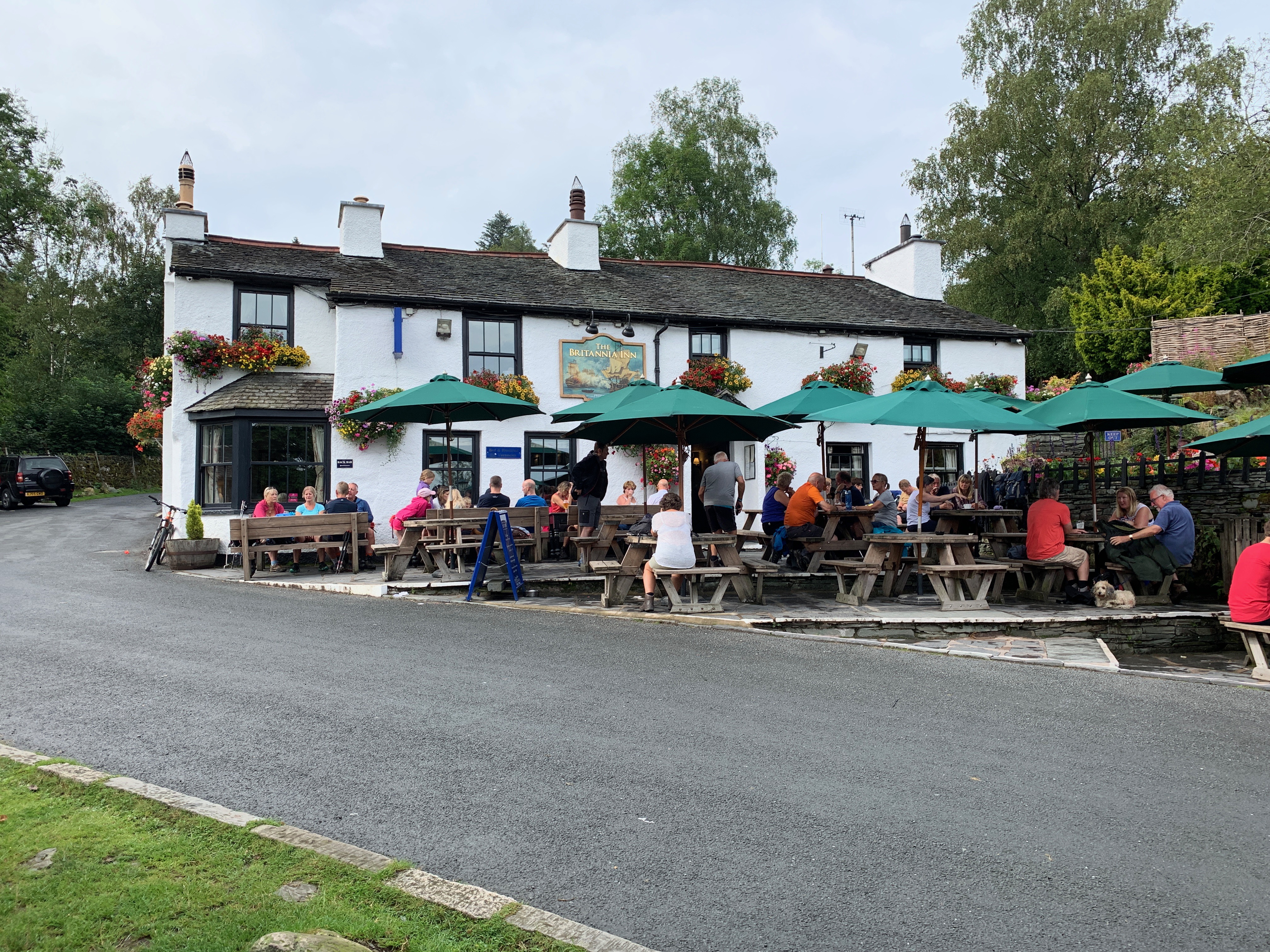
Britannia Inn

The Britannia Inn is a public house and inn in the English village of Elterwater, Cumbria. Dating to the 17th century, it is a Grade II listed building...

Nearby Amenities

Located within 500m of 54.432664,-3.0550827
Waterway: waterfall
Lat/Long: 54.4297793/-3.0601265
Baysbrown Wood
Natural: wood
Lat/Long: 54.432213/-3.0538225
Howebanks Wood
Natural: wood
Lat/Long: 54.4295432/-3.0522748
Waterway: waterfall
Lat/Long: 54.4300087/-3.0536272
Direction: 225
Man Made: adit
Lat/Long: 54.430292/-3.056347
Ford: yes
Lat/Long: 54.4301265/-3.0533032
The data included in this document is from www.openstreetmap.org. The data is made available under ODbL.

Have you been to Baysbrown Wood?

Leave your review of Baysbrown Wood below (or comments, questions and feedback).