Beck Leven Coppice

Wood, Forest in Lancashire South Lakeland

England

Beck Leven Coppice

Coniston village sign This road sign on the A593 was erected by Lancashire County Council, pre-dating the formation of Cumbria in 1974 which incorporated that part of Lancashire north of Morecambe Bay.
Located at Park Gate, the sign is unusually far from the village, being almost 1.6km (1 mile) south of the centre of Coniston.
Coniston village sign Credit: Adrian Taylor

Beck Leven Coppice is a picturesque wood located in the county of Lancashire, England. Covering an area of approximately 50 acres, it is a renowned destination for nature enthusiasts and outdoor lovers. The wood is situated near the village of Coppice and is easily accessible by foot or car.

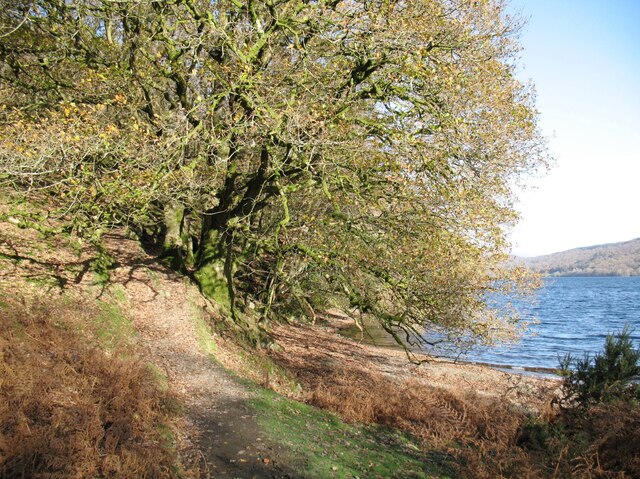
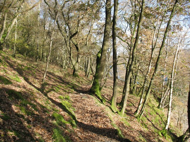
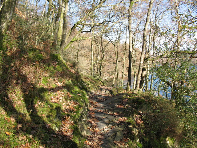
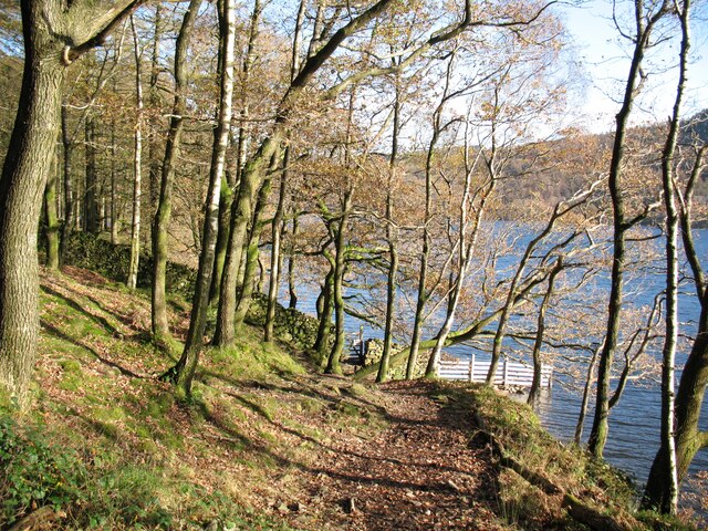
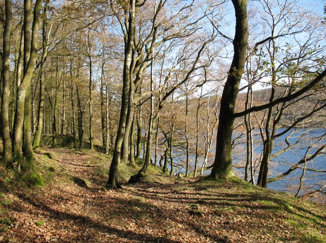
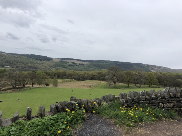
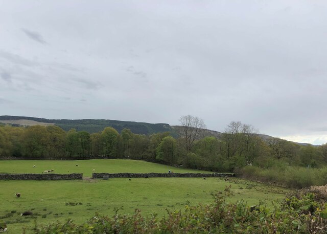
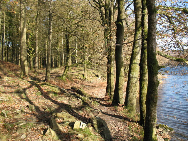
The landscape of Beck Leven Coppice is characterized by dense, mature trees that form a lush canopy, providing a serene and sheltered environment. The dominant tree species in the area include oak, beech, and birch, creating a diverse and vibrant ecosystem. The forest floor is adorned with a variety of wildflowers and ferns, adding to the beauty of the wood.

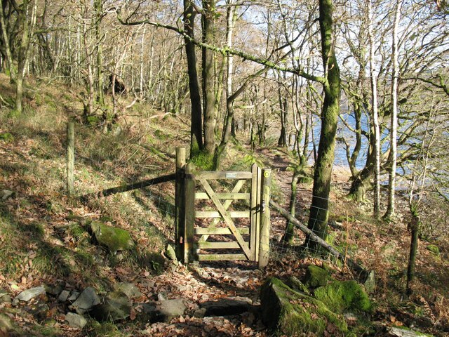
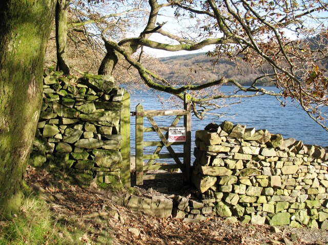
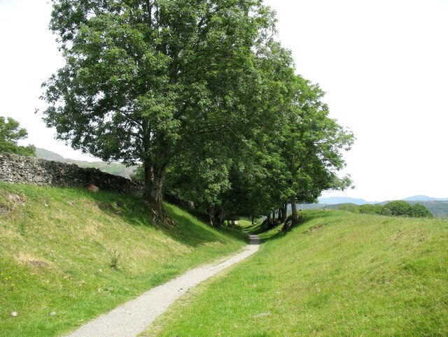
The wood is crisscrossed by several well-maintained footpaths, allowing visitors to explore the area at their leisure. These paths lead to a tranquil stream, known as Beck Leven, which runs through the heart of the wood. The stream is home to various aquatic species, including brown trout, adding to the biodiversity of the area.

Beck Leven Coppice is also a haven for wildlife, attracting a range of species such as deer, foxes, badgers, and numerous bird species. Birdwatchers can spot woodpeckers, owls, and thrushes, among others. The wood provides an important habitat for these creatures, making it a popular spot for nature lovers and photographers.

Overall, Beck Leven Coppice offers visitors a chance to immerse themselves in the beauty of nature. Whether it is a peaceful stroll along the paths, birdwatching, or simply enjoying the tranquility, this wood is a must-visit destination for those seeking a break from the hustle and bustle of everyday life.

If you have any feedback on the listing, please let us know in the comments section below.

Beck Leven Coppice Images

Images are sourced within 2km of 54.348872/-3.0604269 or Grid Reference SD3195. Thanks to Geograph Open Source API. All images are credited.

Coniston village sign This road sign on the A593 was erected by Lancashire County Council, pre-dating the formation of Cumbria in 1974 which incorporated that part of Lancashire north of Morecambe Bay.
Located at Park Gate, the sign is unusually far from the village, being almost 1.6km (1 mile) south of the centre of Coniston.
Coniston village sign
This road sign on the A593 was erected by Lancashire County Council, pre-dating the formation of Cumbria in 1974 which incorporated that part of Lancashire north of Morecambe Bay. Located at Park Gate, the sign is unusually far from the village, being almost 1.6km (1 mile) south of the centre of Coniston.
The Cumbria Way, Moor Gill Foot The Cumbria Way follows the western shore of Coniston Water through woodland below Torver Back Common (next photograph <a href="https://www.geograph.org.uk/photo/7004202">SD2993 : The Cumbria Way in Torver Common Wood</a>).
The Cumbria Way, Moor Gill Foot
The Cumbria Way follows the western shore of Coniston Water through woodland below Torver Back Common (next photograph SD2993 : The Cumbria Way in Torver Common Wood).
Gate in Torver Common Wood The gate crosses a public footpath from Delicars to Coniston which is also the route of The Cumbria Way long distance trail.
Coniston Water can be glimpsed through the trees (next photograph <a href="https://www.geograph.org.uk/photo/7004844">SD2994 : Rocky path in Torver Common Wood</a>).
Gate in Torver Common Wood
The gate crosses a public footpath from Delicars to Coniston which is also the route of The Cumbria Way long distance trail. Coniston Water can be glimpsed through the trees (next photograph SD2994 : Rocky path in Torver Common Wood).
The Cumbria Way in Torver Common Wood The Cumbria Way follows a public footpath along the western shore of Coniston Water through Torver Common Wood (next photograph <a href="https://www.geograph.org.uk/photo/7004120">SD2994 : Gate in Torver Common Wood</a>).
The Cumbria Way in Torver Common Wood
The Cumbria Way follows a public footpath along the western shore of Coniston Water through Torver Common Wood (next photograph SD2994 : Gate in Torver Common Wood).
Rocky path in Torver Common Wood The Cumbria Way follows a public footpath along the western shore of Coniston Water through Torver Common Wood, rounding a rocky spur above the lake shortly before reaching Harrison’s Coppice (next photograph <a href="https://www.geograph.org.uk/photo/7005690">SD2994 : Paths in Torver Common Wood</a>).
Rocky path in Torver Common Wood
The Cumbria Way follows a public footpath along the western shore of Coniston Water through Torver Common Wood, rounding a rocky spur above the lake shortly before reaching Harrison’s Coppice (next photograph SD2994 : Paths in Torver Common Wood).
Gate beside Coniston Water The public footpath from Delicars to Coniston passes through the gate leading from Torver Common Wood into Harrison Coppice.
The waymark on the right hand gatepost indicates that this is the route of The Cumbria Way (next photograph <a href="https://www.geograph.org.uk/photo/7006419">SD2994 : The Cumbria Way, Harrison Coppice</a>).
Gate beside Coniston Water
The public footpath from Delicars to Coniston passes through the gate leading from Torver Common Wood into Harrison Coppice. The waymark on the right hand gatepost indicates that this is the route of The Cumbria Way (next photograph SD2994 : The Cumbria Way, Harrison Coppice).
The Cumbria Way near Coniston Water The Cumbria Way follows the public footpath from Delicars to Coniston along the western shore of Coniston Water (next photograph <a href="https://www.geograph.org.uk/photo/7005687">SD2994 : Gate beside Coniston Water</a>).
The Cumbria Way near Coniston Water
The Cumbria Way follows the public footpath from Delicars to Coniston along the western shore of Coniston Water (next photograph SD2994 : Gate beside Coniston Water).
Paths in Torver Common Wood The path on the left doubles back up through the wood towards the top of Torver Back Common.  The public footpath from Delicars to Coniston and The Cumbria Way follow the path dropping down to the right towards the shore of Coniston Water (next photograph <a href="https://www.geograph.org.uk/photo/7005689">SD2994 : The Cumbria Way near Coniston Water</a>).
Paths in Torver Common Wood
The path on the left doubles back up through the wood towards the top of Torver Back Common. The public footpath from Delicars to Coniston and The Cumbria Way follow the path dropping down to the right towards the shore of Coniston Water (next photograph SD2994 : The Cumbria Way near Coniston Water).
Pasture south of Coniston Park coppice behind and Grizedale Forest on the hills
Pasture south of Coniston
Park coppice behind and Grizedale Forest on the hills
Grazing near Coniston Park Coppice
The Cumbria Way, Harrison Coppice The Cumbria Way follows the public footpath from Delicars to Coniston along the western shore of Coniston Water through Harrison Coppice (next photograph <a href="https://www.geograph.org.uk/photo/7006411">SD3094 : Ford in Harrison Coppice</a>).
The Cumbria Way, Harrison Coppice
The Cumbria Way follows the public footpath from Delicars to Coniston along the western shore of Coniston Water through Harrison Coppice (next photograph SD3094 : Ford in Harrison Coppice).
The Coniston Branch near Park Gate Now only used by walkers and sheep, this is the route of the former Furness Railway branch line from Foxfield to Coniston.
The last passenger service ran on 4 October 1958 with a final enthusiasts’ special train on the 27 August 1961.  The last freight train ran during the week ending 29 April 1962 and the track was lifted early in 1963.
The Coniston Branch near Park Gate
Now only used by walkers and sheep, this is the route of the former Furness Railway branch line from Foxfield to Coniston. The last passenger service ran on 4 October 1958 with a final enthusiasts’ special train on the 27 August 1961. The last freight train ran during the week ending 29 April 1962 and the track was lifted early in 1963.
Bowmanstead
Bowmanstead
Farmland near Torver
Woodland and the end of a track by Coniston Water
Ordnance Survey Cut Mark This OS cut mark can be found on the west parapet of Adam Bridge. It marks a point 74.6135m above mean sea level.
Ordnance Survey Cut Mark
This OS cut mark can be found on the west parapet of Adam Bridge. It marks a point 74.6135m above mean sea level.
Path through woodland on west side of Coniston Water The trees are either part of Torver Common Wood or that wood is beyond the dry stone wall. A hill walker, hard to see in his dark clothing, is making his way along the path.
Path through woodland on west side of Coniston Water
The trees are either part of Torver Common Wood or that wood is beyond the dry stone wall. A hill walker, hard to see in his dark clothing, is making his way along the path.
Sacred Heart RC Church
Show me another place!

Beck Leven Coppice is located at Grid Ref: SD3195 (Lat: 54.348872, Lng: -3.0604269)

Administrative County: Cumbria

District: South Lakeland

Police Authority: Cumbria

What 3 Words

///overheat.website.robot. Near Windermere, Cumbria

Related Wikis

Coniston Water

Coniston Water is a lake in the Lake District in North West England. It is the third largest by volume, after Windermere and Ullswater, and the fifth-largest...
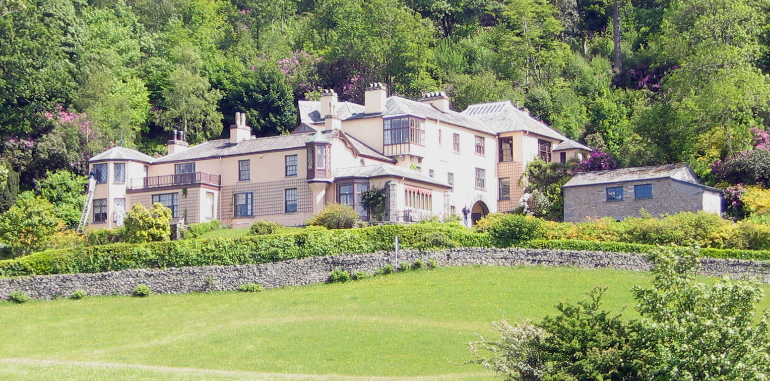
Brantwood

Brantwood is a historic house museum in Cumbria, England, overlooking Coniston Water. It has been the home of a number of prominent people. The house and...

Lawson Park

Lawson Park is a remote English Lake District hillfarm, leased by Grizedale Arts (a contemporary art commissioner) from the Forestry Commission. It is...

Coniston Hall

Coniston Hall is a former house on the west bank of Coniston Water in the English Lake District. It is recorded in the National Heritage List for England...

Nearby Amenities

Located within 500m of 54.348872,-3.0604269
Beck Leven Foot
Source: OS OpenData StreetView
Waterway: rivermouth
Lat/Long: 54.3478609/-3.064133
Parking
Source: OS OpenData StreetView
Lat/Long: 54.3453552/-3.0640112
Ferry Terminal
Lat/Long: 54.3531856/-3.0616052
Bus Stop
Brantwood
Naptan AtcoCode: 090079152194
Naptan Bearing: S
Naptan BusStopType: CUS
Naptan CommonName: Brantwood
Naptan Indicator: o/s
Naptan Landmark: Brantwood
Naptan NaptanCode: cumdgtwj
Naptan Street: No name
Naptan Verified: no
Source: naptan_import
Lat/Long: 54.3532037/-3.0596584
Defibrillator
Access: yes
Defibrillator Location: On the outside wall of the café.
Emergency: defibrillator
Indoor: no
Lat/Long: 54.3529208/-3.0598409
Ruskin's stone seat
Leisure: outdoor_seating
Lat/Long: 54.3528045/-3.0588701
Power: pole
Lat/Long: 54.3446008/-3.060087
The data included in this document is from www.openstreetmap.org. The data is made available under ODbL.

Have you been to Beck Leven Coppice?

Leave your review of Beck Leven Coppice below (or comments, questions and feedback).