Dingle Wood

Wood, Forest in Shropshire

England

Dingle Wood

Glyn
Glyn Credit: N Chadwick

Dingle Wood is a serene and picturesque forest located in the county of Shropshire, England. Nestled within the enchanting landscape of the county, this wood offers a tranquil escape for nature enthusiasts and those seeking solace in a peaceful environment.

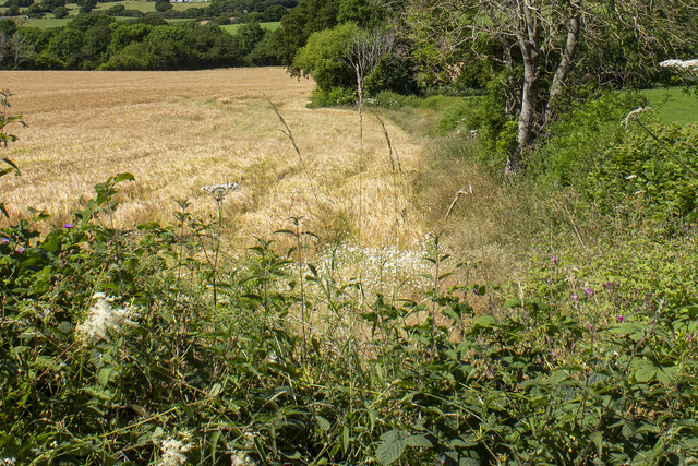
Covering a vast area of approximately 200 acres, Dingle Wood is primarily characterized by its dense canopy of towering oak trees that provide ample shade and create a cool and inviting atmosphere. The wood is also home to a diverse range of flora and fauna, with an array of wildflowers, ferns, and mosses thriving in the forest floor. The rich biodiversity attracts a variety of bird species, making it a popular spot for birdwatchers.

Dingle Wood is crisscrossed with a network of well-maintained footpaths, allowing visitors to explore and immerse themselves in the natural beauty of the surroundings. As visitors meander through the wood, they may stumble upon babbling brooks and small ponds, adding to the idyllic ambiance of the place.

The wood is particularly captivating during the spring season when a vibrant carpet of bluebells blankets the forest floor, creating a breathtaking sight that attracts many photographers and nature enthusiasts. Autumn is another magical time in Dingle Wood, as the changing leaves paint the landscape in hues of gold, red, and orange, providing a stunning visual spectacle.

Dingle Wood is not only a haven for nature lovers but also a popular location for leisurely walks, picnics, and family outings. Its tranquil setting and natural beauty make it an ideal destination for those looking to escape the hustle and bustle of everyday life and reconnect with nature.

If you have any feedback on the listing, please let us know in the comments section below.
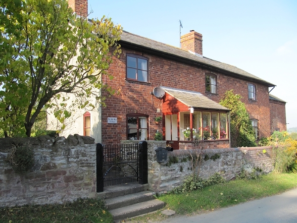
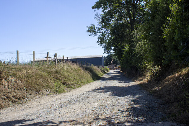
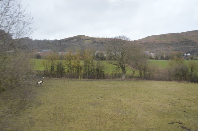
Dingle Wood Images

Images are sourced within 2km of 52.69065/-3.031795 or Grid Reference SJ3010. Thanks to Geograph Open Source API. All images are credited.

View to Winnington Green
Middletown chapel
Middletown chapel
Old Toll House, Winnington Green The Old Rose & Crown, site of a Toll Post by the C466W, in the parish of Westbury.

Shropshire HER (PRN): 15410 <span class="nowrap"><a title="https://www.heritagegateway.org.uk/Gateway/Results_Single.aspx?uid=MSA18344&resourceID=1015" rel="nofollow ugc noopener" href="https://www.heritagegateway.org.uk/Gateway/Results_Single.aspx?uid=MSA18344&resourceID=1015">Link</a><img style="margin-left:2px;" alt="External link" title="External link - shift click to open in new window" src="https://s1.geograph.org.uk/img/external.png" width="10" height="10"/></span>

To be surveyed

Milestone Society National ID: SA.WES
Old Toll House, Winnington Green
The Old Rose & Crown, site of a Toll Post by the C466W, in the parish of Westbury. Shropshire HER (PRN): 15410 LinkExternal link To be surveyed Milestone Society National ID: SA.WES
Upper Winnington Farm Modern farm building at Upper Winnington Farm
Upper Winnington Farm
Modern farm building at Upper Winnington Farm
Hedgerow and cereal field Hedgerow and cereal field near Lower Trefnant Farm
Hedgerow and cereal field
Hedgerow and cereal field near Lower Trefnant Farm
Pont wan / Weak bridge So say the signs, and it's easy to see what they mean. The lane crosses the railway line between Welshpool and Shrewsbury.
Pont wan / Weak bridge
So say the signs, and it's easy to see what they mean. The lane crosses the railway line between Welshpool and Shrewsbury.
Plas-y-Court railway Halt (site), Shropshire Opened in 1934 jointly by the Great Western Railway and London Midland & Scottish Railway on the line from Shrewsbury to Welshpool, this halt closed in 1960.
View west towards Breidden and Welshpool. The diminutive single, timber platform  had been to the left of the track. The railway line had opened in 1862 so this halt was a late addition.
Plas-y-Court railway Halt (site), Shropshire
Opened in 1934 jointly by the Great Western Railway and London Midland & Scottish Railway on the line from Shrewsbury to Welshpool, this halt closed in 1960. View west towards Breidden and Welshpool. The diminutive single, timber platform had been to the left of the track. The railway line had opened in 1862 so this halt was a late addition.
Breidden railway station (site), Powys Opened in 1862 as "Middletown" by the Shrewsbury & Welshpool Railway on the line between those places, this line was jointly owned by the Great Western and London & North Western Railway. The station name was changed to "Middletown Hills in 1919, and to "Breidden" in 1928. It closed in 1960.
View east towards Plas-y-Court and Shrewsbury. This was a passing point on an otherwise single line, unusually with staggered platforms. The Welshpool-bound platform was in the near distance to the right of the track, the Shrewsbury-bound platform just beyond the curve, to the left of the track. See <a href="https://www.geograph.org.uk/photo/1892512">SJ3012 : Breidden Station</a> for a nearer view taken 67 years previously.
Breidden railway station (site), Powys
Opened in 1862 as "Middletown" by the Shrewsbury & Welshpool Railway on the line between those places, this line was jointly owned by the Great Western and London & North Western Railway. The station name was changed to "Middletown Hills in 1919, and to "Breidden" in 1928. It closed in 1960. View east towards Plas-y-Court and Shrewsbury. This was a passing point on an otherwise single line, unusually with staggered platforms. The Welshpool-bound platform was in the near distance to the right of the track, the Shrewsbury-bound platform just beyond the curve, to the left of the track. See SJ3012 : Breidden Station for a nearer view taken 67 years previously.
Middletown viewed from Middletown Hill Middletown is a small village in Powys, very close to the English border and Shropshire.
Middletown Hill is part of the Breidden Hills, which are made up of Breidden Hill (365m 1,197ft), Moel y Golfa (meaning Bare or Bald Hill), the highest at (403m 1,322ft), Middletown Hill (367m 1,204ft), Kempsters Hill and Bausely Hill. They are on the border of England and Wales (Shropshire/Powys), about ten miles west of Shrewsbury.
Breidden Hill is an extinct volcano, and has Rodney's Pillar on its summit. Middletown Hill has an ancient Iron Age Hill fort on its summit.
Middletown viewed from Middletown Hill
Middletown is a small village in Powys, very close to the English border and Shropshire. Middletown Hill is part of the Breidden Hills, which are made up of Breidden Hill (365m 1,197ft), Moel y Golfa (meaning Bare or Bald Hill), the highest at (403m 1,322ft), Middletown Hill (367m 1,204ft), Kempsters Hill and Bausely Hill. They are on the border of England and Wales (Shropshire/Powys), about ten miles west of Shrewsbury. Breidden Hill is an extinct volcano, and has Rodney's Pillar on its summit. Middletown Hill has an ancient Iron Age Hill fort on its summit.
Houses at Middletown
Telephone box in Middletown With the now closed Border Garage in the background across the busy A458.
Telephone box in Middletown
With the now closed Border Garage in the background across the busy A458.
Farm land at Whitfield From railway near Winnington Green
Farm land at Whitfield
From railway near Winnington Green
The Breidden public house in Middletown Roadside pub and car park with the Shrewsbury to Welshpool road adjacent and Moel y Golfa, the highest of the Breidden Hills rising behind into low cloud.
The Breidden public house in Middletown
Roadside pub and car park with the Shrewsbury to Welshpool road adjacent and Moel y Golfa, the highest of the Breidden Hills rising behind into low cloud.
The Breidden, Middletown
Field, Middletown Seen from the A458, with cattle grazing on the lower slopes of Middletown Hill. On the right is Hill Cottage.
Field, Middletown
Seen from the A458, with cattle grazing on the lower slopes of Middletown Hill. On the right is Hill Cottage.
Trees along a stream
The border The line of trees are the England - Wales border.
The border
The line of trees are the England - Wales border.
Show me another place!

Dingle Wood is located at Grid Ref: SJ3010 (Lat: 52.69065, Lng: -3.031795)

Unitary Authority: Shropshire

Police Authority: West Mercia

What 3 Words

///baseballs.bugs.brisk. Near Westbury, Shropshire

Nearby Locations

Dingle Wood

Related Wikis

Breidden railway station

Breidden railway station was a station in Middletown, Powys, Wales. The station closed in 1960. There was a station house and two staggered platforms as...

Middletown, Powys

Middletown (Welsh: Treberfedd) is a hamlet in Powys, Wales near the border with England. It is situated on the A458 road, between the towns of Shrewsbury...

Plas-y-Court Halt railway station

Plas-y-Court Halt railway station was a railway station to the west of Wollaston, Shropshire, England. The station opened in 1934 and closed in 1960...

Trewern

Trewern is a small village, community and electoral ward in Montgomeryshire, Powys, Wales. The community includes the villages of Buttington and Middletown...

Have you been to Dingle Wood?

Leave your review of Dingle Wood below (or comments, questions and feedback).