Oak Haw Wood

Wood, Forest in Lancashire South Lakeland

England

Oak Haw Wood

Coniston Water Coniston Water is the fifth largest of the lakes, at five miles long, and with a maximum depth of 184 feet. It provided an important fish source for the monks of Furness Abbey who owned the lake and much of the surrounding land in the 13th and 14th Centuries.
Coniston Water Credit: Eirian Evans

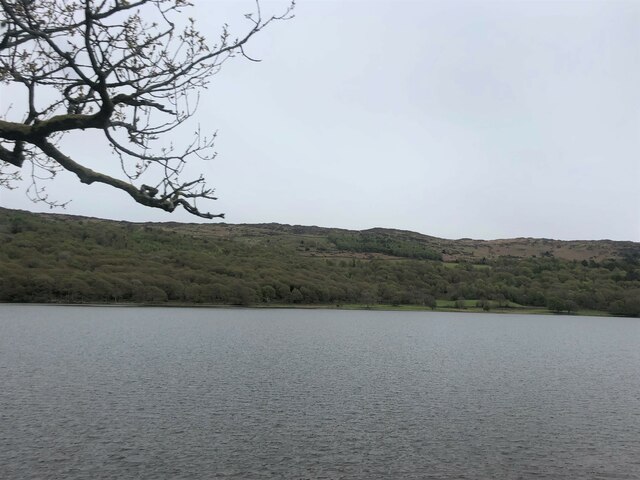
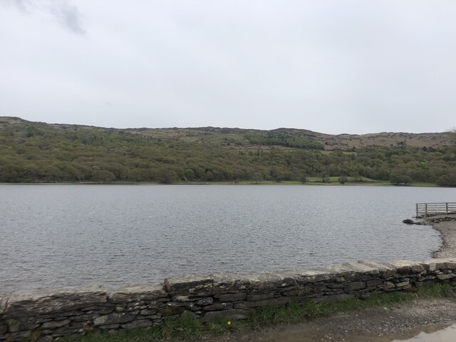
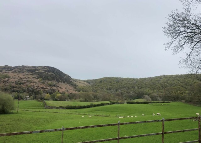
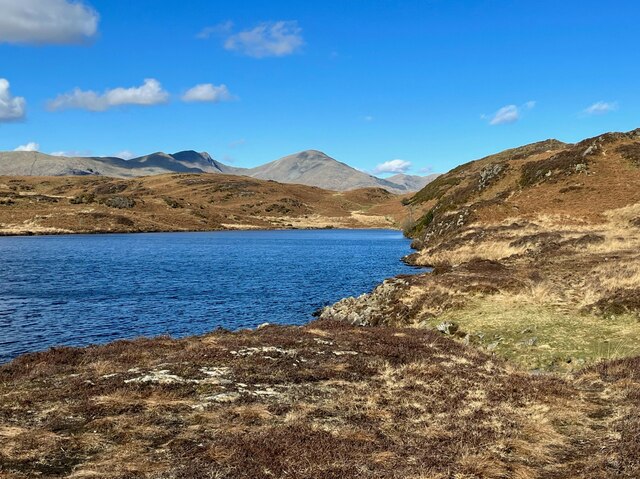
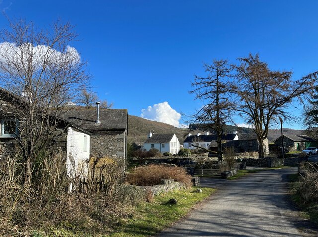
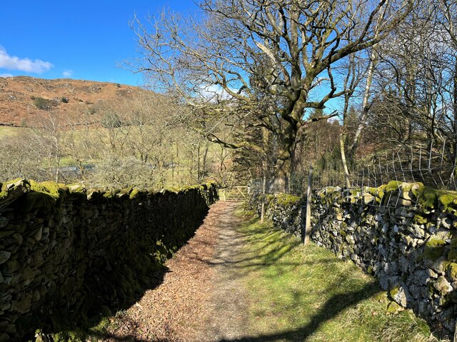
Oak Haw Wood is a picturesque forest located in the county of Lancashire, England. Spread across an area of approximately 200 acres, this woodland offers an enchanting escape for nature lovers and outdoor enthusiasts alike. Situated just a few miles outside the town of Lancashire, Oak Haw Wood is easily accessible and attracts visitors from near and far.

As its name suggests, Oak Haw Wood is predominantly populated by majestic oak trees, which provide a dense canopy of foliage, offering shade and shelter for the diverse range of flora and fauna that call this forest home. The wood is also home to a variety of other tree species, including birch, beech, and hazel, adding to the rich biodiversity of the area.

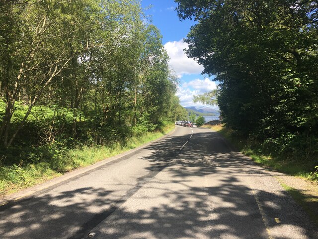
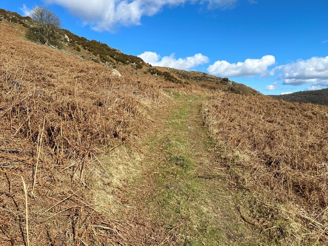
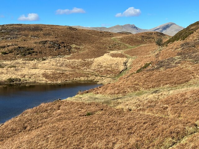
The forest is crisscrossed with a network of well-maintained walking trails, making it a popular destination for hikers and nature walkers. These paths wind their way through the forest, offering visitors the chance to immerse themselves in the tranquil beauty of their surroundings. Along the way, walkers may spot wildflowers, ferns, and mosses carpeting the forest floor, adding bursts of color to the green landscape.

Wildlife enthusiasts will be delighted by the array of creatures that inhabit Oak Haw Wood. The forest is home to a diverse range of bird species, including woodpeckers, owls, and various songbirds. Squirrels and rabbits can often be seen darting through the undergrowth, while lucky visitors may even catch a glimpse of deer or foxes.

Overall, Oak Haw Wood is a haven of natural beauty and tranquility, offering a peaceful retreat for those seeking solace in nature's embrace.

If you have any feedback on the listing, please let us know in the comments section below.
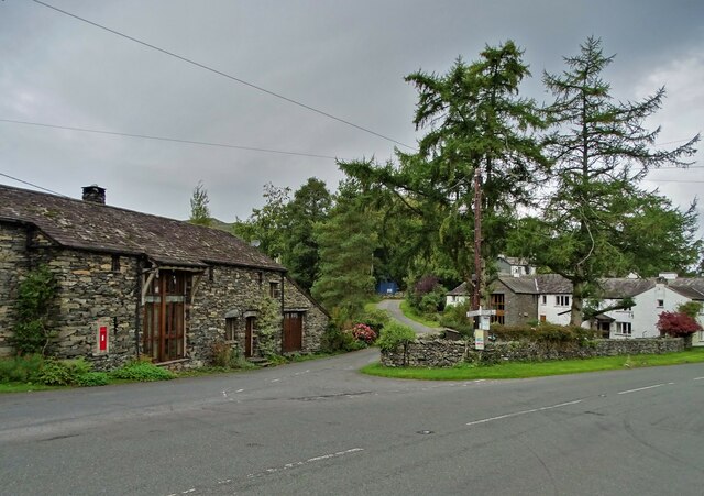
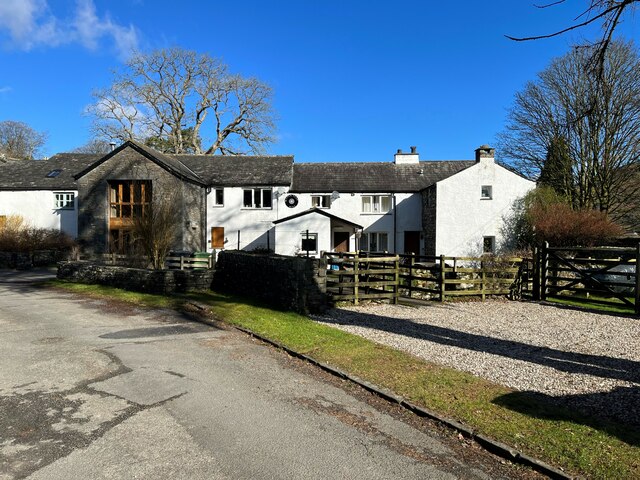
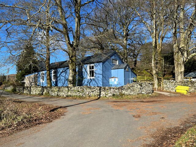
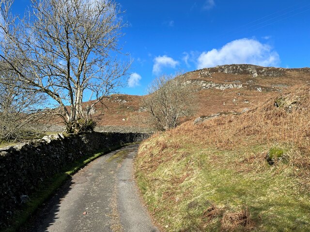
Oak Haw Wood Images

Images are sourced within 2km of 54.296559/-3.089106 or Grid Reference SD2989. Thanks to Geograph Open Source API. All images are credited.

Coniston Water Coniston Water is the fifth largest of the lakes, at five miles long, and with a maximum depth of 184 feet. It provided an important fish source for the monks of Furness Abbey who owned the lake and much of the surrounding land in the 13th and 14th Centuries.
Coniston Water
Coniston Water is the fifth largest of the lakes, at five miles long, and with a maximum depth of 184 feet. It provided an important fish source for the monks of Furness Abbey who owned the lake and much of the surrounding land in the 13th and 14th Centuries.
A glimpse of Coniston Water Towards the southern end of the lake. Boon Wood on the left
A glimpse of Coniston Water
Towards the southern end of the lake. Boon Wood on the left
Farmland at High Nibthwaite South of Coniston Water. The crag on the left is Brook Barrow
Farmland at High Nibthwaite
South of Coniston Water. The crag on the left is Brook Barrow
Wide valley of the River Crake
Former Blawith church Formerly this was the Church of St John the Baptist but it became redundant in 1988 and was sold to be converted in 2012
Former Blawith church
Formerly this was the Church of St John the Baptist but it became redundant in 1988 and was sold to be converted in 2012
A5084 near Coniston Water
Road junction in Water Yeat
At Low Peel Near, Coniston Water
At Low Peel Near looking up Coniston Water
Water Yeat Mill This former corn mill was supplied with water power by Greenholme Beck, fed by Beacon Tarn.  It was converted in the mid-1960s into sheltered accommodation for elderly people and now, much altered, it is partly residential with the remainder let for holidays.
Water Yeat Mill
This former corn mill was supplied with water power by Greenholme Beck, fed by Beacon Tarn. It was converted in the mid-1960s into sheltered accommodation for elderly people and now, much altered, it is partly residential with the remainder let for holidays.
Blawith and Nibthwaite Village Hall This small, wooden village hall is located in Water Yeat.  It is run as a charity by and for the benefit of the local community.
Blawith and Nibthwaite Village Hall
This small, wooden village hall is located in Water Yeat. It is run as a charity by and for the benefit of the local community.
The road to Greenholme Farm Bowder Knott is the hill in the right background.
The road to Greenholme Farm
Bowder Knott is the hill in the right background.
Beacon Tarn The Cumbria Way long distance path follows the far shore of the tarn; Dow Crag and Coniston Old Man form an impressive backdrop.
Beacon Tarn
The Cumbria Way long distance path follows the far shore of the tarn; Dow Crag and Coniston Old Man form an impressive backdrop.
Water Yeat The building on the left is a former corn mill, supplied with water power by Greenholme Beck.
Water Yeat
The building on the left is a former corn mill, supplied with water power by Greenholme Beck.
Track near Greenholme Farm
Beacon Tarn and the Coniston Fells Beacon Tarn lies in a hollow in the Blawith Fells; in the background are Dow Crag and Coniston Old Man.  The steep gorse covered bank to the right is the western slope of Beacon Fell and the path leading through the col behind the solitary hawthorn tree is The Cumbria Way.
Beacon Tarn and the Coniston Fells
Beacon Tarn lies in a hollow in the Blawith Fells; in the background are Dow Crag and Coniston Old Man. The steep gorse covered bank to the right is the western slope of Beacon Fell and the path leading through the col behind the solitary hawthorn tree is The Cumbria Way.
Lane near Cockenskell The Tottlebank Farm to Beacon Tarn public footpath passes through a walled lane near Cockenskell. This is the route of The Cumbria Way long distance path (next photograph <a href="https://www.geograph.org.uk/photo/6884736">SD2789 : Gate on The Cumbria Way near Cockenskell</a>).
Lane near Cockenskell
The Tottlebank Farm to Beacon Tarn public footpath passes through a walled lane near Cockenskell. This is the route of The Cumbria Way long distance path (next photograph SD2789 : Gate on The Cumbria Way near Cockenskell).
Show me another place!

Oak Haw Wood is located at Grid Ref: SD2989 (Lat: 54.296559, Lng: -3.089106)

Administrative County: Cumbria

District: South Lakeland

Police Authority: Cumbria

What 3 Words

///succeed.unscathed.inflamed. Near Ulverston, Cumbria

Related Wikis

Nibthwaite

Nibthwaite is a village in the South Lakeland District in the county of Cumbria in the northwest of England. It is in the civil parish of Colton, and on...

St John the Baptist's Church, Blawith

St John the Baptist's Church is a redundant Anglican church in the settlement of Blawith, Cumbria, England. It is located to the east of the A5084 road...

Blawith and Subberthwaite

Blawith and Subberthwaite is a civil parish in the South Lakeland district of Cumbria, England. It is situated in the Lake District National Park, and...

Beacon Fell, Cumbria

Beacon Fell is a fell in the southern Lake District of England with an altitude of 836 feet (255 m). It is the subject of a chapter of Wainwright's book...

North Lonsdale Rural District

North Lonsdale was a rural district in the county of Lancashire, England from 1894 to 1974. It was created in 1894 as the Ulverston Rural District, and...

Woodland Fell

Woodland Fell is an upland area in the south of the English Lake District, south of Torver, Cumbria. It is the subject of a chapter of Wainwright's book...

Peel Island, Cumbria

Peel Island (formerly known as Montague Island or the Gridiron) is one of the three islands of Coniston Water in the English Lake District, Cumbria. The...

Bandrake Head

Bandrake Head is a village in Cumbria, England. == External links == Media related to Bandrake Head at Wikimedia Commons

Nearby Amenities

Located within 500m of 54.296559,-3.089106
Source: NPE tracing
Lat/Long: 54.2988844/-3.0926449
Source: NPE tracing
Lat/Long: 54.2988102/-3.0924367
Source: NPE tracing
Lat/Long: 54.2986162/-3.0913986
Source: NPE tracing
Lat/Long: 54.2979024/-3.0910057
Source: NPE tracing
Lat/Long: 54.2977334/-3.0906208
Source: NPE tracing
Lat/Long: 54.2978837/-3.0900629
High Nibthwaite
Place: village
Wikidata: Q18353207
Wikipedia: en:Nibthwaite
Lat/Long: 54.2981884/-3.0865565
Lake Bank
Place: hamlet
Lat/Long: 54.2985875/-3.0957377
Source: NPE tracing
Lat/Long: 54.2997118/-3.0926901
Barrier: kissing_gate
Lat/Long: 54.2934436/-3.0886036
Barrier: kissing_gate
Lat/Long: 54.2942266/-3.0871927
Barrier: cattle_grid
Lat/Long: 54.2952981/-3.0949267
Barrier: stile
Lat/Long: 54.2941457/-3.0862876
Telephone
Booth: K6
Covered: booth
Lat/Long: 54.2980082/-3.0862413
Anna's Nab
Place: locality
Lat/Long: 54.3008726/-3.0904321
Nibthwaite Quay
Place: locality
Lat/Long: 54.2989131/-3.0891995
Source: NPE tracing
Lat/Long: 54.2975818/-3.0901423
Barrier: stile
Stile: squeezer
Lat/Long: 54.2987817/-3.0876197
Post Box
Post Box Type: wall
Ref: LA12 19
Royal Cypher: VR
Royal Cypher Wikidata: Q33102356
Lat/Long: 54.2980934/-3.0863833
Generator Method: photovoltaic
Generator Output Electricity: yes
Generator Source: solar
Generator Type: solar_photovoltaic_panel
Location: roof
Power: generator
Lat/Long: 54.2983042/-3.0860723
Information: guidepost
Tourism: information
Lat/Long: 54.2941258/-3.0862814
Information: guidepost
Tourism: information
Lat/Long: 54.2982079/-3.0857893
Power: pole
Lat/Long: 54.2975549/-3.0818707
Power: pole
Lat/Long: 54.2975334/-3.0835797
Power: pole
Lat/Long: 54.2967809/-3.0933877
Power: pole
Lat/Long: 54.296921/-3.0915433
Power: pole
Lat/Long: 54.29705/-3.0893685
Power: pole
Lat/Long: 54.2972068/-3.0874931
Power: pole
Lat/Long: 54.2973413/-3.0861692
The data included in this document is from www.openstreetmap.org. The data is made available under ODbL.

Have you been to Oak Haw Wood?

Leave your review of Oak Haw Wood below (or comments, questions and feedback).