Newlands Wood

Wood, Forest in Lancashire South Lakeland

England

Newlands Wood

Torver Goods Yard The old railway goods yard at Torver is now used by a local builder for storage.  The stone built goods shed contained a loading platform upon which was mounted a 1 ton hand operated crane manufactured by R. Kitchen ironfounders in Warrington.  The crane has subsequently been relocated to the rear of The Wilson’s Arms.  The goods shed was used as a hay barn after the railway closed but lost its roof in a fire and stood derelict for a number of years before being repaired, altered and re-roofed and brought back into use.
Torver Goods Yard Credit: Adrian Taylor

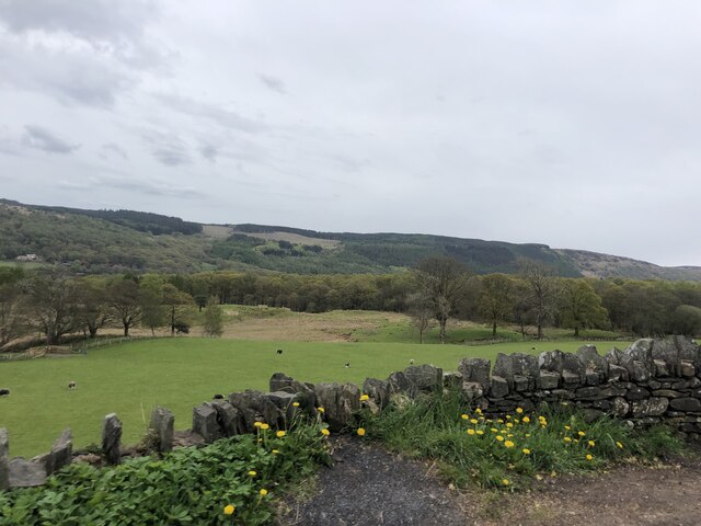
Newlands Wood is a picturesque woodland located in Lancashire, England. Covering an area of approximately 50 acres, it is a popular destination for nature enthusiasts and outdoor enthusiasts alike. The wood is situated near the village of Newlands, which is known for its stunning natural beauty and tranquil atmosphere.

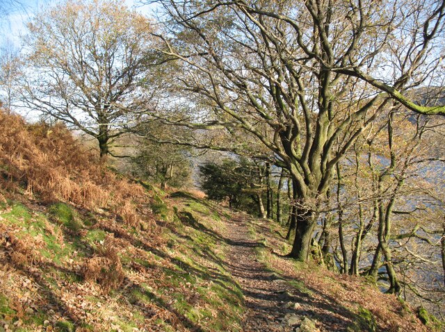
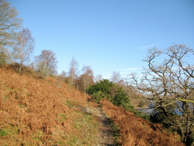
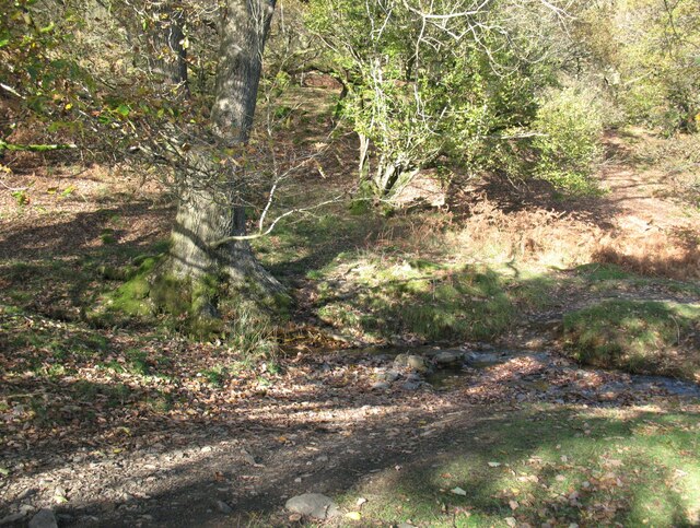
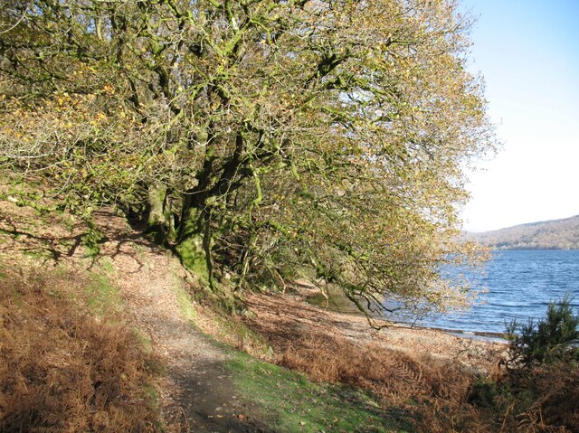
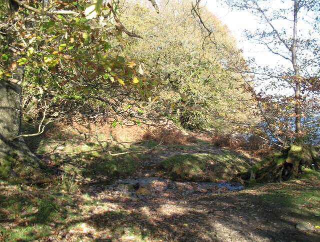
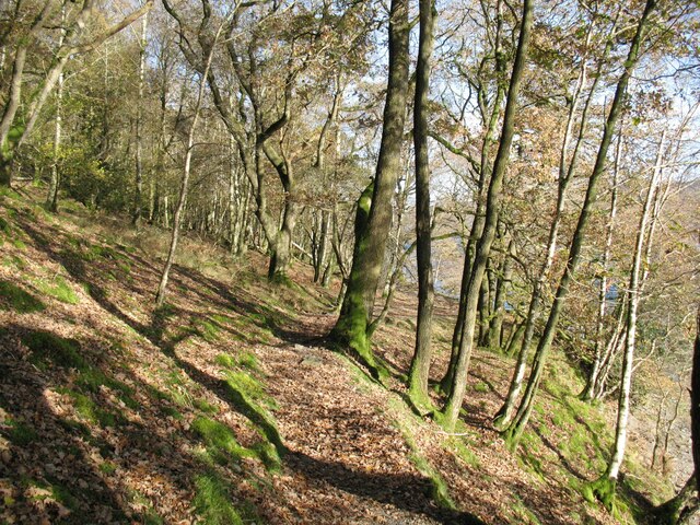
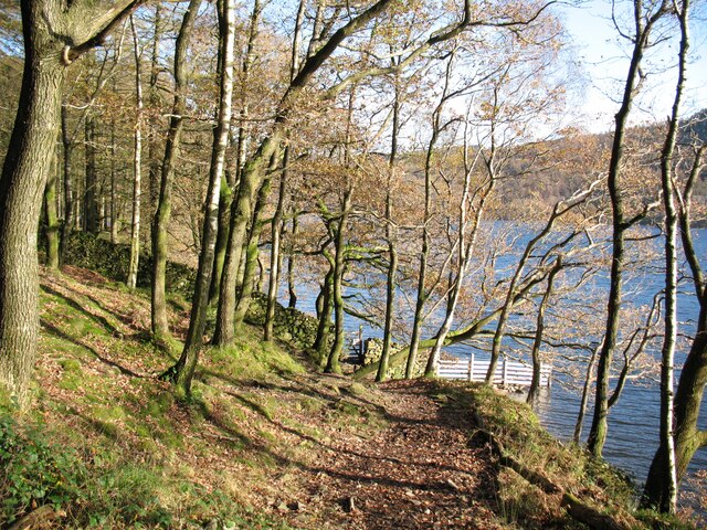
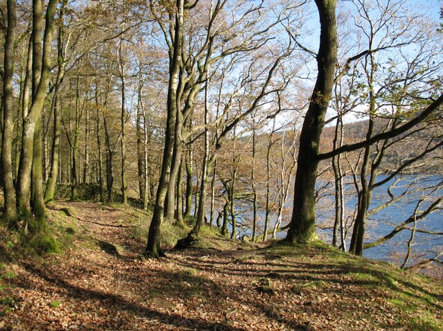
Newlands Wood boasts a diverse range of tree species, including oak, beech, and birch, which create a vibrant and verdant landscape throughout the year. The wood is also home to a variety of wildlife, such as deer, rabbits, and numerous bird species, making it a haven for nature lovers and birdwatchers.

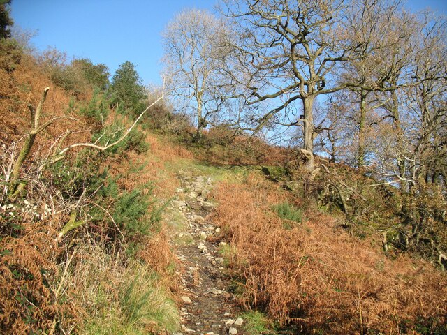
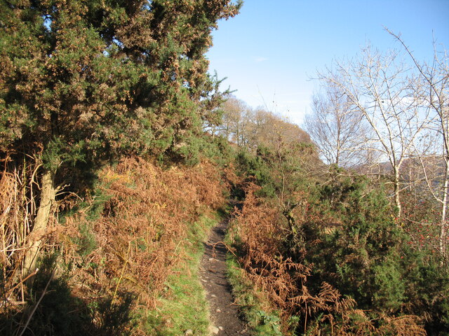
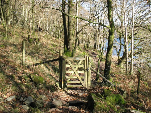
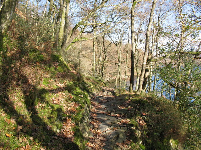
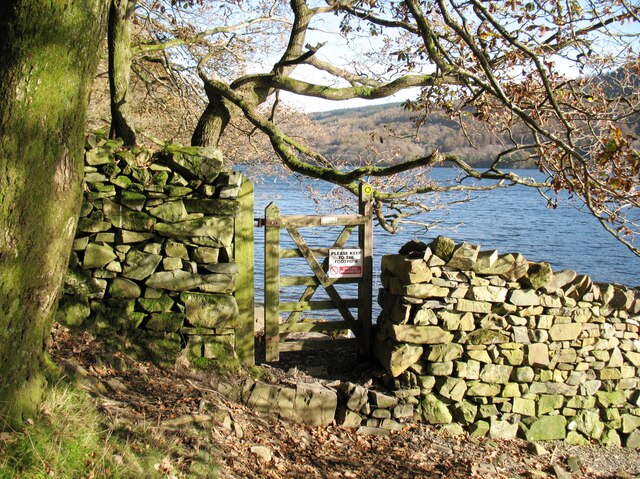
Visitors to Newlands Wood can enjoy a network of well-maintained footpaths and trails that wind their way through the woodland, providing an opportunity to explore the area's natural wonders. The paths are suitable for both leisurely strolls and more challenging hikes, offering something for everyone.

In addition to its natural beauty, Newlands Wood features several amenities to enhance visitors' experience. There are picnic areas where families and friends can relax and enjoy a meal surrounded by the peaceful ambiance of the wood. The wood also provides educational opportunities, with information boards dotted throughout, offering insights into the local flora and fauna.

Newlands Wood is easily accessible, with ample parking available nearby. It is a popular destination for locals and tourists alike, offering a tranquil retreat from the bustling city life. Whether for a leisurely walk, a picnic, or birdwatching, Newlands Wood offers a delightful escape into nature's embrace.

If you have any feedback on the listing, please let us know in the comments section below.

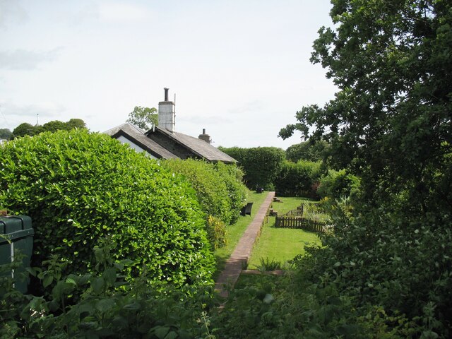
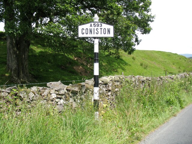
Newlands Wood Images

Images are sourced within 2km of 54.34408/-3.099746 or Grid Reference SD2894. Thanks to Geograph Open Source API. All images are credited.

Torver Goods Yard The old railway goods yard at Torver is now used by a local builder for storage.  The stone built goods shed contained a loading platform upon which was mounted a 1 ton hand operated crane manufactured by R. Kitchen ironfounders in Warrington.  The crane has subsequently been relocated to the rear of The Wilson’s Arms.  The goods shed was used as a hay barn after the railway closed but lost its roof in a fire and stood derelict for a number of years before being repaired, altered and re-roofed and brought back into use.
Torver Goods Yard
The old railway goods yard at Torver is now used by a local builder for storage. The stone built goods shed contained a loading platform upon which was mounted a 1 ton hand operated crane manufactured by R. Kitchen ironfounders in Warrington. The crane has subsequently been relocated to the rear of The Wilson’s Arms. The goods shed was used as a hay barn after the railway closed but lost its roof in a fire and stood derelict for a number of years before being repaired, altered and re-roofed and brought back into use.
Torver The road here passing in front of the cottages and The Wilson Arms was originally the A593 road until it was realigned between a point near Torver Station and Dalton Road Gates level crossing, taking advantage of the alignment of the former railway.
Torver
The road here passing in front of the cottages and The Wilson Arms was originally the A593 road until it was realigned between a point near Torver Station and Dalton Road Gates level crossing, taking advantage of the alignment of the former railway.
Torver Station The station building is now let as a holiday cottage and the old platform is still visible.  The platform and track bed have been converted into a garden with a fenced pond.
Torver station was on the Foxfield to Coniston branch of The Furness Railway.  It was only provided with a single low platform; the red sandstone coping stones still bear a few faint traces of white paint on the platform edge more than 60 years after the line closed to passengers.
Torver Station
The station building is now let as a holiday cottage and the old platform is still visible. The platform and track bed have been converted into a garden with a fenced pond. Torver station was on the Foxfield to Coniston branch of The Furness Railway. It was only provided with a single low platform; the red sandstone coping stones still bear a few faint traces of white paint on the platform edge more than 60 years after the line closed to passengers.
Coniston village sign This road sign on the A593 was erected by Lancashire County Council, pre-dating the formation of Cumbria in 1974 which incorporated that part of Lancashire north of Morecambe Bay.
Located at Park Gate, the sign is unusually far from the village, being almost 1.6km (1 mile) south of the centre of Coniston.
Coniston village sign
This road sign on the A593 was erected by Lancashire County Council, pre-dating the formation of Cumbria in 1974 which incorporated that part of Lancashire north of Morecambe Bay. Located at Park Gate, the sign is unusually far from the village, being almost 1.6km (1 mile) south of the centre of Coniston.
The Cumbria Way, Torver Back Common The Cumbria Way long distance path follows the shore of Coniston Water along the public footpath from Delicars to Coniston.  At this point it climbs away from the lake as it approaches a wooded section of the shoreline (next photograph <a href="https://www.geograph.org.uk/photo/7002618">SD2993 : The Cumbria Way, Torver Back Common</a>).
The Cumbria Way, Torver Back Common
The Cumbria Way long distance path follows the shore of Coniston Water along the public footpath from Delicars to Coniston. At this point it climbs away from the lake as it approaches a wooded section of the shoreline (next photograph SD2993 : The Cumbria Way, Torver Back Common).
The Cumbria Way near Sunny Bank Jetty The path is a public footpath from Delicars to Coniston.  It is also the route of The Cumbria Way long distance trail from Ulverston to Carlisle (next photograph <a href="https://www.geograph.org.uk/photo/6975735">SD2993 : The Cumbria Way, Torver Back Common</a>).
The Cumbria Way near Sunny Bank Jetty
The path is a public footpath from Delicars to Coniston. It is also the route of The Cumbria Way long distance trail from Ulverston to Carlisle (next photograph SD2993 : The Cumbria Way, Torver Back Common).
The Cumbria Way, Torver Back Common The Cumbria Way follows the public footpath from Delicars to Coniston above the shore of Coniston Water (next photograph <a href="https://www.geograph.org.uk/photo/7003403">SD2993 : The Cumbria Way near Bellman’s Hole</a>).
The Cumbria Way, Torver Back Common
The Cumbria Way follows the public footpath from Delicars to Coniston above the shore of Coniston Water (next photograph SD2993 : The Cumbria Way near Bellman’s Hole).
The Cumbria Way near Bellman’s Hole This path above the shore of Coniston Water is the public footpath from Delicars to Coniston. It is the route of The Cumbria Way long distance path from Ulverston to Carlisle (next photograph <a href="https://www.geograph.org.uk/photo/7003650">SD2993 : Moor Gill Foot Ford</a>).
The Cumbria Way near Bellman’s Hole
This path above the shore of Coniston Water is the public footpath from Delicars to Coniston. It is the route of The Cumbria Way long distance path from Ulverston to Carlisle (next photograph SD2993 : Moor Gill Foot Ford).
Moor Gill Foot Ford Moor Gill rises on Torver Back Common and drains into Coniston Water just below this small ford.  The public footpath from Delicars to Coniston which is also the route of The Cumbria Way crosses the ford.
Moor Gill Foot Ford
Moor Gill rises on Torver Back Common and drains into Coniston Water just below this small ford. The public footpath from Delicars to Coniston which is also the route of The Cumbria Way crosses the ford.
The Cumbria Way, Moor Gill Foot The Cumbria Way follows the western shore of Coniston Water through woodland below Torver Back Common (next photograph <a href="https://www.geograph.org.uk/photo/7004202">SD2993 : The Cumbria Way in Torver Common Wood</a>).
The Cumbria Way, Moor Gill Foot
The Cumbria Way follows the western shore of Coniston Water through woodland below Torver Back Common (next photograph SD2993 : The Cumbria Way in Torver Common Wood).
Moor Gill Foot Ford Moor Gill rises on Torver Back Common and drains into Coniston Water just below this small ford.  The public footpath from Delicars to Coniston crosses the ford; it  is the route of The Cumbria Way long distance path (next photograph <a href="https://www.geograph.org.uk/photo/7003649">SD2993 : The Cumbria Way, Moor Gill Foot</a>).
Moor Gill Foot Ford
Moor Gill rises on Torver Back Common and drains into Coniston Water just below this small ford. The public footpath from Delicars to Coniston crosses the ford; it is the route of The Cumbria Way long distance path (next photograph SD2993 : The Cumbria Way, Moor Gill Foot).
Gate in Torver Common Wood The gate crosses a public footpath from Delicars to Coniston which is also the route of The Cumbria Way long distance trail.
Coniston Water can be glimpsed through the trees (next photograph <a href="https://www.geograph.org.uk/photo/7004844">SD2994 : Rocky path in Torver Common Wood</a>).
Gate in Torver Common Wood
The gate crosses a public footpath from Delicars to Coniston which is also the route of The Cumbria Way long distance trail. Coniston Water can be glimpsed through the trees (next photograph SD2994 : Rocky path in Torver Common Wood).
The Cumbria Way in Torver Common Wood The Cumbria Way follows a public footpath along the western shore of Coniston Water through Torver Common Wood (next photograph <a href="https://www.geograph.org.uk/photo/7004120">SD2994 : Gate in Torver Common Wood</a>).
The Cumbria Way in Torver Common Wood
The Cumbria Way follows a public footpath along the western shore of Coniston Water through Torver Common Wood (next photograph SD2994 : Gate in Torver Common Wood).
Rocky path in Torver Common Wood The Cumbria Way follows a public footpath along the western shore of Coniston Water through Torver Common Wood, rounding a rocky spur above the lake shortly before reaching Harrison’s Coppice (next photograph <a href="https://www.geograph.org.uk/photo/7005690">SD2994 : Paths in Torver Common Wood</a>).
Rocky path in Torver Common Wood
The Cumbria Way follows a public footpath along the western shore of Coniston Water through Torver Common Wood, rounding a rocky spur above the lake shortly before reaching Harrison’s Coppice (next photograph SD2994 : Paths in Torver Common Wood).
Gate beside Coniston Water The public footpath from Delicars to Coniston passes through the gate leading from Torver Common Wood into Harrison Coppice.
The waymark on the right hand gatepost indicates that this is the route of The Cumbria Way (next photograph <a href="https://www.geograph.org.uk/photo/7006419">SD2994 : The Cumbria Way, Harrison Coppice</a>).
Gate beside Coniston Water
The public footpath from Delicars to Coniston passes through the gate leading from Torver Common Wood into Harrison Coppice. The waymark on the right hand gatepost indicates that this is the route of The Cumbria Way (next photograph SD2994 : The Cumbria Way, Harrison Coppice).
The Cumbria Way near Coniston Water The Cumbria Way follows the public footpath from Delicars to Coniston along the western shore of Coniston Water (next photograph <a href="https://www.geograph.org.uk/photo/7005687">SD2994 : Gate beside Coniston Water</a>).
The Cumbria Way near Coniston Water
The Cumbria Way follows the public footpath from Delicars to Coniston along the western shore of Coniston Water (next photograph SD2994 : Gate beside Coniston Water).
Paths in Torver Common Wood The path on the left doubles back up through the wood towards the top of Torver Back Common.  The public footpath from Delicars to Coniston and The Cumbria Way follow the path dropping down to the right towards the shore of Coniston Water (next photograph <a href="https://www.geograph.org.uk/photo/7005689">SD2994 : The Cumbria Way near Coniston Water</a>).
Paths in Torver Common Wood
The path on the left doubles back up through the wood towards the top of Torver Back Common. The public footpath from Delicars to Coniston and The Cumbria Way follow the path dropping down to the right towards the shore of Coniston Water (next photograph SD2994 : The Cumbria Way near Coniston Water).
Pasture south of Coniston Park coppice behind and Grizedale Forest on the hills
Pasture south of Coniston
Park coppice behind and Grizedale Forest on the hills
Show me another place!

Newlands Wood is located at Grid Ref: SD2894 (Lat: 54.34408, Lng: -3.099746)

Administrative County: Cumbria

District: South Lakeland

Police Authority: Cumbria

What 3 Words

///broadens.fulfilled.etchings. Near Windermere, Cumbria

Related Wikis

Torver railway station

Torver railway station served the village of Torver, in Lancashire, England (now in Cumbria). It was on the branch line to Coniston. == History == Authorised...

St Luke's Church, Torver

St Luke's Church is in the village of Torver, Cumbria, England. It is an active Anglican parish church in the deanery of Furness, the archdeaconry of...

Torver

Torver is a village and civil parish in the South Lakeland district of Cumbria, England, 3 miles (4.8 km) south west of the village of Coniston and 1 mile...

Bowmanstead

Bowmanstead is a village in Cumbria, England. It is situated 1 mile to the south of Coniston and contains a Catholic church and a pub - The Ship Inn, it...

Nearby Amenities

Located within 500m of 54.34408,-3.099746
Post Box
Collection Times: Mo-Fr 16:15; Sa 11:00
Post Box Type: wall
Ref: LA21 25
Royal Cypher: GR
Royal Cypher Wikidata: Q33102273
Lat/Long: 54.3425491/-3.0966129
The Old Rectory Country Guest House
Addr City: Torver
Addr Postcode: LA21 8AX
Email: enquiries@theoldrectoryhotel.com
Fax: +441539441156
Fhrs Id: 328963
Internet Access: wlan
Internet Access Fee: no
Phone: +44 15394 41353
Smoking: no
Stars: 4
Tourism: guest_house
Website: https://www.theoldrectoryhotel.com/
Lat/Long: 54.3419471/-3.0955613
Barrier: stile
Lat/Long: 54.3403091/-3.0962444
Barrier: stile
Lat/Long: 54.3406923/-3.1033194
Brigg House
Addr City: Torver, Coniston
Addr Postcode: LA21 8AY
Phone: +44 15395 38180
Tourism: guest_house
Website: https://www.lakeland-cottage-company.co.uk/lake-district-cottage/brigg_house/
Lat/Long: 54.3411856/-3.0994924
Barrier: cattle_grid
Lat/Long: 54.3455889/-3.0940102
Barrier: stile
Lat/Long: 54.3455439/-3.094616
Coniston Country Cottages
Addr City: Little Arrow
Addr Postcode: LA21 8AU
Phone: +44 15394 41114
Tourism: guest_house
Website: https://www.conistoncottages.co.uk/
Lat/Long: 54.3459186/-3.0930914
Wheelgate B&B
Addr City: Little Arrow
Addr Postcode: LA21 8AU
Phone: +44 15394 41418
Tourism: guest_house
Website: https://www.wheelgate.co.uk/
Lat/Long: 54.3457327/-3.0932131
Barrier: cattle_grid
Lat/Long: 54.3425282/-3.0947096
Barrier: kissing_gate
Lat/Long: 54.3404073/-3.0979864
Source: survey
Lat/Long: 54.3440004/-3.1023182
Generator Method: photovoltaic
Generator Orientation: east
Generator Output Electricity: yes
Generator Solar Modules: 15
Generator Source: solar
Generator Type: solar_photovoltaic_panel
Location: roof
Power: generator
Lat/Long: 54.3401893/-3.1008076
Material: wood
Power: pole
Lat/Long: 54.3440228/-3.0932589
Material: wood
Power: pole
Lat/Long: 54.3446153/-3.0946764
Power: pole
Lat/Long: 54.3426711/-3.0924971
Power: pole
Lat/Long: 54.3419964/-3.0934064
Power: pole
Lat/Long: 54.3414617/-3.0941199
Power: pole
Lat/Long: 54.3450555/-3.0957064
Power: pole
Lat/Long: 54.3481961/-3.1002344
Power: pole
Lat/Long: 54.3472059/-3.0992395
Power: pole
Lat/Long: 54.3461057/-3.0996563
Power: pole
Lat/Long: 54.345151/-3.0994558
Power: pole
Lat/Long: 54.3444702/-3.0993024
Power: pole
Lat/Long: 54.3405512/-3.1042824
Power: pole
Lat/Long: 54.3410142/-3.1030028
Power: pole
Lat/Long: 54.3414269/-3.1018726
Power: pole
Lat/Long: 54.3423385/-3.1006888
Power: pole
Lat/Long: 54.3437394/-3.099138
Power: pole
Lat/Long: 54.3430655/-3.0981621
Material: wood
Power: pole
Lat/Long: 54.3425751/-3.0974444
Power: pole
Lat/Long: 54.3408807/-3.095244
Power: pole
Lat/Long: 54.3414944/-3.0957542
Power: pole
Lat/Long: 54.3420731/-3.0965566
Bench
Backrest: yes
Material: wood
Seats: 3
Lat/Long: 54.3411006/-3.101417
Man Made: mounting_block
Lat/Long: 54.3409398/-3.1014103
Power: pole
Lat/Long: 54.3402665/-3.1024832
Power: pole
Transformer: yes
Lat/Long: 54.3398732/-3.100784
Bench
Note: horse shoe shaped bench. no back. inscribed with places on the old railway line
Lat/Long: 54.3400401/-3.0985236
Power: pole
Lat/Long: 54.3461346/-3.0983134
Power: pole
Lat/Long: 54.346162/-3.0970616
Power: pole
Lat/Long: 54.3461966/-3.0956502
Power: pole
Lat/Long: 54.3462133/-3.0945927
Power: pole
Lat/Long: 54.3462431/-3.0934187
The data included in this document is from www.openstreetmap.org. The data is made available under ODbL.

Have you been to Newlands Wood?

Leave your review of Newlands Wood below (or comments, questions and feedback).