Ashness Wood

Wood, Forest in Cumberland Allerdale

England

Ashness Wood

Footbridge over the River Derwent Across the flat river flood plain can be seen Shepherds Crag.
Footbridge over the River Derwent Credit: Clive Nicholson

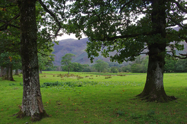
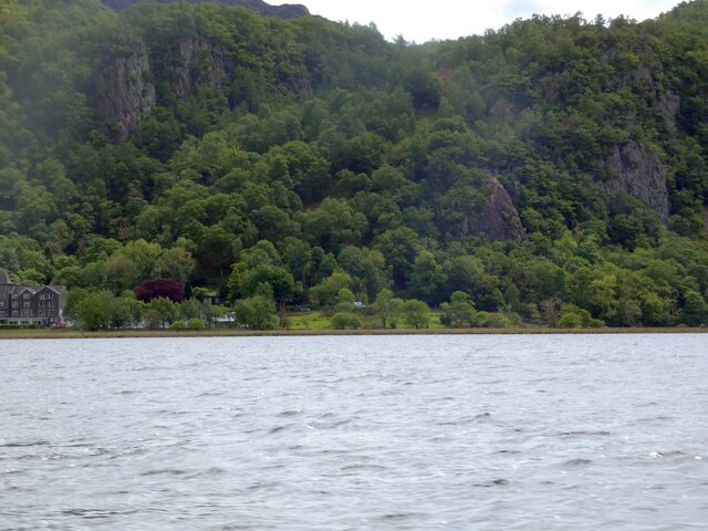
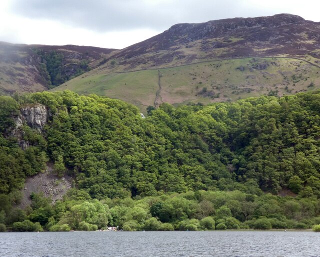
Ashness Wood is a picturesque woodland located in the county of Cumberland in northwest England. Situated near the village of Keswick, the woodland covers an area of approximately 100 acres and is a popular destination for nature lovers and hikers.

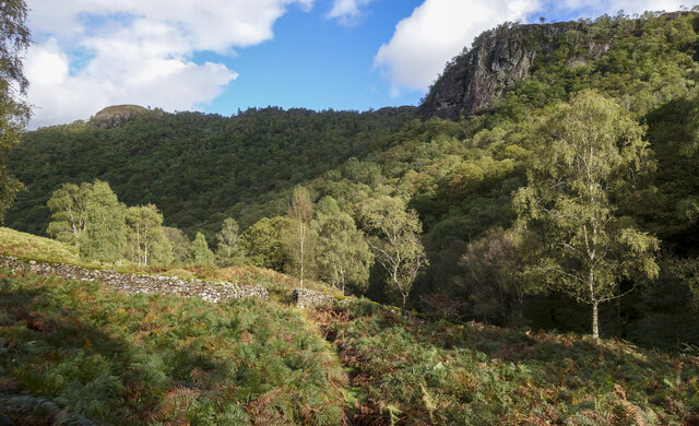
The woodland is primarily composed of ash trees, which give it its name, as well as other native tree species such as oak, birch, and rowan. The dense canopy created by these trees provides a cool and shaded environment, perfect for a leisurely stroll or a peaceful picnic.

Ashness Wood is known for its rich biodiversity, with a variety of plant and animal species calling it home. A wide range of wildflowers can be found here, including bluebells and primroses, which create a vibrant display during the spring months. The woodland also supports a diverse bird population, with species such as woodpeckers, nuthatches, and tawny owls frequently spotted.

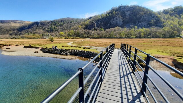
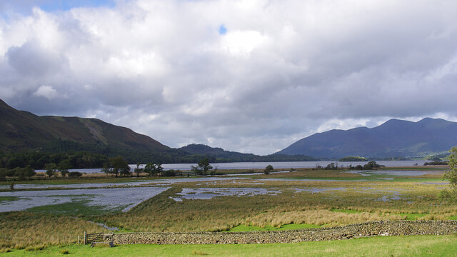
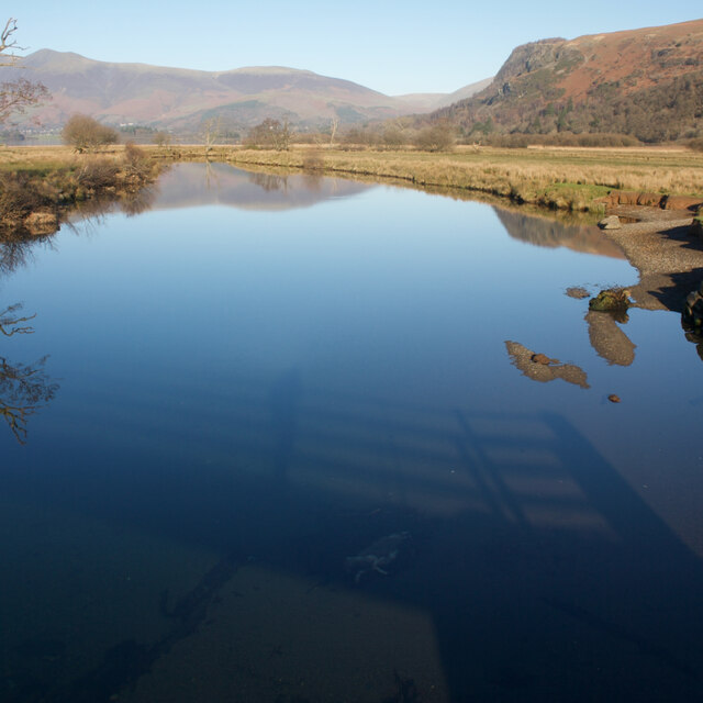
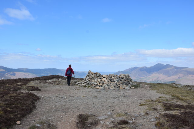
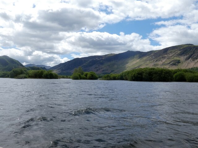
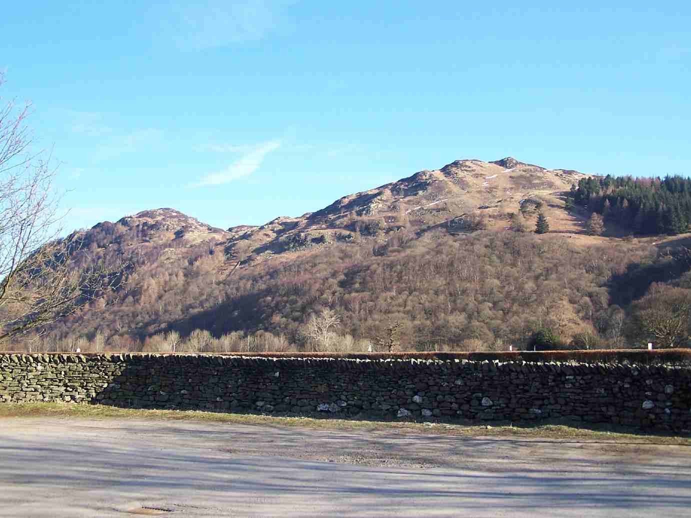
In addition to its natural beauty, Ashness Wood offers stunning panoramic views of the surrounding countryside. On a clear day, visitors can enjoy uninterrupted vistas of the nearby Derwentwater and the imposing peaks of Skiddaw and Blencathra.

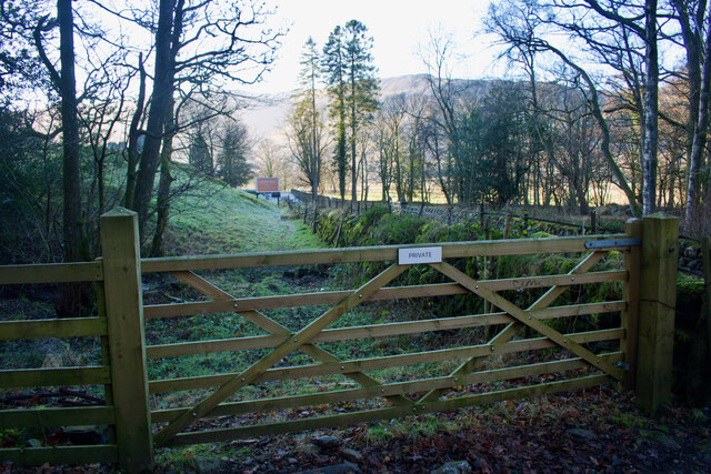
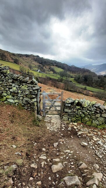
The woodland is easily accessible, with well-maintained paths and trails that cater to different levels of fitness. There are also several viewpoints and picnic areas scattered throughout the woodland, providing opportunities to rest and take in the breathtaking scenery.

Overall, Ashness Wood is a tranquil haven that offers a true escape from the hustle and bustle of everyday life, allowing visitors to immerse themselves in the beauty of nature and enjoy the serenity of this enchanting woodland.

If you have any feedback on the listing, please let us know in the comments section below.

Ashness Wood Images

Images are sourced within 2km of 54.55718/-3.1302307 or Grid Reference NY2718. Thanks to Geograph Open Source API. All images are credited.

Footbridge over the River Derwent Across the flat river flood plain can be seen Shepherds Crag.
Footbridge over the River Derwent
Across the flat river flood plain can be seen Shepherds Crag.
Wall with gap in Troutdale Troutdale is a minor side valley in Borrowdale. The gap in the wall presumably was once sealable by a gate; a bridleway passes through there now.
Wall with gap in Troutdale
Troutdale is a minor side valley in Borrowdale. The gap in the wall presumably was once sealable by a gate; a bridleway passes through there now.
Roadside trees, Borrowdale The number of trees increases as you move away from the head of Derwent Water or the River Derwent.
Roadside trees, Borrowdale
The number of trees increases as you move away from the head of Derwent Water or the River Derwent.
River Derwent flood plain The flat ground at the head of Derwent Water frequently floods. Skiddaw is in the far distance.
River Derwent flood plain
The flat ground at the head of Derwent Water frequently floods. Skiddaw is in the far distance.
Summit, Bleaberry Fell
Ashness Bridge On the minor road from Barrow Bay to Watendlath, the Grade II listed Ashness Bridge over Barrow Beck is a popular tourist attraction.
Barrow Beck flows into Derwentwater and thence into the River Derwent.
Ashness Bridge
On the minor road from Barrow Bay to Watendlath, the Grade II listed Ashness Bridge over Barrow Beck is a popular tourist attraction. Barrow Beck flows into Derwentwater and thence into the River Derwent.
River Derwent From the Chinese Bridge — looks nice enough to swim in, but take a closer look into the water in the shadow of the bridge: a dead sheep.
River Derwent
From the Chinese Bridge — looks nice enough to swim in, but take a closer look into the water in the shadow of the bridge: a dead sheep.
Footpath through Lodore Hotel On my map this is supposed to be a Permissive path to avoid using the road. On the latest O.S. mapping it's classed as a Public Footpath.

Either way its use is not welcoming and the 'bridge' over the beck just beyond the gate is very precarious.
Footpath through Lodore Hotel
On my map this is supposed to be a Permissive path to avoid using the road. On the latest O.S. mapping it's classed as a Public Footpath. Either way its use is not welcoming and the 'bridge' over the beck just beyond the gate is very precarious.
By heck — a double heck Explanation: a 'heck' is a Cumbrian water-gate.
By heck — a double heck
Explanation: a 'heck' is a Cumbrian water-gate.
Ashness Bridge
Ashness Bridge
Gate on Brown Knotts
Bleaberry Fell The wind shelter on the summit of the fell. Looking north west with Skiddaw in the distance on the right of the shot.
Bleaberry Fell
The wind shelter on the summit of the fell. Looking north west with Skiddaw in the distance on the right of the shot.
Brandelhow Point Housing at Brandelhow Point.
Brandelhow Point
Housing at Brandelhow Point.
Housing at Brandelhow Point
Southern end of Derwentwater On the left is the Lodore Falls Hotel.  The B5289 to Borrowdale hugs the ground beneath Shepherds Crag <a href="https://www.geograph.org.uk/photo/1513276">NY2618 : Shepherds Crag</a>.
Southern end of Derwentwater
On the left is the Lodore Falls Hotel. The B5289 to Borrowdale hugs the ground beneath Shepherds Crag NY2618 : Shepherds Crag.
Wooded cliffs overlooking Derwentwater 
Between the Bleaberry Fell and the lakeside are cliffs covered in trees. On the left, above a landslide, there seems to be some kind of face.
Wooded cliffs overlooking Derwentwater
Between the Bleaberry Fell and the lakeside are cliffs covered in trees. On the left, above a landslide, there seems to be some kind of face.
Buoys on Derwentwater Buoys direct boats into the channel for the Lodore landing stage. On the right water from the lake drains into the River Derwent. In the background is the Lodore Falls Hotel.
Buoys on Derwentwater
Buoys direct boats into the channel for the Lodore landing stage. On the right water from the lake drains into the River Derwent. In the background is the Lodore Falls Hotel.
Great Bay The southern end of Derwentwater.
Great Bay
The southern end of Derwentwater.
Show me another place!

Ashness Wood is located at Grid Ref: NY2718 (Lat: 54.55718, Lng: -3.1302307)

Administrative County: Cumbria

District: Allerdale

Police Authority: Cumbria

What 3 Words

///removing.bulbs.pockets. Near Keswick, Cumbria

Nearby Locations

Ashness Fell Ashness Wood

Related Wikis

Lodore Falls

Lodore Falls is a waterfall in Cumbria, England, close to Derwentwater and downstream from Watendlath. The falls are located on the beck that flows from...

Cataract of Lodore

"The Cataract of Lodore" is a poem written in 1820 by the English poet Robert Southey which describes the Lodore Falls on the Watendlath. == Publication... ==
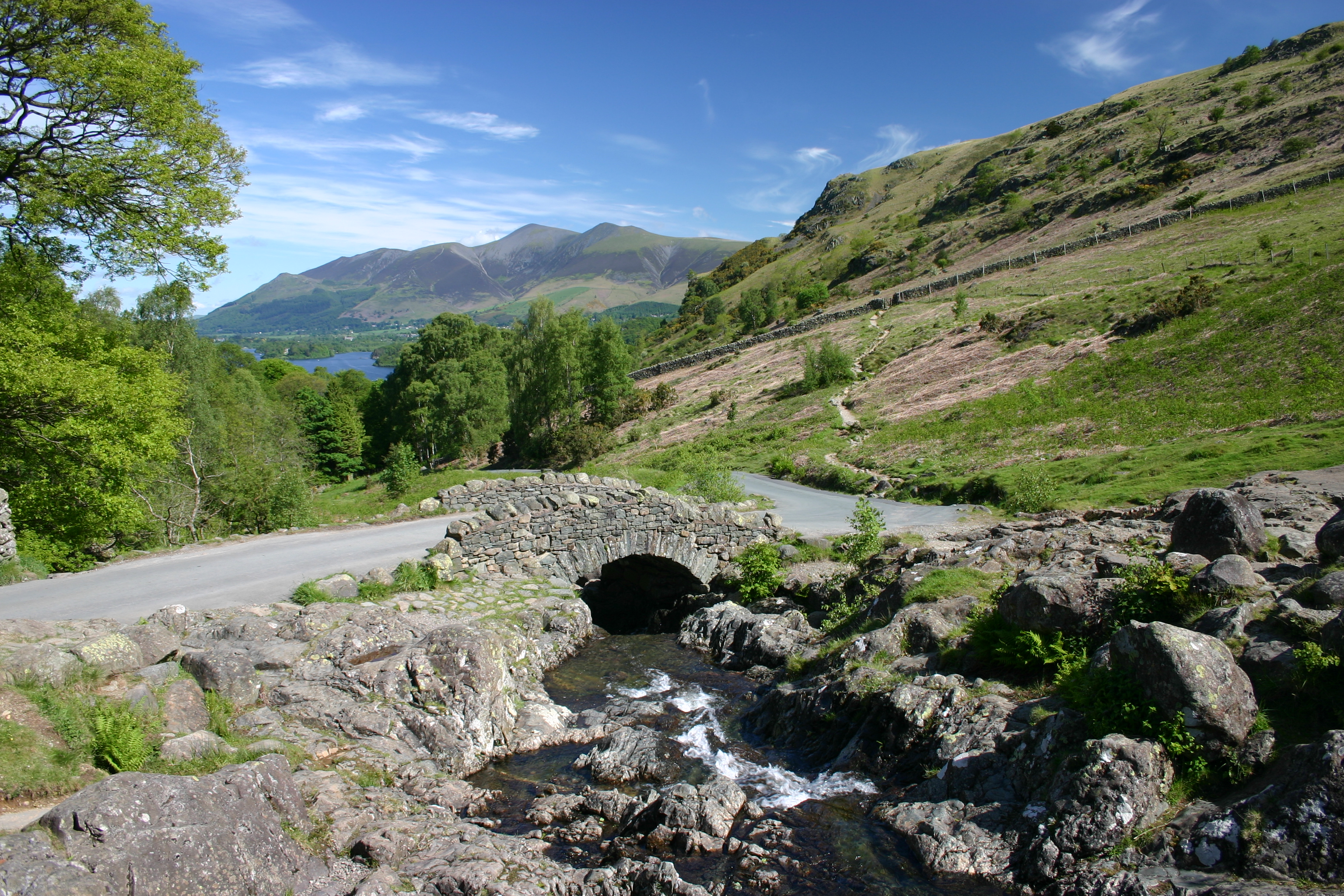
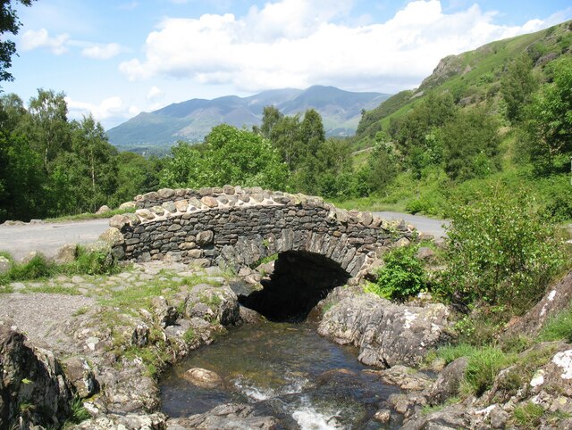
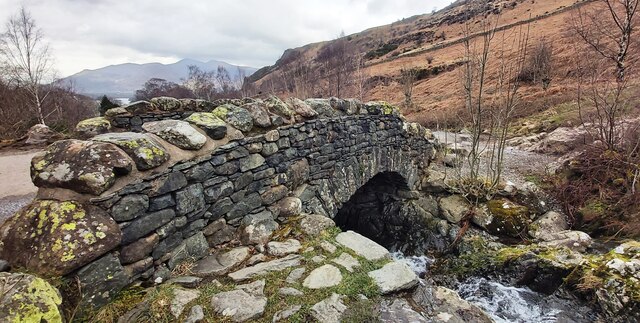
Ashness Bridge

Ashness Bridge is a traditional stone-built bridge on the single-track road from the Borrowdale road (B5289) to Watendlath, in the English Lake District...

Grange Fell

Grange Fell is a small fell in the English Lake District in the county of Cumbria, situated in the Borrowdale valley overlooking the villages of Grange...

Nearby Amenities

Located within 500m of 54.55718,-3.1302307
Barrier: kissing_gate
Source: survey
Lat/Long: 54.5548463/-3.1366319
Barrier: kissing_gate
Source: survey
Lat/Long: 54.5533299/-3.1333603
Surprise View Point
Tourism: viewpoint
Lat/Long: 54.5609149/-3.1332108
Ford: yes
Lat/Long: 54.5557343/-3.134978
Bench
Backrest: no
Lat/Long: 54.5608728/-3.1331487
Skelly Crag
Place: locality
Lat/Long: 54.5566822/-3.1288816
Mossmire Coppice
Natural: wood
Lat/Long: 54.5543947/-3.1355957
Ashness Wood
Natural: wood
Lat/Long: 54.5586507/-3.1309485
Hogs Earth
Place: locality
Lat/Long: 54.5575101/-3.1349344
Gowder Crag
Place: locality
Lat/Long: 54.5581492/-3.1370452
Skelly Close
Place: locality
Lat/Long: 54.5603657/-3.1310092
Barrier: cattle_grid
Lat/Long: 54.5531977/-3.130912
The data included in this document is from www.openstreetmap.org. The data is made available under ODbL.

Have you been to Ashness Wood?

Leave your review of Ashness Wood below (or comments, questions and feedback).