Ashness Fell

Downs, Moorland in Cumberland Allerdale

England

Ashness Fell

Footbridge over the River Derwent Across the flat river flood plain can be seen Shepherds Crag.
Footbridge over the River Derwent Credit: Clive Nicholson

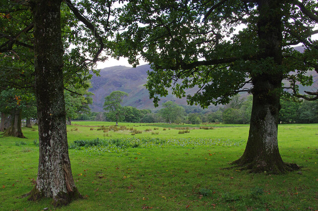
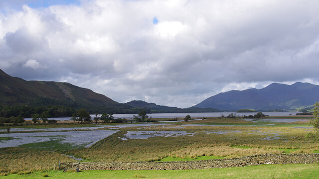
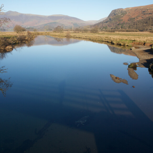
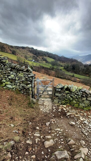
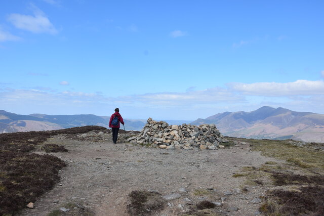
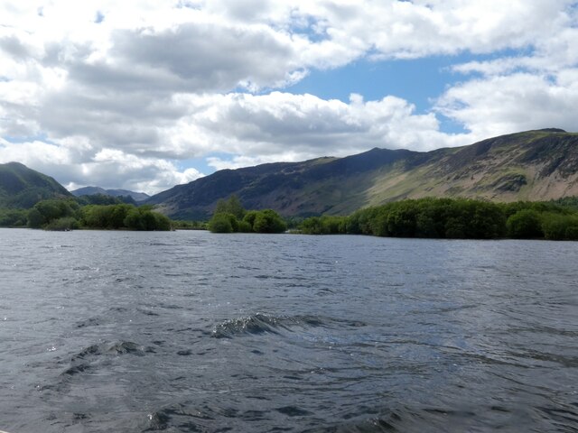
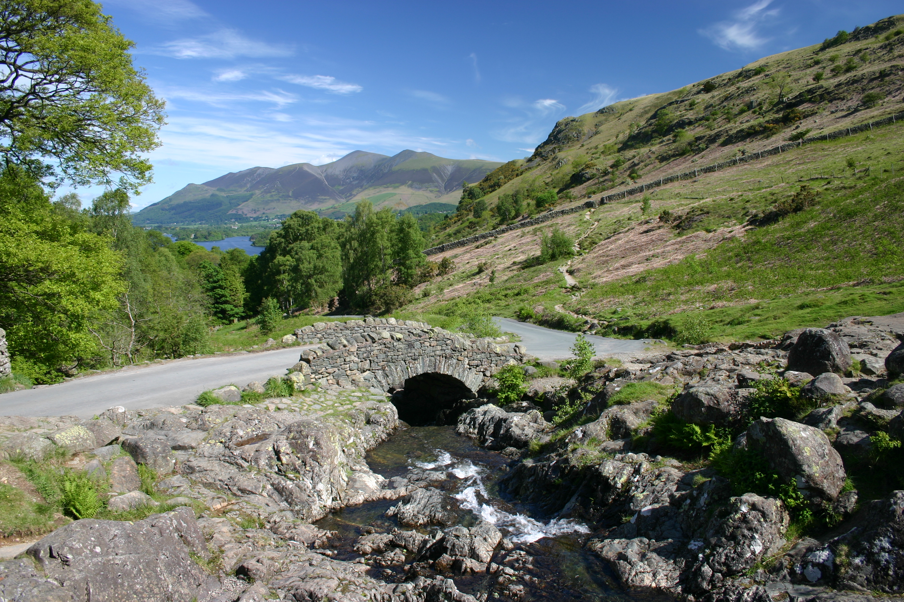
Ashness Fell is a picturesque and renowned landscape located in Cumberland, England. Situated in the Lake District National Park, this elevated area offers breathtaking views of the surrounding countryside. With its rolling hills, verdant meadows, and expansive moorland, Ashness Fell is a haven for nature enthusiasts and hikers alike.

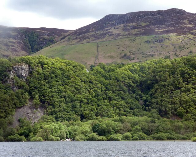
The fell is characterized by its gentle slopes and craggy outcrops, which add a touch of ruggedness to the otherwise serene landscape. The area is rich in biodiversity, hosting a variety of plant species such as heather, bracken, and bilberry. These vibrant flora provide a stunning backdrop, especially when they bloom in the summer months.

Ashness Fell is also home to several animal species, including wild deer, foxes, and birds of prey. Visitors may be lucky enough to catch a glimpse of a majestic red deer or be treated to the sight of a soaring buzzard in the sky.

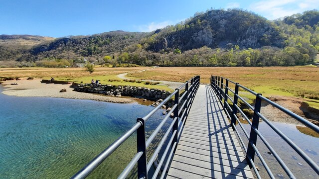
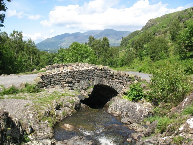
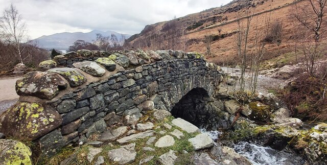
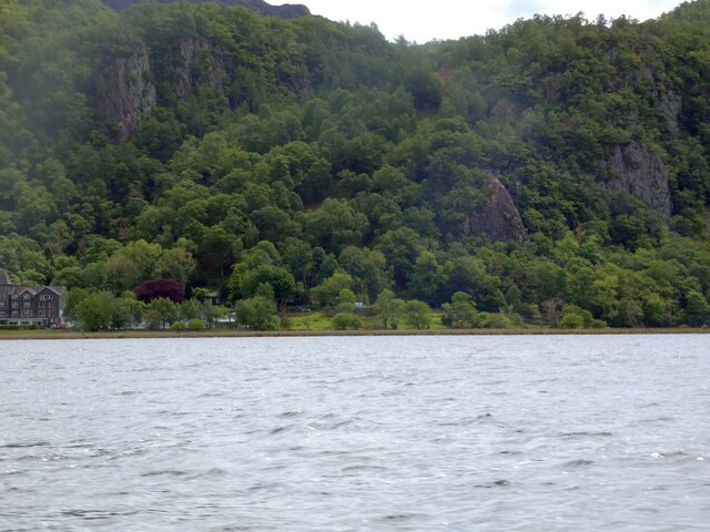
One of the main attractions of Ashness Fell is the Ashness Bridge, a traditional stone bridge that spans over a cascading beck. This iconic landmark has been immortalized in countless photographs, thanks to its idyllic setting with Derwentwater in the background.

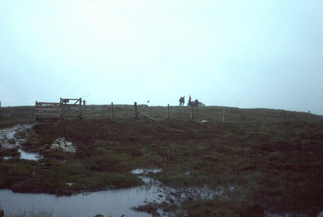
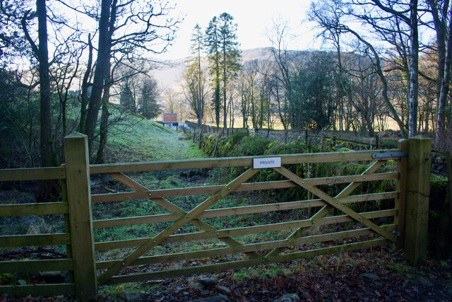
Aside from its natural beauty, Ashness Fell offers numerous walking trails, allowing visitors to explore the area at their own pace. The most popular route is the Ashness Bridge to Watendlath walk, a moderate hike that takes you through woodlands and open moorland, offering stunning panoramic views along the way.

In conclusion, Ashness Fell is a captivating blend of rolling hills, moorland, and stunning vistas. Its location within the Lake District National Park makes it a must-visit destination for those seeking tranquility and natural beauty.

If you have any feedback on the listing, please let us know in the comments section below.

Ashness Fell Images

Images are sourced within 2km of 54.557546/-3.1208545 or Grid Reference NY2718. Thanks to Geograph Open Source API. All images are credited.

Footbridge over the River Derwent Across the flat river flood plain can be seen Shepherds Crag.
Footbridge over the River Derwent
Across the flat river flood plain can be seen Shepherds Crag.
Roadside trees, Borrowdale The number of trees increases as you move away from the head of Derwent Water or the River Derwent.
Roadside trees, Borrowdale
The number of trees increases as you move away from the head of Derwent Water or the River Derwent.
River Derwent flood plain The flat ground at the head of Derwent Water frequently floods. Skiddaw is in the far distance.
River Derwent flood plain
The flat ground at the head of Derwent Water frequently floods. Skiddaw is in the far distance.
Summit, Bleaberry Fell
Ashness Bridge On the minor road from Barrow Bay to Watendlath, the Grade II listed Ashness Bridge over Barrow Beck is a popular tourist attraction.
Barrow Beck flows into Derwentwater and thence into the River Derwent.
Ashness Bridge
On the minor road from Barrow Bay to Watendlath, the Grade II listed Ashness Bridge over Barrow Beck is a popular tourist attraction. Barrow Beck flows into Derwentwater and thence into the River Derwent.
River Derwent From the Chinese Bridge — looks nice enough to swim in, but take a closer look into the water in the shadow of the bridge: a dead sheep.
River Derwent
From the Chinese Bridge — looks nice enough to swim in, but take a closer look into the water in the shadow of the bridge: a dead sheep.
Footpath through Lodore Hotel On my map this is supposed to be a Permissive path to avoid using the road. On the latest O.S. mapping it's classed as a Public Footpath.

Either way its use is not welcoming and the 'bridge' over the beck just beyond the gate is very precarious.
Footpath through Lodore Hotel
On my map this is supposed to be a Permissive path to avoid using the road. On the latest O.S. mapping it's classed as a Public Footpath. Either way its use is not welcoming and the 'bridge' over the beck just beyond the gate is very precarious.
By heck — a double heck Explanation: a 'heck' is a Cumbrian water-gate.
By heck — a double heck
Explanation: a 'heck' is a Cumbrian water-gate.
Ashness Bridge
Ashness Bridge
Gate on Brown Knotts
Bleaberry Fell The wind shelter on the summit of the fell. Looking north west with Skiddaw in the distance on the right of the shot.
Bleaberry Fell
The wind shelter on the summit of the fell. Looking north west with Skiddaw in the distance on the right of the shot.
Southern end of Derwentwater On the left is the Lodore Falls Hotel.  The B5289 to Borrowdale hugs the ground beneath Shepherds Crag <a href="https://www.geograph.org.uk/photo/1513276">NY2618 : Shepherds Crag</a>.
Southern end of Derwentwater
On the left is the Lodore Falls Hotel. The B5289 to Borrowdale hugs the ground beneath Shepherds Crag NY2618 : Shepherds Crag.
Wooded cliffs overlooking Derwentwater 
Between the Bleaberry Fell and the lakeside are cliffs covered in trees. On the left, above a landslide, there seems to be some kind of face.
Wooded cliffs overlooking Derwentwater
Between the Bleaberry Fell and the lakeside are cliffs covered in trees. On the left, above a landslide, there seems to be some kind of face.
Buoys on Derwentwater Buoys direct boats into the channel for the Lodore landing stage. On the right water from the lake drains into the River Derwent. In the background is the Lodore Falls Hotel.
Buoys on Derwentwater
Buoys direct boats into the channel for the Lodore landing stage. On the right water from the lake drains into the River Derwent. In the background is the Lodore Falls Hotel.
Great Bay The southern end of Derwentwater.
Great Bay
The southern end of Derwentwater.
Outflow to the River Derwent 
Buoys direct vessels away from the river and towards the channel into the Lodore landing stage.
Outflow to the River Derwent
Buoys direct vessels away from the river and towards the channel into the Lodore landing stage.
Lodore Falls Hotel 
The main building dates from 1870 and was built on the site of a public house that dates back to at least 1795. It has had a number of owners over the years and is currently owned by Lake District Hotels Ltd. <span class="nowrap"><a title="https://issuu.com/lakedistricthotelsltd/docs/lodore_hotel_history_web" rel="nofollow ugc noopener" href="https://issuu.com/lakedistricthotelsltd/docs/lodore_hotel_history_web">Link</a><img style="margin-left:2px;" alt="External link" title="External link - shift click to open in new window" src="https://s1.geograph.org.uk/img/external.png" width="10" height="10"/></span>
Lodore Falls Hotel
The main building dates from 1870 and was built on the site of a public house that dates back to at least 1795. It has had a number of owners over the years and is currently owned by Lake District Hotels Ltd. LinkExternal link
Lodore Landing Stage
Show me another place!

Ashness Fell is located at Grid Ref: NY2718 (Lat: 54.557546, Lng: -3.1208545)

Administrative County: Cumbria

District: Allerdale

Police Authority: Cumbria

What 3 Words

///tracking.bumps.argue. Near Keswick, Cumbria

Nearby Locations

Ashness Fell Ashness Wood

Related Wikis

Lodore Falls

Lodore Falls is a waterfall in Cumbria, England, close to Derwentwater and downstream from Watendlath. The falls are located on the beck that flows from...

Cataract of Lodore

"The Cataract of Lodore" is a poem written in 1820 by the English poet Robert Southey which describes the Lodore Falls on the Watendlath. == Publication... ==

Ashness Bridge

Ashness Bridge is a traditional stone-built bridge on the single-track road from the Borrowdale road (B5289) to Watendlath, in the English Lake District...

High Seat (Lake District)

High Seat is a fell in the centre of the English Lake District. Despite being below 2,000 ft it is the highest point for about 5 miles (8 km) in any direction...

Nearby Amenities

Located within 500m of 54.557546,-3.1208545
Dodd
Place: locality
Lat/Long: 54.5599222/-3.117548
The data included in this document is from www.openstreetmap.org. The data is made available under ODbL.

Have you been to Ashness Fell?

Leave your review of Ashness Fell below (or comments, questions and feedback).