Crawley Common

Wood, Forest in Dorset East Devon

England

Crawley Common

Metal Gate to a Field A metal gate into a field viewed from a minor road situated west of Chard and near Deerham's Farm in East Devon.
Metal Gate to a Field Credit: John P Reeves

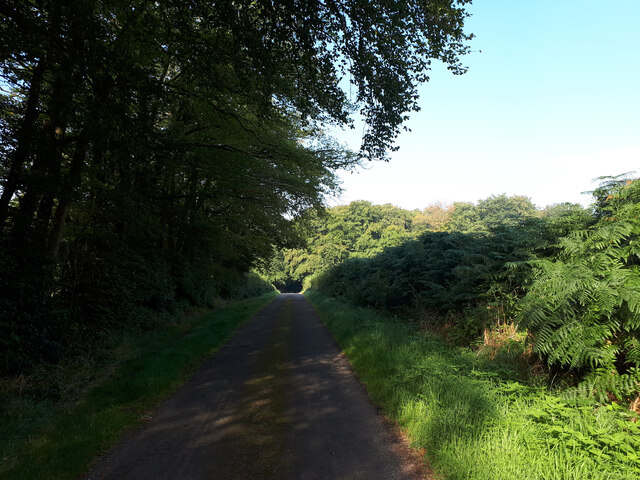
Crawley Common is a picturesque woodland area located in the county of Dorset, England. Covering an area of approximately 100 acres, it is a part of the larger Dorset forest and is known for its natural beauty and diverse wildlife.

The common is characterized by its dense canopy of trees, primarily consisting of oak, beech, and birch. These trees provide a rich habitat for a wide range of animal species, including deer, foxes, rabbits, and various bird species. The forest floor is adorned with a carpet of ferns, bluebells, and wildflowers, creating a vibrant and enchanting landscape.

Crawley Common is a popular destination among nature enthusiasts and hikers, offering a number of well-maintained walking trails that wind through the forest. These trails provide visitors with the opportunity to immerse themselves in the tranquil surroundings, while also allowing them to observe the local wildlife in its natural habitat.

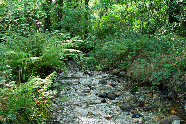
The common is also home to a small pond, which serves as a watering hole for the resident wildlife and attracts a variety of bird species. Birdwatchers can often be found in the area, armed with binoculars and cameras, hoping to catch a glimpse of rare or migratory birds.

Overall, Crawley Common in Dorset is a haven for nature lovers, providing a peaceful retreat from the hustle and bustle of modern life. Its stunning natural beauty, abundant wildlife, and well-maintained trails make it a must-visit destination for those seeking a connection with the great outdoors.

If you have any feedback on the listing, please let us know in the comments section below.

Crawley Common Images

Images are sourced within 2km of 50.865861/-3.0436868 or Grid Reference ST2607. Thanks to Geograph Open Source API. All images are credited.

Metal Gate to a Field A metal gate into a field viewed from a minor road situated west of Chard and near Deerham's Farm in East Devon.
Metal Gate to a Field
A metal gate into a field viewed from a minor road situated west of Chard and near Deerham's Farm in East Devon.
Cyclist, country lane near Wambrook
Bend in lane Continue left for Mounter's Hill.
Bend in lane
Continue left for Mounter's Hill.
Minor road towards New Plantation
Turnpike Caravan Park A view looking to the southwest at the entrance to the Turnpike Caravan Park, showing the novel brick stagecoach and the arrivals area.
Turnpike Caravan Park
A view looking to the southwest at the entrance to the Turnpike Caravan Park, showing the novel brick stagecoach and the arrivals area.
Turnpike Caravan Park A view looking to the north to the touring caravans and a solitary tent at the Turnpike Caravan Park. The amenities building is at the right.
Turnpike Caravan Park
A view looking to the north to the touring caravans and a solitary tent at the Turnpike Caravan Park. The amenities building is at the right.
Yarcombe: footpath through maize A public path has been left through a corn crop. Looking south-south-east
Yarcombe: footpath through maize
A public path has been left through a corn crop. Looking south-south-east
Yarcombe: Chaffhay Farm The slate roof perhaps indicates an extension to the original building. Looking south-south-east
Yarcombe: Chaffhay Farm
The slate roof perhaps indicates an extension to the original building. Looking south-south-east
Yarcombe: the Yarty valley Seen from Pound Lane. Looking east-north-east. Out beyond the square, up on the right, is Gilletts Farm
Yarcombe: the Yarty valley
Seen from Pound Lane. Looking east-north-east. Out beyond the square, up on the right, is Gilletts Farm
Yarcombe: towards Underdown Looking west-south-west from Pound Lane. Unseen in the wood on the right skyline, and beyond the square, the A30 climbs up from Yarcombe village to join the A303 Trunk Road in Upottery, the next parish
Yarcombe: towards Underdown
Looking west-south-west from Pound Lane. Unseen in the wood on the right skyline, and beyond the square, the A30 climbs up from Yarcombe village to join the A303 Trunk Road in Upottery, the next parish
Yarcombe: by Bridge Meadow Looking north. Beyond the gate on the right a public footpath runs along the Yarty valley to Howley
Yarcombe: by Bridge Meadow
Looking north. Beyond the gate on the right a public footpath runs along the Yarty valley to Howley
Yarcombe: filling station Looking east-south-east on the A30 Trunk Road. Yarcombe Coachworks stands in the fork between the main road and the lane to Crawley
Yarcombe: filling station
Looking east-south-east on the A30 Trunk Road. Yarcombe Coachworks stands in the fork between the main road and the lane to Crawley
Yarcombe: bridge over the Yarty The river is crossed on the skew and the bridge appears to be of recent construction. The road from Howley leads to Sheafhayne Cross. Looking west
Yarcombe: bridge over the Yarty
The river is crossed on the skew and the bridge appears to be of recent construction. The road from Howley leads to Sheafhayne Cross. Looking west
Yarcombe: on Cleave Hill Looking north-north-east
Yarcombe: on Cleave Hill
Looking north-north-east
Wambrook: near Wildway House Looking west
Wambrook: near Wildway House
Looking west
Wambrook: by Wortheal Cottage Looking east-south-east on an old track to Loomcroft Farm
Wambrook: by Wortheal Cottage
Looking east-south-east on an old track to Loomcroft Farm
Wambrook: stream in Bickham Wood Looking south-south-west. The field across the nearby lane is part of an estate under the management of the Somerset Wildlife Trust and is right on the border with Devon
Wambrook: stream in Bickham Wood
Looking south-south-west. The field across the nearby lane is part of an estate under the management of the Somerset Wildlife Trust and is right on the border with Devon
Membury: Crawley Farm Hard by the A30 Trunk Road between Yarcombe and Chard, and near the Devon – Somerset border. Looking east
Membury: Crawley Farm
Hard by the A30 Trunk Road between Yarcombe and Chard, and near the Devon – Somerset border. Looking east
Show me another place!

Crawley Common is located at Grid Ref: ST2607 (Lat: 50.865861, Lng: -3.0436868)

Administrative County: Devon

District: East Devon

Police Authority: Devon and Cornwall

What 3 Words

///sticky.reworked.airbase. Near Chard, Somerset

Related Wikis

Horse Pool Camp

Horse Pool Camp is a univallate Iron Age hill fort enclosure in the South Somerset district of Somerset, England. It is also known as Whitestaunton Camp...

Yarcombe

Yarcombe is a village and civil parish in the county of Devon, England, situated in the East Devon administrative district on the A30 road near the towns...

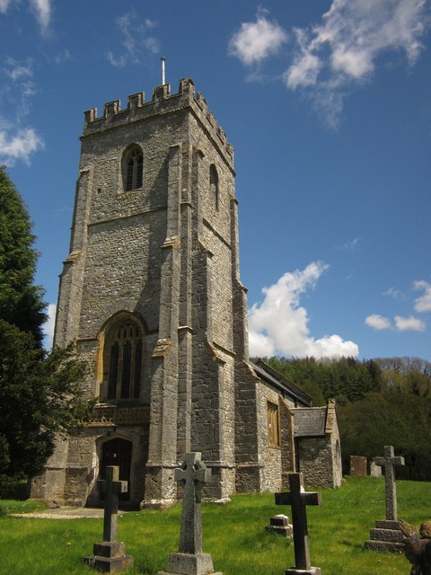
Church of St Mary, Wambrook

The Anglican Church of St Mary in Wambrook, Somerset, England, was built in the 13th century. It is a Grade II* listed building. == History == The church...

Wambrook

Wambrook is a village and civil parish in the Blackdown Hills, Somerset, England. The village lies about 2 miles (3 km) southwest of the town of Chard...

Marsh, Devon

Marsh is a village in the Blackdown Hills, Devon, England. It is part of the East Devon district, and close to the River Yarty and border with Somerset...

Whitestaunton

Whitestaunton is a village and civil parish in the South Somerset district of Somerset, England. The parish includes the hamlet of Northay. It was known...

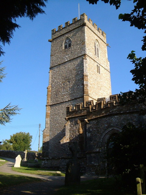
St Andrew's Church, Whitestaunton

The Church of St Andrew in Whitestaunton, Somerset, England, dates from the 13th century and has been designated as a Grade I listed building.The Perpendicular...
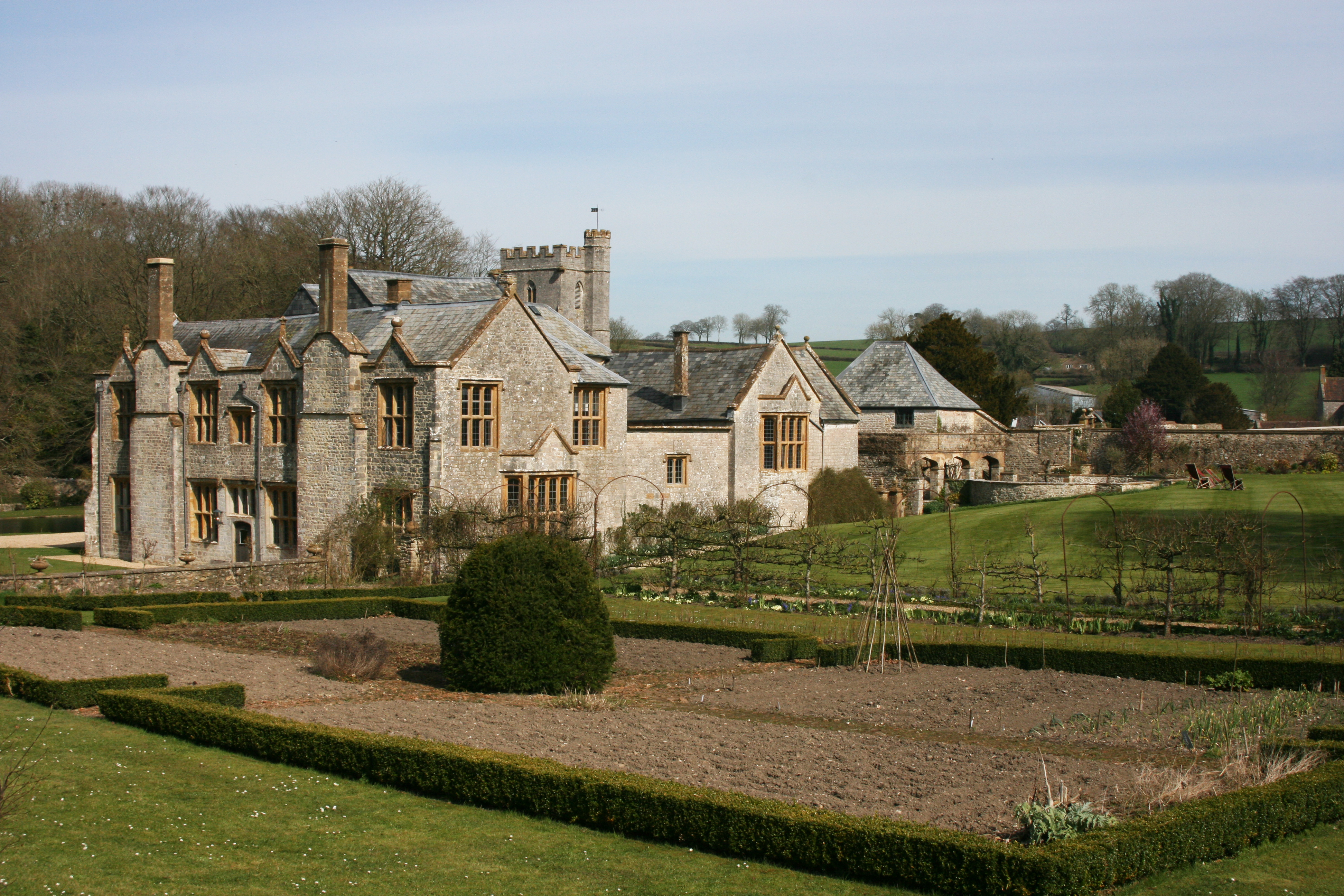
Whitestaunton Manor

Whitestaunton Manor in the village of Whitestaunton, Somerset, England was built in the 15th century as a Hall house and has been designated as a Grade...

Nearby Amenities

Located within 500m of 50.865861,-3.0436868
Power: pole
Source: bing
Lat/Long: 50.8681699/-3.0443394
Power: pole
Source: bing
Lat/Long: 50.8678331/-3.0486846
Power: pole
Source: bing
Lat/Long: 50.8677908/-3.0497628
Power: pole
Source: bing
Lat/Long: 50.8678885/-3.0475555
Power: pole
Source: bing
Lat/Long: 50.8683815/-3.0447203
Power: pole
Source: bing
Lat/Long: 50.8681344/-3.0457717
Power: pole
Source: bing
Lat/Long: 50.8679329/-3.0466703
Power: pole
Source: bing
Lat/Long: 50.8630033/-3.0473837
Power: pole
Source: bing
Lat/Long: 50.8634096/-3.0465093
Power: pole
Source: bing
Lat/Long: 50.863821/-3.0456564
Power: pole
Source: bing
Lat/Long: 50.8635223/-3.0445552
Power: pole
Source: bing
Lat/Long: 50.8652075/-3.0369875
Power: pole
Source: bing
Lat/Long: 50.8651195/-3.0372691
Power: pole
Source: bing
Lat/Long: 50.8649248/-3.0377868
Power: pole
Source: bing
Lat/Long: 50.8645947/-3.0387497
Power: pole
Source: bing
Lat/Long: 50.864246/-3.0396643
Power: pole
Source: bing
Lat/Long: 50.863825/-3.0408123
Power: pole
Source: bing
Lat/Long: 50.8633775/-3.041625
Power: pole
Source: bing
Lat/Long: 50.8629289/-3.0424216
Power: pole
Source: bing
Lat/Long: 50.8632268/-3.0435294
Power: pole
Source: bing
Transformer: distribution
Lat/Long: 50.8640056/-3.04122
The data included in this document is from www.openstreetmap.org. The data is made available under ODbL.

Have you been to Crawley Common?

Leave your review of Crawley Common below (or comments, questions and feedback).