Crawley Copse

Wood, Forest in Dorset East Devon

England

Crawley Copse

Metal Gate to a Field A metal gate into a field viewed from a minor road situated west of Chard and near Deerham's Farm in East Devon.
Metal Gate to a Field Credit: John P Reeves

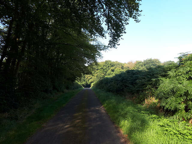
Crawley Copse is a picturesque wood located in the county of Dorset, England. Covering an area of approximately 50 acres, it is a prominent feature of the local landscape and a popular destination for nature enthusiasts and outdoor enthusiasts alike.

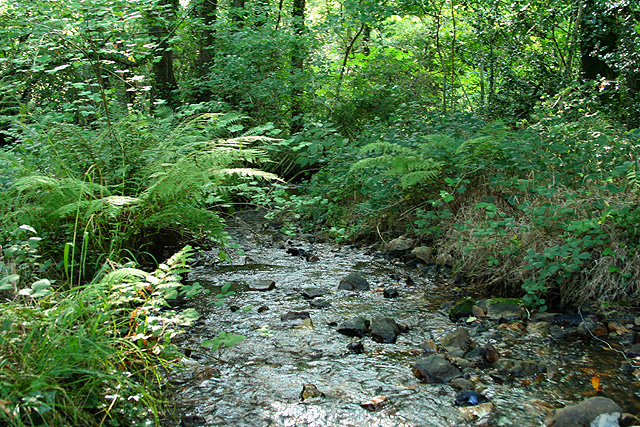
The copse is known for its diverse range of tree species, including oak, beech, hazel, and birch, which create a dense and vibrant woodland environment. The trees form a canopy that provides shade and shelter, making it an ideal habitat for a variety of wildlife.

Visitors to Crawley Copse can enjoy exploring its network of walking trails, which meander through the wood and offer breathtaking views of the surrounding countryside. The trails are well-maintained and suitable for all levels of fitness, making it accessible to both casual strollers and avid hikers.

The copse is also home to a rich array of flora and fauna. Wildflowers such as bluebells, primroses, and foxgloves adorn the forest floor during the spring and summer months, creating a stunning display of color. Birdwatchers will delight in the chance to spot native species such as woodpeckers, thrushes, and owls, while small mammals like squirrels and rabbits can often be seen darting among the undergrowth.

In addition to its natural beauty, Crawley Copse holds historical significance. It was once part of an extensive ancient woodland that covered much of the area and has links to local folklore and legends.

Overall, Crawley Copse is a captivating woodland retreat that offers a tranquil escape from the hustle and bustle of daily life. Its combination of scenic beauty, diverse wildlife, and historical charm makes it a must-visit destination for nature lovers and history enthusiasts alike.

If you have any feedback on the listing, please let us know in the comments section below.

Crawley Copse Images

Images are sourced within 2km of 50.859562/-3.0480787 or Grid Reference ST2607. Thanks to Geograph Open Source API. All images are credited.

Metal Gate to a Field A metal gate into a field viewed from a minor road situated west of Chard and near Deerham's Farm in East Devon.
Metal Gate to a Field
A metal gate into a field viewed from a minor road situated west of Chard and near Deerham's Farm in East Devon.
Cyclist, country lane near Wambrook
Minor road towards New Plantation
Yarcombe: footpath through maize A public path has been left through a corn crop. Looking south-south-east
Yarcombe: footpath through maize
A public path has been left through a corn crop. Looking south-south-east
Yarcombe: Chaffhay Farm The slate roof perhaps indicates an extension to the original building. Looking south-south-east
Yarcombe: Chaffhay Farm
The slate roof perhaps indicates an extension to the original building. Looking south-south-east
Yarcombe: the Yarty valley Seen from Pound Lane. Looking east-north-east. Out beyond the square, up on the right, is Gilletts Farm
Yarcombe: the Yarty valley
Seen from Pound Lane. Looking east-north-east. Out beyond the square, up on the right, is Gilletts Farm
Yarcombe: towards Underdown Looking west-south-west from Pound Lane. Unseen in the wood on the right skyline, and beyond the square, the A30 climbs up from Yarcombe village to join the A303 Trunk Road in Upottery, the next parish
Yarcombe: towards Underdown
Looking west-south-west from Pound Lane. Unseen in the wood on the right skyline, and beyond the square, the A30 climbs up from Yarcombe village to join the A303 Trunk Road in Upottery, the next parish
Yarcombe: by Bridge Meadow Looking north. Beyond the gate on the right a public footpath runs along the Yarty valley to Howley
Yarcombe: by Bridge Meadow
Looking north. Beyond the gate on the right a public footpath runs along the Yarty valley to Howley
Yarcombe: filling station Looking east-south-east on the A30 Trunk Road. Yarcombe Coachworks stands in the fork between the main road and the lane to Crawley
Yarcombe: filling station
Looking east-south-east on the A30 Trunk Road. Yarcombe Coachworks stands in the fork between the main road and the lane to Crawley
Wambrook: near Wildway House Looking west
Wambrook: near Wildway House
Looking west
Wambrook: by Wortheal Cottage Looking east-south-east on an old track to Loomcroft Farm
Wambrook: by Wortheal Cottage
Looking east-south-east on an old track to Loomcroft Farm
Wambrook: stream in Bickham Wood Looking south-south-west. The field across the nearby lane is part of an estate under the management of the Somerset Wildlife Trust and is right on the border with Devon
Wambrook: stream in Bickham Wood
Looking south-south-west. The field across the nearby lane is part of an estate under the management of the Somerset Wildlife Trust and is right on the border with Devon
Membury: Crawley Farm Hard by the A30 Trunk Road between Yarcombe and Chard, and near the Devon – Somerset border. Looking east
Membury: Crawley Farm
Hard by the A30 Trunk Road between Yarcombe and Chard, and near the Devon – Somerset border. Looking east
Membury: oak tree Standing by the entrance to Gilletts Farm. Looking south east
Membury: oak tree
Standing by the entrance to Gilletts Farm. Looking south east
Wambrook: at Mounter’s Hill Looking east-north-east at a crossroads. The road to the left leads to Chard. The way ahead runs to Wambrook and Membury is reached by turning right. A Devon crossroads would be named, but this one is across the border in Somerset
Wambrook: at Mounter’s Hill
Looking east-north-east at a crossroads. The road to the left leads to Chard. The way ahead runs to Wambrook and Membury is reached by turning right. A Devon crossroads would be named, but this one is across the border in Somerset
Wambrook: baling straw at Mounter’s Hill Looking south east
Wambrook: baling straw at Mounter’s Hill
Looking south east
Wambrook: entrance to Deerhams Farm Looking south west on Money Pit Lane
Wambrook: entrance to Deerhams Farm
Looking south west on Money Pit Lane
Membury: former inn at Long Bridge Now a private house, this was formerly the Longbridge Inn and the sign still stands across the road. It was listed as a pub by CAMRA in 1993 when it featured a restaurant and two skittle alleys. There are now two bridges nearby: one over the Yarty and a second over another watercourse, possibly an old leat or tail race or flood channel
Membury: former inn at Long Bridge
Now a private house, this was formerly the Longbridge Inn and the sign still stands across the road. It was listed as a pub by CAMRA in 1993 when it featured a restaurant and two skittle alleys. There are now two bridges nearby: one over the Yarty and a second over another watercourse, possibly an old leat or tail race or flood channel
Show me another place!

Crawley Copse is located at Grid Ref: ST2607 (Lat: 50.859562, Lng: -3.0480787)

Administrative County: Devon

District: East Devon

Police Authority: Devon and Cornwall

What 3 Words

///guests.planting.first. Near Chard, Somerset

Related Wikis

Horse Pool Camp

Horse Pool Camp is a univallate Iron Age hill fort enclosure in the South Somerset district of Somerset, England. It is also known as Whitestaunton Camp...

Yarcombe

Yarcombe is a village and civil parish in the county of Devon, England, situated in the East Devon administrative district on the A30 road near the towns...

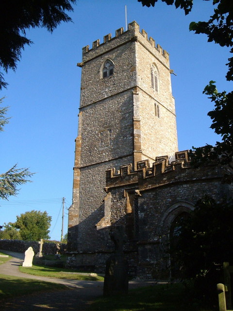
Church of St Mary, Wambrook

The Anglican Church of St Mary in Wambrook, Somerset, England, was built in the 13th century. It is a Grade II* listed building. == History == The church...

Stockland, Devon

Stockland is a village and civil parish in Devon, close to the Somerset boundary. The parish is surrounded clockwise from the north by the parishes of...

Wambrook

Wambrook is a village and civil parish in the Blackdown Hills, Somerset, England. The village lies about 2 miles (3 km) southwest of the town of Chard...

Marsh, Devon

Marsh is a village in the Blackdown Hills, Devon, England. It is part of the East Devon district, and close to the River Yarty and border with Somerset...

Whitestaunton

Whitestaunton is a village and civil parish in the South Somerset district of Somerset, England. The parish includes the hamlet of Northay. It was known...

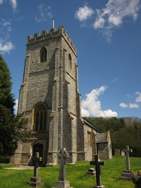
St Andrew's Church, Whitestaunton

The Church of St Andrew in Whitestaunton, Somerset, England, dates from the 13th century and has been designated as a Grade I listed building.The Perpendicular...

Nearby Amenities

Located within 500m of 50.859562,-3.0480787
Power: pole
Source: bing
Lat/Long: 50.8624159/-3.0485773
Power: pole
Source: bing
Lat/Long: 50.8630033/-3.0473837
Power: pole
Source: bing
Lat/Long: 50.8634096/-3.0465093
Power: pole
Source: bing
Transformer: distribution
Lat/Long: 50.8561947/-3.0454539
Power: pole
Source: bing
Lat/Long: 50.8558111/-3.0456349
The data included in this document is from www.openstreetmap.org. The data is made available under ODbL.

Have you been to Crawley Copse?

Leave your review of Crawley Copse below (or comments, questions and feedback).