Clopton Corner

Settlement in Suffolk East Suffolk

England

Clopton Corner

Otley, St Mary
Otley, St Mary Credit: Dave Kelly

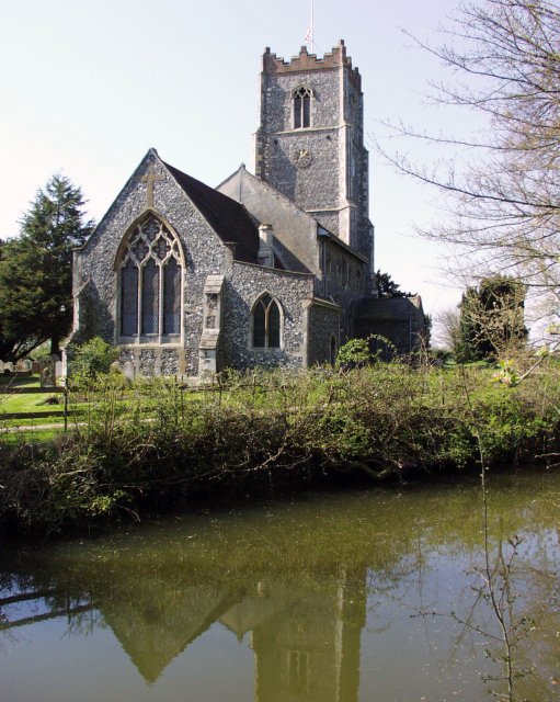
Clopton Corner is a small village located in the county of Suffolk, England. Nestled in the lush countryside, it is situated approximately 11 miles northeast of the county town, Ipswich. With a population of around 300 residents, Clopton Corner exudes a charming and tranquil atmosphere.

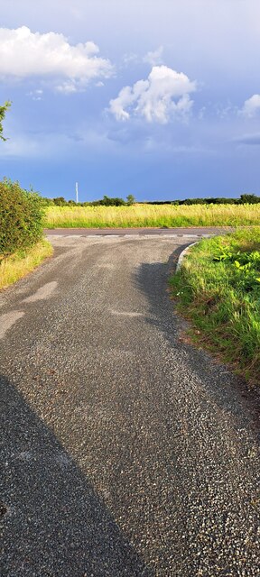
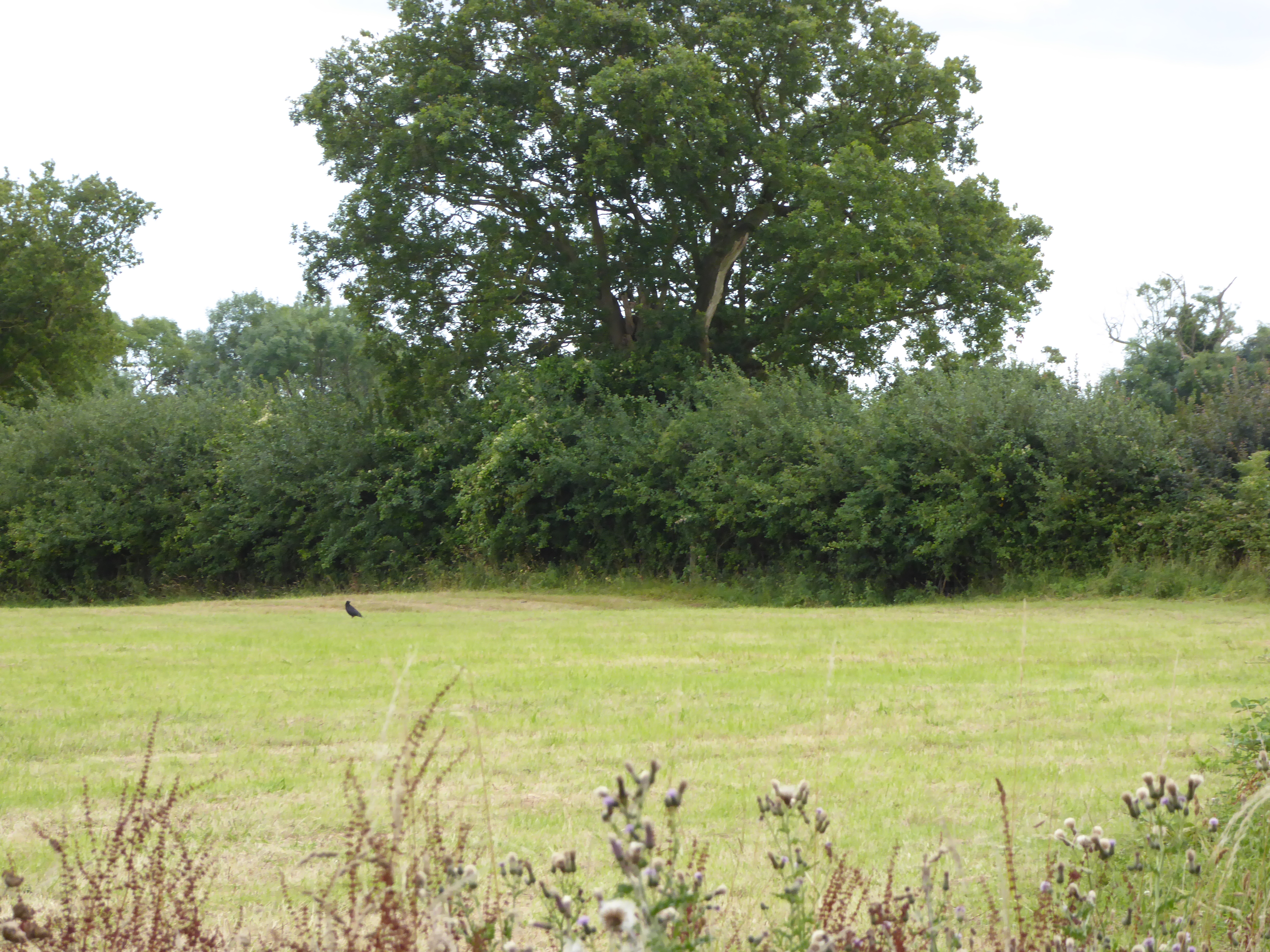
The village is surrounded by picturesque landscapes, with rolling hills and fields stretching as far as the eye can see. It is dotted with traditional cottages, many of which showcase the distinctive Suffolk pink hue. The village is adorned with well-tended gardens and vibrant floral displays, adding to its idyllic appeal.

Although small, Clopton Corner boasts a strong sense of community spirit. The village has a local pub, The Rose and Crown, which serves as a social hub for both residents and visitors. The pub offers a warm and welcoming atmosphere, providing a place to unwind and enjoy a pint of locally brewed ale or a delicious meal.

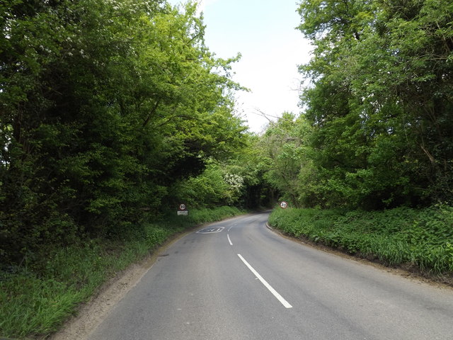
Nature enthusiasts will find themselves at home in Clopton Corner, as it is surrounded by an abundance of walking paths and nature trails. The nearby countryside offers opportunities for leisurely strolls, bike rides, and horseback riding.

Despite its rural location, Clopton Corner benefits from good transport links. The A12 road runs nearby, providing convenient access to Ipswich and the wider region. The village is also serviced by a regular bus service, connecting residents to neighboring towns and villages.

In summary, Clopton Corner is a charming and peaceful village in Suffolk, boasting stunning landscapes, a tight-knit community, and easy access to both rural and urban amenities.

If you have any feedback on the listing, please let us know in the comments section below.

Clopton Corner Images

Images are sourced within 2km of 52.145789/1.247381 or Grid Reference TM2254. Thanks to Geograph Open Source API. All images are credited.

Otley, St Mary
Otley, St Mary
Derelict tin tabernacle next to the B1078, Clopton A Clopton village website (<span class="nowrap"><a title="http://clopton.onesuffolk.net/clopton-village/history-and-heritage/" rel="nofollow ugc noopener" href="http://clopton.onesuffolk.net/clopton-village/history-and-heritage/">Link</a><img style="margin-left:2px;" alt="External link" title="External link - shift click to open in new window" src="https://s1.geograph.org.uk/img/external.png" width="10" height="10"/></span> ) implies that these are the former Mission Rooms, which were replaced by a new village hall in the early 1990s.
Derelict tin tabernacle next to the B1078, Clopton
A Clopton village website (LinkExternal link ) implies that these are the former Mission Rooms, which were replaced by a new village hall in the early 1990s.
Derelict tin tabernacle next to the B1078, Clopton As can just be made out, the roof of the chapel has collapsed at the north-west end (liturgical east end) and the window at that end can be seen from the "inside" side.
A Clopton village website (<span class="nowrap"><a title="http://clopton.onesuffolk.net/clopton-village/history-and-heritage/" rel="nofollow ugc noopener" href="http://clopton.onesuffolk.net/clopton-village/history-and-heritage/">Link</a><img style="margin-left:2px;" alt="External link" title="External link - shift click to open in new window" src="https://s1.geograph.org.uk/img/external.png" width="10" height="10"/></span> ) implies that these are the former Mission Rooms, which were replaced by a new village hall in the early 1990s.
Derelict tin tabernacle next to the B1078, Clopton
As can just be made out, the roof of the chapel has collapsed at the north-west end (liturgical east end) and the window at that end can be seen from the "inside" side. A Clopton village website (LinkExternal link ) implies that these are the former Mission Rooms, which were replaced by a new village hall in the early 1990s.
View out of the valley from the B1078
Former school, Clopton, Suffolk According to a Clopton village website (<span class="nowrap"><a title="http://clopton.onesuffolk.net/clopton-village/history-and-heritage/" rel="nofollow ugc noopener" href="http://clopton.onesuffolk.net/clopton-village/history-and-heritage/">Link</a><img style="margin-left:2px;" alt="External link" title="External link - shift click to open in new window" src="https://s1.geograph.org.uk/img/external.png" width="10" height="10"/></span> ), Clopton school closed in the late 1930s.
Former school, Clopton, Suffolk
According to a Clopton village website (LinkExternal link ), Clopton school closed in the late 1930s.
Cereal crop towards former Debach Airfield
Concrete road Part of the former Debach Airfield.
Concrete road
Part of the former Debach Airfield.
Field of beans, Debach
Minor road, Debach Towards the B1078.
Minor road, Debach
Towards the B1078.
Cereal crop off the B1078
Minor road junction with the B1078, Debach
B1078, Debach
B1078, Debach
View south-east along Martins Lane
Otley  Primary  School  and  Under  5s  Centre.  Chapel  Road
Otley Primary School and Under 5s Centre. Chapel Road
Otley  Post  Office  and  Store.  Chapel  Road
Otley Post Office and Store. Chapel Road
Road  junction  in  Otley  village The village name sign is to the left of the Stop sign
Road junction in Otley village
The village name sign is to the left of the Stop sign
B1079 in Otley Bottom
Entering Otley on the B1079 <span class="nowrap"><a title="https://en.wikipedia.org/wiki/Otley,_Suffolk" rel="nofollow ugc noopener" href="https://en.wikipedia.org/wiki/Otley,_Suffolk">Link</a><img style="margin-left:2px;" alt="External link" title="External link - shift click to open in new window" src="https://s1.geograph.org.uk/img/external.png" width="10" height="10"/></span>
Entering Otley on the B1079
Show me another place!

Clopton Corner is located at Grid Ref: TM2254 (Lat: 52.145789, Lng: 1.247381)

Administrative County: Suffolk

District: East Suffolk

Police Authority: Suffolk

What 3 Words

///roses.looked.hillsides. Near Grundisburgh, Suffolk

Nearby Locations

Clopton Corner Clopton

Related Wikis

Moat Farm Meadows

Moat Farm Meadows is a 3.3-hectare (8.2-acre) biological Site of Special Scientific Interest north-east of Otley in Suffolk. These calcareous meadows are...
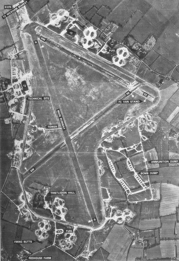
RAF Debach

Royal Air Force Debach or more simply RAF Debach is a former Royal Air Force station located at Debach, 3 miles (4.8 km) northwest of Woodbridge, Suffolk...

Otley, Suffolk

Otley is a village and civil parish in the East Suffolk district, in the English county of Suffolk. It is around 7 miles (11 km) north-east of Ipswich...
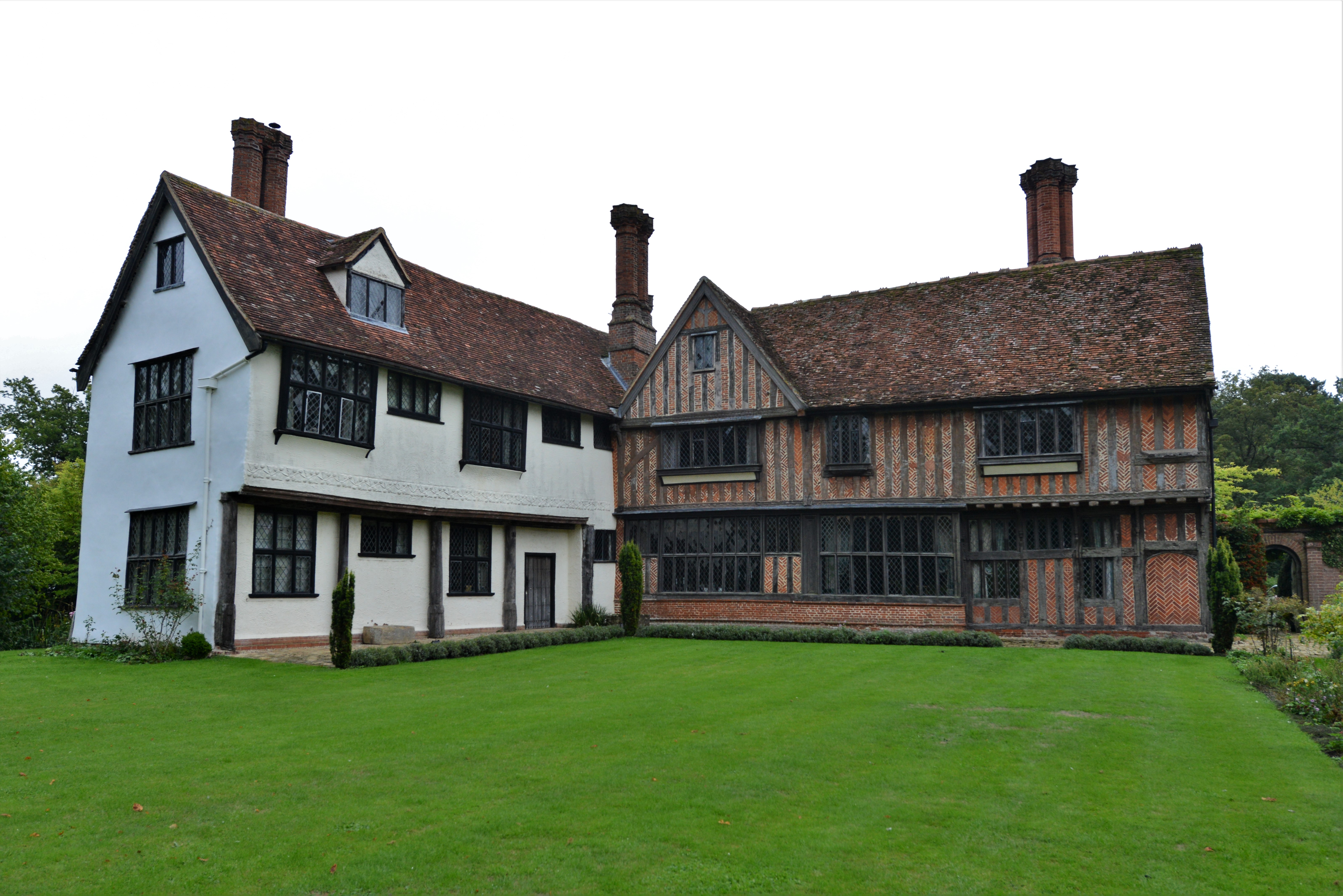
Otley Hall

Otley Hall is a 16th-century English manor house in the civil parish of Otley, in the East Suffolk district, Suffolk, England. It is a Grade I listed building...

Nearby Amenities

Located within 500m of 52.145789,1.247381
Bus Stop
Bus Shelter
Alt Name: Shop Corner
Local Ref: adj
Naptan AltCommonName: Shop Corner
Naptan AtcoCode: 390060316
Naptan Bearing: W
Naptan CommonName: The Firs
Naptan Indicator: adj
Naptan Landmark: Shelter
Naptan NaptanCode: sufgpgdj
Naptan Street: B1078
Naptan Verified: no
Shelter: yes
Source: naptan_import
Lat/Long: 52.1446989/1.2511816
Bus Stop
Shelter
Alt Name: Shop Corner
Local Ref: opp
Naptan AltCommonName: Shop Corner
Naptan AtcoCode: 390060317
Naptan Bearing: E
Naptan BusStopType: CUS
Naptan CommonName: opp Shelter
Naptan Indicator: opp
Naptan Landmark: Shelter
Naptan NaptanCode: sufgpgdm
Naptan Street: B1078
Naptan Verified: no
Public Transport: platform
Source: naptan_import
Lat/Long: 52.1447474/1.2506004
Clopton Corner
Place: hamlet
Source: OS 1:25k + nptg
Lat/Long: 52.1465264/1.250431
Entrance: main
Lat/Long: 52.1439466/1.2493771
Defibrillator
Booth: K6
Covered: booth
Defibrillator Location: inside old red phone box, Clopton
Emergency: defibrillator
Indoor: no
Man Made: telephone_box
Operator: Community Heartbeat
Ref: CHT-9978
Lat/Long: 52.1446862/1.2510658
The data included in this document is from www.openstreetmap.org. The data is made available under ODbL.

Have you been to Clopton Corner?

Leave your review of Clopton Corner below (or comments, questions and feedback).