Millham Copse

Wood, Forest in Somerset South Somerset

England

Millham Copse

Buckland St Mary : Countryside Scenery Looking across towards Cross Hill Farm.
Buckland St Mary : Countryside Scenery Credit: Lewis Clarke

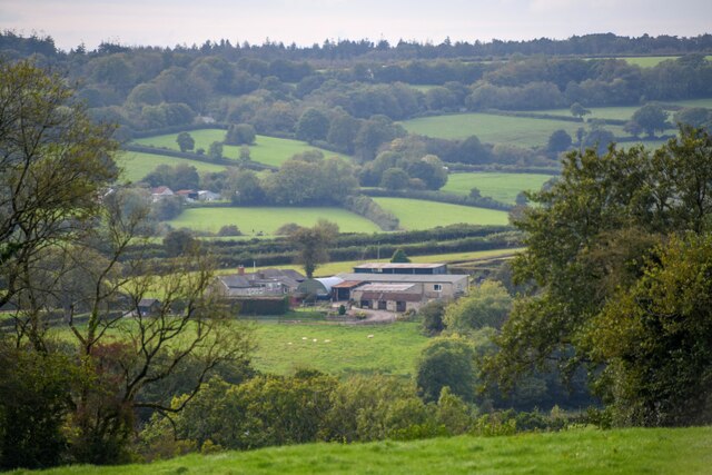
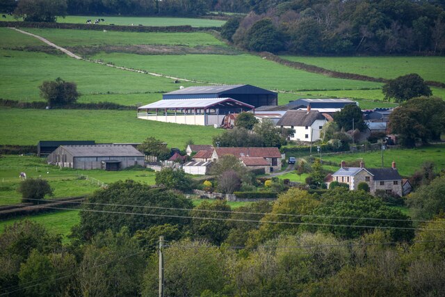
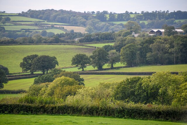
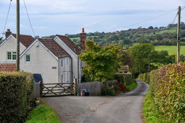
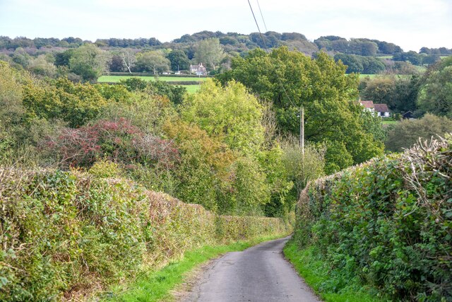
Millham Copse is a picturesque woodland located in Somerset, England. Situated near the village of Millham, the copse covers an area of approximately 20 acres and is a cherished natural gem in the region.

The copse is known for its diverse range of tree species, including oak, beech, ash, and chestnut. The trees tower majestically, creating a dense canopy that provides shade and shelter for various wildlife. The forest floor is adorned with a rich carpet of wildflowers, ferns, and moss, creating a stunning display of colors throughout the seasons.

Millham Copse is a popular destination for nature enthusiasts, hikers, and birdwatchers. The tranquil atmosphere and abundance of wildlife make it an ideal spot for observing and appreciating nature. Bird species such as woodpeckers, thrushes, and warblers can be spotted among the treetops, while small mammals like squirrels and rabbits scurry about on the forest floor.

The copse is intersected by a network of well-maintained footpaths, allowing visitors to explore and immerse themselves in the woodland's beauty. These paths wind through the trees, leading to secluded clearings and hidden corners that offer a sense of solitude and tranquility.

Millham Copse is also home to a small pond, which attracts a variety of aquatic creatures and provides a peaceful spot for reflection and relaxation. The pond is teeming with life, from dragonflies and water beetles to frogs and newts.

Overall, Millham Copse is a stunning woodland that offers a haven for both nature lovers and those seeking a peaceful retreat. Its diverse flora and fauna, combined with its serene atmosphere, make it a must-visit destination for anyone visiting Somerset.

If you have any feedback on the listing, please let us know in the comments section below.

Millham Copse Images

Images are sourced within 2km of 50.913999/-3.0675519 or Grid Reference ST2513. Thanks to Geograph Open Source API. All images are credited.

Buckland St Mary : Countryside Scenery Looking across towards Cross Hill Farm.
Buckland St Mary : Countryside Scenery
Looking across towards Cross Hill Farm.
Buckland St Mary : Countryside Scenery Looking towards Higher Blindmoor Farm.
Buckland St Mary : Countryside Scenery
Looking towards Higher Blindmoor Farm.
Buckland St Mary : Countryside Scenery Looking out across the countryside.
Buckland St Mary : Countryside Scenery
Looking out across the countryside.
Buckland St Mary : Pound Lane Pound Lane passing Paddock Cottage.
Buckland St Mary : Pound Lane
Pound Lane passing Paddock Cottage.
Buckland St Mary : Pound Lane Looking along Pound Lane.
Buckland St Mary : Pound Lane
Looking along Pound Lane.
Buckland St Mary : Pound Lane Passing Stonebyres and Rowsell Cottage.
Buckland St Mary : Pound Lane
Passing Stonebyres and Rowsell Cottage.
Buckland St Mary : Pound Lane Looking along a small lane.
Buckland St Mary : Pound Lane
Looking along a small lane.
Buckland St Mary : Pound Lane The lane heads down the hill.
Buckland St Mary : Pound Lane
The lane heads down the hill.
Buckland St Mary : Grassy Field A field beyond the gate off Pound Lane.
Buckland St Mary : Grassy Field
A field beyond the gate off Pound Lane.
Buckland St Mary : Grassy Field & Alpacas Alpacas in a field.
Buckland St Mary : Grassy Field & Alpacas
Alpacas in a field.
Buckland St Mary : Lower Blindmoor Seen from Pound Lane.
Buckland St Mary : Lower Blindmoor
Seen from Pound Lane.
Buckland St Mary : The Milkchurns Looking towards geese in the yard.
Buckland St Mary : The Milkchurns
Looking towards geese in the yard.
Buckland St Mary : The Milkchurns Looking across the yard, which is also part of the right of way.
Buckland St Mary : The Milkchurns
Looking across the yard, which is also part of the right of way.
Buckland St Mary : Grassy Field A horse seen in the field.
Buckland St Mary : Grassy Field
A horse seen in the field.
Buckland St Mary : Grassy Field & Tree A tree in a field.
Buckland St Mary : Grassy Field & Tree
A tree in a field.
Buckland St Mary : Grassy Field A grassy field with muddy tracks heading into it.
Buckland St Mary : Grassy Field
A grassy field with muddy tracks heading into it.
Buckland St Mary : Grassy field Looking across a grassy field.
Buckland St Mary : Grassy field
Looking across a grassy field.
Buckland St Mary : Woodland A small patch of woodland with a right of way through it.
Buckland St Mary : Woodland
A small patch of woodland with a right of way through it.
Show me another place!

Millham Copse is located at Grid Ref: ST2513 (Lat: 50.913999, Lng: -3.0675519)

Administrative County: Somerset

District: South Somerset

Police Authority: Avon and Somerset

What 3 Words

///blackmail.cowboys.refilled. Near Chard, Somerset

Related Wikis

Bishopswood Meadows

Bishopswood Meadows is a nature reserve situated within the Blackdown Hills Area of Outstanding Natural Beauty in the county of Somerset, England. The...

Robin Hood's Butts

Robin Hood's Butts are a group of nine Bronze Age barrows near Otterford on the Blackdown Hills in Somerset, England. They have been scheduled as ancient...

Buckland St Mary

Buckland St Mary is a village and parish in Somerset, England, situated 6 miles (9.7 km) to the west of Ilminster and 8 miles (12.9 km) south of Taunton...

Long Lye

Long Lye (grid reference ST265122) is an 11.7 hectare (29.0 acre) biological Site of Special Scientific Interest at Buckland St Mary in the Blackdown Hills...

Church of St Mary, Buckland St Mary

The Anglican Church of St Mary in Buckland St Mary, Somerset, England was built in 1853-1863. It is a Grade II* listed building. == History == The church...

Long Lye Meadow

Long Lye Meadow (grid reference ST267119) is a 3.3 hectare biological Site of Special Scientific Interest at Buckland St Mary in the Blackdown Hills, Somerset...

Otterhead Lakes

Otterhead Lakes are a pair of reservoirs in the Blackdown Hills Area of Outstanding Natural Beauty south of Otterford in Somerset, England. They are fed...

Marsh, Devon

Marsh is a village in the Blackdown Hills, Devon, England. It is part of the East Devon district, and close to the River Yarty and border with Somerset...

Nearby Amenities

Located within 500m of 50.913999,-3.0675519
Generator Method: photovoltaic
Generator Output Electricity: yes
Generator Source: solar
Generator Type: solar_photovoltaic_panel
Location: roof
Power: generator
Source: Bing
Lat/Long: 50.9100867/-3.0640456
Power: pole
Source: bing
Lat/Long: 50.9177397/-3.0637291
Power: pole
Source: bing
Lat/Long: 50.9171547/-3.0631202
Power: pole
Source: bing
Transformer: distribution
Lat/Long: 50.9102778/-3.0637908
Power: pole
Source: bing
Lat/Long: 50.9109382/-3.0635494
Power: pole
Source: bing
Lat/Long: 50.9116536/-3.0632865
Power: pole
Source: bing
Lat/Long: 50.9123689/-3.0631605
Power: pole
Source: bing
Lat/Long: 50.9141362/-3.0628896
Power: pole
Source: bing
Lat/Long: 50.9165797/-3.0625275
Power: pole
Source: bing
Lat/Long: 50.9157494/-3.0626482
Power: pole
Source: bing
Lat/Long: 50.9145978/-3.0723564
Power: pole
Source: bing
Lat/Long: 50.9159067/-3.0730069
Power: pole
Source: bing
Lat/Long: 50.915478/-3.0740476
Power: pole
Source: bing
Lat/Long: 50.9155321/-3.0741227
Power: pole
Source: bing
Lat/Long: 50.9143349/-3.0686805
Power: pole
Source: bing
Lat/Long: 50.91417/-3.0697694
Power: pole
Source: bing
Lat/Long: 50.9139967/-3.0709577
Power: pole
Source: bing
Transformer: distribution
Lat/Long: 50.9132957/-3.0715545
Power: pole
Source: bing
Lat/Long: 50.9144693/-3.0677792
Power: pole
Source: bing
Lat/Long: 50.9146722/-3.0664542
Power: pole
Source: bing
Lat/Long: 50.9150882/-3.0636862
Power: pole
Source: bing
Lat/Long: 50.9149124/-3.0627716
Power: pole
Source: bing
Lat/Long: 50.9146773/-3.0615485
The data included in this document is from www.openstreetmap.org. The data is made available under ODbL.

Have you been to Millham Copse?

Leave your review of Millham Copse below (or comments, questions and feedback).