Lawrenceholme Wood

Wood, Forest in Cumberland Allerdale

England

Lawrenceholme Wood

Flooded area of former peat extraction With heavy winter rainfall this area was nearly flooded and the vegetation was less developed than most of the moss.
Flooded area of former peat extraction Credit: Graham Cole

Lawrenceholme Wood is a picturesque forest located in Cumberland, a historic county in northwest England. Spread over a vast area, the wood is known for its enchanting beauty and diverse flora and fauna. It is situated near the village of Lawrenceholme, which gives the wood its name.

Covering a mix of deciduous and coniferous trees, Lawrenceholme Wood offers a breathtaking display of colors throughout the year. In spring, the forest floor is carpeted with vibrant wildflowers, while in autumn, the foliage transforms into a stunning array of red, orange, and gold. The wood is particularly famous for its ancient oak trees, some of which are believed to be centuries old, providing a haven for numerous species of birds, insects, and small animals.

The wood is crisscrossed by a network of well-maintained footpaths, making it easily accessible for nature enthusiasts and walkers. These paths wind through the woodland, allowing visitors to explore the diverse habitats and take in the tranquil atmosphere. The forest also offers picnic areas, making it an ideal spot for families and groups to enjoy a day out in nature.

Lawrenceholme Wood is not only a haven for wildlife but also holds historical significance. It is believed that the wood was once part of a larger ancient forest that covered much of the surrounding area. Today, it stands as a testament to the natural beauty and rich history of Cumberland, attracting both locals and tourists alike.

If you have any feedback on the listing, please let us know in the comments section below.

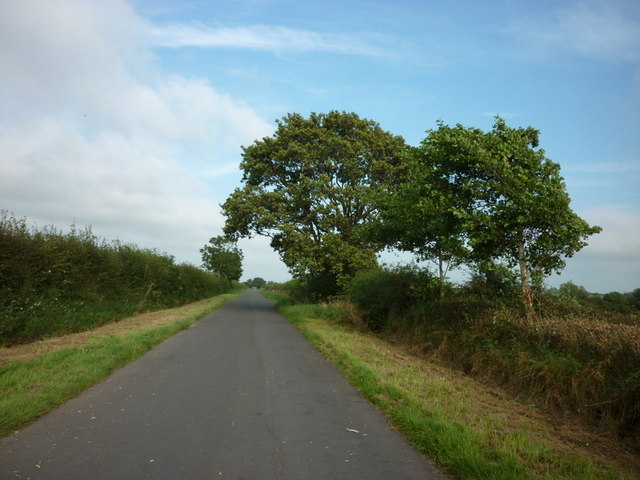
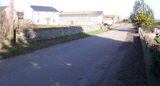
Lawrenceholme Wood Images

Images are sourced within 2km of 54.862545/-3.2060168 or Grid Reference NY2252. Thanks to Geograph Open Source API. All images are credited.

Flooded area of former peat extraction With heavy winter rainfall this area was nearly flooded and the vegetation was less developed than most of the moss.
Flooded area of former peat extraction
With heavy winter rainfall this area was nearly flooded and the vegetation was less developed than most of the moss.
Tall heather and woods At the edge of the moss where the ground is slightly higher the vegetation is very different
Tall heather and woods
At the edge of the moss where the ground is slightly higher the vegetation is very different
Spruce sapling Under careful management this reserve gained much healthy vegetation. Of the many young trees some were probably seeded naturally.
Spruce sapling
Under careful management this reserve gained much healthy vegetation. Of the many young trees some were probably seeded naturally.
The result of peat extraction This land is lower and wetter because of peat removal mainly in the 19th century.
The result of peat extraction
This land is lower and wetter because of peat removal mainly in the 19th century.
Ditch and bank When peat extraction ended and this became a nature reserve there was some ground work needed such as creating this access bank. See also in this square an early photo showing a causeway of bare peat after formation. It didn't stay bare for long!
Ditch and bank
When peat extraction ended and this became a nature reserve there was some ground work needed such as creating this access bank. See also in this square an early photo showing a causeway of bare peat after formation. It didn't stay bare for long!
Vegetation restored to black peat Conservation management has restored plenty of vegetation here. Small scattered trees, plenty of grasses and small heathers are just about everywhere except in pools. This was in January, not the most colourful time.
Vegetation restored to black peat
Conservation management has restored plenty of vegetation here. Small scattered trees, plenty of grasses and small heathers are just about everywhere except in pools. This was in January, not the most colourful time.
Woods on the reserve boundary Growing in wet ground the trees were mostly birch but a few oak trees were surviving as well.
Woods on the reserve boundary
Growing in wet ground the trees were mostly birch but a few oak trees were surviving as well.
Lawrenceholme Lonning This is the access track to Lawrenceholme Farm leading from the Wigton to Kirkbride Road.
The woodland on the left borders Wedholme Flow and is part of the South Solway Mosses National Nature Reserve.
Lawrenceholme Lonning
This is the access track to Lawrenceholme Farm leading from the Wigton to Kirkbride Road. The woodland on the left borders Wedholme Flow and is part of the South Solway Mosses National Nature Reserve.
Heading east towards Corbet Houses
Wedholme Flow and South Solway Mosses NNR Looking east from near Silloth
Wedholme Flow and South Solway Mosses NNR
Looking east from near Silloth
Wedholme Flow from the Viewpoint The viewpoint is only two or three metres higher than the rest of the Flow, but as the terrain is so flat it does give extensive views.
Wedholme Flow from the Viewpoint
The viewpoint is only two or three metres higher than the rest of the Flow, but as the terrain is so flat it does give extensive views.
The road to Kirkbride
Fields near Oulton
Fields near Oulton
Fields at Lessonhall
Panoramic view north to Scotland from near Eskrigg
Lane northbound near Low Eskrigg
Bird-in-Hand and Corbet Houses, Middlemoor Situated on the minor road linking Wigton to Kirkbride.
Bird-in-Hand and Corbet Houses, Middlemoor
Situated on the minor road linking Wigton to Kirkbride.
Colmire, near Oulton A patch of open water in damp meadows at Colmire, on the southern edge of the Wedholme flow
Colmire, near Oulton
A patch of open water in damp meadows at Colmire, on the southern edge of the Wedholme flow
Show me another place!

Lawrenceholme Wood is located at Grid Ref: NY2252 (Lat: 54.862545, Lng: -3.2060168)

Administrative County: Cumbria

District: Allerdale

Police Authority: Cumbria

What 3 Words

///earplugs.edits.segments. Near Wigton, Cumbria

Nearby Locations

Lawrenceholme Wood

Related Wikis

RAF Kirkbride

RAF Kirkbride, was a Second World War era airfield in the village of Kirkbride, Cumbria, England. Opened in June 1939, the base was intended to be an aircraft...

Oulton, Cumbria

Oulton is a hamlet and former civil parish, now in the parish of Woodside, near the small town of Wigton, in the Allerdale district of the county of Cumbria...

Biglands

Biglands is a hamlet in Cumbria, England. It is located to the north of Gamelsby, and east of the River Wampool.It is not the location of Milefortlet 1...

Moss Side, Cumbria

Moss Side is a hamlet on the B5307 road, in the civil parish of Holme East Waver in Cumbria, United Kingdom. Nearby settlements include the villages of...
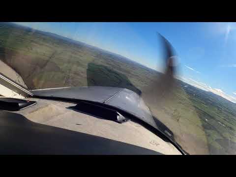
Related Videos

Departing from Kirkbride Airfeild

Departing from East Kirkbride.

Chris Jones Gyroplane

Chris Jones Gyroplane when over the lake district for 1 hour dad really enjoyed himself The picture was taken by dad when flying ...

Exploring WW2 Shelter In Great Condition. SD, HD.

Thanks for all the likes and comments on all the past videos well appreciated. The air ride is one of several across Kerkbrid airfield ...

Have you been to Lawrenceholme Wood?

Leave your review of Lawrenceholme Wood below (or comments, questions and feedback).