Hobkin Ground Wood

Wood, Forest in Lancashire South Lakeland

England

Hobkin Ground Wood

Remains of wooden ballast bin Only a few rotten pieces of wood remain from this ballast bin beside the former Furness Railway Coniston Branch near Moss Side.  Built from old wooden railway sleepers it is difficult to place an age on this ballast bin, but it is possible it pre-dates the formation of the London Midland and Scottish Railway in 1923 who later introduced concrete bins (see photograph <a href="https://www.geograph.org.uk/photo/6797992">NY2924 : LMS Standard Concrete Ballast Bin</a>).
Positioned approximately every mile, more frequently on curved track, ballast bins were used to store small stone chippings which were used by the railway Lengthsmen to pack and adjust the railway sleepers. Using only a jack and a shovel, an experienced Lengthsman could judge exactly the right quantity of chippings to use to obtain a perfect ‘top’ to the rail and they often took great pride in the quality of their work.
The Coniston Branch closed to passengers in October 1958 and to all traffic with effect from the 30 April 1962 although the last train had run during the preceding week.  The track bed in front of the ballast bin is deep in mud and trampled by cows.
Remains of wooden ballast bin Credit: Adrian Taylor

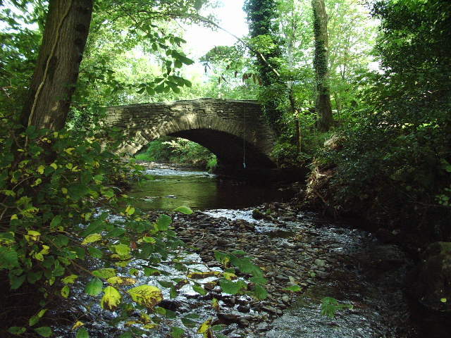
Hobkin Ground Wood, located in Lancashire, is a magnificent forested area known for its natural beauty and rich biodiversity. Spanning over a vast expanse, the wood is a popular destination for nature enthusiasts, hikers, and birdwatchers alike.

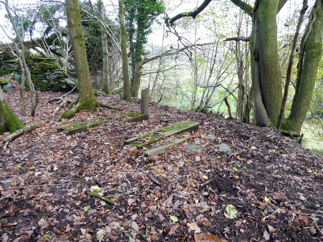
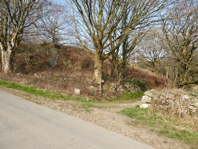
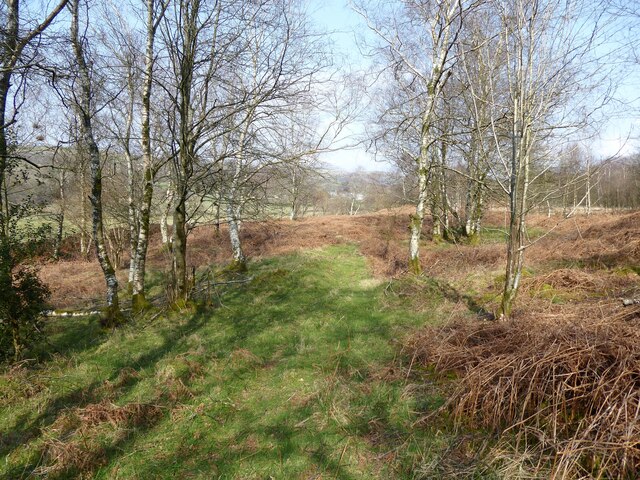
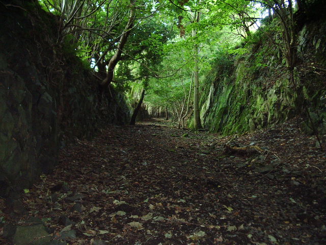
The wood is characterized by its dense canopy of tall, majestic trees that create a serene and tranquil atmosphere. Oak, beech, and birch trees dominate the landscape, providing ample shade and shelter for a variety of wildlife species. The forest floor is adorned with a lush carpet of ferns, mosses, and wildflowers, adding to the wood's enchanting appeal.

Home to an array of wildlife, Hobkin Ground Wood is a haven for nature lovers. Visitors may encounter red squirrels, roe deer, and a diverse range of bird species, including woodpeckers, warblers, and owls. The wood's diverse ecosystem supports a thriving population of plants and animals, contributing to its status as a designated Site of Special Scientific Interest.

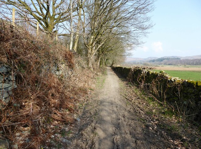
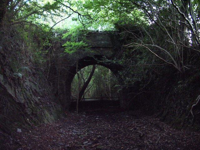
Trails and pathways crisscross the wood, offering visitors the opportunity to explore its natural wonders. Whether strolling along the peaceful woodland paths or venturing deeper into the forest, visitors are treated to breathtaking vistas and a sense of tranquility that can only be found in such a pristine natural setting.

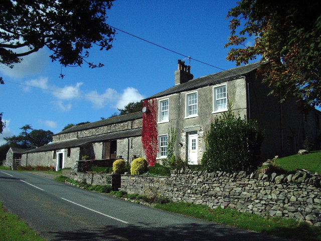
Hobkin Ground Wood is not only a haven for wildlife and nature enthusiasts but also a place of immense historical and cultural significance. It has been a cherished part of the local community for generations, and its preservation and conservation efforts ensure that future generations can continue to appreciate its beauty and ecological importance.

If you have any feedback on the listing, please let us know in the comments section below.

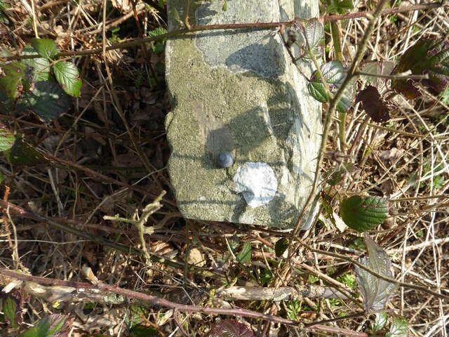
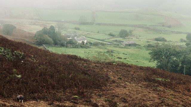
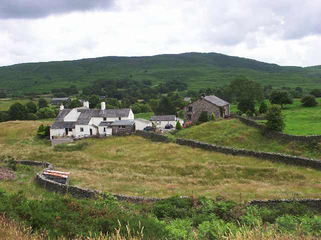
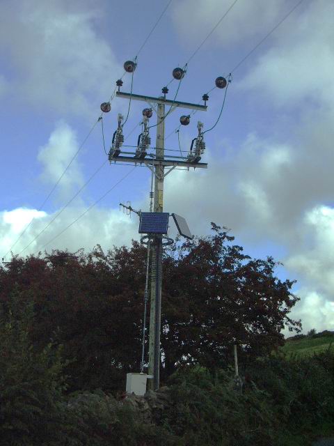
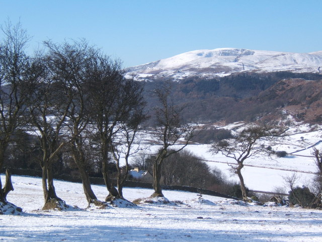
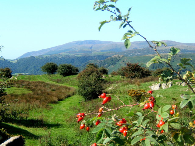
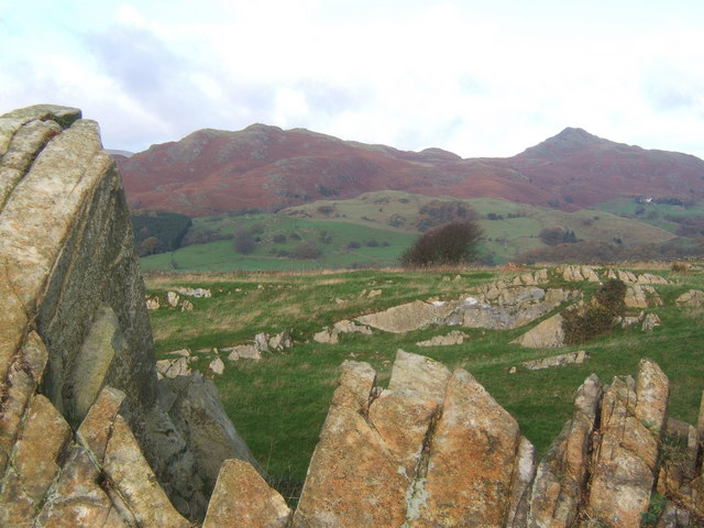
Hobkin Ground Wood Images

Images are sourced within 2km of 54.305932/-3.190113 or Grid Reference SD2290. Thanks to Geograph Open Source API. All images are credited.

Remains of wooden ballast bin Only a few rotten pieces of wood remain from this ballast bin beside the former Furness Railway Coniston Branch near Moss Side.  Built from old wooden railway sleepers it is difficult to place an age on this ballast bin, but it is possible it pre-dates the formation of the London Midland and Scottish Railway in 1923 who later introduced concrete bins (see photograph <a href="https://www.geograph.org.uk/photo/6797992">NY2924 : LMS Standard Concrete Ballast Bin</a>).
Positioned approximately every mile, more frequently on curved track, ballast bins were used to store small stone chippings which were used by the railway Lengthsmen to pack and adjust the railway sleepers. Using only a jack and a shovel, an experienced Lengthsman could judge exactly the right quantity of chippings to use to obtain a perfect ‘top’ to the rail and they often took great pride in the quality of their work.
The Coniston Branch closed to passengers in October 1958 and to all traffic with effect from the 30 April 1962 although the last train had run during the preceding week.  The track bed in front of the ballast bin is deep in mud and trampled by cows.
Remains of wooden ballast bin
Only a few rotten pieces of wood remain from this ballast bin beside the former Furness Railway Coniston Branch near Moss Side. Built from old wooden railway sleepers it is difficult to place an age on this ballast bin, but it is possible it pre-dates the formation of the London Midland and Scottish Railway in 1923 who later introduced concrete bins (see photograph NY2924 : LMS Standard Concrete Ballast Bin). Positioned approximately every mile, more frequently on curved track, ballast bins were used to store small stone chippings which were used by the railway Lengthsmen to pack and adjust the railway sleepers. Using only a jack and a shovel, an experienced Lengthsman could judge exactly the right quantity of chippings to use to obtain a perfect ‘top’ to the rail and they often took great pride in the quality of their work. The Coniston Branch closed to passengers in October 1958 and to all traffic with effect from the 30 April 1962 although the last train had run during the preceding week. The track bed in front of the ballast bin is deep in mud and trampled by cows.
Kirkby Pool
Kirkby Pool
Lane near Brookside The lane is a public footpath leading to Buttstead Wood.
Lane near Brookside
The lane is a public footpath leading to Buttstead Wood.
Stile beside Buttstead Wood The public footpath from The Hill to Woodland crosses this stile adjacent to Buttstead Wood.
There is an Ordnance Survey rivet benchmark with cut mark on the bottom stone step of the stile (detail photograph <a href="https://www.geograph.org.uk/photo/7259390">SD2389 : Benchmark, Buttstead Wood</a>).
Stile beside Buttstead Wood
The public footpath from The Hill to Woodland crosses this stile adjacent to Buttstead Wood. There is an Ordnance Survey rivet benchmark with cut mark on the bottom stone step of the stile (detail photograph SD2389 : Benchmark, Buttstead Wood).
Benchmark, Buttstead Wood Detail of the Ordnance Survey rivet benchmark with cut mark on the horizontal bottom step of a public footpath stile adjacent to Buttstead Wood.  The benchmark marks a height of 8.6076m above mean sea level (Ordnance Datum Newlyn) last verified in 1954 (location photograph <a href="https://www.geograph.org.uk/photo/7259381">SD2389 : Stile beside Buttstead Wood</a>).
Benchmark, Buttstead Wood
Detail of the Ordnance Survey rivet benchmark with cut mark on the horizontal bottom step of a public footpath stile adjacent to Buttstead Wood. The benchmark marks a height of 8.6076m above mean sea level (Ordnance Datum Newlyn) last verified in 1954 (location photograph SD2389 : Stile beside Buttstead Wood).
Lane entrance near Brookside Leading from the road near Brookside the lane leads to Buttstead Wood and carries a public footpath to Low Rosthwaite.
There is an Ordnance Survey rivet benchmark on the top of the low stone post partially hidden in the brambles to the left of the footpath signpost (photograph <a href="https://www.geograph.org.uk/photo/7260566">SD2389 : Rivet benchmark near Brookside</a>).
Lane entrance near Brookside
Leading from the road near Brookside the lane leads to Buttstead Wood and carries a public footpath to Low Rosthwaite. There is an Ordnance Survey rivet benchmark on the top of the low stone post partially hidden in the brambles to the left of the footpath signpost (photograph SD2389 : Rivet benchmark near Brookside).
Rivet benchmark near Brookside Detail of an Ordnance Survey rivet benchmark on the top of a low stone post near Brookside.  The benchmark marks a height of 11.0246m above mean sea level (Ordnance Datum Newlyn) last verified in 1972 (location photograph <a href="https://www.geograph.org.uk/photo/7260558">SD2389 : Lane entrance near Brookside</a>).
Rivet benchmark near Brookside
Detail of an Ordnance Survey rivet benchmark on the top of a low stone post near Brookside. The benchmark marks a height of 11.0246m above mean sea level (Ordnance Datum Newlyn) last verified in 1972 (location photograph SD2389 : Lane entrance near Brookside).
Woodland path near Latter Rigg
Carter Ground
Carter Ground
Ringhouse Farm and Cottages, Lake District This is Ringhouse Farm and its associated cottages which are available for rent (google 'em for details). Ideally situated for access to the south lakes and beyond and plenty of walks from the farm if you don't feel like getting into the car.
Ringhouse Farm and Cottages, Lake District
This is Ringhouse Farm and its associated cottages which are available for rent (google 'em for details). Ideally situated for access to the south lakes and beyond and plenty of walks from the farm if you don't feel like getting into the car.
Road bridge Road bridge over the River Lickle near Hartley Ground
Road bridge
Road bridge over the River Lickle near Hartley Ground
High Aulthwaite Side
Road bridge This bridge spans the old Broughton-in-Furness to Coniston Railway about 2 miles NE of Broughton
Road bridge
This bridge spans the old Broughton-in-Furness to Coniston Railway about 2 miles NE of Broughton
Dismantled railway Looking SE towards Broughton-in-Furness along the old Broughton-in-Furness to Coniston Railway
Dismantled railway
Looking SE towards Broughton-in-Furness along the old Broughton-in-Furness to Coniston Railway
Is this the way forward Is this trying to tell us something about the price of electricity? Somebody makes the effort to install solar panels to power their equipment which is attached to a power line. I wonder if they sell the surplus (if any) to the National Grid
Is this the way forward
Is this trying to tell us something about the price of electricity? Somebody makes the effort to install solar panels to power their equipment which is attached to a power line. I wonder if they sell the surplus (if any) to the National Grid
Wintry view of the lower Lickle Valley
View from a lane above Hawthwaite Black Combe in the distance.
View from a lane above Hawthwaite
Black Combe in the distance.
Rocky outcrop on ridge near Broughton Mills Looking to the Dunnerdale Fells, with Stickle Pike to the right.
Rocky outcrop on ridge near Broughton Mills
Looking to the Dunnerdale Fells, with Stickle Pike to the right.
Show me another place!

Hobkin Ground Wood is located at Grid Ref: SD2290 (Lat: 54.305932, Lng: -3.190113)

Administrative County: Cumbria

District: South Lakeland

Police Authority: Cumbria

What 3 Words

///shadowing.message.conducted. Near Millom, Cumbria

Related Wikis

Blacksmiths Arms, Broughton Mills

The Blacksmiths Arms is a Grade II listed public house at Broughton Mills, Cumbria, England.It is on the Campaign for Real Ale's National Inventory of...

Broughton West

Broughton West is a civil parish in the Westmorland and Furness district of Cumbria, England. In the 2001 census the parish had a population of 954, decreasing...

Broughton Mills

Broughton Mills is a village in Cumbria, England, located 3.5 kilometres from the larger town of Broughton-in-furness. The village consists of about 40...

Woodland railway station

Woodland railway station served the hamlet of Woodland, in Lancashire, England (now in Cumbria). It was on the branch line to Coniston. == History == Authorised...

Nearby Amenities

Located within 500m of 54.305932,-3.190113
The Corn Mill
Naptan AtcoCode: 090079202818
Naptan Bearing: N
Naptan BusStopType: CUS
Naptan CommonName: The Corn Mill
Naptan Indicator: o/s
Naptan Landmark: The Corn Mill near Shop Bridge
Naptan NaptanCode: cumdgwmd
Naptan Street: No name
Naptan Verified: no
Source: naptan_import
Lat/Long: 54.3056835/-3.1963985
Broughton Mills
Place: hamlet
Wikidata: Q2926306
Lat/Long: 54.3054966/-3.1967305
Walk Mill
Place: hamlet
Lat/Long: 54.3043747/-3.194674
Barrier: stile
Lat/Long: 54.3033104/-3.1888258
Post Box
Collection Times: Mo-Fr 17:00; Sa 08:30
Drive Through: no
Post Box Type: wall
Ref: LA20 33
Lat/Long: 54.3043493/-3.1968024
Information: guidepost
Tourism: information
Lat/Long: 54.3057634/-3.1825454
Information: guidepost
Tourism: information
Lat/Long: 54.3056975/-3.1824784
Power: pole
Lat/Long: 54.3084994/-3.1960048
Power: pole
Lat/Long: 54.308693/-3.1953267
Power: pole
Lat/Long: 54.3090463/-3.1939871
Power: pole
Lat/Long: 54.3092969/-3.1871428
Power: pole
Lat/Long: 54.3085269/-3.188451
Power: pole
Lat/Long: 54.3078685/-3.1896322
Power: pole
Lat/Long: 54.3079117/-3.1909511
Power: pole
Lat/Long: 54.3079755/-3.1924955
The data included in this document is from www.openstreetmap.org. The data is made available under ODbL.

Have you been to Hobkin Ground Wood?

Leave your review of Hobkin Ground Wood below (or comments, questions and feedback).