Newfield Wood

Wood, Forest in Lancashire South Lakeland

England

Newfield Wood

Road by Under Crag
Road by Under Crag Credit: P Gaskell

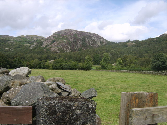
Newfield Wood is a beautiful woodland located in Lancashire, England. Covering an area of approximately 100 acres, this ancient forest is a popular destination for nature lovers and outdoor enthusiasts. The wood is characterized by a diverse range of tree species, including oak, beech, birch, and pine, creating a rich and vibrant ecosystem.

Visitors to Newfield Wood can enjoy a variety of activities such as hiking, birdwatching, and photography. The woodland is home to a wide array of wildlife, including deer, foxes, and a variety of bird species, making it a great spot for wildlife enthusiasts.

The wood is well-maintained with clearly marked trails and paths, making it easy for visitors to explore and navigate through the forest. There are also picnic areas and benches scattered throughout the woodland, providing the perfect spot to relax and enjoy the natural surroundings.

Overall, Newfield Wood is a serene and picturesque destination that offers a peaceful escape from the hustle and bustle of everyday life. Whether you are looking for a leisurely stroll through the forest or a more adventurous hike, this woodland has something to offer for everyone.

If you have any feedback on the listing, please let us know in the comments section below.

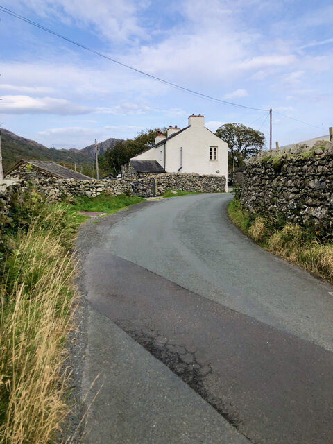
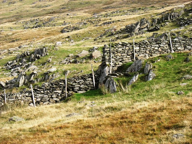
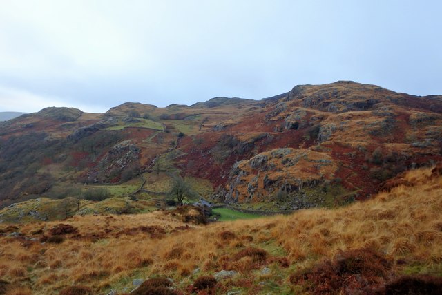
Newfield Wood Images

Images are sourced within 2km of 54.35149/-3.1947221 or Grid Reference SD2295. Thanks to Geograph Open Source API. All images are credited.

Road by Under Crag
Road by Under Crag
Snowy road
Snowy road
Building at Seathwaite
Vernacular farm building at Hall Dunnerdale
Vernacular farm building at The Crook
Green Pikes Green Pikes hardly appears prominent from close up, certainly compared to nearby Caw and Pikes.  Yet it is sufficiently noticeable when viewed from some directions to merit its own name. In the background is the upper Duddon valley, with Harter Fell on the left.
Green Pikes
Green Pikes hardly appears prominent from close up, certainly compared to nearby Caw and Pikes. Yet it is sufficiently noticeable when viewed from some directions to merit its own name. In the background is the upper Duddon valley, with Harter Fell on the left.
Tales of a Tarmac Lane—Barn, Bend, and Blue Pipe A glimpse down a paved path leading to a leftward bend, featuring a stone barn sporting a slate roof, with its barn entrance sealed shut by corrugated steel. A conspicuous coil of blue water pipe leans nonchalently against the barn's side wall.
Tales of a Tarmac Lane—Barn, Bend, and Blue Pipe
A glimpse down a paved path leading to a leftward bend, featuring a stone barn sporting a slate roof, with its barn entrance sealed shut by corrugated steel. A conspicuous coil of blue water pipe leans nonchalently against the barn's side wall.
Flanked by dry stone walls, a lane bearing the scar of road works
Confluence of Tarn Beck with the River Duddon
Footbridge over the River Duddon There are stepping stones a short distance downstream (to the right), but nobody in their right minds would risk them when this bridge, constructed in 1934, is available. The stones are large and often sloping, and a slip could easily result in a broken ankle, or worse.

For the acknowledgement to the bridge builder, see <a href="https://www.geograph.org.uk/photo/4699873">SD2296 : River Duddon footbridge plaque</a>.
Footbridge over the River Duddon
There are stepping stones a short distance downstream (to the right), but nobody in their right minds would risk them when this bridge, constructed in 1934, is available. The stones are large and often sloping, and a slip could easily result in a broken ankle, or worse. For the acknowledgement to the bridge builder, see SD2296 : River Duddon footbridge plaque.
River Duddon footbridge plaque The plaque on the bridge seen in <a href="https://www.geograph.org.uk/photo/4699863">SD2296 : Footbridge over the River Duddon</a> and <a href="https://www.geograph.org.uk/photo/3796711">SD2296 : Stone footbridge over River Duddon</a>. 

If anyone can tell me who A.F. and R.A.F. are, I would be interested. In context, they are clearly not just 'Air Force' and 'Royal Air Force'.
River Duddon footbridge plaque
The plaque on the bridge seen in SD2296 : Footbridge over the River Duddon and SD2296 : Stone footbridge over River Duddon. If anyone can tell me who A.F. and R.A.F. are, I would be interested. In context, they are clearly not just 'Air Force' and 'Royal Air Force'.
Postbox on Hall Bridge An unusual spot for a postbox, on a bridge over the River Duddon, but presumably convenient for local residents (and the postman!). The box is seen in more detail in <a href="https://www.geograph.org.uk/photo/1806956">SD2195 : Postbox, Hall Dunnerdale</a>.
Postbox on Hall Bridge
An unusual spot for a postbox, on a bridge over the River Duddon, but presumably convenient for local residents (and the postman!). The box is seen in more detail in SD2195 : Postbox, Hall Dunnerdale.
The north-east ridge of Caw The rather faint path heads for Pikes. In the distance is the Dow Crag / Old Man of Coniston range.
The north-east ridge of Caw
The rather faint path heads for Pikes. In the distance is the Dow Crag / Old Man of Coniston range.
Descending to Seathwaite from Green Pikes Looking to the upper Duddon valley, with Hard Knott in the middle distance (just left of centre) and the Sca Fell range beyond.
Descending to Seathwaite from Green Pikes
Looking to the upper Duddon valley, with Hard Knott in the middle distance (just left of centre) and the Sca Fell range beyond.
Drystone walling on Green Pikes The way in which the waller has coped with the short cliff is impressive.
Drystone walling on Green Pikes
The way in which the waller has coped with the short cliff is impressive.
River Duddon From the footbridge near High Wallowbarrow
River Duddon
From the footbridge near High Wallowbarrow
Rake Beck Lovely stream cascading through the woods
Rake Beck
Lovely stream cascading through the woods
Above Low Stoneythwaite On High Wallowbarrow. A house in a great setting.
Above Low Stoneythwaite
On High Wallowbarrow. A house in a great setting.
Show me another place!

Newfield Wood is located at Grid Ref: SD2295 (Lat: 54.35149, Lng: -3.1947221)

Administrative County: Cumbria

District: South Lakeland

Police Authority: Cumbria

What 3 Words

///merely.frame.notched. Near Millom, Cumbria

Related Wikis

Seathwaite, Westmorland and Furness

Seathwaite is a village in the Dunnerdale-with-Seathwaite civil parish in the Westmorland and Furness district of Cumbria in North West England. It is...

Dunnerdale-with-Seathwaite

Dunnerdale-with-Seathwaite is a civil parish in the Westmorland and Furness district of the ceremonial county of Cumbria, England. It includes the village...

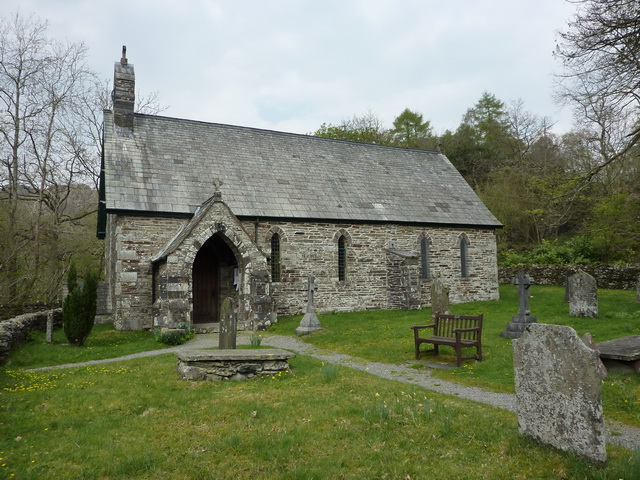
Holy Trinity Church, Seathwaite

Holy Trinity Church is in the village of Seathwaite, Cumbria, England. It is an active Anglican parish church in the deanery of Furness, the archdeaconry...

Wallowbarrow Crag

Wallowbarrow Crag is a hill of 292 metres (958 ft) in the Lake District, England. It is on the west of the Duddon Valley, across the valley from the village...

Nearby Amenities

Located within 500m of 54.35149,-3.1947221
Post Box
Collection Times: Mo-Fr 16:45; Sa 10:30
Drive Through: no
Post Box Type: lamp
Ref: LA20 88
Royal Cypher: EIIR
Royal Cypher Wikidata: Q33102113
Lat/Long: 54.3538596/-3.1901794
Telephone
Booth: KX100
Check Date: 2022-05-02
Covered: booth
Lat/Long: 54.353868/-3.1901247
Newfield Inn
Naptan AtcoCode: 090079202730
Naptan Bearing: W
Naptan BusStopType: CUS
Naptan CommonName: Newfield Inn
Naptan Indicator: o/s
Naptan Landmark: The Newfield Inn Seathwaite
Naptan NaptanCode: cumdgwma
Naptan Street: No name
Naptan Verified: no
Source: naptan_import
Lat/Long: 54.3537037/-3.1897929
Newfield Inn
Phone: +44 1229 716208
Tourism: guest_house
Lat/Long: 54.3535232/-3.1896599
New Close
Place: locality
Lat/Long: 54.3482751/-3.1949552
Ford: yes
Lat/Long: 54.3517719/-3.1902898
Ford: yes
Lat/Long: 54.3486532/-3.1928314
Defibrillator
Access: yes
Defibrillator Location: on outside wall of Newfield Inn ,Seathwaite - facing phone box
Emergency: defibrillator
Indoor: no
Lat/Long: 54.3537595/-3.1900335
Seathwaite
Place: village
Wikidata: Q988461
Lat/Long: 54.3541488/-3.1905844
The data included in this document is from www.openstreetmap.org. The data is made available under ODbL.

Have you been to Newfield Wood?

Leave your review of Newfield Wood below (or comments, questions and feedback).