Mountain Copse
Wood, Forest in Devon East Devon
England
Mountain Copse

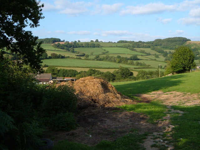
Mountain Copse, located in Devon, England, is a picturesque woodland area known for its natural beauty and diverse flora and fauna. Spanning approximately 100 acres, this enchanting forest is nestled amidst the rolling hills and valleys of the region, offering visitors a tranquil retreat from the bustling city life.
The woodland of Mountain Copse is predominantly composed of native deciduous trees, including oak, beech, and ash, which create a dense canopy that filters the sunlight and creates a cool and shaded atmosphere. The forest floor is covered in a rich carpet of mosses, ferns, and wildflowers, providing a lush habitat for a variety of wildlife.
Nature lovers flock to Mountain Copse to explore its numerous walking trails, which wind through the forest, revealing stunning vistas and hidden glades. The area is home to a diverse range of wildlife species, including deer, foxes, badgers, and a plethora of bird species, making it a haven for birdwatchers and wildlife enthusiasts.
In addition to its natural beauty, Mountain Copse also holds historical significance. The forest has been a part of the local landscape for centuries and has witnessed the passage of time. It is believed that the area was once used for charcoal production and timber harvesting, contributing to the local economy.
Today, Mountain Copse remains a popular destination for nature lovers, hikers, and those seeking solace in the embrace of nature. Its unspoiled beauty, coupled with its rich biodiversity and historical charm, make it a truly remarkable woodland worth exploring.
If you have any feedback on the listing, please let us know in the comments section below.
Mountain Copse Images
Images are sourced within 2km of 50.783887/-3.1037798 or Grid Reference SY2298. Thanks to Geograph Open Source API. All images are credited.


Mountain Copse is located at Grid Ref: SY2298 (Lat: 50.783887, Lng: -3.1037798)
Administrative County: Devon
District: East Devon
Police Authority: Devon and Cornwall
What 3 Words
///camper.indulgent.qualifier. Near Colyton, Devon
Nearby Locations
Related Wikis

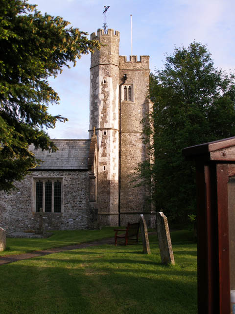
Widworthy
Widworthy is a village, parish and former manor in Devon, England. The village is 3 1/2 miles east of Honiton and the parish is surrounded clockwise from...

Wilmington, Devon
Wilmington is a village between Axminster and Honiton in East Devon on the A35 road.The entire village is now in the parish of Widworthy, although this...
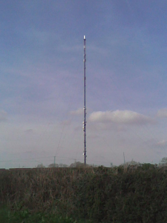
Stockland Hill transmitting station
The Stockland Hill transmitting station is a transmitting facility of FM Radio and UHF television located near Honiton, Devon, England. This transmitter...
Offwell
Offwell is a village and civil parish in East Devon in the English county of Devon, approximately 2 miles south-east from the nearest town, Honiton. Offwell...
Nearby Amenities
Located within 500m of 50.783887,-3.1037798Have you been to Mountain Copse?
Leave your review of Mountain Copse below (or comments, questions and feedback).