Shutland's Copse

Wood, Forest in Somerset Somerset West and Taunton

England

Shutland's Copse

Pitminster: The Queen’s Arms This is one of the earliest recorded mill sites in Somerset. A mill was extant here in 1036 when owned by St Swithun’s Priory, Winchester. A flour mill in 1804, the premises were later converted to a public house. The section nearest the camera looks more like a mill than a pub.
Pitminster: The Queen’s Arms Credit: Martin Bodman

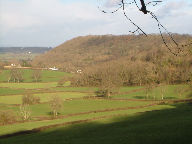
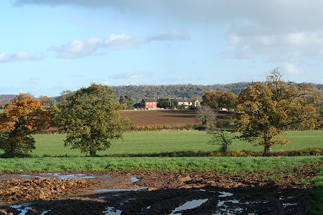
Shutland's Copse is a picturesque woodland located in Somerset, England. This woodland, also known as a copse, is situated near the charming village of Shutland, from which it derives its name. Covering an area of approximately 50 acres, Shutland's Copse is a haven for nature enthusiasts and those seeking tranquility amidst the bustling modern world.

The copse is characterized by a diverse range of native trees, including oak, beech, and ash, which provide a dense canopy. The woodland floor is carpeted with an array of vibrant wildflowers, such as bluebells and primroses, creating a stunning display of color during the spring months.

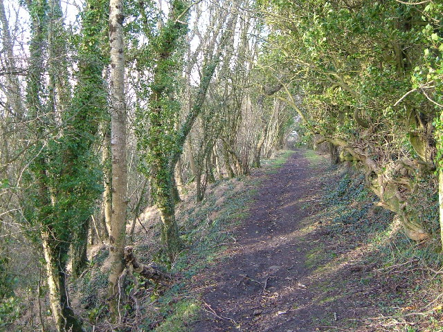
The copse is crisscrossed by a network of well-maintained footpaths, allowing visitors to explore its natural beauty at their own pace. These paths lead to various points of interest, including a small pond teeming with aquatic life and a tranquil meadow that offers a perfect spot for picnicking.

Shutland's Copse is home to a rich variety of wildlife, making it a popular destination for birdwatchers and nature photographers. Visitors may catch a glimpse of woodland birds, such as woodpeckers and warblers, as well as larger mammals like deer and foxes. The copse also provides a habitat for numerous species of butterflies and insects.

With its peaceful ambiance and stunning natural beauty, Shutland's Copse offers an escape from the stresses of everyday life. Whether exploring its winding trails, observing its wildlife, or simply enjoying a moment of solitude, visitors to this enchanting woodland are sure to experience a deep connection with nature.

If you have any feedback on the listing, please let us know in the comments section below.

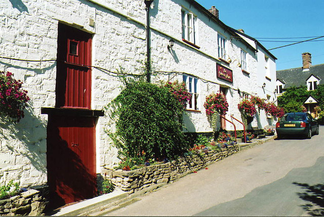
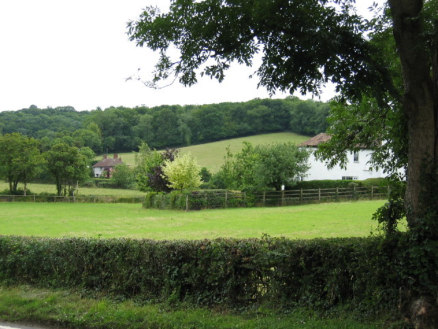
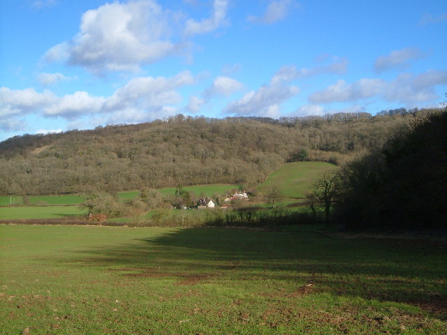
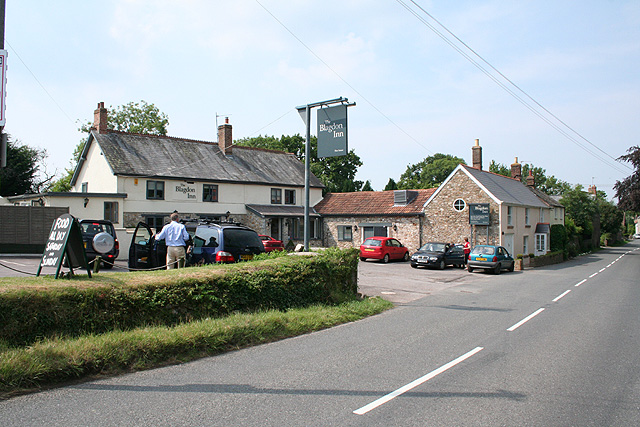
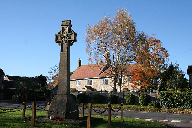
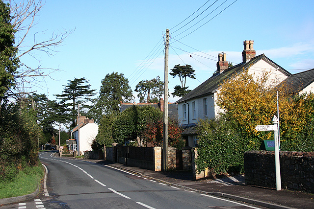
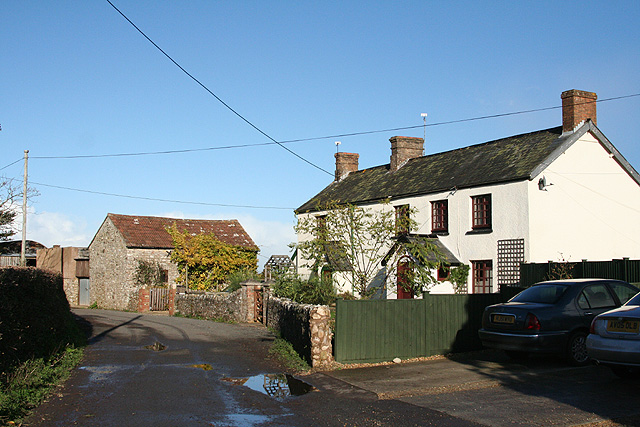
Shutland's Copse Images

Images are sourced within 2km of 50.965355/-3.1147549 or Grid Reference ST2119. Thanks to Geograph Open Source API. All images are credited.

Pitminster: The Queen’s Arms This is one of the earliest recorded mill sites in Somerset. A mill was extant here in 1036 when owned by St Swithun’s Priory, Winchester. A flour mill in 1804, the premises were later converted to a public house. The section nearest the camera looks more like a mill than a pub.
Pitminster: The Queen’s Arms
This is one of the earliest recorded mill sites in Somerset. A mill was extant here in 1036 when owned by St Swithun’s Priory, Winchester. A flour mill in 1804, the premises were later converted to a public house. The section nearest the camera looks more like a mill than a pub.
Corfe Farmland Residential housing dotted on farmland on the outskirts of Corfe, Somerset.
Corfe Farmland
Residential housing dotted on farmland on the outskirts of Corfe, Somerset.
Curdleigh & Adcombe Hill View, east-by-north across a small valley in the steep northern slopes of the Blackdown Hills
Curdleigh & Adcombe Hill
View, east-by-north across a small valley in the steep northern slopes of the Blackdown Hills
Adcombe Wood A bridlepath on the brink of the Blackdown Hills, with the gentle slopes of Adcombe Hill behind the trees on the right, while on the left Adcombe Wood plunges down the scarp into a side valley. View looking roughly north-west, probably from ST 224 178
Adcombe Wood
A bridlepath on the brink of the Blackdown Hills, with the gentle slopes of Adcombe Hill behind the trees on the right, while on the left Adcombe Wood plunges down the scarp into a side valley. View looking roughly north-west, probably from ST 224 178
Murlinch Wood, Woodram Looking northeast along the wooded scarp of the Blackdown Hills, with the fields around Woodram below, and the houses of Corfe village under Pickeridge Hill beyond. Taken from where Woodram Lane, here byway T 21/84, emerges from the woods. See also <a href="https://www.geograph.org.uk/photo/1609699">ST2218 : Fields southwest of Corfe</a>.
Murlinch Wood, Woodram
Looking northeast along the wooded scarp of the Blackdown Hills, with the fields around Woodram below, and the houses of Corfe village under Pickeridge Hill beyond. Taken from where Woodram Lane, here byway T 21/84, emerges from the woods. See also ST2218 : Fields southwest of Corfe.
Pitminster church Church of St Andrew and St Mary, Pitminster from south-east; unusual for the area in having a spire. Full details at <span class="nowrap"><a title="http://digbig.com/4gjyy" rel="nofollow ugc noopener" href="http://digbig.com/4gjyy">Link</a><img style="margin-left:2px;" alt="External link" title="External link - shift click to open in new window" src="https://s1.geograph.org.uk/img/external.png" width="10" height="10"/></span>
Pitminster church
Church of St Andrew and St Mary, Pitminster from south-east; unusual for the area in having a spire. Full details at LinkExternal link
The Lamb and Flag, Blagdon Hill
Blagdon Hill Entering the village from the Howleigh road.
Blagdon Hill
Entering the village from the Howleigh road.
Pitminster: The Blagdon Inn At Blagdon Hill. Looking north-north-west on the road to Taunton.
Pitminster: The Blagdon Inn
At Blagdon Hill. Looking north-north-west on the road to Taunton.
Pitminster: on Adcombe Hill Looking east-south-east towards Hurley’s Farm on a sultry July afternoon
Pitminster: on Adcombe Hill
Looking east-south-east towards Hurley’s Farm on a sultry July afternoon
Pitminster: Blagdon Hill hairpin The climb onto the Blackdown Hills on one of the routes between Taunton and Honiton. Looking north-northwest.
Pitminster: Blagdon Hill hairpin
The climb onto the Blackdown Hills on one of the routes between Taunton and Honiton. Looking north-northwest.
Pitminster: on Blagdon Hill Looking east-north-east
Pitminster: on Blagdon Hill
Looking east-north-east
Corfe: war memorial Near the 19th century church and by the entrance to Mill Lane. Greystones is the house across the main road. Looking west-south-west
Corfe: war memorial
Near the 19th century church and by the entrance to Mill Lane. Greystones is the house across the main road. Looking west-south-west
Corfe: by the Pitminster turning Looking north towards Taunton on the main road, three miles distant. Behind the photographer stands the White Hart Inn
Corfe: by the Pitminster turning
Looking north towards Taunton on the main road, three miles distant. Behind the photographer stands the White Hart Inn
Pitminster: cottages at Howleigh Hillcrest and Hillcrest Cottage, looking north-north-east
Pitminster: cottages at Howleigh
Hillcrest and Hillcrest Cottage, looking north-north-east
Pitminster: towards Sellick’s Green Looking east near Howleigh Farm with Pickeridge Hill providing the backdrop
Pitminster: towards Sellick’s Green
Looking east near Howleigh Farm with Pickeridge Hill providing the backdrop
Pitminster telephone box This is No 2 of 42 images of BT telephone boxes in Taunton Deane which BT is trying to cull due to their claimed 'lack of use'.  If you would like to see this phone box stay in situ, please email savethispayphone@ukpayphone.com
Pitminster telephone box
This is No 2 of 42 images of BT telephone boxes in Taunton Deane which BT is trying to cull due to their claimed 'lack of use'. If you would like to see this phone box stay in situ, please email savethispayphone@ukpayphone.com
Blagdon Hill telephone box This is No 3 of 42 images of BT telephone boxes in Taunton Deane which BT is trying to cull due to their claimed 'lack of use'.  If you would like to see this phone box stay in situ, please email savethispayphone@ukpayphone.com
Blagdon Hill telephone box
This is No 3 of 42 images of BT telephone boxes in Taunton Deane which BT is trying to cull due to their claimed 'lack of use'. If you would like to see this phone box stay in situ, please email savethispayphone@ukpayphone.com
Show me another place!

Shutland's Copse is located at Grid Ref: ST2119 (Lat: 50.965355, Lng: -3.1147549)

Administrative County: Somerset

District: Somerset West and Taunton

Police Authority: Avon and Somerset

What 3 Words

///flexibly.comedy.heads. Near Taunton, Somerset

Related Wikis

Pitminster

Pitminster is a village and civil parish in Somerset, England, situated 4 miles (6.4 km) south of Taunton. The parish has a population of 956. The parish...

Poundisford Park

Poundisford Park north of Pitminster, Somerset, England is an English country house that typifies progressive housebuilding on the part of the West Country...

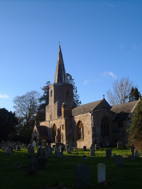
Church of St Nicholas, Corfe

The Anglican Church of St Nicholas in Corfe, Somerset, England was built in the Norman period and rebuilt in 1842. It is a Grade II* listed building....

Corfe

Corfe is a village and civil parish in Somerset, England, situated below the Blackdown Hills 4 miles (6.4 km) south of Taunton. The village has a population...

Church of St Michael, Angersleigh

The Anglican Church of St Michael in Angersleigh, Somerset, England was built in the 14th century. It is a Grade II* listed building. == History == The...

Luxhay Reservoir

Luxhay Reservoir is an artificial reservoir near Angersleigh, Somerset, England. It is now owned by Wessex Water. It was built in 1905 by the town corporation...

Prior's Park & Adcombe Wood

Prior's Park & Adcombe Wood (grid reference ST225170) is a 103.6 hectare (256.0 acre) biological Site of Special Scientific Interest south of Pitminster...

Leigh Reservoir

Leigh Reservoir, or Leigh Hill Reservoir, is a small reservoir in Somerset, England. It was built in 1893 to supply water to the town of Taunton, Somerset...

Nearby Amenities

Located within 500m of 50.965355,-3.1147549
Entrance: yes
Lat/Long: 50.9661923/-3.1113434
Pitminster
Place: village
Wikidata: Q2677744
Wikipedia: en:Pitminster
Lat/Long: 50.9676212/-3.1116128
Defibrillator
Booth: K6
Covered: booth
Defibrillator Location: inside old red phone box in Pitminster
Disused Amenity: telephone
Emergency: defibrillator
Information: map
Man Made: telephone_box
Tourism: information
Lat/Long: 50.9676623/-3.1109147
Barrier: stile
Lat/Long: 50.965113/-3.1084117
Post Box
Brand: Royal Mail
Brand Wikidata: Q638098
Mapillary: 245667290689145
Operator: Royal Mail
Operator Wikidata: Q638098
Post Box Type: lamp
Ref: TA3 238
Royal Cypher: EIIR
Royal Cypher Wikidata: Q33102113
Source Position: Mapillary 2020-05-13
Survey Date: 2020-05-13
Lat/Long: 50.9676743/-3.1109231
Barrier: stile
Lat/Long: 50.9651811/-3.1196438
Barrier: stile
Lat/Long: 50.9633662/-3.1155391
Barrier: stile
Lat/Long: 50.9652006/-3.1097773
Barrier: stile
Lat/Long: 50.9626312/-3.1189215
Barrier: stile
Lat/Long: 50.9632559/-3.1161502
Power: pole
Lat/Long: 50.9677754/-3.1203827
Power: pole
Lat/Long: 50.9668751/-3.1199241
Power: pole
Lat/Long: 50.9659967/-3.1194815
Power: pole
Lat/Long: 50.9654342/-3.1191865
Power: pole
Lat/Long: 50.9648379/-3.1188834
Power: pole
Lat/Long: 50.9643446/-3.121587
Power: pole
Lat/Long: 50.9640811/-3.1202996
Power: pole
Lat/Long: 50.963674/-3.1182638
Power: pole
Lat/Long: 50.9666622/-3.1212088
Power: pole
Lat/Long: 50.9655997/-3.121174
Power: pole
Lat/Long: 50.9643378/-3.1211042
Power: pole
Lat/Long: 50.9633429/-3.1210077
Shelter
Shelter Type: public_transport
Lat/Long: 50.9676604/-3.1109395
Defibrillator
Emergency: defibrillator
Lat/Long: 50.9676656/-3.1109251
The data included in this document is from www.openstreetmap.org. The data is made available under ODbL.

Have you been to Shutland's Copse?

Leave your review of Shutland's Copse below (or comments, questions and feedback).