Suttonthorn Wood

Wood, Forest in Devon East Devon

England

Suttonthorn Wood

On the A35 heading east, about to cross the Exeter to Waterloo railway line
On the A35 heading east, about to cross the Exeter to Waterloo railway line Credit: Rob Purvis

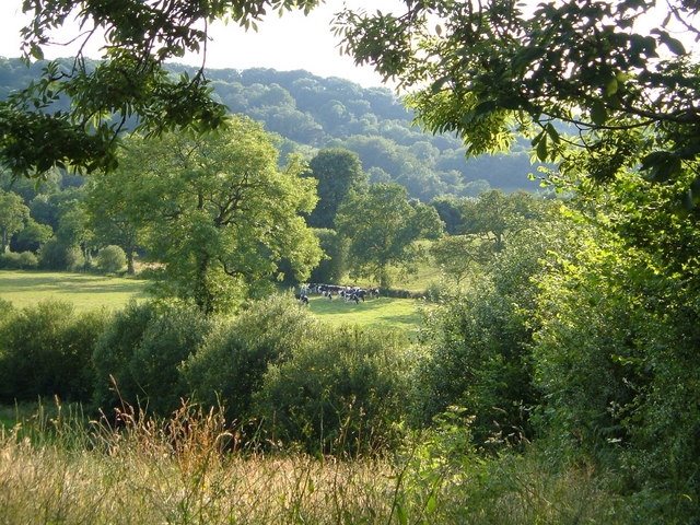
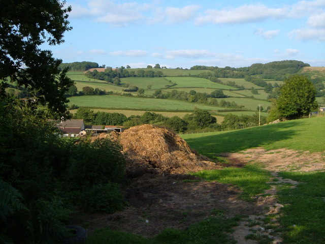
Suttonthorn Wood is a picturesque woodland located in the county of Devon, England. Spread over an area of approximately 100 acres, it is a captivating natural landscape that attracts nature enthusiasts, hikers, and photographers alike.

Situated on the outskirts of the village of Suttonthorn, this woodland is characterized by its dense canopy of towering trees, predominantly consisting of oak, beech, and ash. The wood is known for its rich biodiversity, housing a wide range of plant and animal species. Bluebells carpet the forest floor in the spring, creating a breathtaking sight for visitors.

Suttonthorn Wood offers a network of well-maintained footpaths, allowing visitors to explore its diverse terrain. As they meander through the woodland, visitors may come across babbling brooks, hidden ponds, and small meadows bursting with wildflowers. These features provide a habitat for a variety of wildlife, including deer, foxes, badgers, and a plethora of bird species.

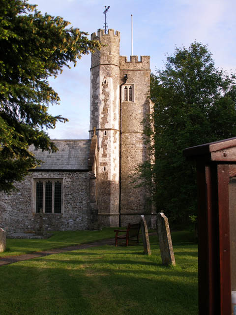
In addition to its natural beauty, Suttonthorn Wood also holds historical significance. The woodland is believed to have been in existence for centuries, with evidence of human habitation dating back to the medieval period. Remnants of old settlements, such as stone walls and ancient ruins, can still be seen in certain areas of the wood, adding to its charm and allure.

Overall, Suttonthorn Wood is a captivating natural treasure in Devon, offering visitors a peaceful and enchanting escape into nature. Whether it be for a leisurely stroll, a family picnic, or wildlife spotting, this woodland is a must-visit destination for nature lovers seeking tranquility and beauty.

If you have any feedback on the listing, please let us know in the comments section below.

Suttonthorn Wood Images

Images are sourced within 2km of 50.774183/-3.1113375 or Grid Reference SY2197. Thanks to Geograph Open Source API. All images are credited.

On the A35 heading east, about to cross the Exeter to Waterloo railway line
On the A35 towards Axminster, approaching turning to Umborne
Widworthy Hill Trigpoint A view of the Trigpoint on the edge of a crop field on Widworthy Hill in Devon.
Widworthy Hill Trigpoint
A view of the Trigpoint on the edge of a crop field on Widworthy Hill in Devon.
Crossroad Signpost The New Cross signpost at a road junction near the village of Widworthy in Devon.
Crossroad Signpost
The New Cross signpost at a road junction near the village of Widworthy in Devon.
View from a Stile A stile marking the public footpath on a hillside overlooking the valley of Umborne Brook near the village of Widsworthy in Devon.
View from a Stile
A stile marking the public footpath on a hillside overlooking the valley of Umborne Brook near the village of Widsworthy in Devon.
Footpath through the Woods  The public footpath running past the summit of Widsworthy Hill near the village of Widsworthy in Devon.
Footpath through the Woods
The public footpath running past the summit of Widsworthy Hill near the village of Widsworthy in Devon.
St Cuthbert's Church in Widworthy A view of St Cuthbert's Church in Widworthy, Devon situated east of Honiton.
St Cuthbert's Church in Widworthy
A view of St Cuthbert's Church in Widworthy, Devon situated east of Honiton.
Offwell Brook valley below Colwell From the track that continues Rock Lane towards Slade Farm, a view across a tributary of the Offwell Brook.
Offwell Brook valley below Colwell
From the track that continues Rock Lane towards Slade Farm, a view across a tributary of the Offwell Brook.
View near Smallicombe Farm The farm's buildings are on the left. Behind is the valley of the Offwell Brook. The wooded hill on the right is Suttonthorn Covert.
View near Smallicombe Farm
The farm's buildings are on the left. Behind is the valley of the Offwell Brook. The wooded hill on the right is Suttonthorn Covert.
Umborne Valley View down the Umborne valley.
Umborne Valley
View down the Umborne valley.
Railway Railway line to Exeter running through the Umborne valley.
Railway
Railway line to Exeter running through the Umborne valley.
Colyton: Higher Watchcombe Looking north east. Outbuildings here have been converted to residential accommodation
Colyton: Higher Watchcombe
Looking north east. Outbuildings here have been converted to residential accommodation
Widworthy: Homebush Cross Horse and rider pass the turning to Watchcombe. Looking west-north-west
Widworthy: Homebush Cross
Horse and rider pass the turning to Watchcombe. Looking west-north-west
Widworthy: lane to recycling centre Looking west-south-west
Widworthy: lane to recycling centre
Looking west-south-west
Widworthy: Widworthy Barton An Elizabethan manor house, seen from St Cuthbert’s churchyard. Looking south west
Widworthy: Widworthy Barton
An Elizabethan manor house, seen from St Cuthbert’s churchyard. Looking south west
Withworthy: St Cuthbert’s church and churchyard With Widworthy Barton beyond. Looking south west
Withworthy: St Cuthbert’s church and churchyard
With Widworthy Barton beyond. Looking south west
Widworthy: near Widworthy Hill At the junction with New Road, by a small reservoir. The tractor is hauling compost from Widworthy recycling centre to a farm at Watchcombe. Looking north-north-west
Widworthy: near Widworthy Hill
At the junction with New Road, by a small reservoir. The tractor is hauling compost from Widworthy recycling centre to a farm at Watchcombe. Looking north-north-west
Widworthy: by Homebush Cross At the edge of Home Bush wood, looking south east
Widworthy: by Homebush Cross
At the edge of Home Bush wood, looking south east
Show me another place!

Suttonthorn Wood is located at Grid Ref: SY2197 (Lat: 50.774183, Lng: -3.1113375)

Administrative County: Devon

District: East Devon

Police Authority: Devon and Cornwall

What 3 Words

///bungalows.playroom.incensed. Near Colyton, Devon

Related Wikis

Widworthy

Widworthy is a village, parish and former manor in Devon, England. The village is 3 1/2 miles east of Honiton and the parish is surrounded clockwise from...

Wilmington, Devon

Wilmington is a village between Axminster and Honiton in East Devon on the A35 road.The entire village is now in the parish of Widworthy, although this...

Northleigh

Northleigh is a village and civil parish in the East Devon district of Devon, England. Its nearest town is Colyton, which lies approximately 3.5 miles...

Offwell

Offwell is a village and civil parish in East Devon in the English county of Devon, approximately 2 miles south-east from the nearest town, Honiton. Offwell...

Nearby Amenities

Located within 500m of 50.774183,-3.1113375
Power: pole
Source: bing
Lat/Long: 50.7711552/-3.1121953
Power: pole
Source: bing
Lat/Long: 50.7711654/-3.1128202
Power: pole
Source: bing
Lat/Long: 50.7711909/-3.1138717
Power: pole
Source: bing
Lat/Long: 50.7712299/-3.1153187
Power: pole
Source: bing
Lat/Long: 50.7712452/-3.1162146
The data included in this document is from www.openstreetmap.org. The data is made available under ODbL.

Have you been to Suttonthorn Wood?

Leave your review of Suttonthorn Wood below (or comments, questions and feedback).