Wood Copse

Wood, Forest in Devon East Devon

England

Wood Copse

Turning to Upottery and Rawridge from the A30, heading north-east
Turning to Upottery and Rawridge from the A30, heading north-east Credit: Rob Purvis

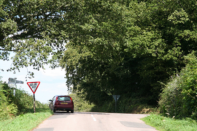
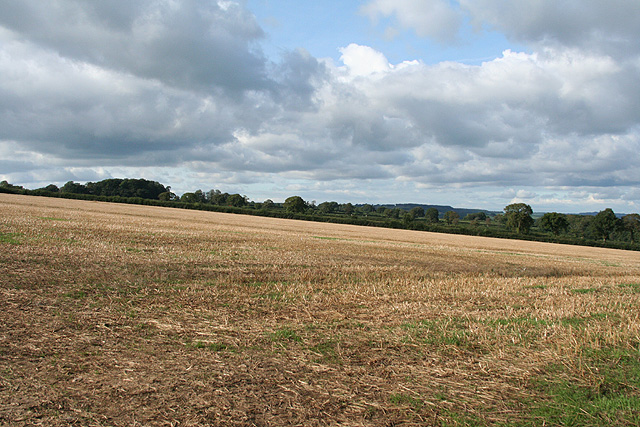
Wood Copse is a picturesque woodland located in the county of Devon, England. Spread across a sprawling area, it is a haven for nature lovers and outdoor enthusiasts. The copse is nestled within the stunning landscape, surrounded by rolling hills, verdant meadows, and scenic countryside.

This woodland boasts a rich variety of trees, including beech, oak, and birch, which create a dense canopy overhead, providing a cool and refreshing ambiance. The forest floor is covered with a carpet of wildflowers, ferns, and moss, adding to its enchanting beauty. The diverse ecosystem supports a wide range of wildlife, with sightings of deer, squirrels, and various bird species being common.

Wood Copse offers numerous walking trails and pathways, allowing visitors to explore its beauty at their own pace. Whether it's a leisurely stroll or a more challenging hike, there is something for everyone. The trails wind through the forest, offering glimpses of cascading streams, tranquil ponds, and hidden clearings. Along the way, benches and picnic spots are strategically placed, providing opportunities to rest and soak in the peaceful surroundings.

This woodland is a popular destination for families, nature photographers, and birdwatchers. Its serene and untouched atmosphere offers a welcome escape from the hustle and bustle of everyday life. Wood Copse is also a designated nature reserve, showcasing its importance in conservation efforts and the preservation of biodiversity.

In summary, Wood Copse in Devon is a magnificent forest that captivates visitors with its scenic beauty and abundant wildlife. It provides a tranquil retreat where one can immerse themselves in nature and experience the wonders of the British countryside.

If you have any feedback on the listing, please let us know in the comments section below.
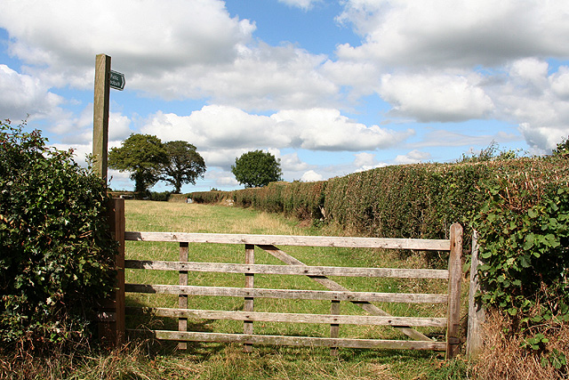
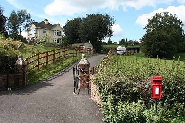
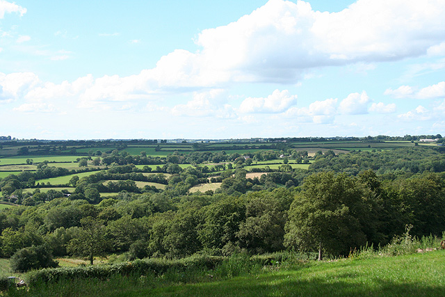
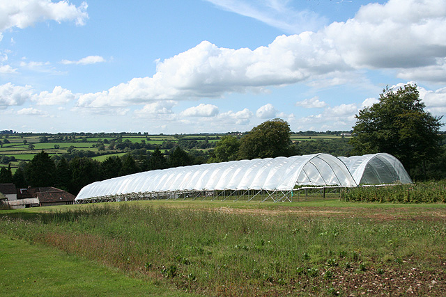
Wood Copse Images

Images are sourced within 2km of 50.833119/-3.1220099 or Grid Reference ST2104. Thanks to Geograph Open Source API. All images are credited.

Turning to Upottery and Rawridge from the A30, heading north-east
Cottage on Old Chard Road Attractive cottage and garden a little to the west of Three Mariners Farm.
Cottage on Old Chard Road
Attractive cottage and garden a little to the west of Three Mariners Farm.
Monkton: mowing at Monkton Barton Looking south west across the Otter valley on a humid June day. The farmer driving the tractor told me that on a clear day you could see Dartmoor from this point
Monkton: mowing at Monkton Barton
Looking south west across the Otter valley on a humid June day. The farmer driving the tractor told me that on a clear day you could see Dartmoor from this point
Upottery: Otter valley Near Hayne Farm, looking north-north-west
Upottery: Otter valley
Near Hayne Farm, looking north-north-west
Upottery: Otter valley Looking south west near the Otter Valley Golf Centre. Dumpdon Hill, belonging to the National Trust and with an Iron Age hillfort atop, is just visible on the skyline, centre
Upottery: Otter valley
Looking south west near the Otter Valley Golf Centre. Dumpdon Hill, belonging to the National Trust and with an Iron Age hillfort atop, is just visible on the skyline, centre
Upottery: the A30 near Yard Cross Looking north-north-east in the London direction. The trunk road climbs up from the Otter valley onto the Blackdowns. Because it hasn’t been widened to dual carriageway north east of Honiton, the route can become very congested in summer
Upottery: the A30 near Yard Cross
Looking north-north-east in the London direction. The trunk road climbs up from the Otter valley onto the Blackdowns. Because it hasn’t been widened to dual carriageway north east of Honiton, the route can become very congested in summer
The A30 north of Yard Cross With a clump of snowdrops by the roadside in the foreground.
The A30 north of Yard Cross
With a clump of snowdrops by the roadside in the foreground.
Monkton: huts at Three Mariners Cross Looking north west from the crossroads
Monkton: huts at Three Mariners Cross
Looking north west from the crossroads
Cotleigh: footpath to South Wood Farm Seen by the Old Chard Road. Looking north
Cotleigh: footpath to South Wood Farm
Seen by the Old Chard Road. Looking north
Cotleigh: Brookside Lodge Seen from the Old Chard Road near Cotleigh Bridge. The bridge crosses the Umborne Brook which flows to Colyton. Looking north-north-west
Cotleigh: Brookside Lodge
Seen from the Old Chard Road near Cotleigh Bridge. The bridge crosses the Umborne Brook which flows to Colyton. Looking north-north-west
Stockland: above Royal Oak Farm Looking west-north-west towards the Umborne valley
Stockland: above Royal Oak Farm
Looking west-north-west towards the Umborne valley
Stockland: Royal Oak Farm A crop being cultivated off the ground in plastic tunnels. Looking north west
Stockland: Royal Oak Farm
A crop being cultivated off the ground in plastic tunnels. Looking north west
Stockland: Royal Oak Cross Here the Honiton-Stockland road crosses the route from Upottery to Axminster. Looking north east in the Stockland direction
Stockland: Royal Oak Cross
Here the Honiton-Stockland road crosses the route from Upottery to Axminster. Looking north east in the Stockland direction
Stockland: woodland near Lower Brimpitt Looking south-south-east by a track from Quantock Common. The Ordnance Survey map for Chard has ‘Brimpit’ rather than the local spelling of the name
Stockland: woodland near Lower Brimpitt
Looking south-south-east by a track from Quantock Common. The Ordnance Survey map for Chard has ‘Brimpit’ rather than the local spelling of the name
Stockland: herd of cattle Looking north on the lane to Lake Farm
Stockland: herd of cattle
Looking north on the lane to Lake Farm
Stockland: lane near Hillgrounds Looking south-south-east
Stockland: lane near Hillgrounds
Looking south-south-east
Stockland: Honiton Hill Rally The rally is held on Sunday and Monday of the August Bank Holiday, with features such as shire horses, traction engines and a field gun display team from Portsmouth. A view east south east in a field near Rising Sun Cross three days before the event
Stockland: Honiton Hill Rally
The rally is held on Sunday and Monday of the August Bank Holiday, with features such as shire horses, traction engines and a field gun display team from Portsmouth. A view east south east in a field near Rising Sun Cross three days before the event
Stockland: Rising Sun Cross The 19th century building on the left may have been an inn, or possibly built upon the site of an inn. It is now a private residence, although there is a showroom in the yard for Colystock Kitchens. Looking north-north-west
Stockland: Rising Sun Cross
The 19th century building on the left may have been an inn, or possibly built upon the site of an inn. It is now a private residence, although there is a showroom in the yard for Colystock Kitchens. Looking north-north-west
Show me another place!

Wood Copse is located at Grid Ref: ST2104 (Lat: 50.833119, Lng: -3.1220099)

Administrative County: Devon

District: East Devon

Police Authority: Devon and Cornwall

What 3 Words

///inflating.golf.rang. Near Honiton, Devon

Nearby Locations

Snodwell Copses Wood Copse

Related Wikis

Stockland Castle

Stockland Castle is the name given to two Iron Age hill forts on Stockland Hill close to Stockland in Devon, England. Stockland Great Castle (50.8178°N...

Mohuns Ottery

Mohuns Ottery or Mohun's Ottery ( "moon's awtrey"), is a house and historic manor in the parish of Luppitt, 1 mile south-east of the village of Luppitt...

Cotleigh

Cotleigh is a village and civil parish near Honiton in Devon, England. It is surrounded clockwise from the north by the parishes of Upottery, Stockland...

Monkton, Devon

Monkton is a village and civil parish on the River Otter, about 2 miles north east of Honiton railway station, in the East Devon district, in the county...

Nearby Amenities

Located within 500m of 50.833119,-3.1220099
The data included in this document is from www.openstreetmap.org. The data is made available under ODbL.

Have you been to Wood Copse?

Leave your review of Wood Copse below (or comments, questions and feedback).